How to get there:
One first must go to Rwanda, the capital Kigali is where most
people will arrive by air. In order to avoid possible unexpected
red-tape, the most convenient (but also more expensive!)
approach is to use a local tour company.
I decided to use Bambou Tours and have them organize the permits, guides and
transportation logistics.
Tour companies may also be able to offer a low cost "do it yourself" option, with
only minimal "administrative support".
From Kigali, one travel north to the town of Ruhengeri. From here, it is a short drive
to the National Park Office, located at S01.43220, E029.59473.
Rwanda authorities do require that a guide is used, but obviously, one may try to
organize the trip directly with the National Park Office after arrival in Rwanda.
All guides that can be used are employed (and paid) by the National Park. Thus, all trips
originate from their office.
From the Park office
one typically travels to the trailhead together with the
assigned guide.
The normal trailhead is
located in a small farm community at location S01.45425, E029.5128, elevation close to 2600 meter.
Route description:
The route first crosses a pretty large farm area before ascending uphill and into the jungle.
The next leg traverses lower
slopes of Bisoke in order to reach the broad saddle between
Bisoke and Karisimbi. From here, the route turns more towards the mountain with a gradual
ascent to reach the camp that has been established near the base of Karisimbi itself.
This camp is at location S01.49395, E029.46566, elevation slightly above 3500 meter.
Thus, this leg may properly be considered the approach hike. What remains is about
1000 meter of vertical ascent on the proper slope of the volcano.
The rest of the route is pretty straightforward, ascending the slope more or less directly to
the summit. The first part is still among trees, the upper part is in more open terrain.
There is a building on the summit plateau. The highest point is among some rocks off to the
right hand side as you approach from below.
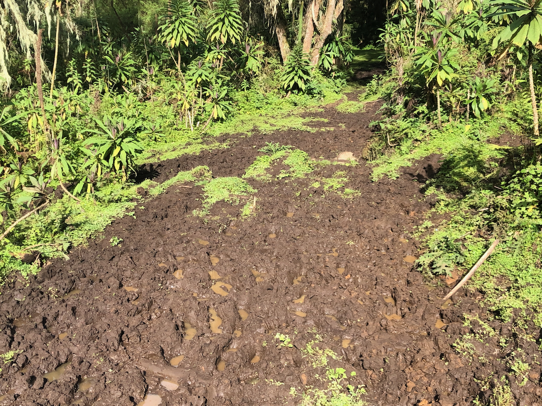
Note I: It is advised to do this hike towards the end of a dry season, to have
a slightly dry trail. In any case, high rubber boots should be taken along, Wellies in English.
At the end of May, the entire trail was incredibly muddy and the hike required extra work/energy
since your feet needs to be pulled back out of the mud all the time.
Note II: The National Park has done a good job keeping the trails and park
free of trash. My guide on Muhabura did find a couple of plastic items that he immediately
picked up and carried back out.
The summit plateau of Karisimbi even has a sign advising people to take their trash out. However,
the plateau leaves a very sad impression,
since there is garbage everywhere. Most of it from the
construction work of the antenna and the building. The National park should have all this cleaned up.
Comments:
Pickup by Simon at my hotel at 0630. We drove to the National Park office and after a short
wait, we had our guide named Christofe, age mid 40s. He then drove with us to the trailhead.
The last part of the road was fairly rough, 4WD absolutely needed.
At the trailhead, two porters were located. One for the guide and one for me. I could easily have
carried my backpack (not much weight), but the payment of these local porters in Africa is an
important contribution to very low income local families. The porter gets paid directly. I therefore
use porters in Africa. The system could still be improved, since it is a bit random how much
anybody is paid for the same effort. For example, it is unclear what the guide's porter received.
I gave him a smaller tip while I paid the guy "Emmy" that carried my pack.
We started out at 0810. I was advised to use my high rubber boots, "Wellies", since the trail
was muddy. Good advice, unlike the dry trail on Muhabura,
this was indeed 5 star mud!
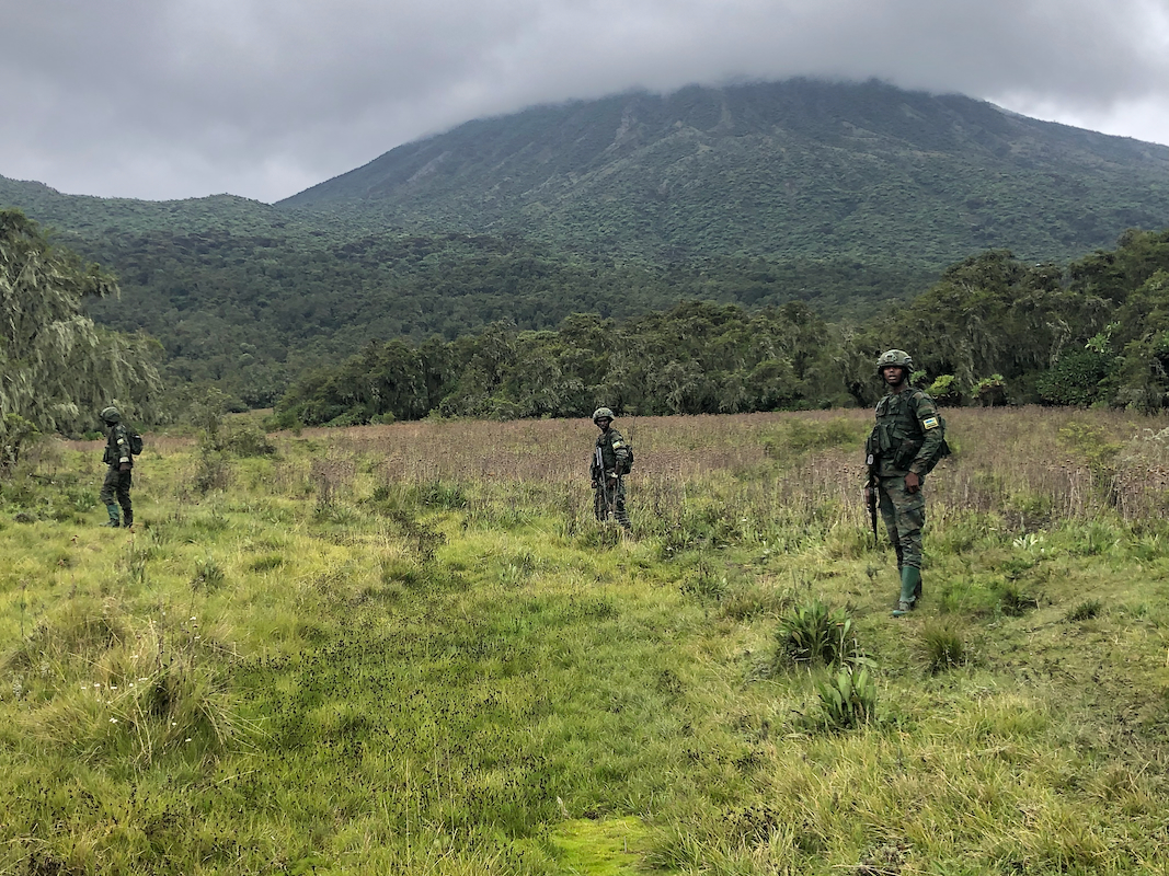
We soon met the Rwanda army, they came along with about 12 men, all armed. Obviously, this is
not to protect against wild animals. They carried normal combat AK-47 guns, but also more heavy
machine guns with a tripod etc. Nobody had been on Karisimbi for a long time. Unlike previous
reports, the Park authorities specifically requested if the climb could have been done in
a single day, most likely security concerns. I responded to this by saying that it all would
depend on the weather and the trail conditions among other factors. A decision could be
taken along the way.
It soon became clear to me that a single day hike was unlikely. The guide asked for several
short breaks along the way, possibly to have the military in the back catch up. It is hard
work to carry heavy machine guns in a bog where you sink to your knees.
We had already walked several hours when I finally could see the mountain.
We made steady progress, but
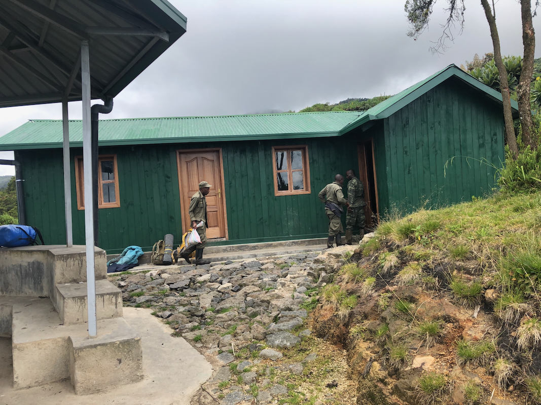
it was 1210 by the time we arrived at the camp.
It had taken us 4 hours ascending 900 vertical, we still
had 1000 meter left. I estimated that we would summit around 1500 at the earliest and a return hike
in all this bog/mud after dark was not really an option. Everyone wanted a break at the camp.
The weather still looked ok and the guide wanted to go for the summit in the afternoon.
We started the summit push at 1300. The trail was still exceptionally muddy and slippery, now also
steeper. Progress was steady, but this was not going to be quick. In fact, as we reached 4100 meter,
the guide said he was too tired to continue. A few words exchanged with one of the army guys and
I could continue, my porter still seemed ok. We summited at 1530. Interesting weather, no rain, but
very cloudy towards Congo. I could see the villages down on the Rwanda side. After a few minutes
we even had direct sunshine on the summit. The overall impression is not good, the antenna is there,
but heaps of trash and garbage scattered all over the place is worse.
I started descending at 1545, and were back down at
camp by 1715. Obviously too late for
any return hike. A fire was made and it started raining. I needed boild water for my dehydrated
dinner meal - quite easy. I got the large room in the hut all alone. The guide and the porters
stayed in the adjacent smaller room, while the army camped under the circular metal roofs
that had been built in several locations.
Up around 0500, it was getting light and we were ready to leave by 0615.
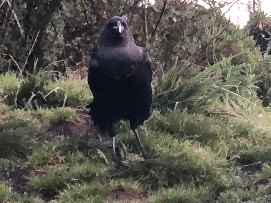
A pretty large bird with a white spot on the back of its neck came to visit.
We had blue sky and
sun, however it rained substantially last night and the mud would not be any better.
Still, we moved somewhat better than yesterday. The fact that it is mainly a gentle downhill
clearly helped. Also, we were staying more as a group. Most soldiers out in front and 4-5
in the back, but mostly staying close on the trail.
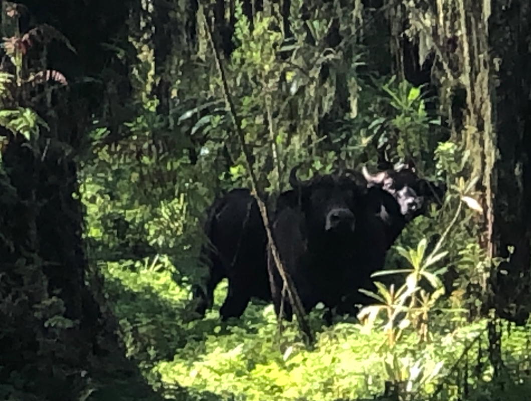
We passed pretty close to some buffalo
otherwise not much wildlife very near.
The guide told me that a mountain gorilla family stayed only about 500 meter from
the trail quite close to where our trail had its final, short descent to the farm-land.
We met a small group of tourists with their own guide and a few military on the way
up to visit this gorilla family.
Back at the trailhead by 0930, so 3:15 on our descent hike from camp.