How to get there:
Access is from the valley between Mount Princeton and Mount Antero.
One can either go west from US 285 (the highway that goes directly
south from Buena Vista) in the little town called Nathrop (about 12 km
south of Buena Vista) on Chaffee County road 162, or one should turn
west onto Main Street in Buena Vista (at the only traffic light in town),
and proceed south-west on Chaffee County road 321, this road is well
marked (going left) about 800 meters west on Main Street.
These two roads meet at the Princeton Hot Springs Lodge, a good place
to stay if a swim in a warm pool is a priority (Otherwise, Buena Vista
offers a better selection in motels and restaurants). From this lodge,
continue on road 162 for about 13 km. The trailhead is called
Baldwin Gulch, there is a sign for Mount Antero and a small parking area
on the right hand side of the road just before the trailhead (which
is a 4 wheel drive road that goes off to the left). Once you have
passed the sign for the small community called Alpine, you are almost there. Route description:
Since I did this climb in March, what follows is a winter description.
Ski the 4WD road as it climbs first south-east later east into the
Baldwin Gulch. After about 5 km one arrives at a clearly marked
fork with one trail going straight ahead to Baldwin Lake, while the
other trail heads left up between Mount Antero and the north-east ridge
of North Carbonate (4228 m). The summit of Antero is visible from this
area. Ski up this trail and find a distinct gully with a broad ridge
on its right hand side. There are a couple of switchbacks from a 4WD
road at the lower part of this ridge, ski until well above the highest
tree, possibly further depending on the snow conditions. We left the
skis at this point and hiked up the ridge (very characteristic with its
yellow gras coming through a thin snow cover). This broad ridge will
get you to the high ridge connecting North Carbonate with Mount Antero.
First climb the point (4212 m) at the north-east end of this ridge. From
here descent slightly and traverse a much more distinct (narrow) ridge
connecting to the final slopes of Mount Antero. This ridge requires
a bit more care in winter, as the east facing bowl often holds much snow
(possible avalanche danger). Stay on top of the ridge except when passing
two blocks of rock, these can both be passed on the right (east) side.
After traversing this ridge what remains is
an easy hike up to the summit of Mount Antero. Comments:
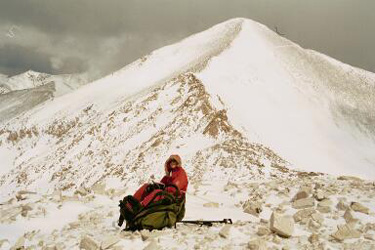
I did this climb with my 12 year old son Pål Jørgen.
We started at 0630, hit the trail fork at 0800, left the skis at
0900, hit the main ridge at 1000 and the summit at 1245. We were
at the skis at 1445 and hit the car at 1530, a total of 9 hours.
The weather started out sunny, but gradually turned to snow, wind and
quite limited visibility.
The summit had a snow drift that was a couple of meters higher than
the highest visible rock, the cairn and summit register were likely
buried below.
Descriptions of this climb say that you will not be alone (due to 4WD
roads and people looking for gems etc.) This is not a problem in
winter, we saw nobody from start to end, not even an old ski track.