Location: North 48.79607, East 090.73286 (GPS at the summit)
Difficulty: YDS class 2
Climbed August 23. 2019.
Information:
How to get there:
See the description for Tsast Uul.. Route description:
From the base camp area established for climbing Tsast Uul,
one should follow´the valley above (behind) camp. This valley turns more left and is quite pleasant
to hike. Stay in the main valley until it sort of ends in a pretty flat area. Go left and
follow a path of least resistance to locate the pretty distinct summit at the far end of
the high plateau. This location is N48.79607, E090.73286, elevation near 3660 meter.
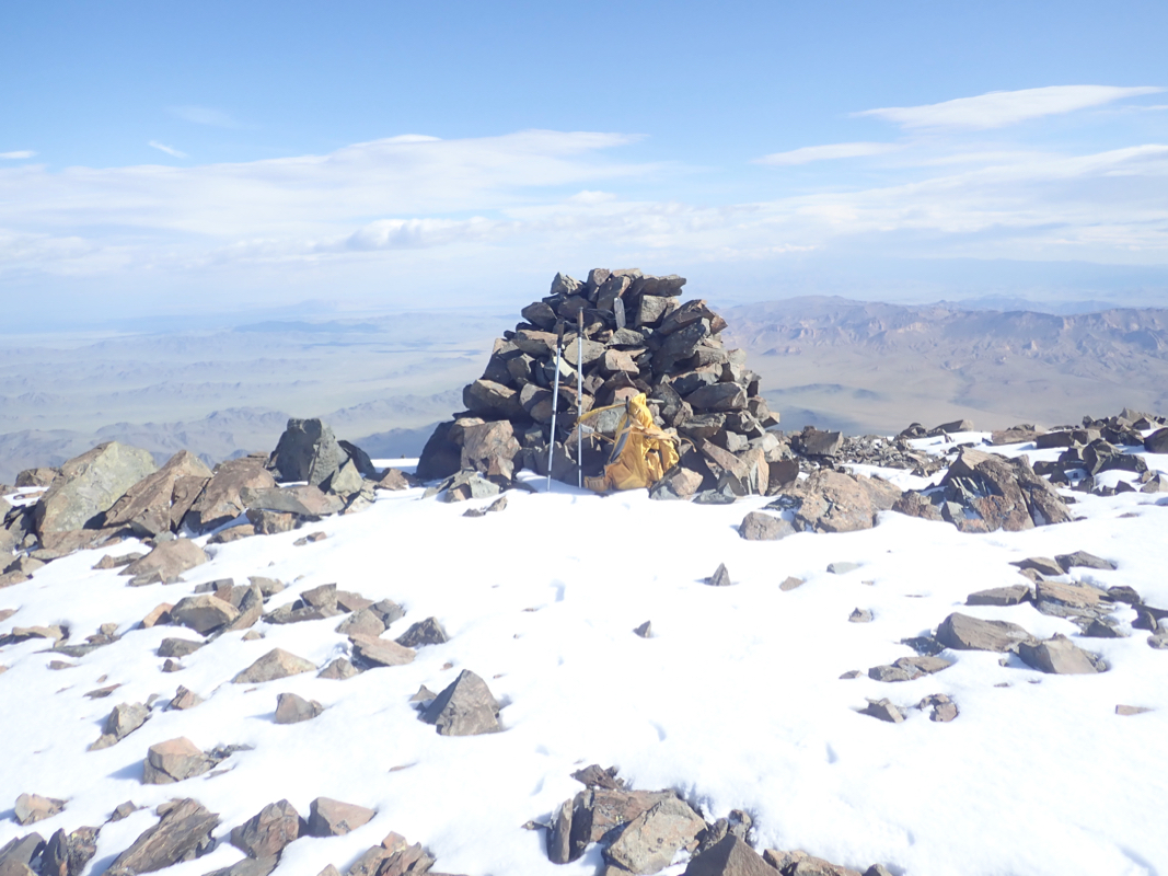
There is a pretty large cairn built on the summit.
Comments:
After a successful climb of Tsast Uul, I had an extra day
before returning to Oglii on Saturday. Gangaamaa was clearly tired after yesterday and seemed quite
happy when I proposed a solo climb giving her a day off to rest. I was eager to explore the mountain
on the opposite side of the valley. I had given it a careful look yesterday, there were patches of snow
near the highest terrain and somewhat depending on the elevation of the connecting saddle, this mountain
was most likely at least a major mountain with prominence exceeding 600 meter.
An excellent breakfast was served at 0600 and I was off walking by 0630. I followed the valley as it
turned left and gradually ascended. Higher up, I forked up a side-valley going right. This turned
out to be a mistake, but provided a good circular trip. At the upper end of this valley the terrain
opened up and it was clear that I needed to ascend more left up across open terrain. Higher, I could
see the contours of what looked like a peak, but it vanished up in low clouds. I soon got into
the clouds and ascended in an uphill direction. Somewhat surprising, it seemed like the higher
terrain was going left whereas I had seen what looked like the highest peak more to my right.
Never mind, visibility was now almost nonexistent and I just ascended up a fairly steep slope,
only rocks here. Next, I emerged on what looked like a flat mountain plateau and soon localized
a cairn at location N48.77343, E090.75606,
elevation about 3610 meter. With no visibility, I assumed
for a moment that I had reached the highest point. Then, suddenly, the clouds lifted and I got a
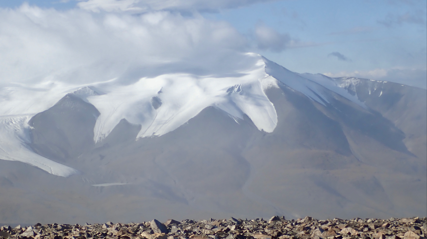
good view across the valley to yesterdays summit Tsast.
Moreover, I could now see higher ground
quite some distance away. In fact, more than a kilometer away, the terrain looked higher.
This was surprising to me and I had never discovered this if the fog had persisted.
I realized that my climb was not even close to finish while descending from my local plateau and
heading across to what clearly looked higher. This was a ridge with its highest point at the
far end. Once there, a new top emerged that would require yet another small descent, before
a final ascent. This definitely looked like the final summit and this was confirmed when I finally
arrived at 0930.
It was very windy near this summit. Hard to keep in balance and walking required extra focus.
I took pictures and tried to find some shelter behing the cairn. Leaving at 0945, I headed back
along a more direct line that led me to the upper part of the main valley. This is certainly a better
route. Lower down in the valley, I ran into more than 20 horses that seemed to like the grass
in the valley. I decided to explore the key saddle before returning home. Thus, I traversed the lower slope
above the valley (left side when descending) and headed across towards the saddle. This saddle
turned out to be much larger than anticpated. A large and very flat area. I walked until it looked
that I was equally far away from all sides. The time was 1200 noon and GPS measurements
confirmed that this mountain has a prominence
near 750 meter. Happy with a very good day, I next turned towards base camp about 2 kilometer away.
Arriving back at camp at 1230, just as lunch was ready, a very nice 6 hour hike had been concluded.
The next morning, Saturday, we broke camp and started our drive back to Oglii. A brief stop at
the highest point of the road was called for,
an excellent spot for some photos and a goodbye
to Tsast Uul. This had indeed been a very successful 3 day trip. Ganga and our locally born driver
had found a near perfect base camp and I had climbed 2 very different, but quite nice summits.
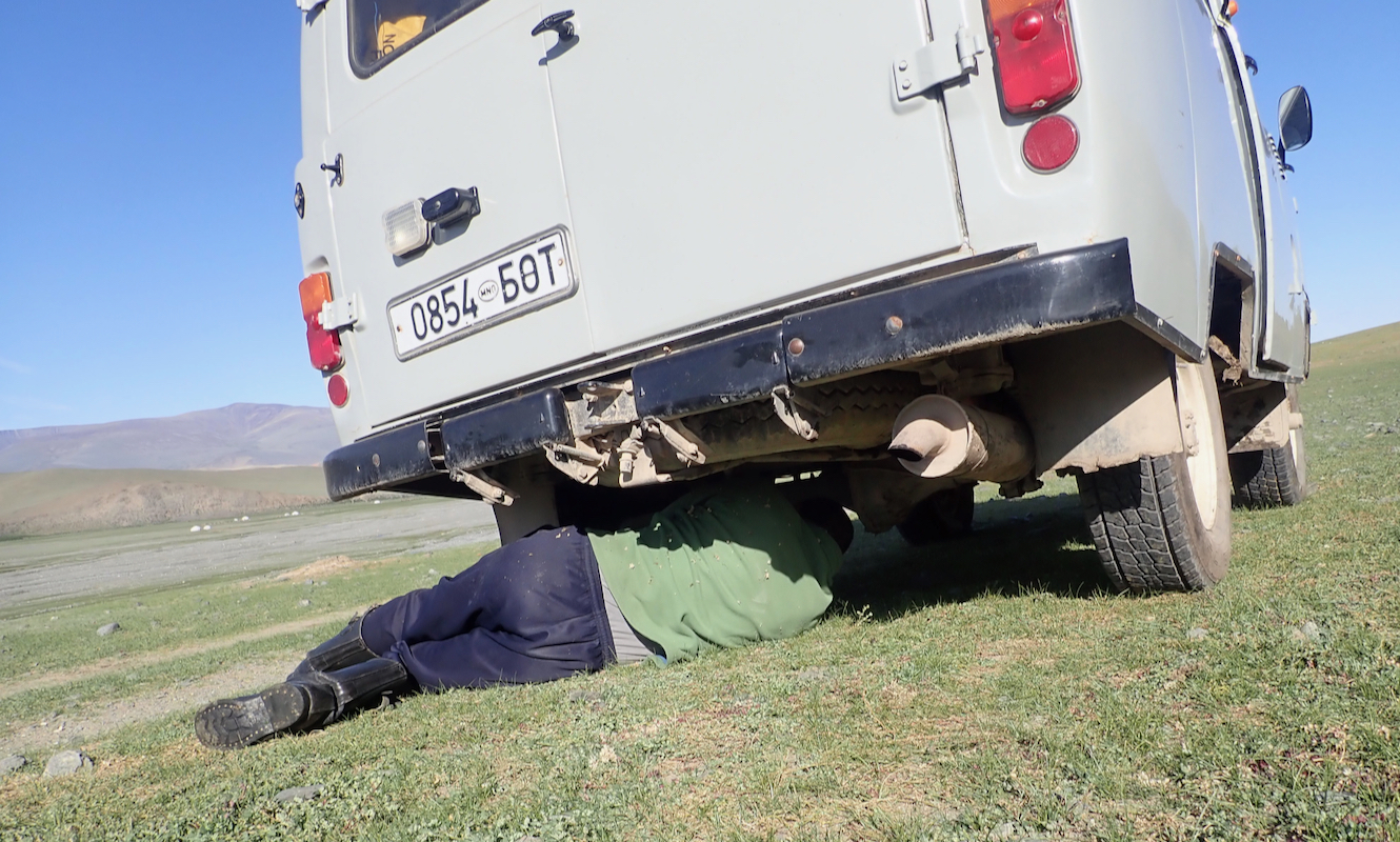
Shortly after resuming our drive, Ganga decleared that the road going downhill was so steep and
dangerous that all 3 should exit the car and walk down to the valley floor. The driver would get
the car safely down on his own. The walk took 30 minutes and when I arrived at the car, the driver
was underneath it adjusting the brakes
after what obviously had been a stressful descent.
Later today (after 1700), the group of 5 more Norwegians would arrive and on Sunday we should
all start our common expedition tom climb Mongolias highest mountain. All preparations had been
expertly carried out by Lars, it promised to be a real adventure. Thus, this trip report
continues with Khüiten Uul.
