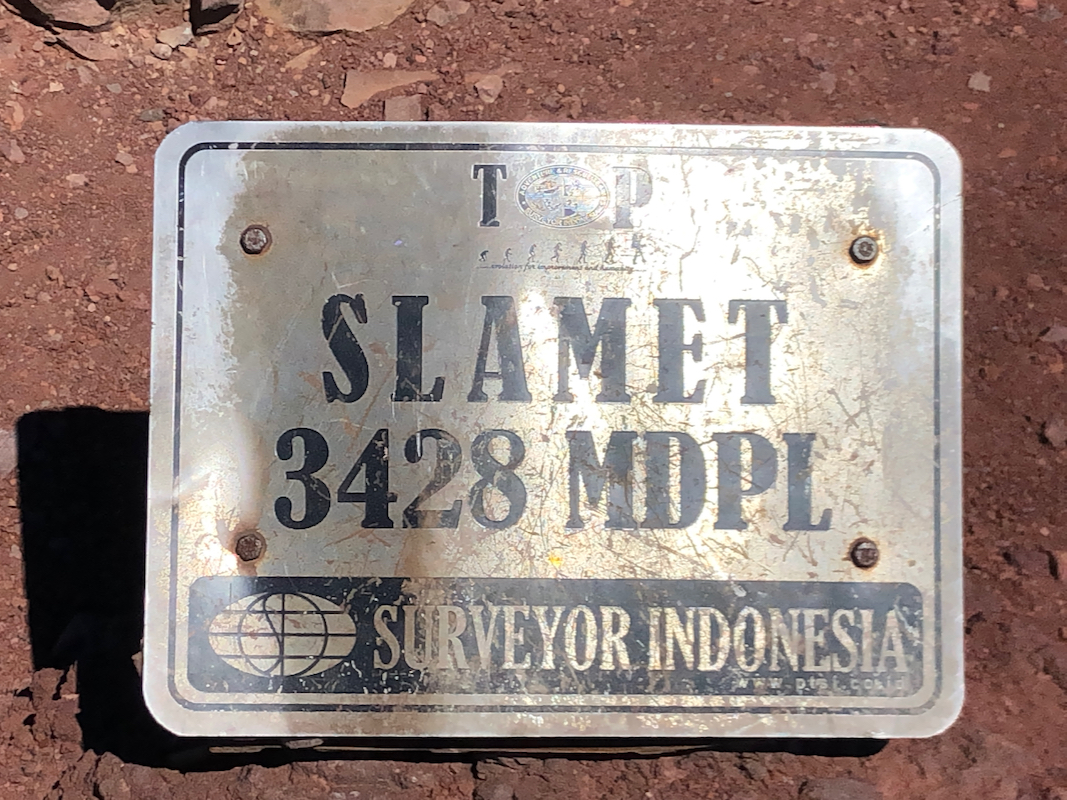
Slamet
- Slamet
- 3428 m
- Primary factor 3284 m
- Java, Indonesia.
- Location: South 07.23914, East 109.22027, (GPS at the summit)
- Difficulty: YDS class 2
- Climbed July 24. 2019
Slamet
|
|
How to get there:
This excellent web-site on climbing
Indonesia peaks should always be consulted.
From Cirebon, go by toll road to Tegal, exit here and continue south in order to
access the east slopes of Slamet. The name Bambangan is often used, the area is
full of small villages and narrow roads. There are at least two trailheads located
closely together. I would certainly recommend the one I used, possibly, this
is the highest TH on this side of the mountain.
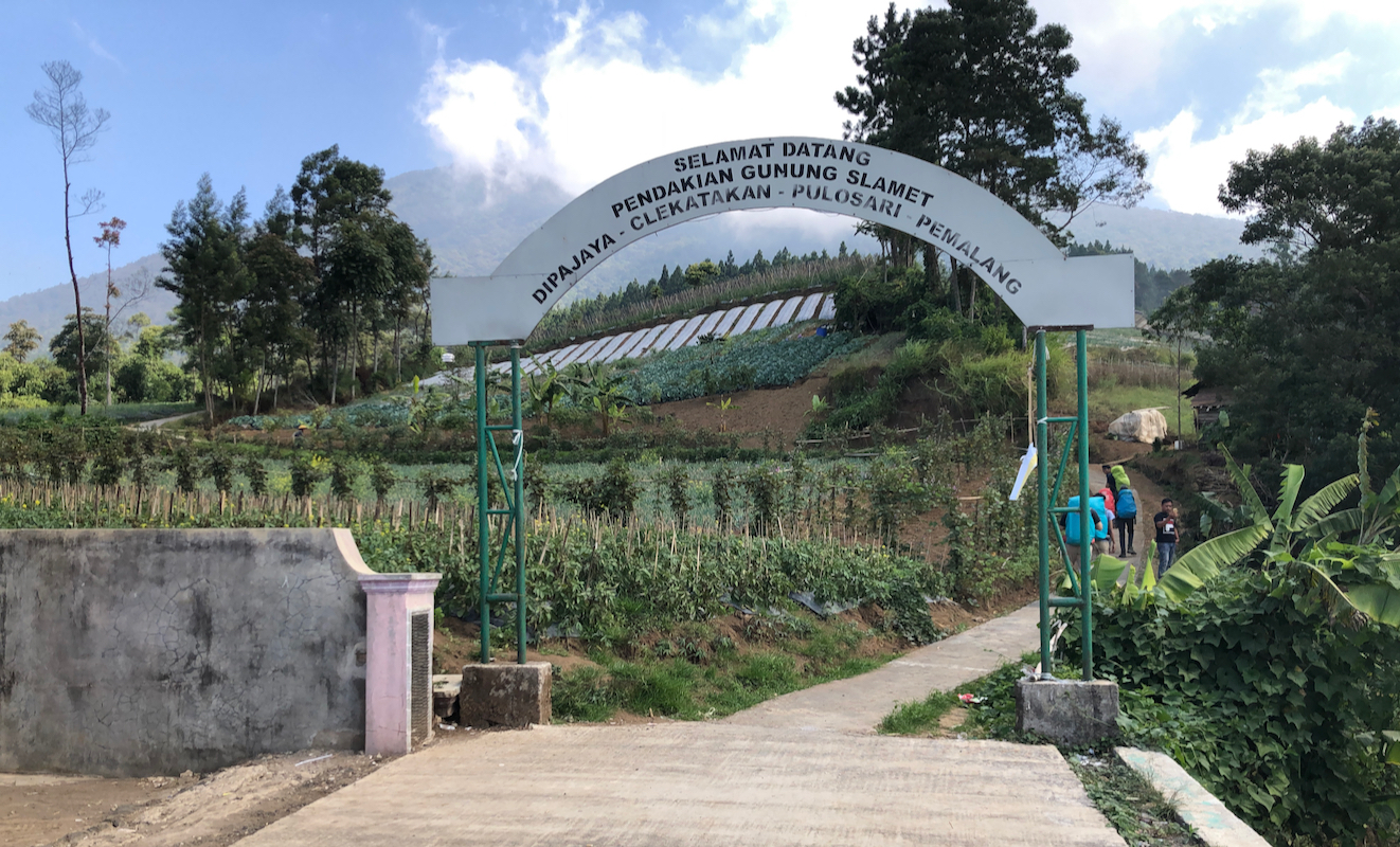
Locate a steep uphill road that will get you to location
S7.22182, E109.25976, elevation close to 1590 meter. The road just turns into a narrow
concrete path that continues uphill. This is the trailhead. There is an
official portal near this location.
Here is a summary and quick reference to the climbs on this trip.
Route description:
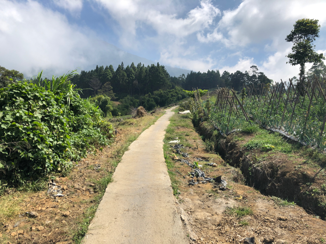
Walk up the concrete path and
locate a second gate where
the path turns from concrete to dirt.
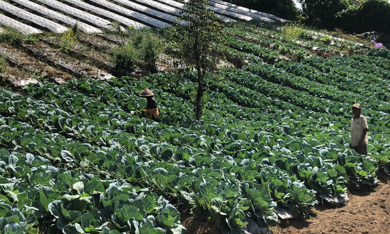
There is farmland on both sides.
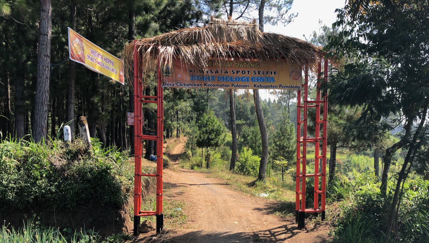
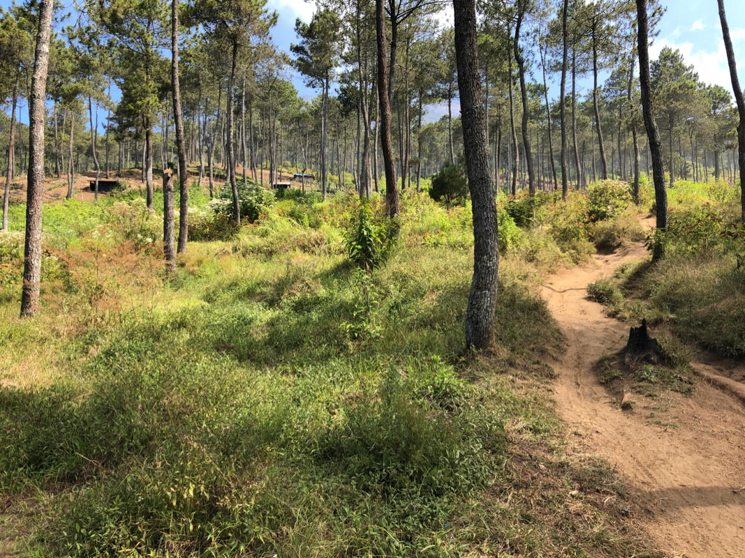
The trail is quite nice, first across a short section of forest, next uphill passing
the highest farmland with a
few scattered huts. Next, into the forest on the slope of
the mountain. You almost immediately arrive at POS I, located
at about 1940 meter. POS II follows at about 2170 meter. The trail merges with
the trail starting a bit further south 100 meter above POS II, at location
S07.22978, E109.23980, elevation about 2270 meter.
The next several POS locations are at elevation 2440 meter, 2630 meter,
2760 meter, and finally at 3000 meter.
Above this, the trail is more sandy as vegetation thins and ends at elevation
3160 meter at location S07.23800, E109.22391. Record this place as it is important
for finding your way back down, not ending up on a different trail.
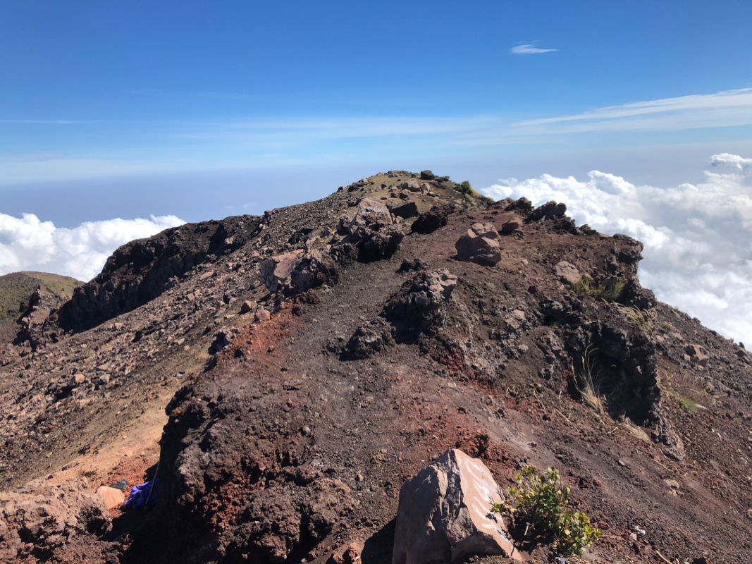
From here to the summit, there is loose scree between volcanic rock. The best route
stays right, one easily recognizes how far right one can go without leaving the good
route of ascent. Zig-zag uphill until you meet a final small cliff,
climb across or turn it on the left,
then stroll a few meter
up the summit ridge
to the highest point.
Comments:
I had agreed with Abdullah (driver) to pick me
up at 4AM, one hour later than yesterday.
We drove to the trailhead where I discovered that
there had to be two trailheads locally, since my GPS track
from Ken (he was here in 2018), did not match. No worries, this
was obviously a trailhead, possibly even a bit higher than
the one I had read about.
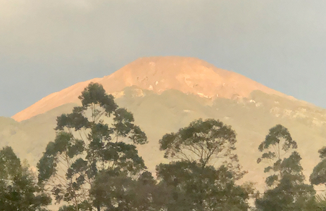
The morning sun hit the peak, it looked like a long way up there.
I started walking at 0630, an early start since this was supposed to be a pretty
long and hard climb. In fact, all trip reports I had seen recommended doing this peak
as a 2 day climb. It was a nice morning and nobody elseto be seen. I passed through
a small forest, then the highest agriculture land with a few scattered huts, before
the trail entered the forest. This trail immediately appealed to me, perhaps
because of the strong contrast with yesterdays trail on Cikuray. Steady uphill, but
certainly well suited for normal walking.
I came to POS I then in a while POS II. Above this, my trail merged with the
one starting further left. Higher up, I started to see various tents. Almost all
Indonesians bring full camping gear and make these climbs a multi day trip.
I took a short break up at POS IV, half a liter of water quickly consumed.
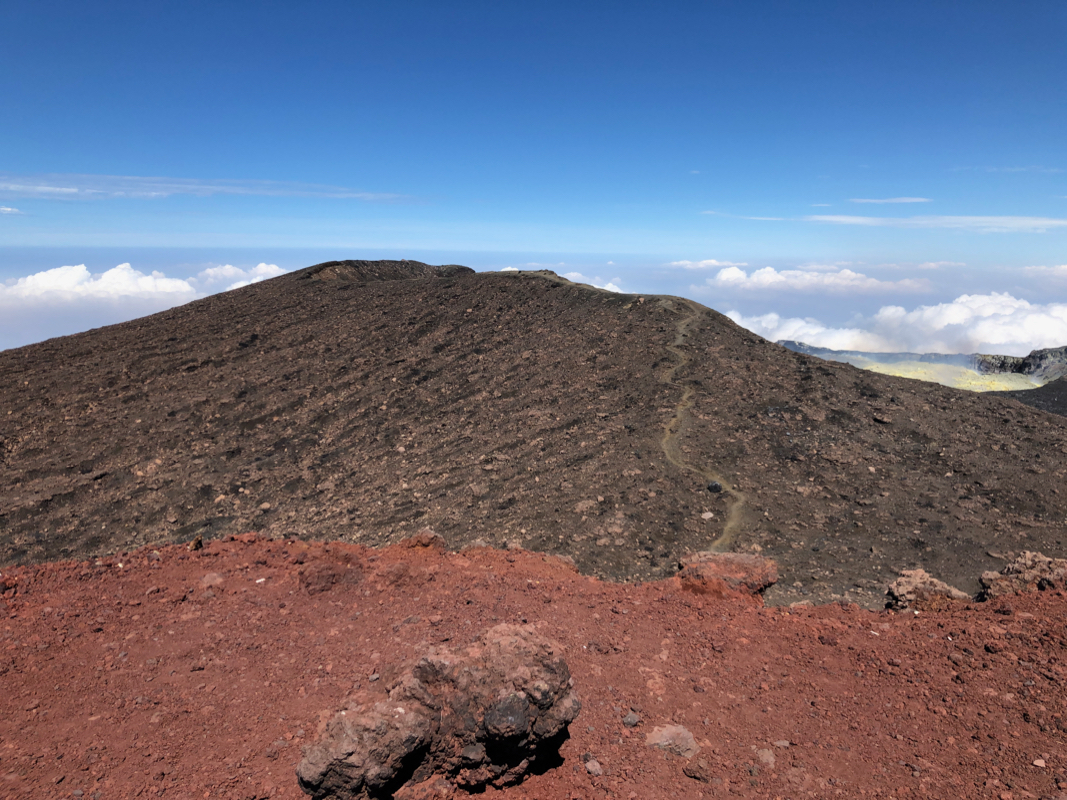
The highest POS VI ?, just about 3000 meter, the trail got more sandy and soon vegetation
ended. The summit cone consisted of volcanic rock and loose scree. Quite a change from
the typical trail where one almost never see any rocks at all.
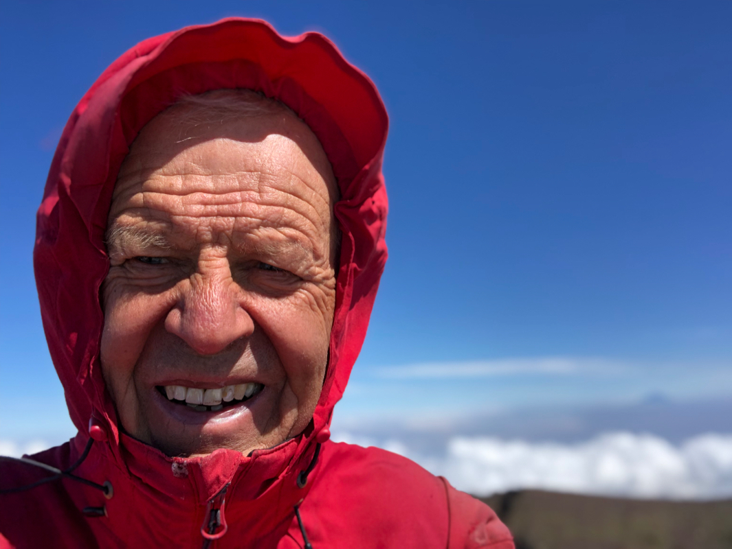
I arrived on top precisely
at 1000, so 3.5 hours. Surprisingly windy up here, similar to the summit of Ciremai two
days ago. One group of climbers were at the summit when
I arrived, they celebrated and
took pictures. The view was nice. I could see Ciremai above the clouds, even more pronounced,
the twin volcanos of Sundoro and Sumbing floating among big clouds.
It was quite windy on top, so no desire to stay very long.
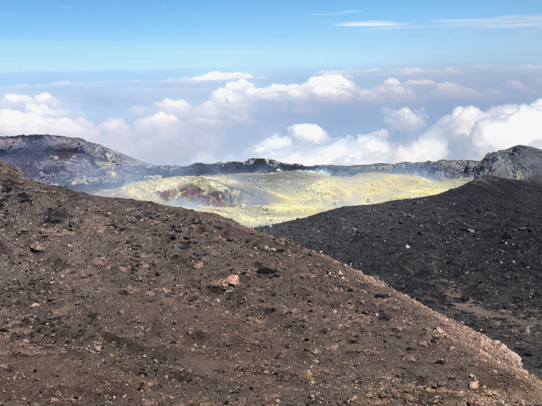
There is a pretty large
area going west. An
interesting sulphur lake can also be seen nearby.
I left at 1015 and arrived back at my car 2.5 hours later at 1245. This had
certainly been a very nice hike.