How to get there:
A good point of reference is the city of Bend in Oregon. Bend is located
south-east of Portland, more precisely at the intersection of Hwy. 97 and Hwy. 20.
Another way to locate Bend is to start out from Eugene on Interstate 5 (south of
Portland) and then travel east following Hwy. 126, 242 and 20.
Exit Hwy. 97 onto Business 97 at exit 136 (going south, mile 0.0), turn right (west) off
Business 97 at mile 1.4, then right again at T-junction at mile 2.6. You will approach
a very distinct traffic circle having a red bird sculpture at mile 3.0, turn left here.
Continue straight across traffic circles at mile 3.4, mile 4.0 and mile 4.4, you are now
on Cascades Lakes Highway. You will drive by the Mount Batchelor Ski Area, then turn left
at mile 30, into the Devils Lake Trailhead where you locate a large parking area. This
location is N44:02.115, W121:45.959, elevation 1670 meter. Park here, a North-West National
Forest parking permit is required (dollar 5 per day, dollar 30 annually in 2010). Route description:
From the trailhead, the trail (South Sister summit) starts out near the toilets, crosses a
stream, then the road before arriving at a self serve trail permit register where you are
supposed to sign up for your trip. From here, the trail runs uphill among the trees, fairly
steeply and sometimes with switchbacks. As you emerge from the trees and the slope, you
cross straight over a 4-way trail junction at
a sandy saddle, then undulating (fairly flat)
in more open landscape along a broad, open ridge with
your goal, the South Sister, in clear view.
The trail is fairly obvious, and obviously popular. It climbs fairly steeply and higher up,
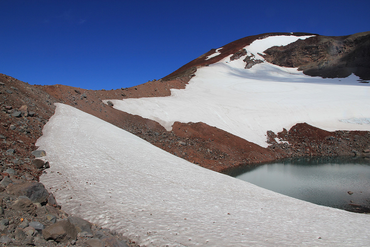
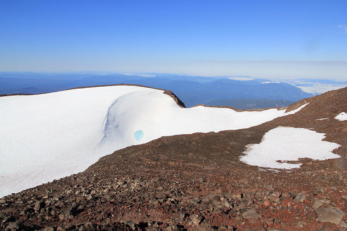
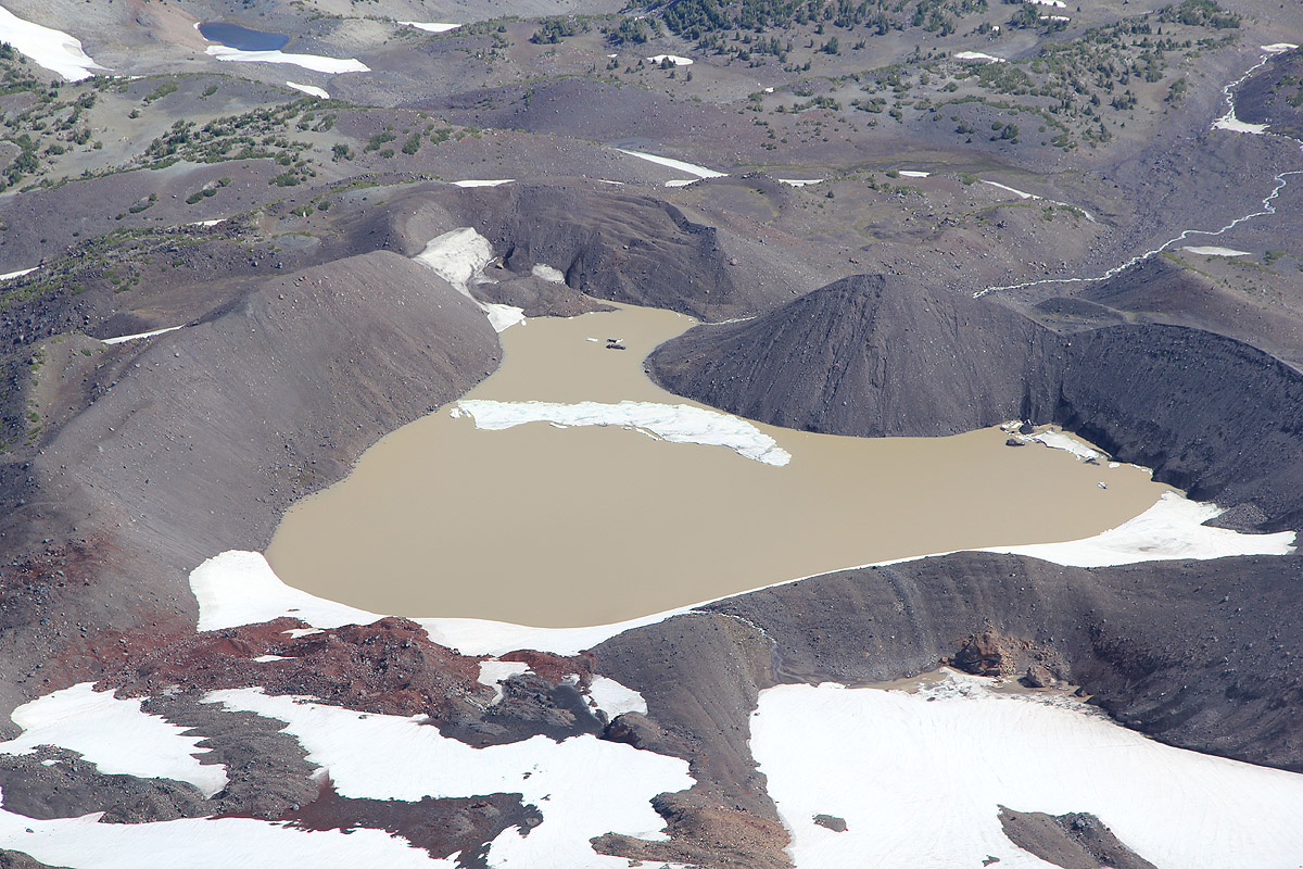
among somewhat loose boulders to a small (local) saddle next to a small lake at the lower end
of a small glacier. The trail turns more left here
and follows the obvious ridge (more loose
scree and sand) upwards to the crater rim. The shortest route
then follows the crater to your right, possibly also
taking a short-cut across the snow that might be present in the crater (the picture is from the summit).
The highest point on the rim is clearly defined and there is a trail that gets you all the way
there.
Returning, it may be reasonable to follow the crater rim all
around for a good view in all
directions. Subsequently, descend your route of ascent.
Comments / Trip report:
We stayed in Bend after a
drive the previous day, from La Grande in eastern Oregon.
Starting early (before reasonable daylight), we drove straight across (instead of turning left) in the traffic circle with
the red bird sculpture. This caused us to drive 10 miles west on the wrong road before
we discovered the mistake and then returned to Bend. Sometimes it just does not pay
to start early.
Despite more than 30 minutes driving on the wrong road, we had parked at the trailhead and were
ready to leave by 0700. A few other cars and hikers were there and some people had started out
while we prepared for departure. The trail was nice and the air fresh as we quickly ascended
the initial slopes and got up on the broad ridge that led across to the mountain itself.
We did catch up with a few other parties, the last group having reached the small lake at the
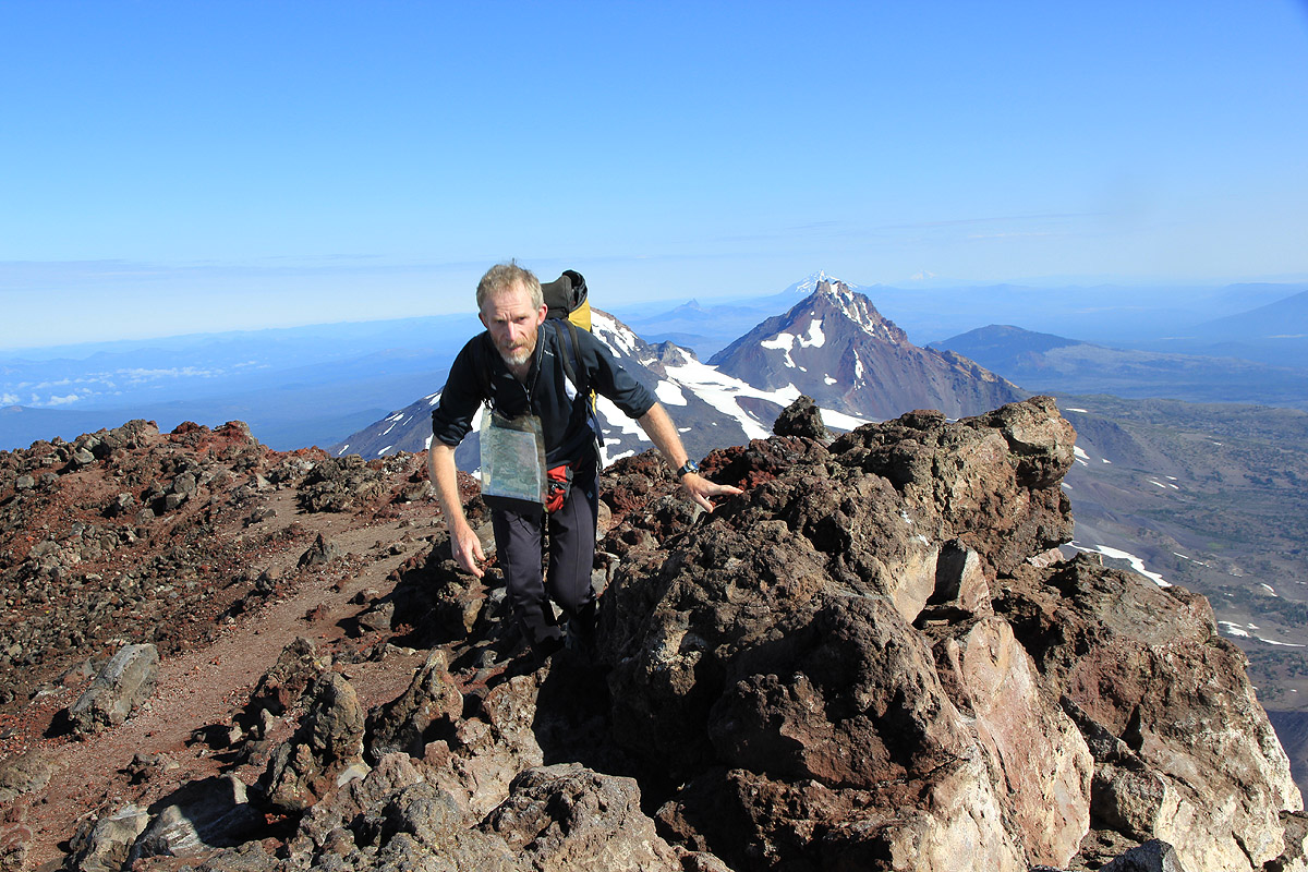
base of the tiny glacier. We hit the crater rim at 0925, decided to take the long (clockwise)
way around and sat
down at the highest summit at 0940. Nobody around, but a very nice view.
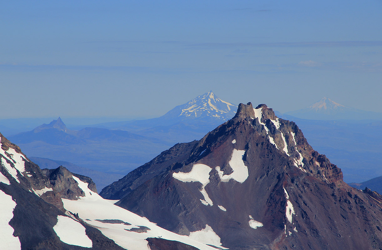
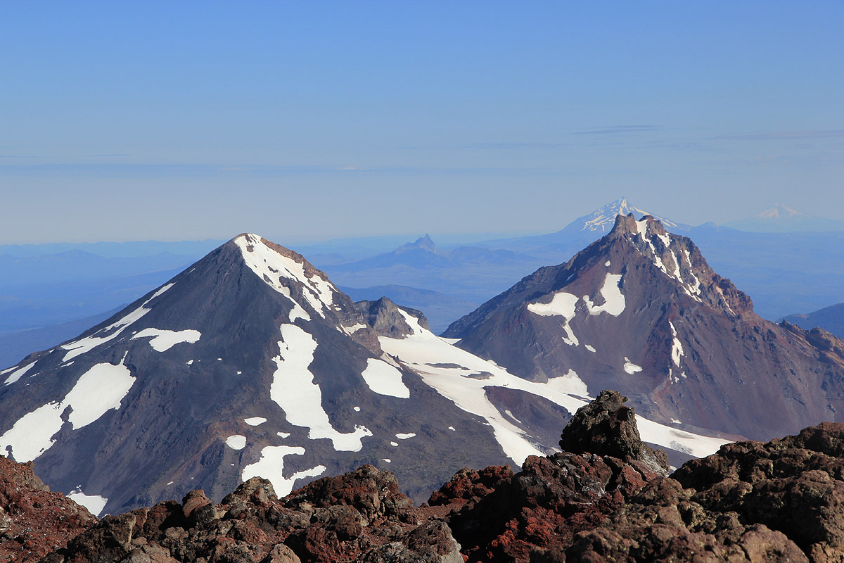
I immediately realized that I should have taken a picture of Mount Jefferson before getting
to the summit, it is well hidden behind the Middle and North Sister as seen from the summit.
I strolled back along the rim until I could get my picture then
returned back to the summit.
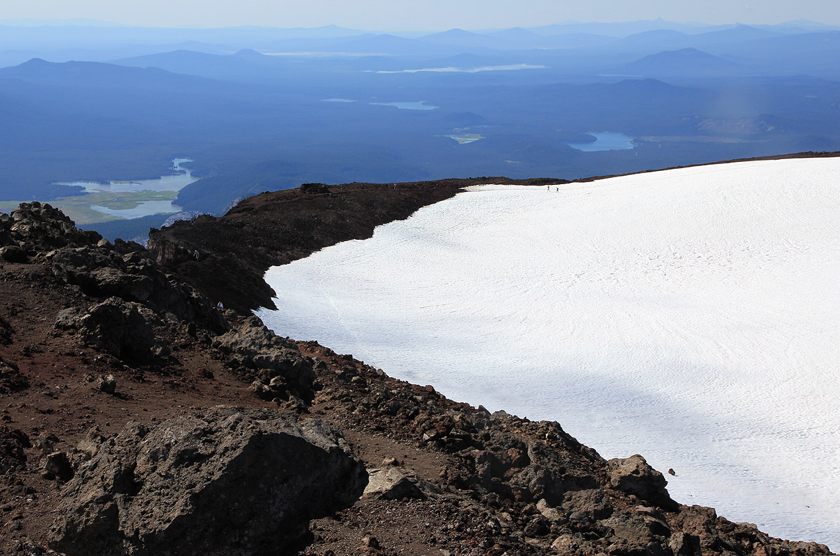
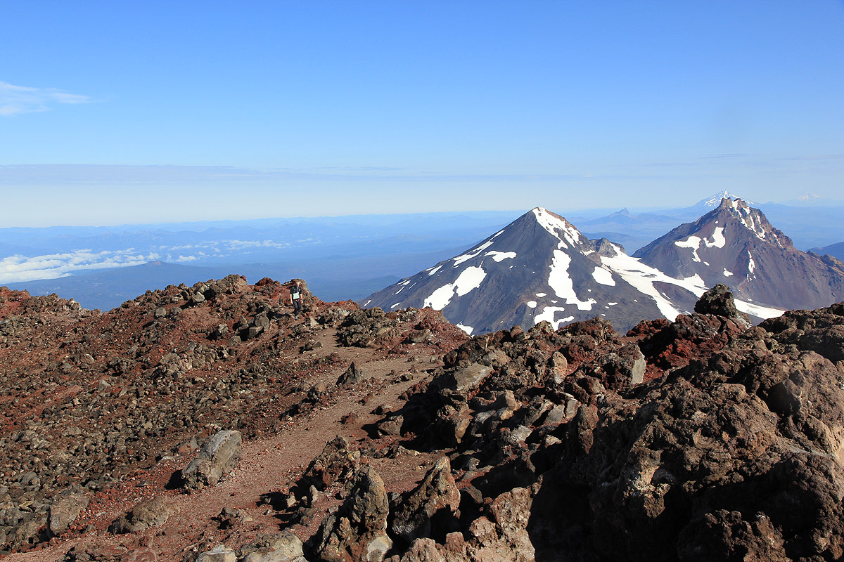
Unfortunately, haze obscured the really long distance views, but we could see the big vulcanos
to the north. Interesting landscape to look down at.
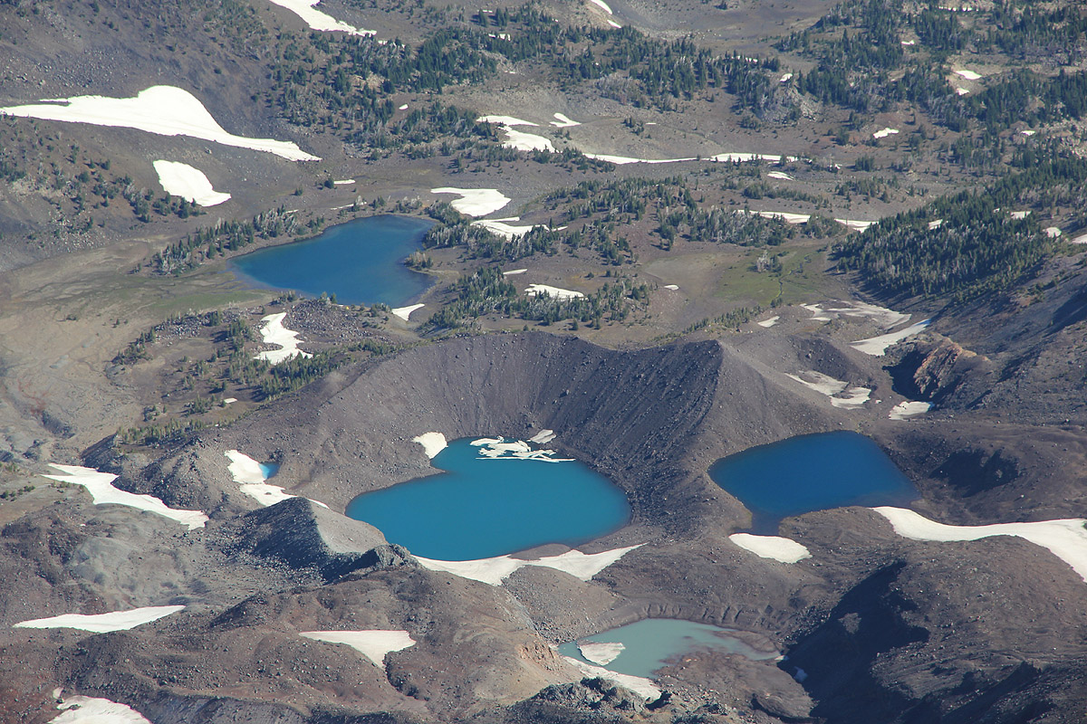
It is evident that "The Sisters" have played with the
landscape, small lakes all
dammed by vulcano rocks.
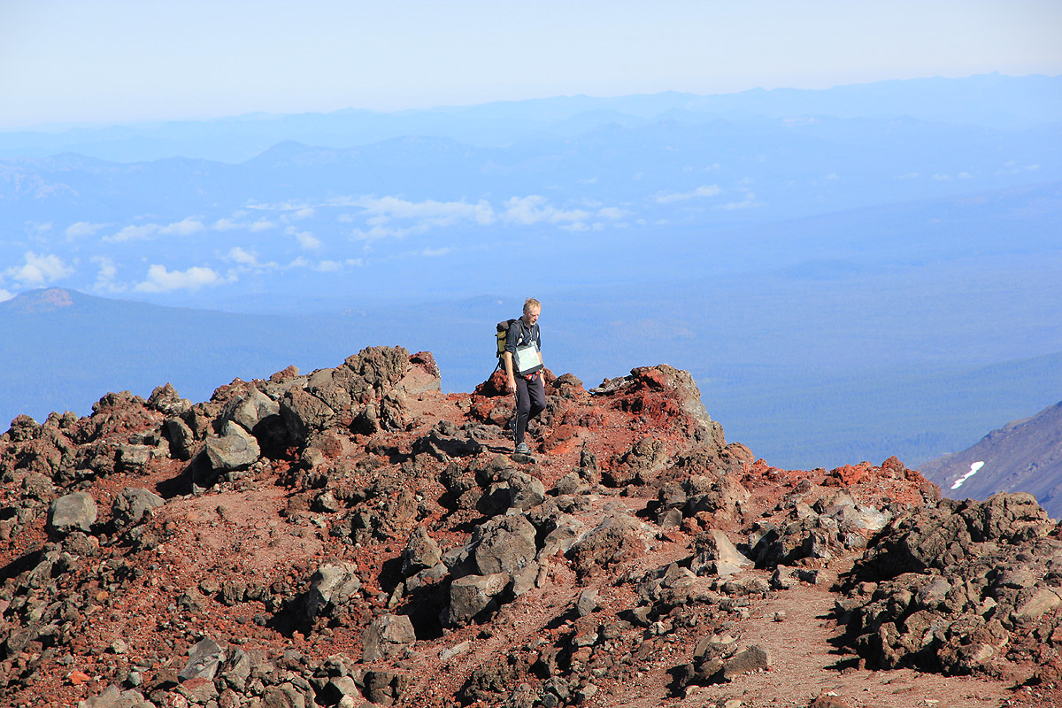
Vulcano rock sculptures and a rather rugged slope below the summit.
We enjoyed the good weather and stayed around until 1045. At this time, the first
other hiker started to approach and we decided to leave the summit to the new arrivals.
As we descended the upper ridge, we met a long string of hikers, obviously a very popular destination
today. Lower down, we continued to meet small and larger groups, including a few that
had already turned around without making the summit. The trail was good and we changed into
a light jogging pace. It felt good for my right leg and it was indeed a very nice trail to run.
We arrived back at the car by 1215, so only 1:30 for descending. Quite an easy day, but we
knew that the next peak
was Mount Jefferson, a considerably bigger challenge.
See also the nice picture story by Rob.
Resources:
Images
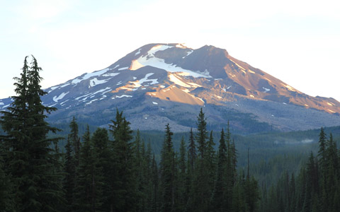
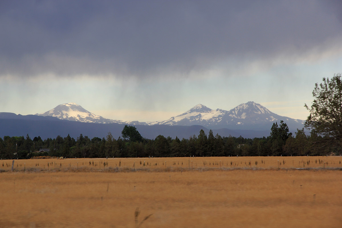
The Sisters, South, Middle and North, as seen from Hwy. 97.
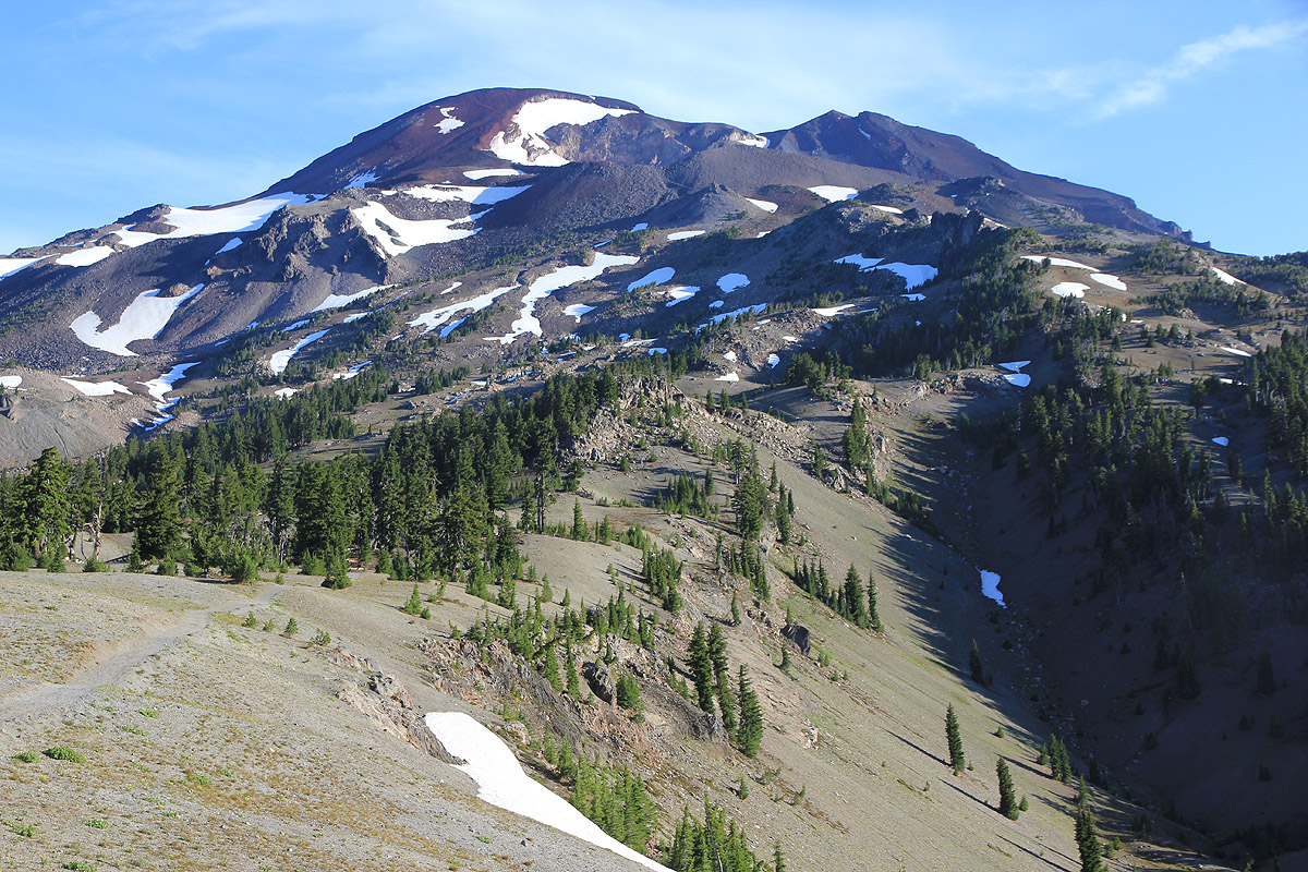
South Sister, as seen from the Cascades Lakes Highway.