Location: South 08.10777, East 112.92200 (GPS at the summit)
Difficulty: (YDS) class 2
Climbed July 25, 2015
Information:
How to get there:
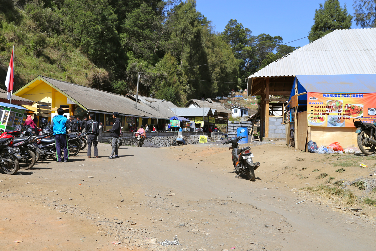
The starting point for this very nice trek/climb is the mountain village
Ranu Pani. A major city from where one may travel is Malang.
The drive from Malang to Ranu Pani takes about 2 hours.
One first drives from Malang to Tumpang, in Tumpang one may quick and easily
obtain the required medical certificate. There is a good local supply of
transportation services between Tumpang and Ranu Pani as well. (Share space in a jeep etc.)
Contrary to what is often said, the road from Tumpang to Ranu Pani is actually for the
most part quite good.
The road is also quite scenic,
running partly on top of a very narrow ridge as high as 2400 meter.
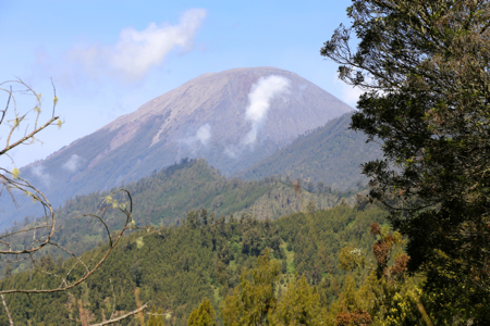
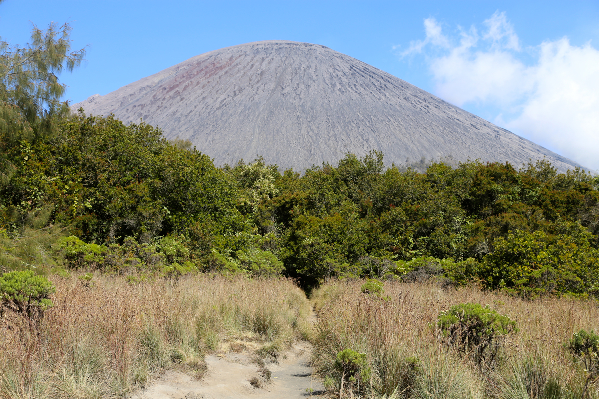
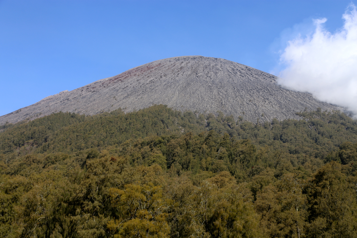
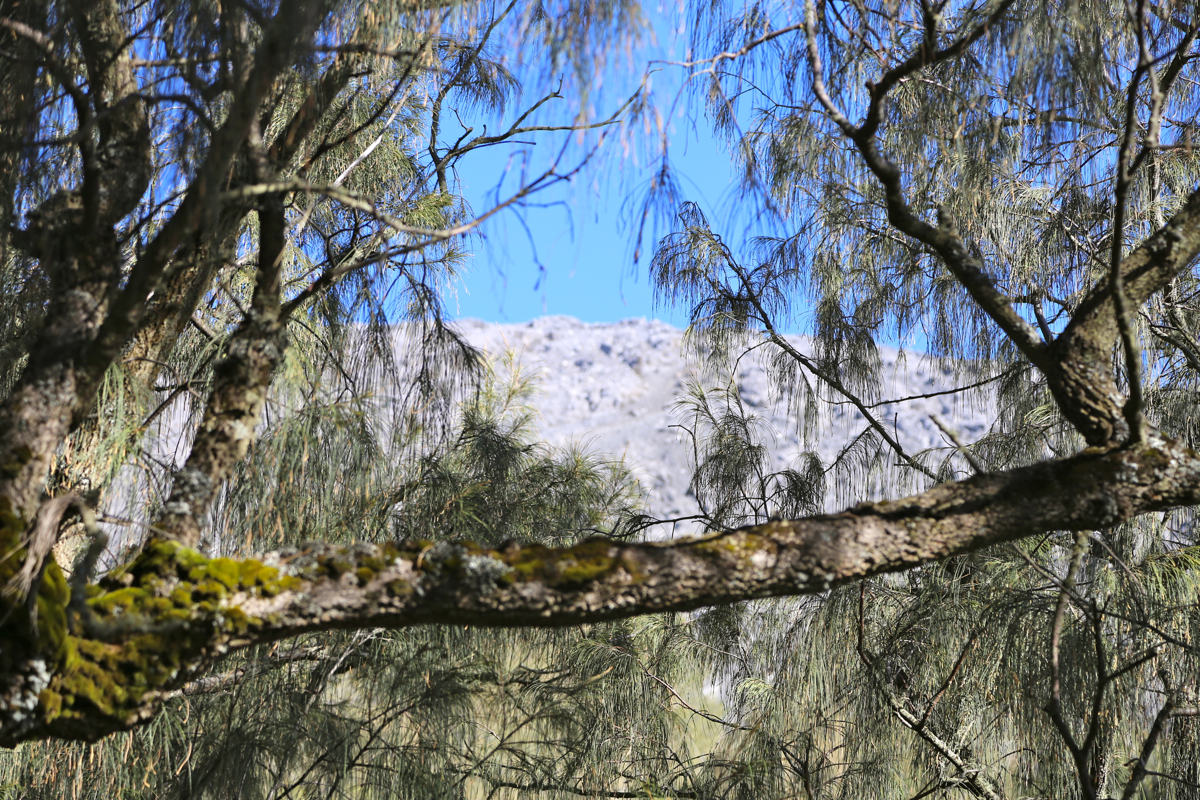
Gunung Semeru is visible from the road,
nice to see the mountain before actually walking.
It can certainly be driven by normal cars as long as one pays
attention to a few, short sections having some road damage.
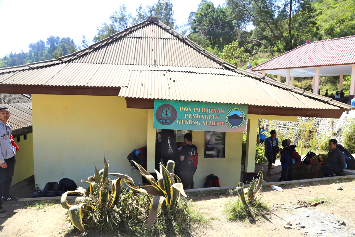
The park office and trailhead
is located at the very far end of the village, beyond the last parking area.
This location is S08.01414, E112.94549, elevation about 2130 meter.
This is a quick summary and reference to climbs made in the summer 2015.
Red Tape:
There is a certain amount of red tape, however, this is normally not a big problem.
A medical statement that declares reasonable health is perhaps the most unusual requirement.
Most people arrange that in the nearby town of Tumpang. There is a doctor there that obviously
specializes in providing just this information. This is quick and inexpensive.
Next, you fill in a form that asks various questions about your trip. All this is presented at the
window on the left hand side of the road at location S08.01414, E112.94549. In 2015,
I paid 207.500 (IDR) for a permit. You do receive a copy, when you return you should report
back and they will record that you are exiting the park.
Route description.
Continue along the road from the park office,
it curves right, then descends into
a small valley with farms. Follow the road along the left side of the field, you will
see a portal up ahead, turn right (going through this portal). The path now runs straight
ahead, but you should take the left fork that goes uphill, this is quite shortly after
the portal. Just after the top of this first uphill, there is a signed fork. The smaller
trail going right, is a short-cut, but you do have to climb over a small hill. The bigger
trail is left, it runs around this ridge and meets the smaller trail on the far side.
Either choice is fine, I did both trails (going and coming).
The trail now runs along the general hillside, curving in and out of several smaller
side-valleys. Finally, it climbs a bit more steeply (right), then crosses more inland and
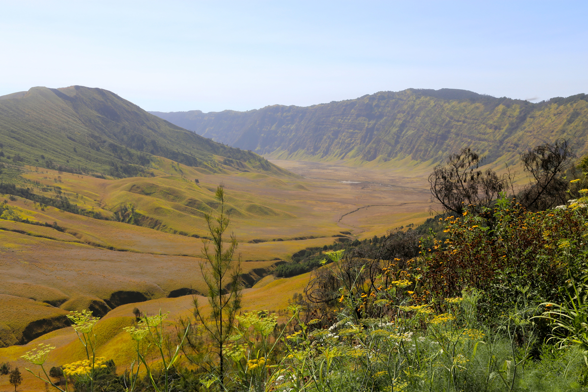
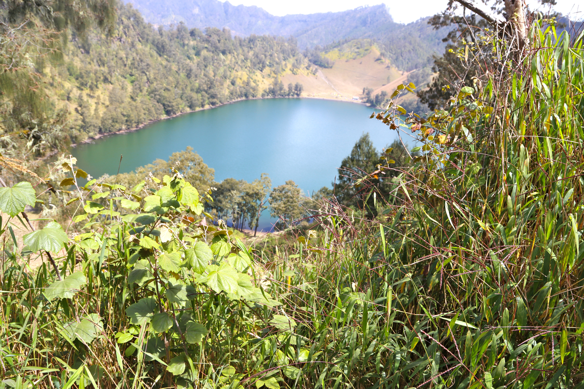
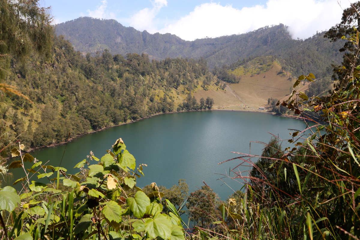
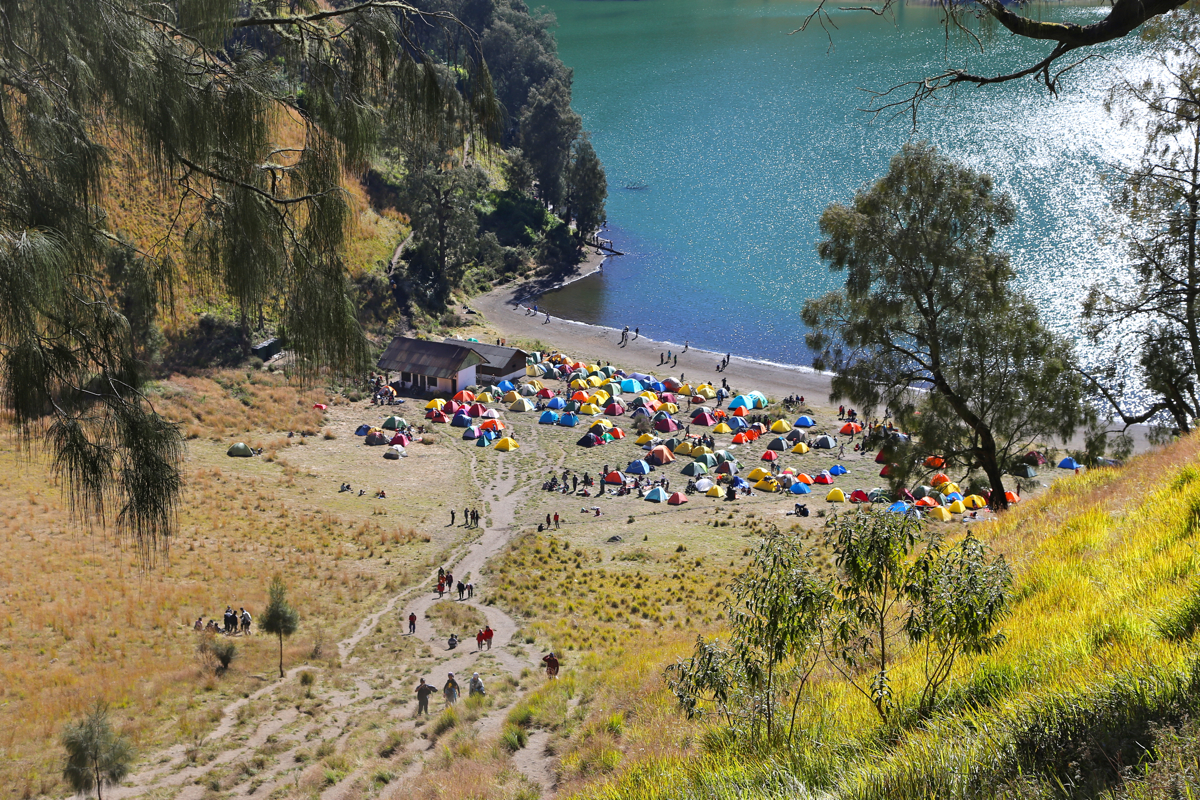
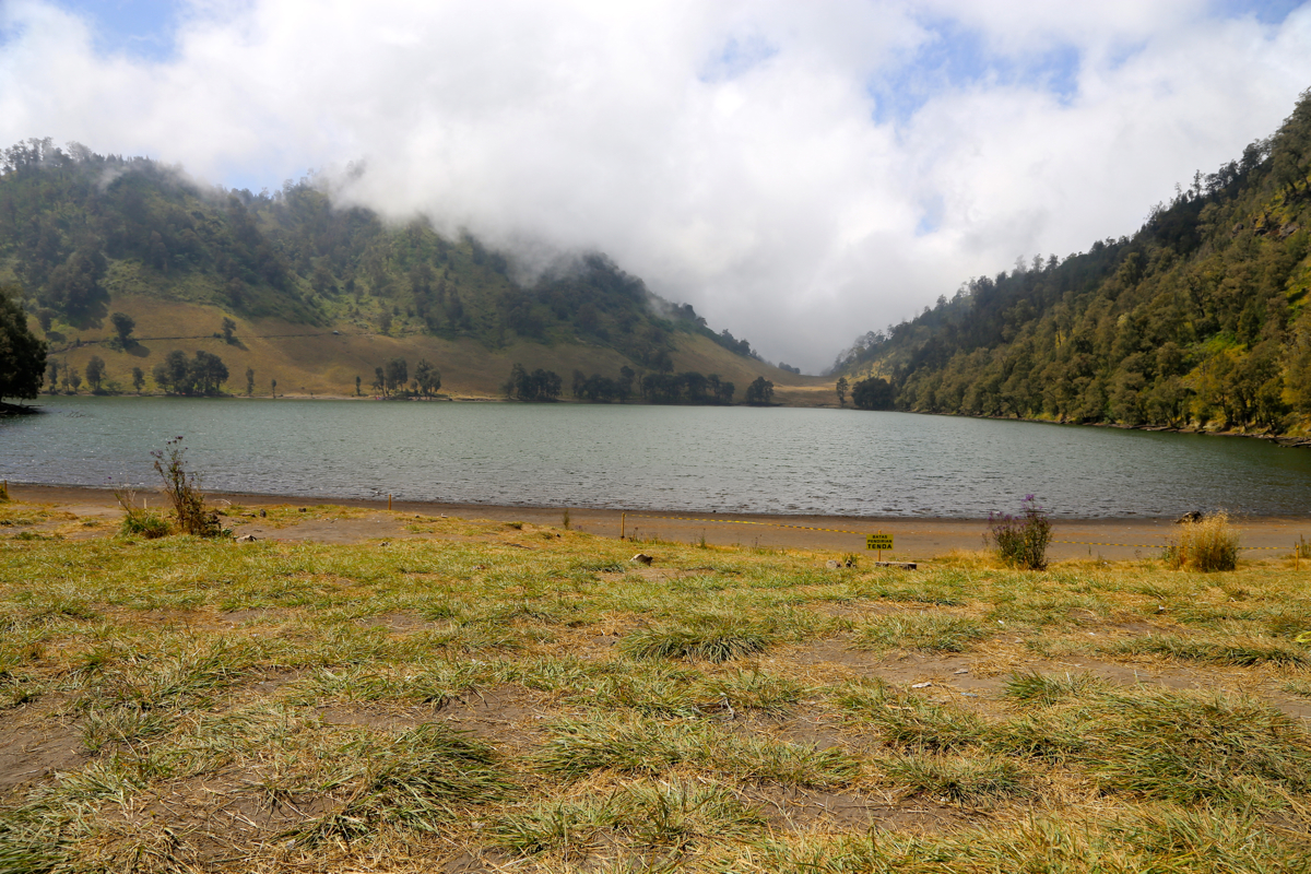
soon overlooks lake Ranu Kumbolo.
Descending to the lake, then crossing from the first (minor)
to the second (more major) camp site.
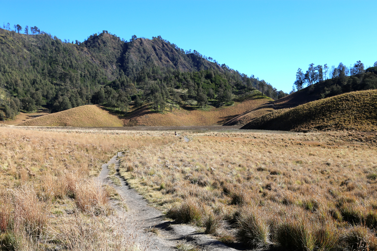
The route now ascends from the lake to a small local col, then descends
to a flat, open area with grass.
From here, a gentle ascent through fairly open forest to a new, higher col.
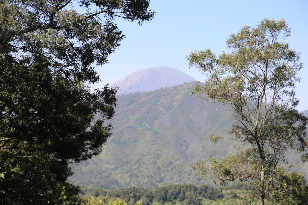
From this col, called Jambangan, you will
see Semeru, a lot closer.
In fact, you realize that Kalimati must be pretty close, located
in the saddle between this col and Semeru itself. Thus, the trail now heads directly towards Semeru,
gently downhill to the Kalimati camp site.
Cross the saddle and head towards the small building. The route runs into the forest just behind this
building. The trail will soon ascend steeply among the trees, this is the first time that one may
say the route is (YDS) class 2, until here it has been a class 1 trail. Near the top of this
small ridge, shortly before the trees end and only the final ascent remains, there are a few flat
spots that may be used as a high camp.
The route now connects nicely with a final, sandy path that extends directly up the slope. This
section is non-trivial since the scree and sand tends to move downhill whenever you try to go
uphill. Finally, near the top, you enter a short stretch of lava with small, passages that lead uphill
to the summit plateau.
The summit area is pretty large and almost flat.
Comments:
Before arriving in Malang, I had several exchanges of email with my hotel
concerning this trip. They were very friendly, but kept proposing a trip
that would be to long (in duration) as well as too complex (in terms of
people and scheduling). I finally decided that the best way to do this climb
would be to only reserve transportation, then climb solo without guides/porters.
I generally feel fine about buying some local services in countries like Indonesia,
but this time it just seemed to carry with it too many complications.
Transportation to Ranu Pani, is another issue. Many will claim that you need an expensive
Jeep (4WD) vehicle because of a poor road. This is, however, not true, a normal car can
easily make it there. The road is paved all the way, the only trouble being some short
sections with pot-holes and damage to the road surface. These sections can be driven as
long as some appropriate care is exercised.
My hotel understood what I wanted and provided a car with driver that would drive me
from my hotel in Malang on Friday, then come back up to Ranu Pani and drive me back to Malang
on the next day. A price of 1.700.000 was agreed, transportation can clearly be organized for
less, but this was "door to door" at my convenience and as such quite acceptable.
I started hiking at 1005, the weather and temperature were both perfect and the trail indeed very
nice and enjoyable. Perhaps a bit crowded, many locals were walking the same trail in both
directions. I arrived at lake Ranu Kumbolo
at 1205, this was a bit quicker than anticipated.
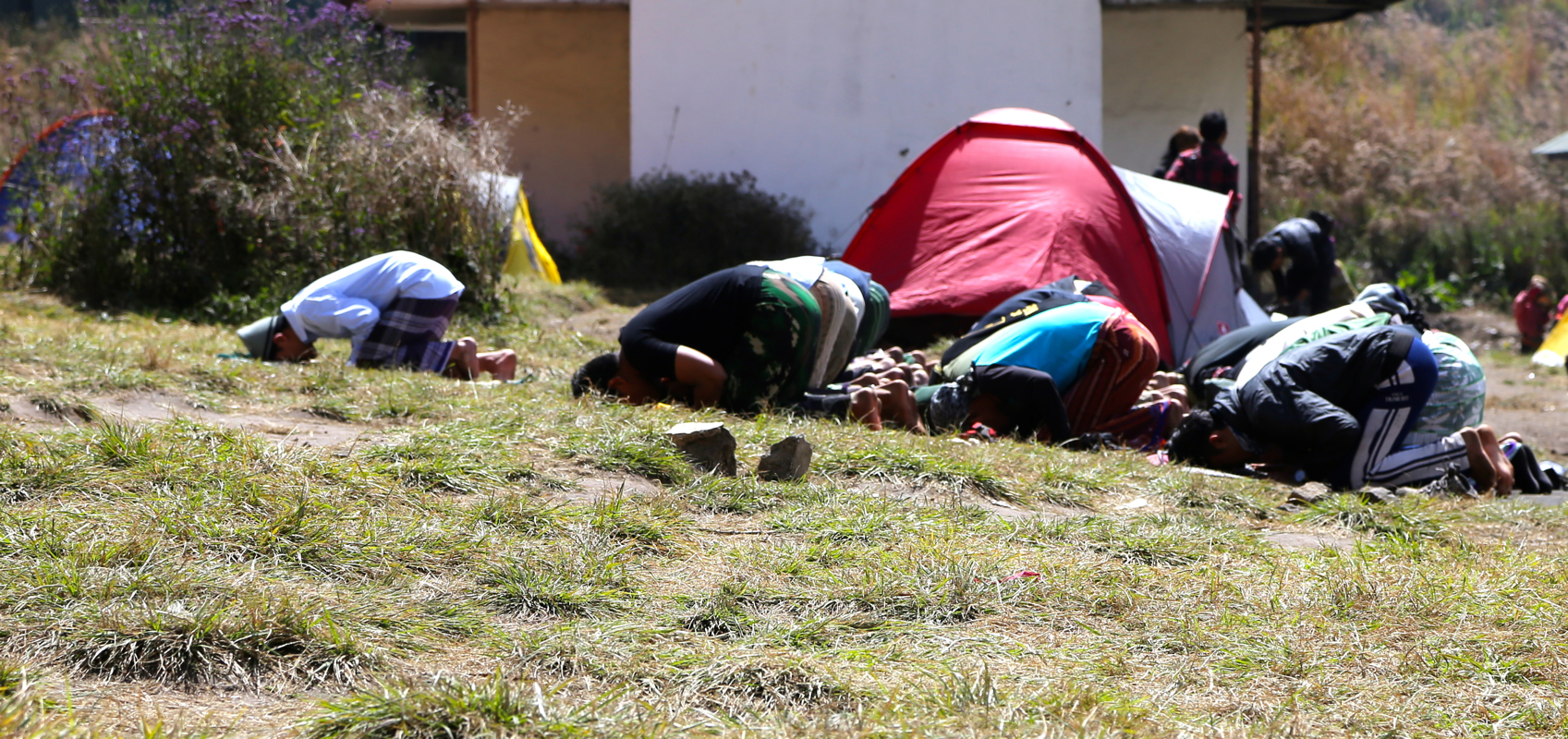
Many tents and hectic
activity. One group of people carried out some religious prayers,
other groups were busy with many different tasks.
People would approch me all the time and ask if they could get a picture with me. I generally said
yes, this was always appreciated. People were smiling, but if a group of 6 shall each have a picture, this
involves 6 differnt pictures, all being arranged etc.
I took a 30 minute break by the lake, mainly
just to observe the local activity. I knew that I should only
walk to the base of Semeru today, then sleep overnight. There were no reasons to arrive at my camp too
early in the day.
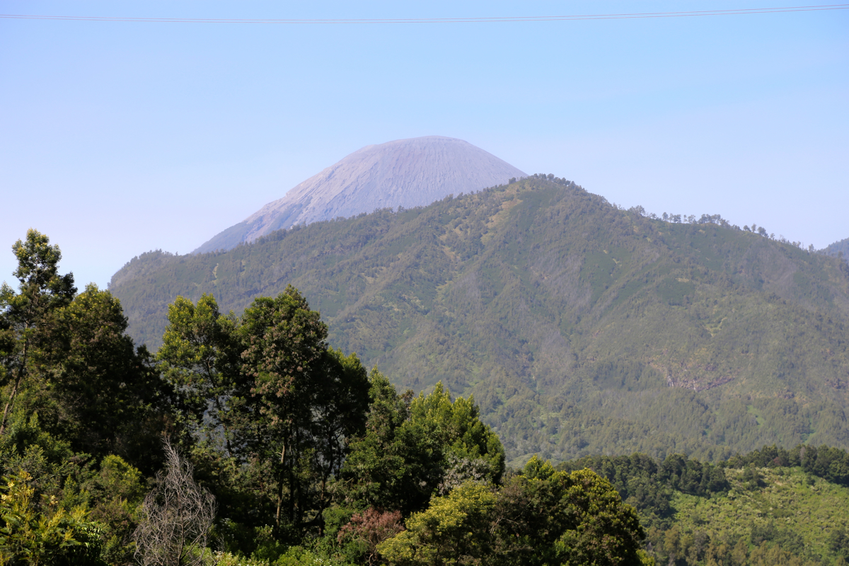
Thus, I continued my walk around 1230. Before long, I reached a distinctive saddle and Semeru came back into
view, much closer than before. It had only taken me one hour to get here and I realized that Kalimati could not
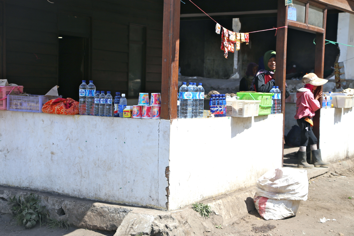
be very far away, necessarily before Semeru itself. A local entrepreneur had set up business at this
saddle, big slices of water melon for sale. The temptation was irresistible, I bough 4 slices and decided that
another good break was called for.
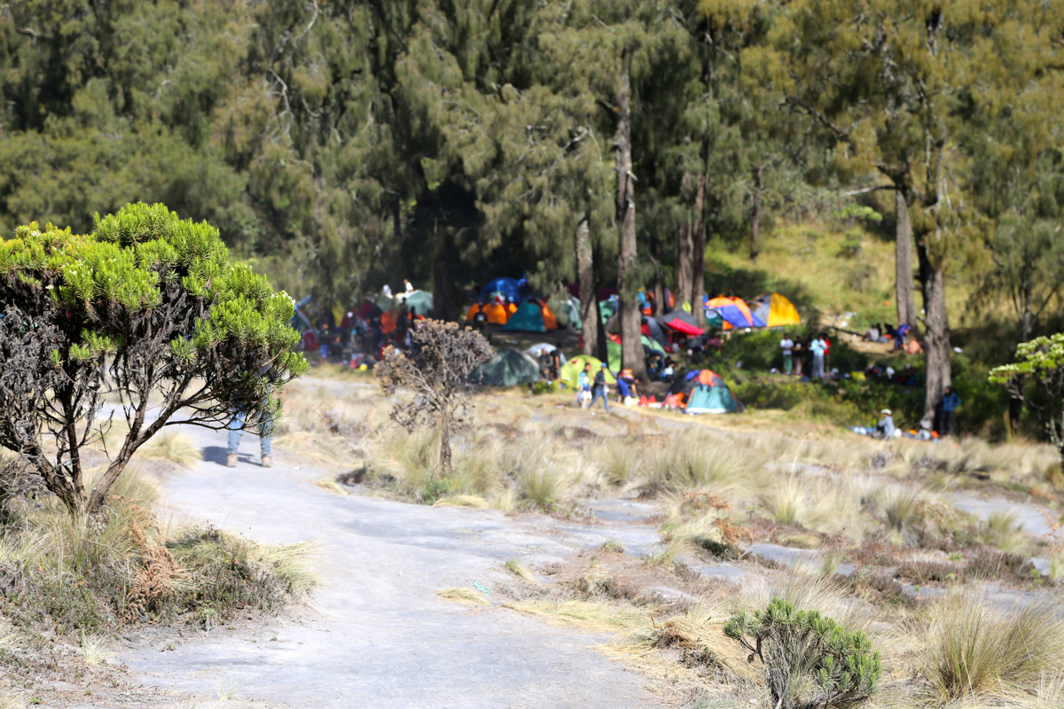
It was still early in the day when I walked across
the Kalimati camp with more than 100 tents, then proceeded
up the trail that leads to the summit.
My plan was to camp as high as possible, then climb to the summit
the next morning. The weather was fine and I realized that there would be time to climb the mountain today, but
then too late to return to Ranu Pani in daylight. However, it is clear that if you start from Ranu Pani in the
early morning, then one can make this climb as a day hike, returning before dark to Ranu Pani.
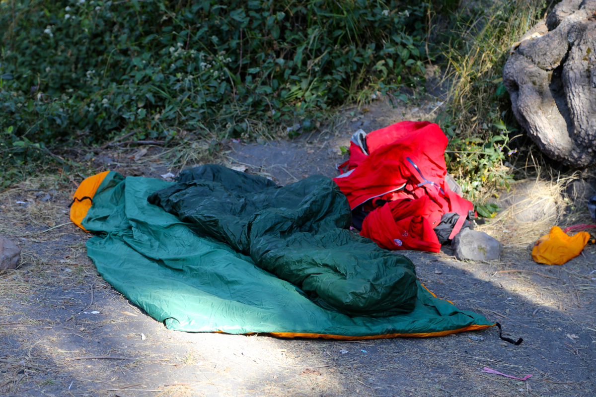
I found a perfect spot to camp,
almost at the top of this area with trees, flat and out of the main
trail going uphill to the summit. I knew that many climbers would start early and I did not want them to
disturb me more than necessary. This spot was at S08.09693, E112.91968, elevation 3050 meter. I quickly got
organized and crawled into my sleeping bag before 1600. With about 600 more meter to gain, it seemed reasonable
to start hiking at 0345 the next morning. This should put me on the summit just before sunrise. The sun set
and I had a good time watching stars before falling asleep.
The first team coming up from Kalimati passed me (too close!) already at 2330. Fortunately, they were a bit
lost, all the teams that followed picked the proper trail and did not disturb me. I woke up as planned around 0330 and
started uphill at 0345. A long string of lights stretching up the slope above me. It looked like everybody
was descending! I soon discovered what caused this. At any given time, about 90 percent of all teams were resting,
more or less collapsed on the ground, facing out. People had incredible trouble with the loose scree and sand.
Many seemed to slip more backwards than their move uphill. Some were trying to drag the person behind uphill,
some were already crawling with arms and legs in the sand. It had not rained for more than a week and the slope
was indeed very loose. Using my boots to kick as if in snow, taking slow, but fairly long strides got me uphill
at a very reasonable speed. I passed more than 100 climbers, many of whom would obviously never make it
anywhere near the top.
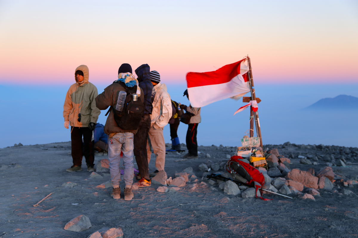
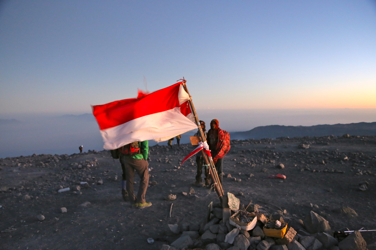
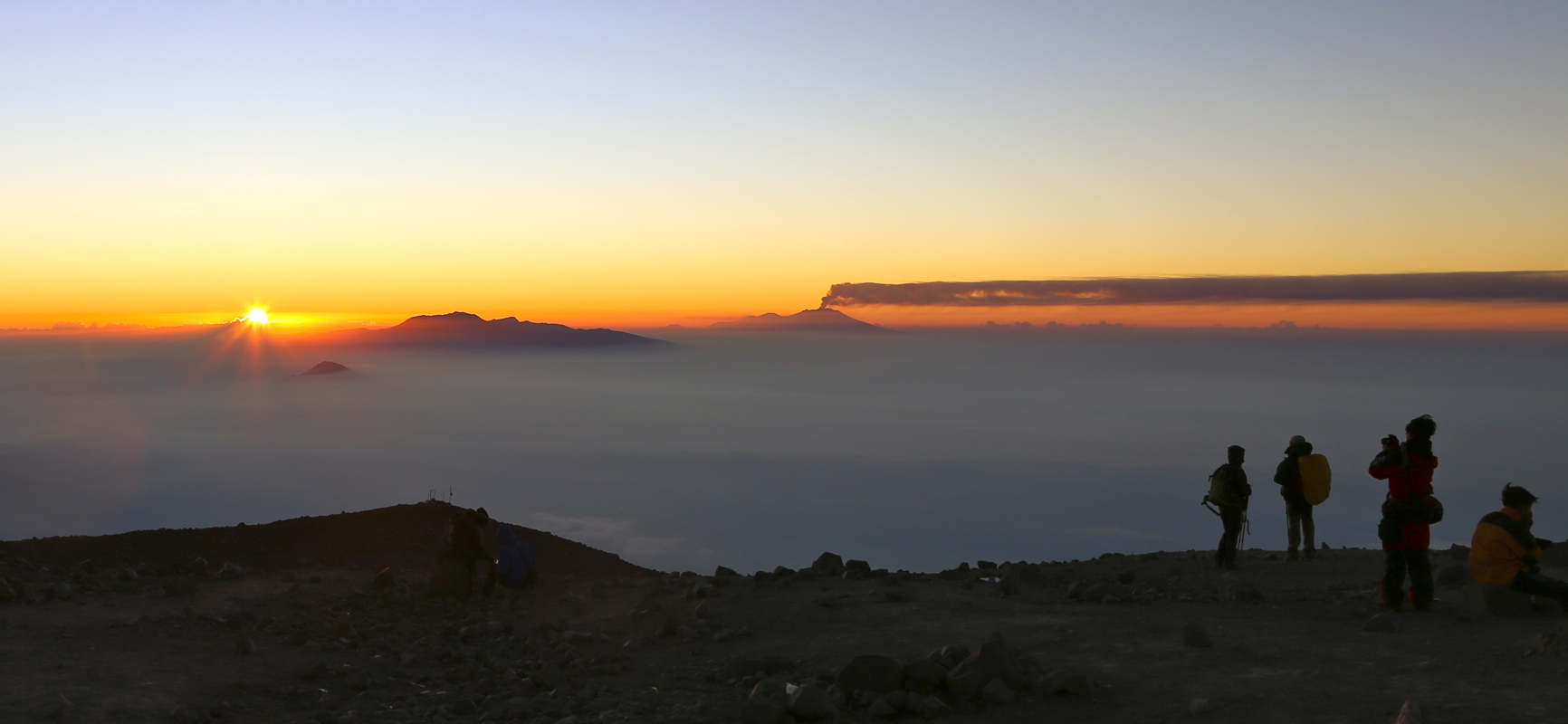
I arrived on top at 0515, so precisely 1.5 hours.
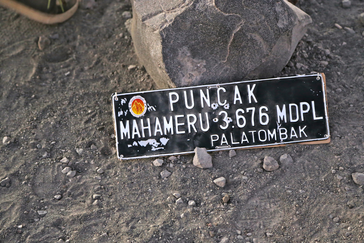
The very summit is called Puncak Mahameru.
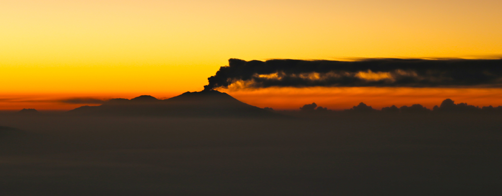
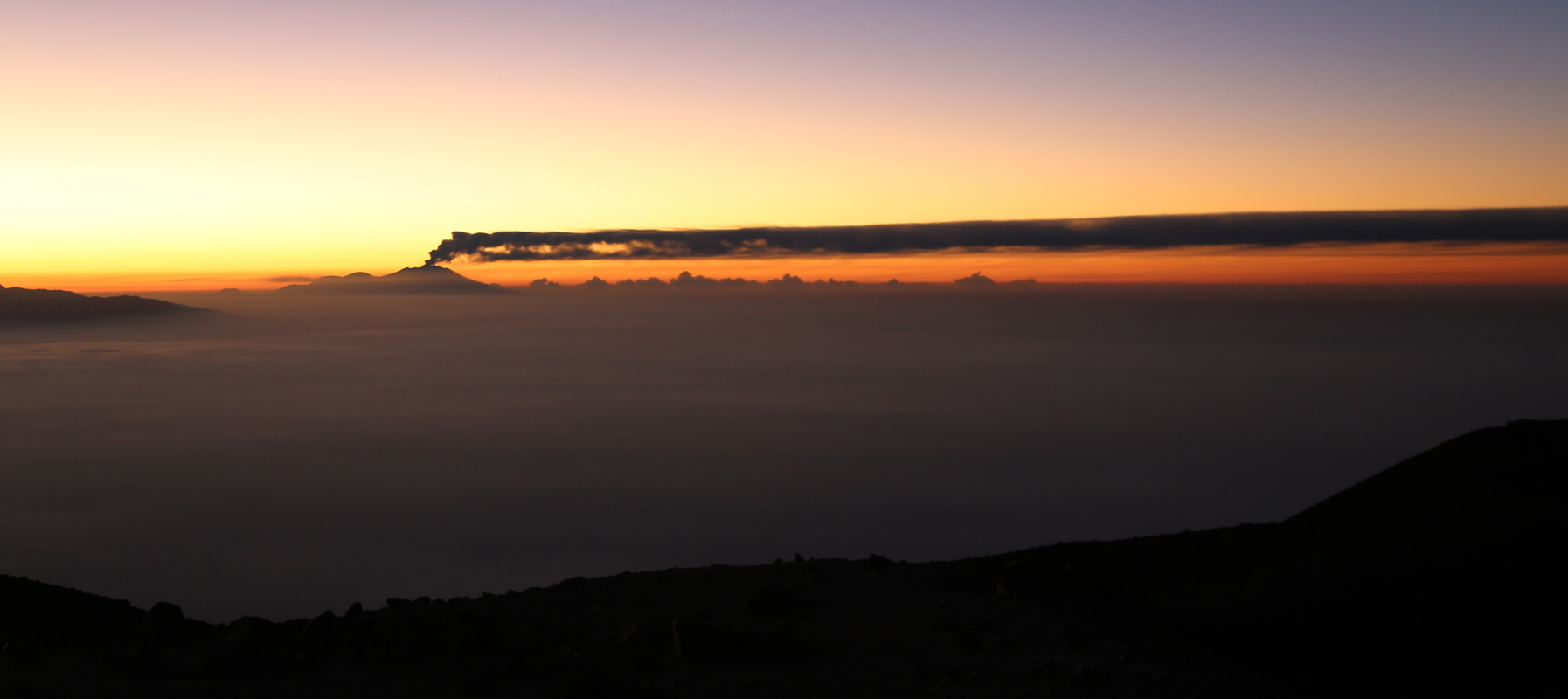
The horizon was red, but the sun still below it. What
immediately caught my attention was the volcano Ruang
further east. What a nice eruption with the
rising sun. Thick smoke going straight up, then bending 90 degrees
and stretching south as far as I could see.
This volcano had just a week ago shut down the Denpasar airport in Bali, our very next destination. The sun came at 0530 and to make things even better,
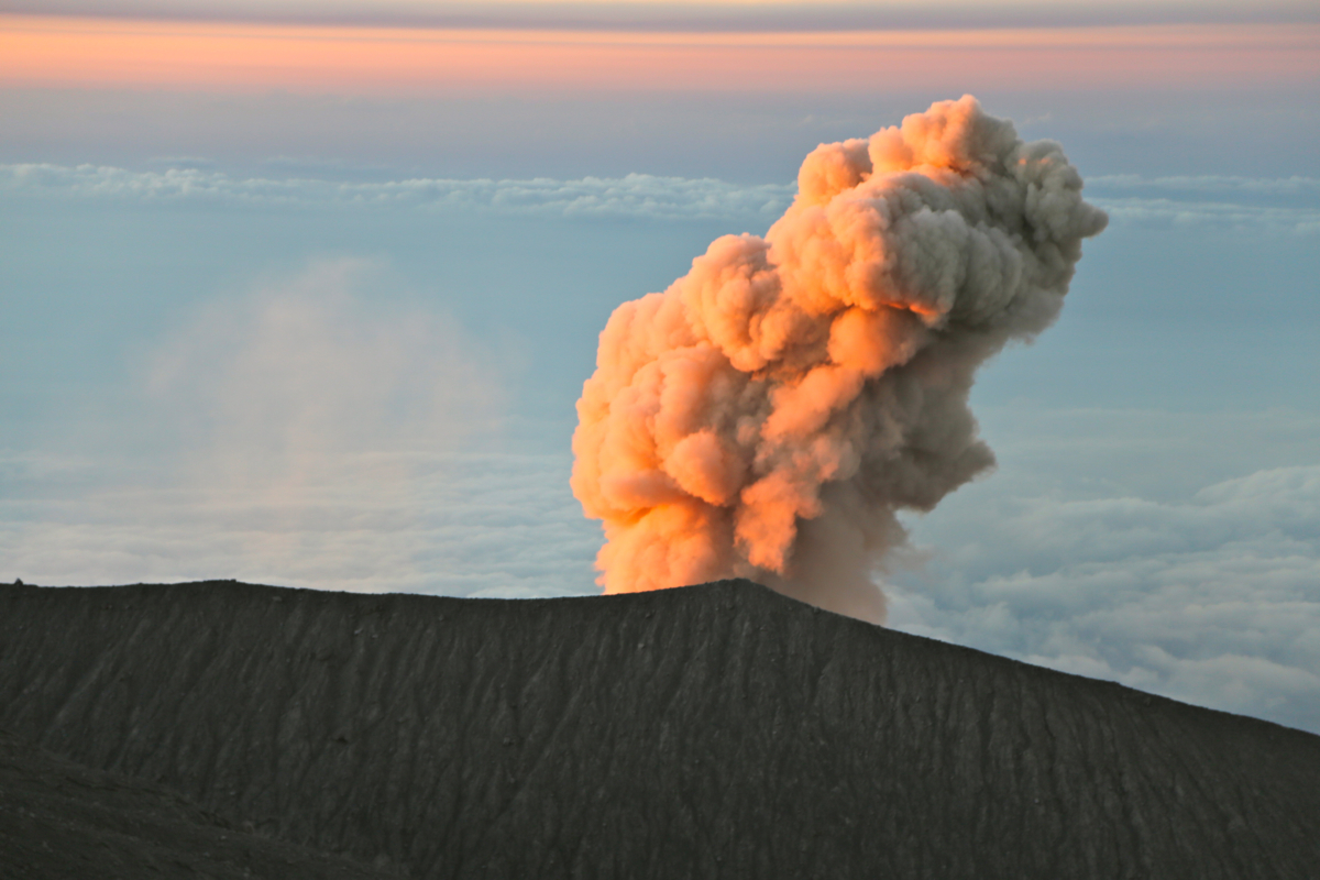
Semeru itself decided to say good morning!
A loud bang followed by a cloud of smoke, nicely illuminated by the rising sun.
I bumped into Florian, a young German man that also had climbed solo. We descended together at 0545. It took
me 30 minutes to reach my campsite. Leaving there around 0645, I walked back to lake Ranu Kumbolo in about
one hour from Kalimati. After a long break there to eat some (limited) breakfast, Florian and I hiked together
back to Ranu Pani, arriving there at 1100. I had booked my return transport for a 1400-1500 departure, so lunch
and a few hours to look at the general life in the village. Florian was happy to get a ride with me back to
Malang. Thanks for good company!
The evening at hotel Tugu was nice, Heidi and I had lobster for dinner and a good German riesling wine,
a perfect way to celebrate that my climbs in Java now had come to an end. Two days later we travelled onwards
to Bali.