Gunung Raung
- Gunung Raung
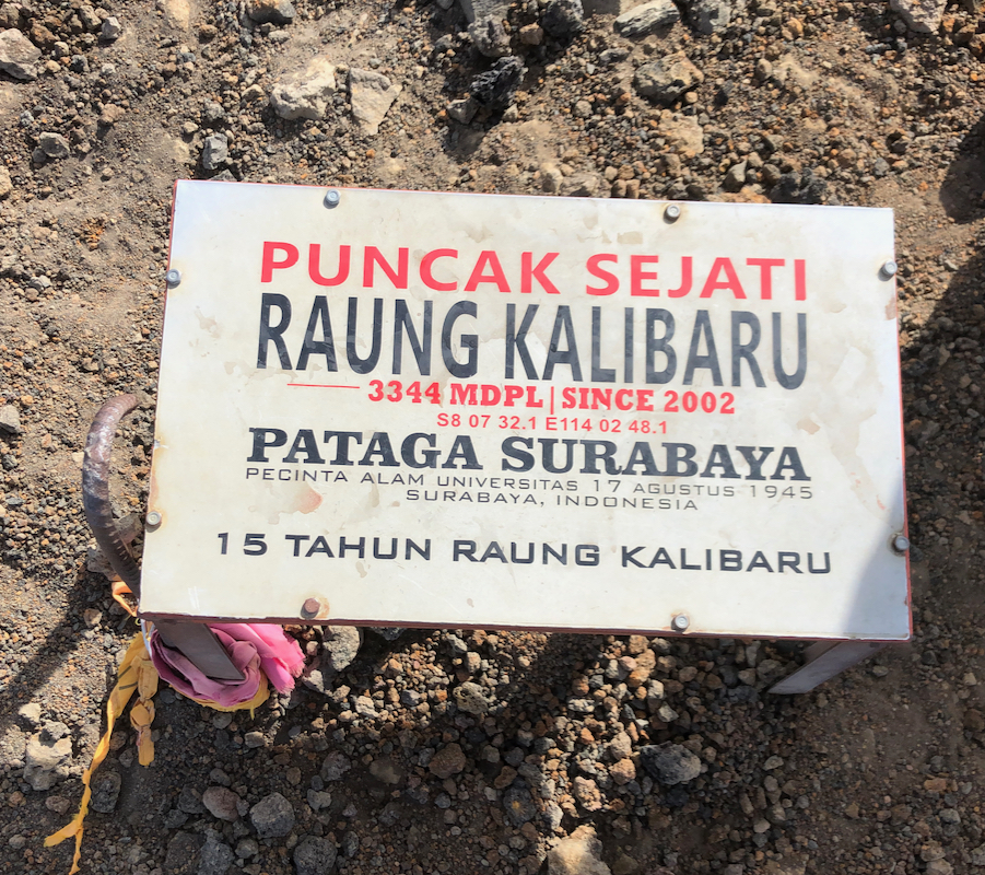
- 3332 m
- Primary factor 3069 m
- Java, Indonesia.
- Location: South 08.12557, East 114.04667 (GPS at the summit)
- Difficulty: YDS class 3
- Climbed August 11. 2019
Gunung Raung
|
|
How to get there:
This excellent web-site on climbing
Indonesia peaks should always be consulted.
One needs to approach this mountain from the south, a village named
Kalibaru. There is another trailhead (north), but that one will not get you
to the true summit. The city of Banyuwangi may be a good point of departure.
Take Hwy. 3 east to Kalibaru, then go north on a pretty rough (still ok for
normal cars) to the area with
the park office as well as several local guide
quarters.
I used Raung Trips, located at S08.25037, E113.98617, elevation about 650 meter.
I had contacted a local guide, Simon, in advance and booked a 2-day trip
with him. His contact details are, email: raungtrip@yahoo.com, and Whatsapp
messages/phone: +62-877-5875-1298. The name of the guide was Simon.
An alternative (private?) email is sionoutdoor@yahoo.co.id.
Here is a summary and quick reference to the climbs on this trip.
Route description:
The registration for
climbing Raung is right across the street from Ranung Trips.
The standard procedure is to use an ojek
(motor-bike) from here to Camp 1. This distance
is more than 5 kilometer and about 250 meter higher.
This ride is rather entertaining as it runs on a trail rather than a road.
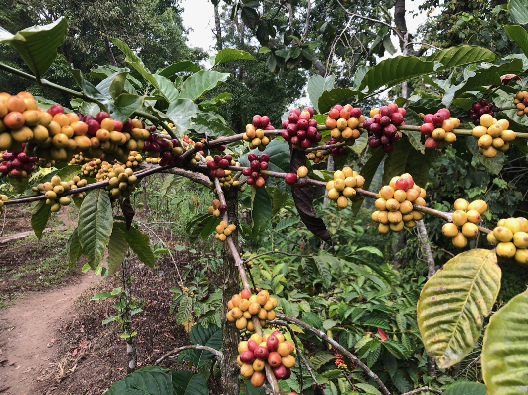
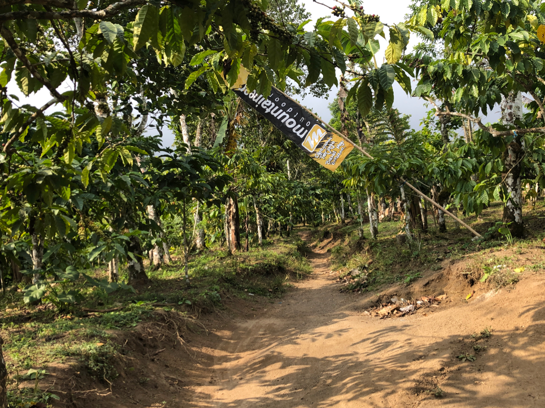
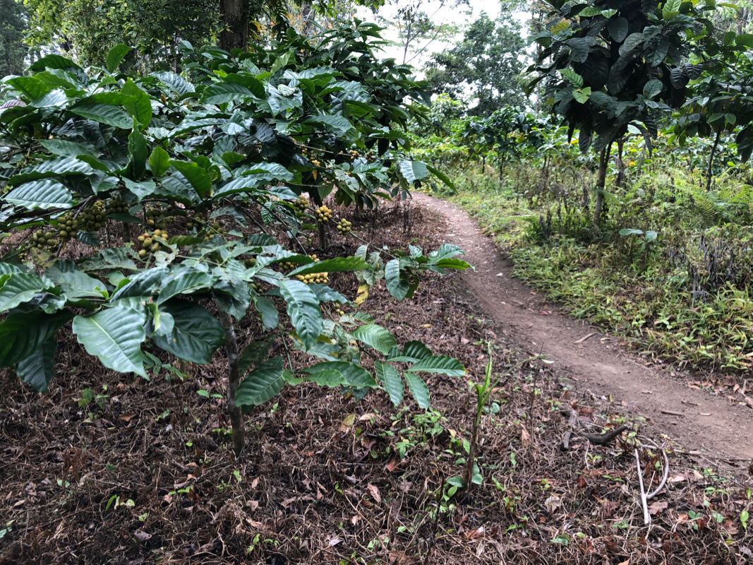
The Camp I area is dominated by
growing coffee.
This location is at S08.20366, E114.00134, elevation about 900 meter.
The trail runs gently uphill
with coffee bushes
on both sides, then gradually enters
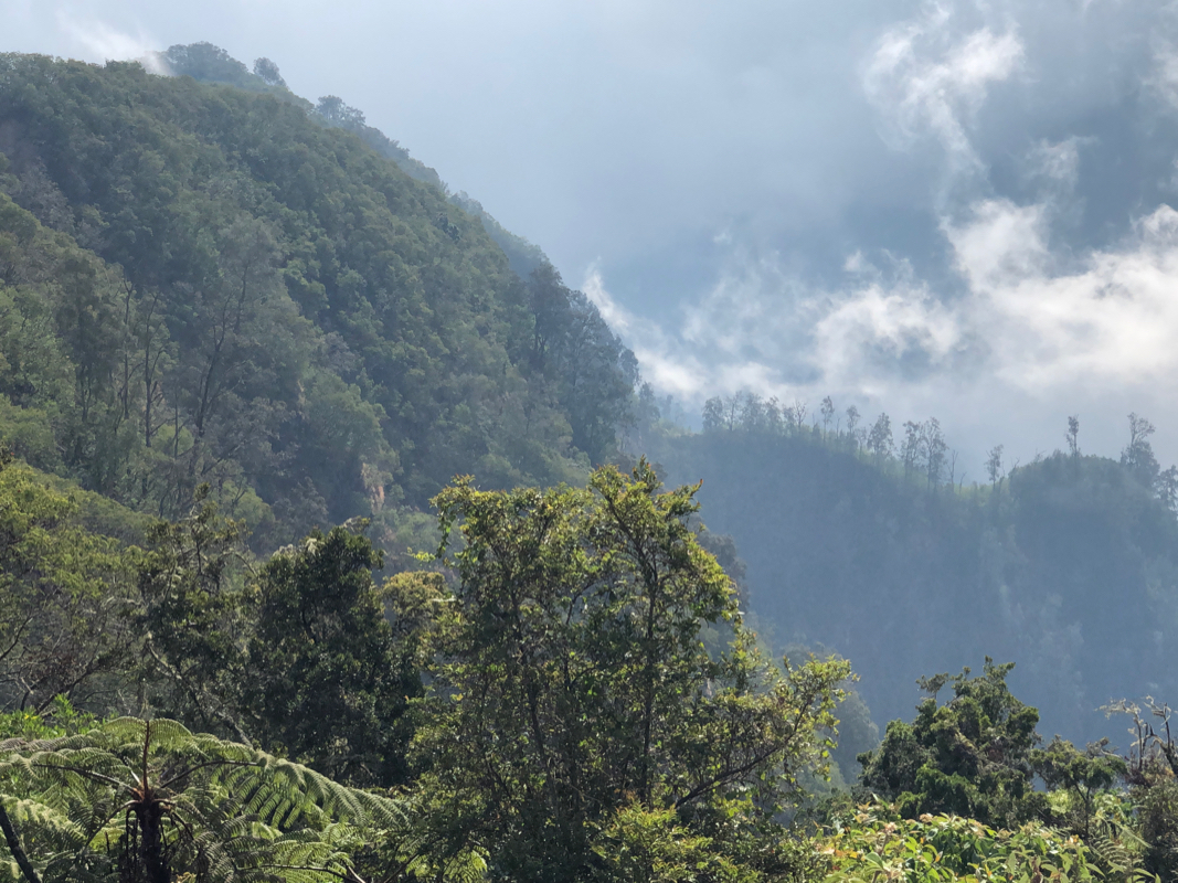
more general jungle. Quite soon, you walk along on the top of a ridge, this will continue
to be the case until you climb the last slope before the summit of Raung. The distance from Camp
I to Camp IV is about 6.5 kilometer, the path is generally very pleasant and easy all the way.
After Camp IV, the trail gets steeper as it keeps climbing the ridge. This ridge is generally
steeper on your left side than on the right, this will become very evident after Camp VII.
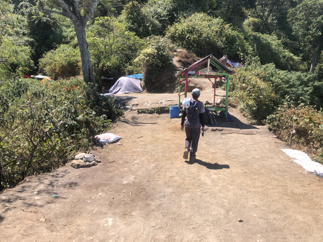
Camp VII is by far the most popular place to spend the night. Some parties stay 2 nights there
on a 3 day climb, but also 2 day trips tend to camp here.
Camp VII is at location
S08.14015, E114.03748, elevation just below 2600 meter.
After Camp VII, the trail becomes even more steep as it keeps climbing the ridge. The left side
of the ridge turns into a steep drop and offers some views when the trail at some points runs
very close to the edge. You pass Camp VIII and then arrive at Camp IX. This camp is very close to
treeline. For a 2 day climb, the best option would really be to stay here, possibly at a slightly
higher cost, see my comments below.
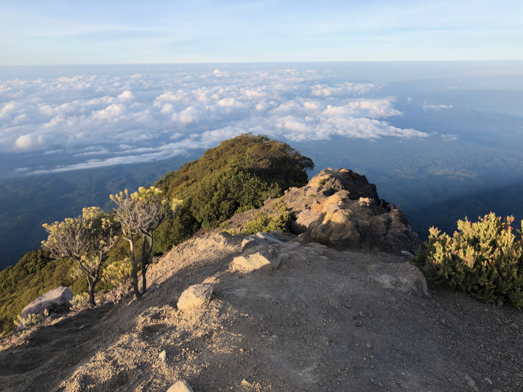
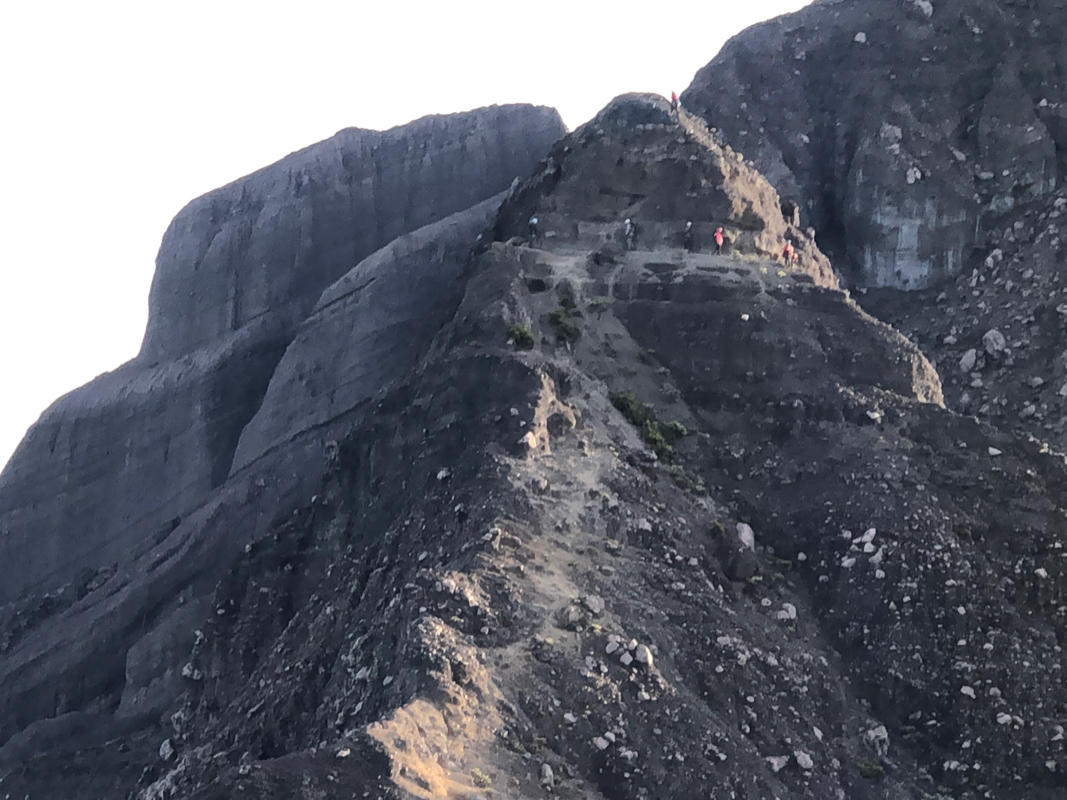
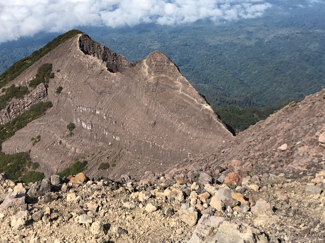
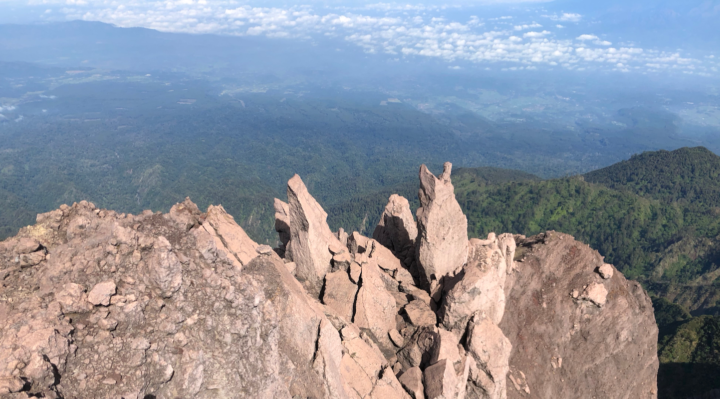
Shortly after Camp IX, the trail exits from the vegetation
and you will see Puncak Bendera with
a flag at a very short distance uphill. The ridge and path from the end of trees to Bendera is
broad and easy. From Bendera
you can see almost
all the rest of the route to the summit.
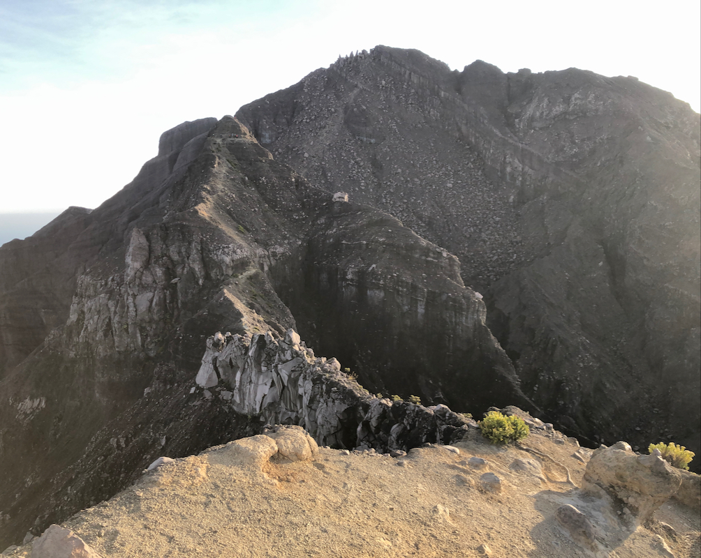
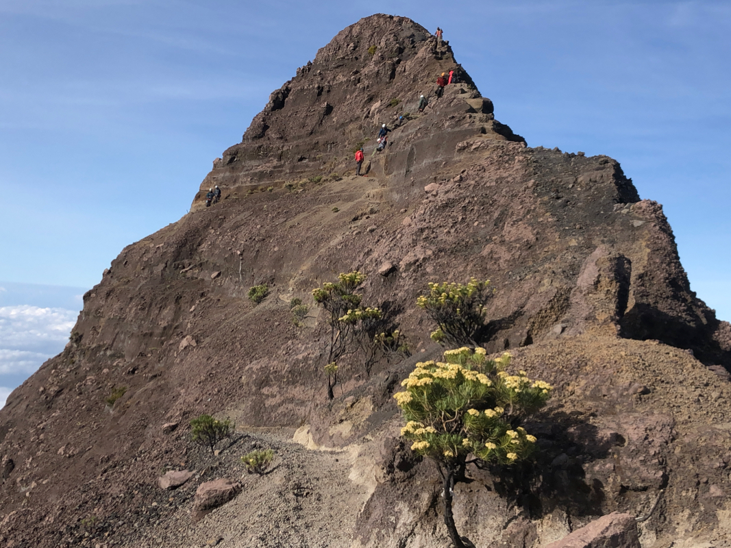
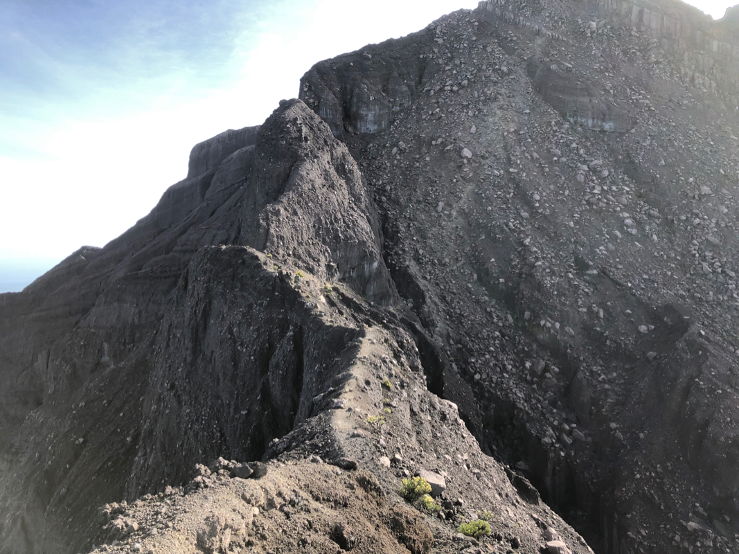
First, descend on a good climbers trail towards the first small saddle on the ridge.
Soon, there is a somewhat narrow section
of the trail, however, still an easy walk.
Descending a bit on the right, There is
a single spot on this trail where you bypass a rock and a careful climbing move is required.
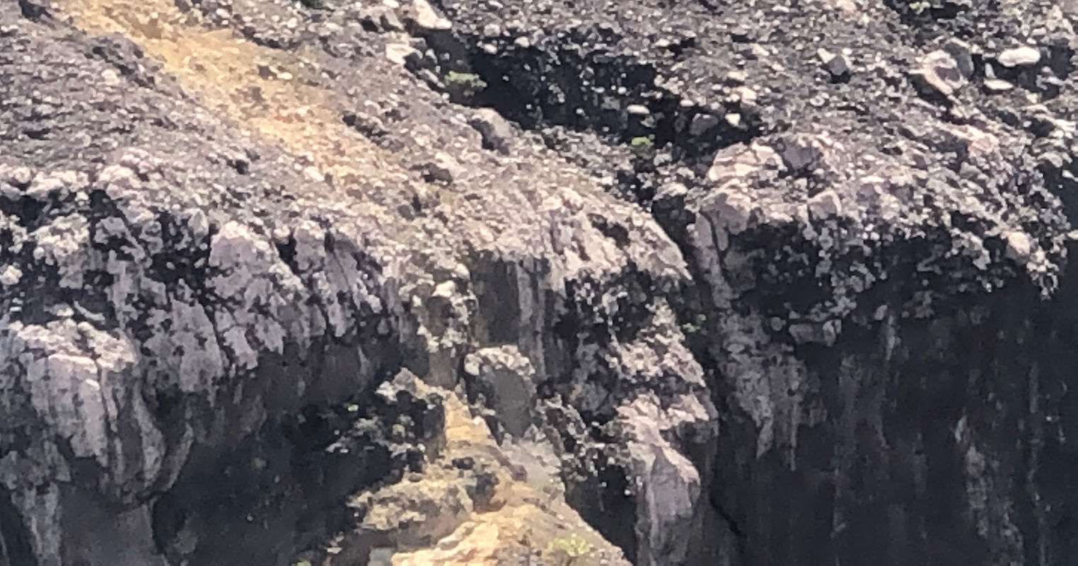
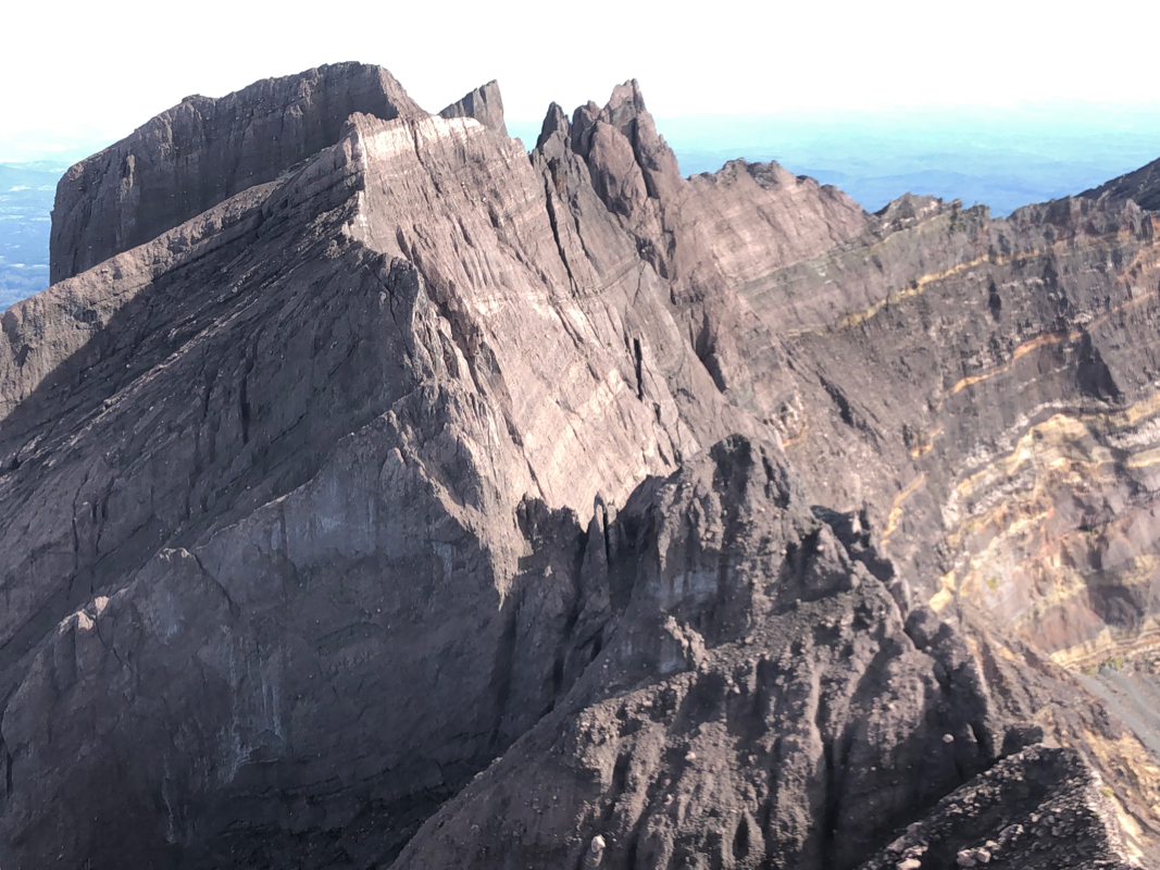
The trail levels out and moves right under a cliffband that blocks access to the slope of
Puncak 17. This is the crux of the route.
Move right on a ledge that narrows, but grants you
access to a sloping rock with many good holds and even a big flat foothold halfway up.
The climb is (YDS) class 3, but there is considerable exposure. The climb is only 3-4 meter,
then you gain easier ground
with several rusty anchors.
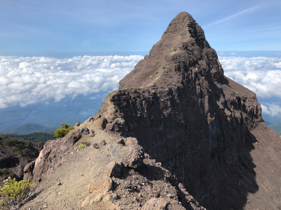
After this, ascend on easy ground towards the next local peak on the ridge, this one is
called Puncak 17.
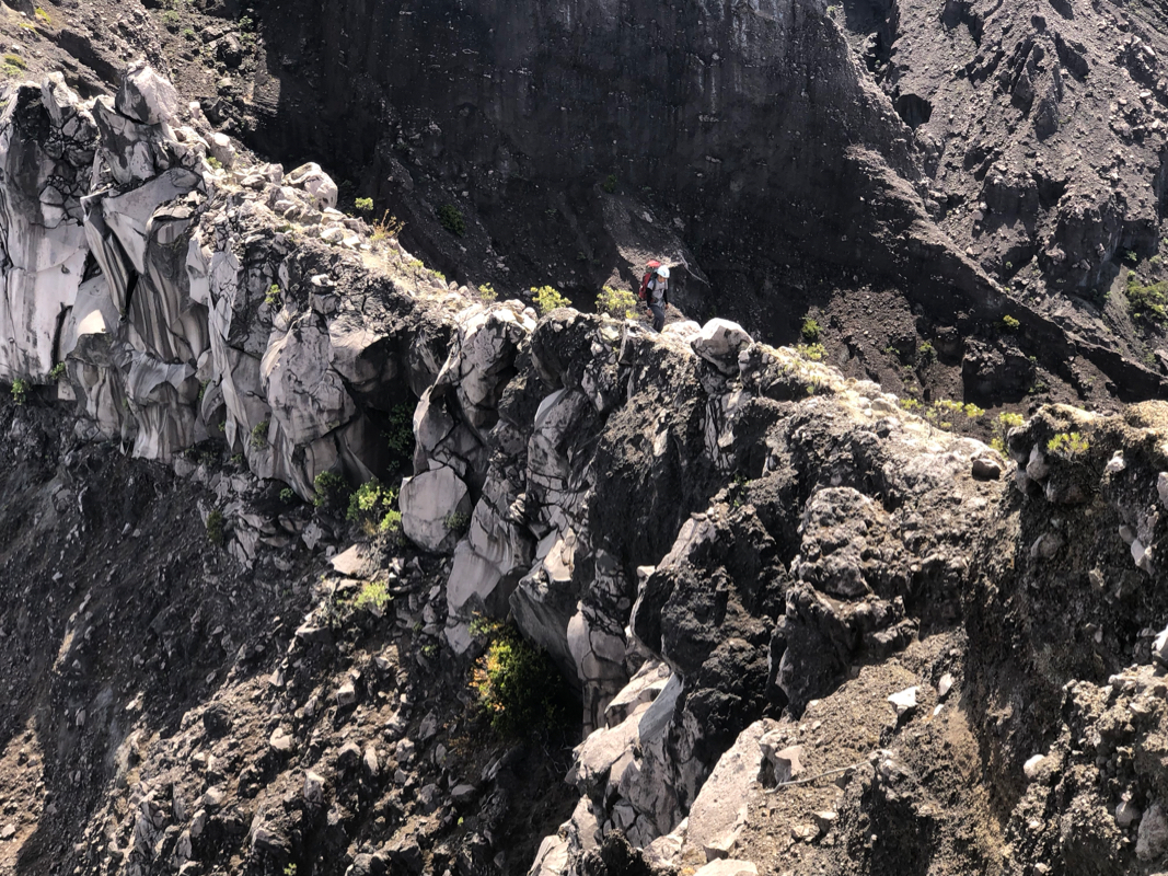
Go as high as convenient, then follow a goat trail that traverses around the
peak on your right hand side. You need to make a few steps down about half way. The trail follows
a narrow, but flat ledge. Again, this is
completely straightforward, but there is exposure and normal care must be exercised. The best way
to visit the summit of Puncak 17 is ascending it
on a climbers trail from the side you are on after
completing this bypass traverse.
The route now continues with a second, horizontal narrow passage on top of the ridge, the path
is wide enough for normal walking. You next
arrive at the upper end of a gully that connects to
a final small col before the terrain slopes uphill towards the
summit of Raung. This gully is not
very steep, but quite loose. Scramble down and exit right at the bottom. The route continues
with a short descend off the ridge to your right, in order to
connect into the local face that
extends uphill almost to the very top. There are small variations, the route is easy to
follow as it generally heads uphill and right. There are several flags that show the general
direction. Near the top there is a fork and the recommended way is to ascend left ignoring one
flag (which is directing more right). You traverse some big boulders,
the easy path is around
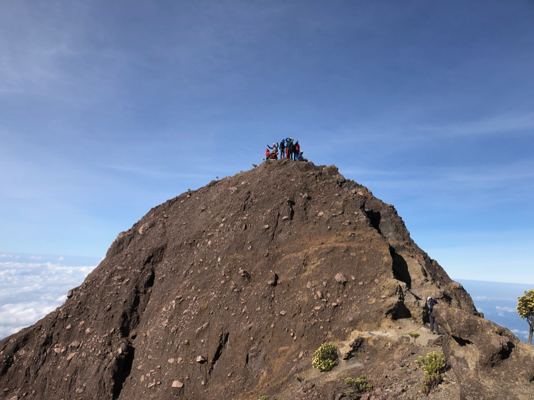
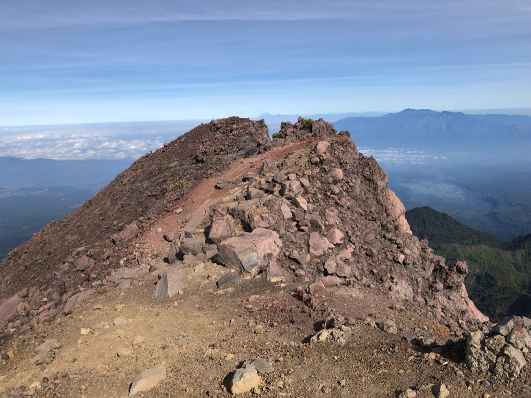
on the outer side, then what remains is a short stroll
gaining the small summit ridge and leading
to the highest point.
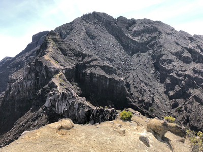
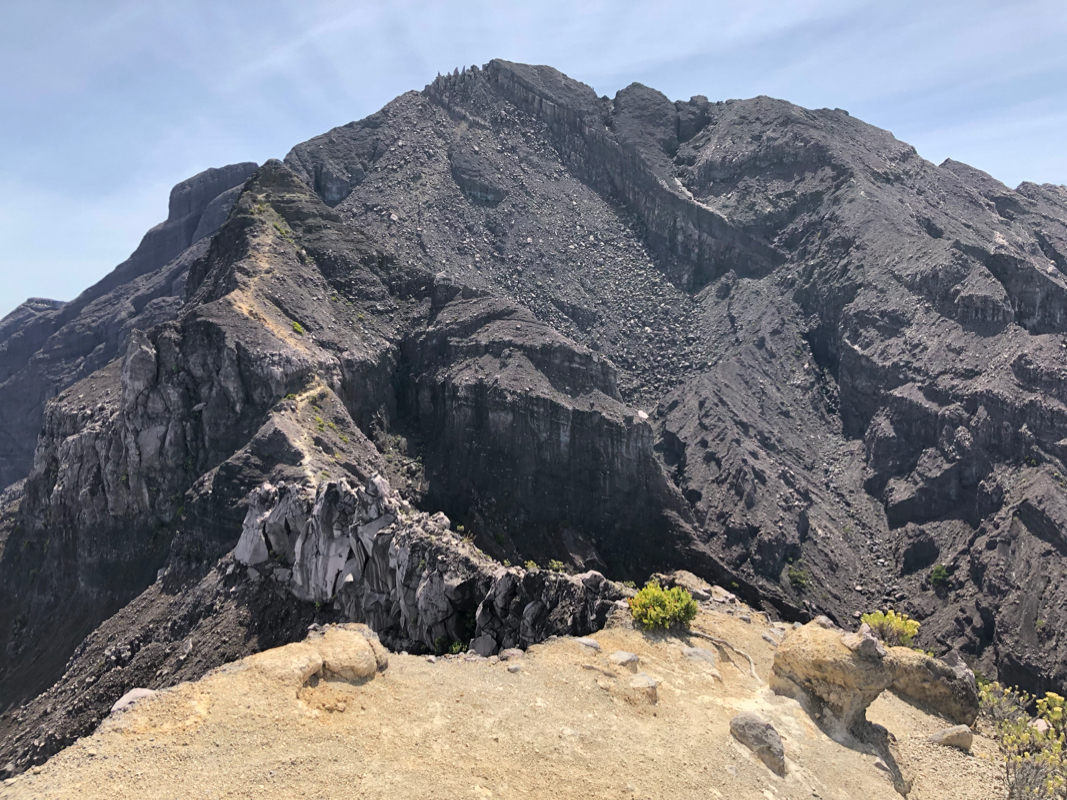
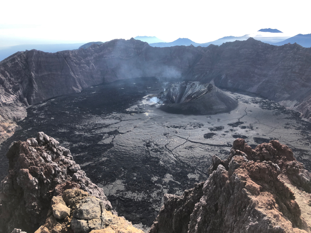
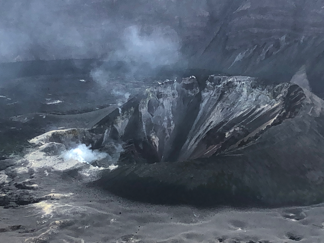
The view of the crater is quite impressive.
From here, one may also look back
at most of the route along the ridge from Puncak Bendera
to the final slopes of Raung.
Comments:
This was my last ultra on Java. It could not be climbed in 2015 due to an eruption.
I had contacted Raung Trips and asked about a 2 day ascent, it seems most people take
3 possibly even 4 days. Thus, it was agreed that I would climb the mountain on the
weekend August 10/11. Heidi and I had established our last "Base Camp" at the small
hotel Bangsring Breeze on the east coast of Java. I first went on to climb
Argopuro,
then enjoyed a couple of rest days at the hotel before heading off for Raung.
When asking about what time to meet, Simon suggested 0700. I organized a car to
take me from the hotel, leaving at 0445. The drive took 2 hours, I arrived at
Raung Trips, the place is called Base Camp Pak Yayan, at 0645.
Simon was having breakfast and I briefly talked with another guide that also
would go up the trail today with 5 people from Singapore. We got ready and departed
on two ojeks.
The ride was rather fun as we drove on a trail rather than on a (bad)
road as is normally the case with ojek transport. We stopped at Camp 1, while our
porters (we had 2) got a ride a bit higher, essentally until the trail became
unsuitable for motor-bikes.
We started walking from camp I at 0815. The trail was pleasant and we soon caught
up with one of our porters. Simon said that we should stop and spend the night
at Camp VII. I realized that this would be a short and easy day indeed. I had told
my driver to be back to pick me up for a return drive the next day (Sunday) at 1500.
Thus, I suggested to Simon that perhaps it would be better to walk all the way up to
Camp IX today, then getting a slightly easier day tomorrow. However, it quickly
became clear that this was not an option. Simon had agreed and paid our porters for
going to Camp VII only. He said the trail above Camp VII was difficult and that
the porters would not carry up there. OK, I surely could have left Bangsring after
breakfast, we could have started the hike up to Camp VII closer to noon etc. No big
deal, but the way things were organized seemed less than optimal.
I arrived at Camp VII at 1145,
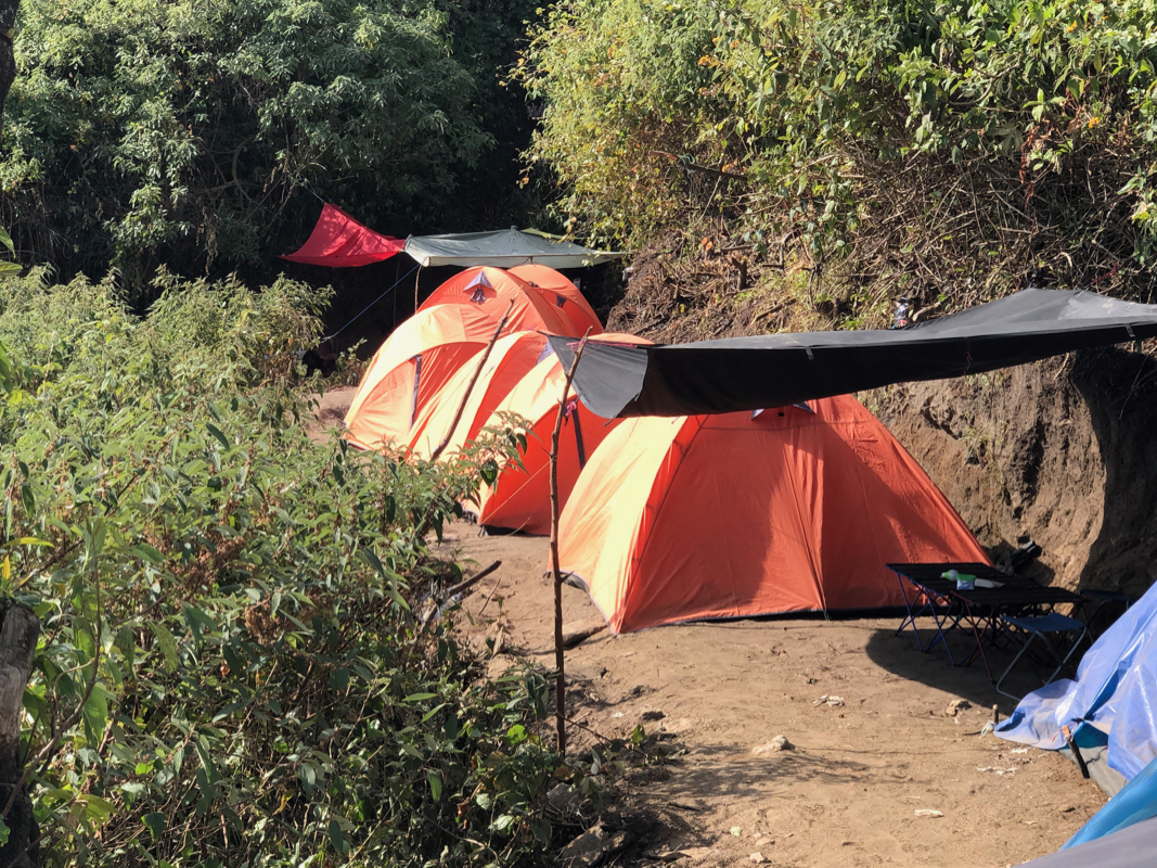
so 3.5 hours to here. Lots of tents.
A group from
Singapore had left for the summit at 0200, they eventually
returned around 1600, so
14 hours. More people (also from Singapore) would arrive in the afternoon with the
guide I had talked to in the morning. Not much to do, but
look at the nearby terrain and talk to
various people. Dinner was served early evening, lots of good Indonesian
food. I was pretty firm to cancel any idea to leave for the summit between
0100 and 0200, I suggested that we might leave sometime before 0500. Simon agreed
to this, he was still somewhat surprised that we had hiked up to this camp in less
than 4 hours.
Our porters arrived with 2 small tents.
A bit later the other guide from Raung Trips arrived
with porters and 5 visitors from Singapore.
They used 2 larger tents, one for the clients
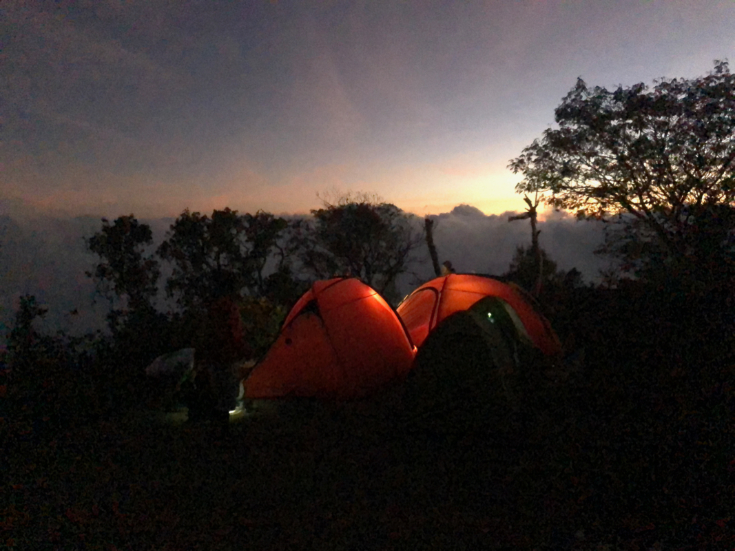
and one for the support team. It was a fine evening
and gradually the light faded and stars
dotted the sky.
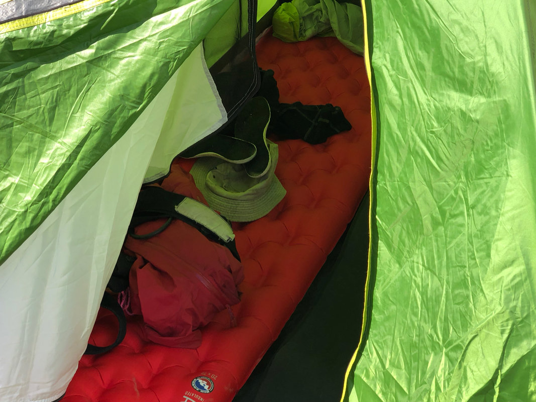
I did not bring a sleeping bag, the
temperature typically stays at 10 C or more even at night.
A warm fleece and some wool underwear would keep me warm and comfortable.
Good sleep, but obviously a bit interrupted by all the noise when the other party
started out between 0100 and 0200. Having a different camp than VII would also
carry the benefit of avoiding the noise from other parties in the middle of night.
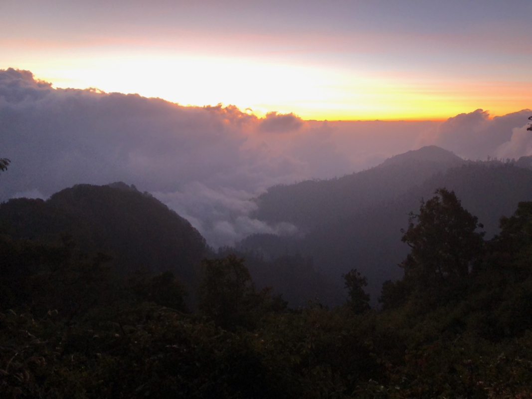
I woke up sometime after 0400, we got ready and left at 0445. The hike up to treeline
is steep, but not very long. As it turned out, one of our porters came along and he
did not keep up. I first waited at camp VIII,
then more waiting at the summit
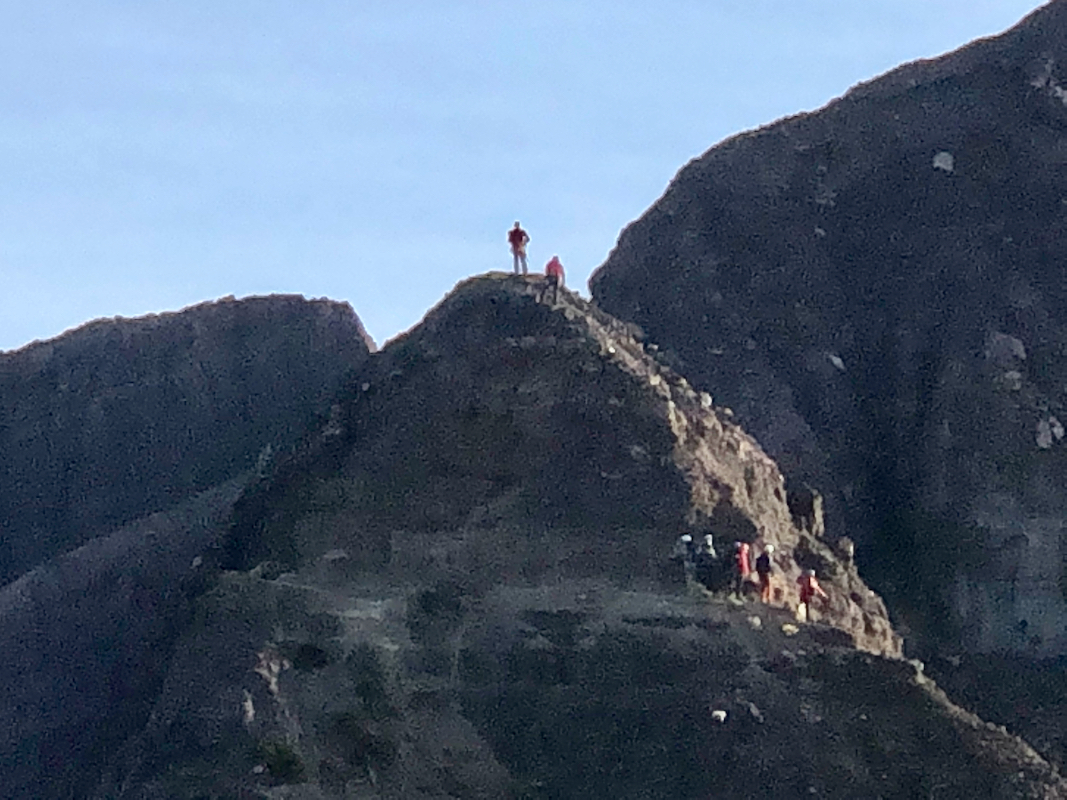
of Puncal Bendera. It was a nice morning and it was interesting to look at the route
onwards to the summit of Raung. The team that started several hours ahead of us
were climbing Puncak 17,
the next peak along the ridge. As soon as Simon and his porter joined me,
we continued down the ridge to the
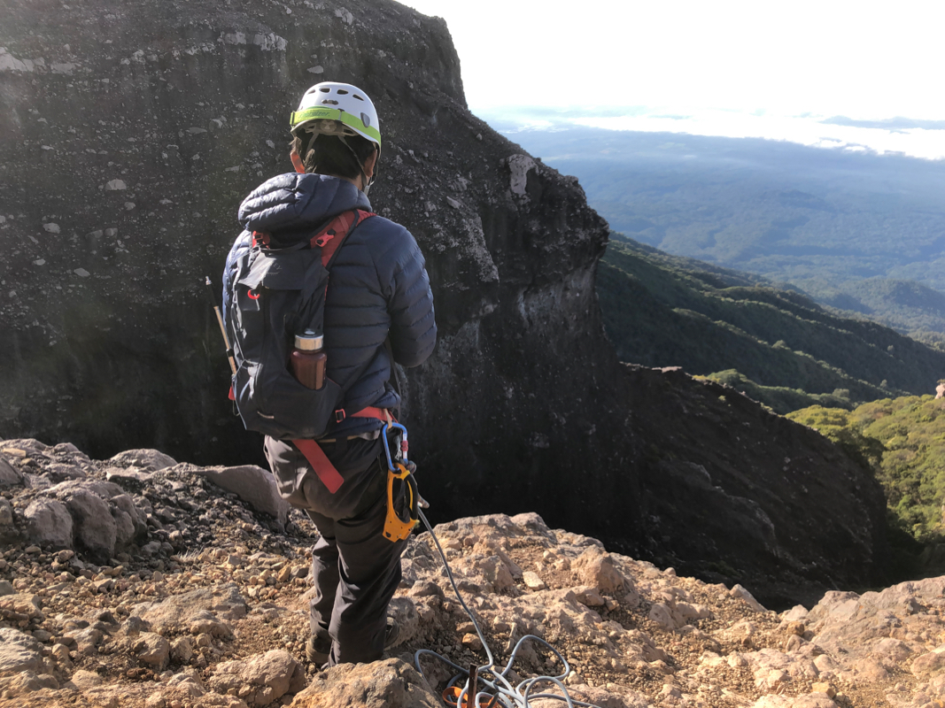
crux part of the route. Simon started out, attached
a carabiner to a permanent bolt high on the rock before the climb, then climbed up, while
I belayed him from below. He signaled that he had established a secure position and
I started up. However, I soon noticed that Simon was not taking in any rope. I asked
him to do so, but it now turned out that he did not have an ATC. Rather, he assumed
that I would climb along a stationary rope using a jumar! Well, too late to do anything
about this now, the rope was slack and I was almost up. I finished the scramble and
joined Simon. He had anchored the rope to two different rusty iron pegs, at least
this part looked good. The porter joined us and we could continue.
Traversing around Puncak 17, put us in front of the other team, since they had
visited the small summit. I proceeded across the narrow ridge and down the gully
before Simon caught up. It seemed that he had expected to use the rope in the
gully as well. Soon, we were on our way up the broad face, easy going. Our porter
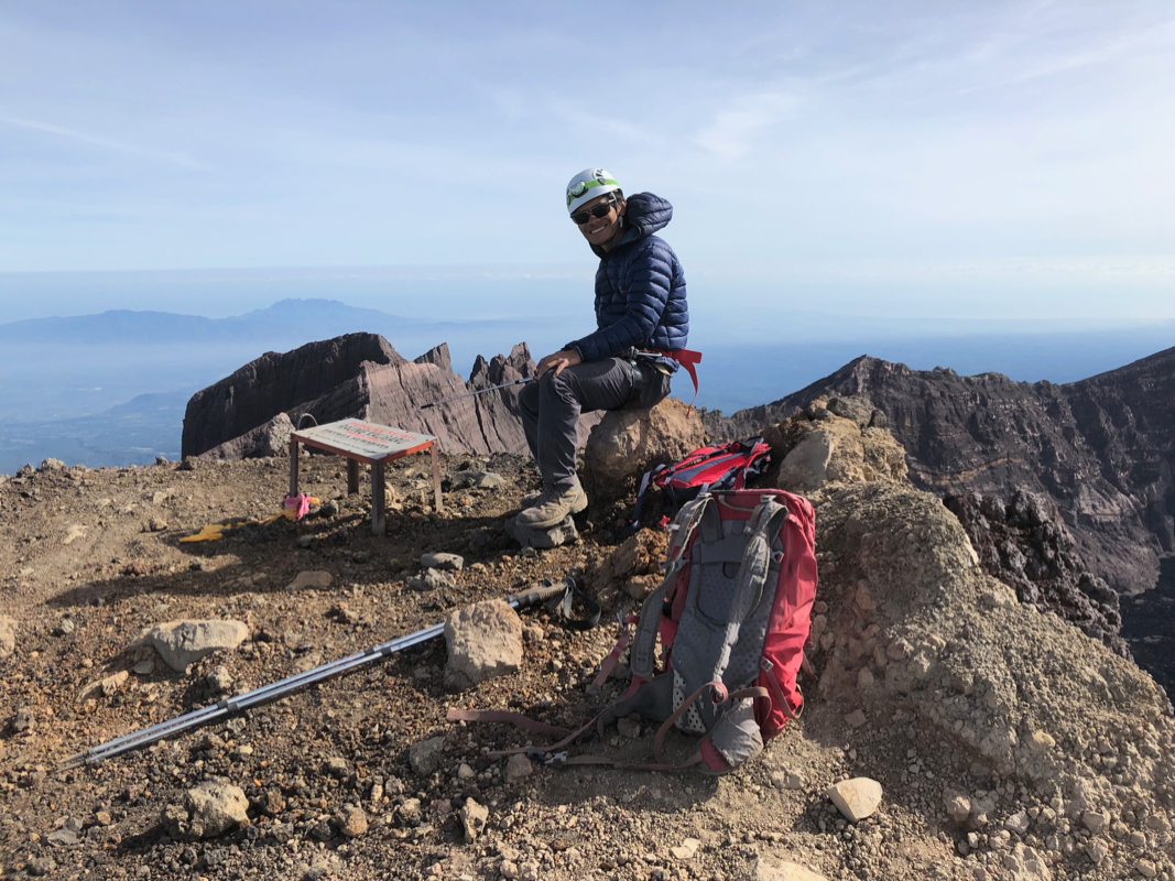
had fallen behind. We arrived at the summit at 0815.
The Raung crater was certainly
impressive. The rock walls that formed the crater
rim, likewise. Mainly clouds around us, but
the nearby scenery compensated well.
I walked to the opposite end of the summit ridge,
verifying that the summit location was
indeed the highest ground.
I left the summit at 0840, starting the descent. Halfway down the first slope, we spoke to
the Singapore team that would soon make the summit. The return hike went smoothly, when we
arrived at the crux, I told Simon that I would prefer to just downclimb the step rather
than setting up an abseil. Having both a good anchor and the rope, Simon would
belay me from above while I climbed down. (I do not know how he did this, using
his figure eight or using a carbiner, it did not really matter.) As soon as I was
down, I took in the rope using a figure eight that I had borrowed from Simon.
I had sort of forgotten that the ATC on my harness was for half-rope only. The rope
we used was too thick to pass through it.
Thus, this was the only place were a rope was used and one could really have done
the entire route without it.
We were safely back on Bendera at 1000, then I descended to Camp VII
at 1115. Our man by the tents had prepared a good meal. Simon arrived 15
minutes after me, he was definitely hungry having left without breakfast
about 6 hours earlier. We continued the descent at 1145, reaching Camp I
at 1415, so 2.5 hours down. Simon had told me that organizing the
return trip by ojek would be easy. Not so. Initially, he said that
ojeks were on the way, should be coming in 15 minutes. However,
when some ojeks finally arrived, they were reserved for another
group descending. After more than one hour waiting, we started hiking
down the trail from Camp I. Shortly thereafter our ojeks finally
showed up. A good ride down the trail and we were both back at
Base Camp shortly before 1600. My car was waiting. Goodbye and then
an uneventful drive got me back to Bangsring Breeze arriving there around 1830.