Pangrango
- Pangrango
- 3019 m
- Primary factor 2426 m
- Java, Indonesia.
- Location: South 06.77047, East 106.96513 (GPS at the summit)
- Difficulty: YDS class 2
- Climbed July 20. 2019

Pangrango
|
|
How to get there:
This excellent web-site on climbing
Indonesia peaks should always be consulted.
Note that the description below is a route that first climbs
Geger Bentang before it continues to Pangrango. The official/direct trail
to Pangrango starts at the National Park office. It seems however, that
this route involves quite a lot of red tape, quite difficult to handle
if you come from abroad.
Here is a summary and quick reference to the climbs on this trip.
Route description:
There are two possible starting points, both going right from the main
road that runs through the village of Cibodas up to the National Park entrance.
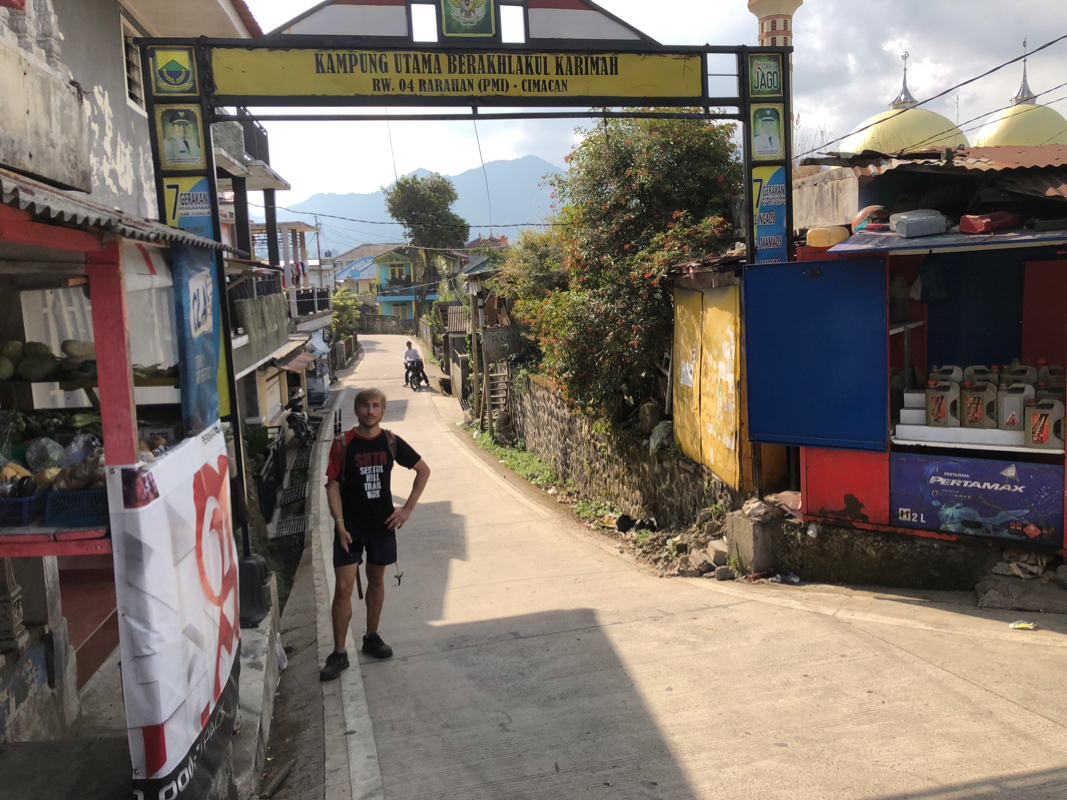
The first option is to take the side street
(under a portal) at location
S06.72901, E107.01416. Follow this road (keep left) up the little
valley, continue when the road ends along a concrete
path. You should follow the small river until approximately at location
S06.732, E107.006, where one may cross the river on a makeshift bridge.
Alternatively, continue up the main street in Cibodas until S06.73375, E107.00847.
Take a small road/path right, descend as this road/path curves left. Locate a small
trail that forks off right at the approximate location S06.73291, E107.00771.
This trail will lead down to the bridge mentioned previously.
After the small bridge, just follow the trail that continues uphill. In the
beginning, this trail runs along the edge of various farmland, before it enters
the forest. This route/trail now climbs a pretty clear ridge up towards the main crest
Stay right at the trailfork (shown on Openstreetmap). The trail is
quite good, uphill all the time until you reach the main ridge.
You are now just on the north side, butvery close to the summit
of Geger Bentang.
Turn left and cross this local summit. The trail now continues (south) along the
main ridge. This section may be a bit bushy depending on recent use, there are
some plastic markers here and there. Descend to the key saddle, then continue to
follow the same ridge as it gradually climbs the slope of Pangrango. The trail gets
a bit steeper and rougher higher up. For a short section there are rocks and a view, then
follows a final steepish section in order to reach a small (false) summit.
Descend slightly and break out into an open meadow. Take careful note of this point as it
is hard to find when reversing the route. Finally,follow a clear trail through a short
section of trees to the main summit. the summit
is recognized by an official marker.
Comments:
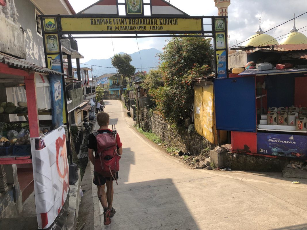
We left the hotel shortly after 0400, a very short drive got us close to the
official park entrance. We started hiking at 0430.
We walked down a small side-road and quickly found the trail as it was indicated
on my Openstreetmap. The small river was crossed on a somewhat questionable bridge
consisting of thin logs held together by some rope. The trail now ran uphill following
the edge of some local fareland before climbing into the hillside forest. There is a fork
on Openstreetmap with two (sort of parallel) trails running up to the top of the ridge
and the summit called Geger Bentang (2042m). Take the right fork, this trail is quite
OK all the way up.
We were on this first summit by 0600. It had started to rain and I had used my light
jacket, while Mykheilo only carried his T-skirt. As it stopped raining, he was getting cold.
I gave him my jacket and continued with my (not waterproof) light windbreaker.
This worked well as Mykheilo regained a more comfortable temperature. All the leaves
were wet and the trail along this ridge was very overgrown. Progress was slow as the
trail was a bit difficult to follow at this point. We both got soaking wet from water
falling from the nearby vegetation.
By 0730, we finally started our final 1100 meter of ascent. The trail was quite good
and gradually getting steeper. Higher up, we passed a short section with less
vegetation and more rocks, a very welcome change. Above this, the trail became
slightly rougher, several logs that needed crossing as well as some larger
steps that asked for (short and easy) scrambling. We first hit a small false summit,
then emerged from the forest onto some meadow. This point should be carefully tracked as
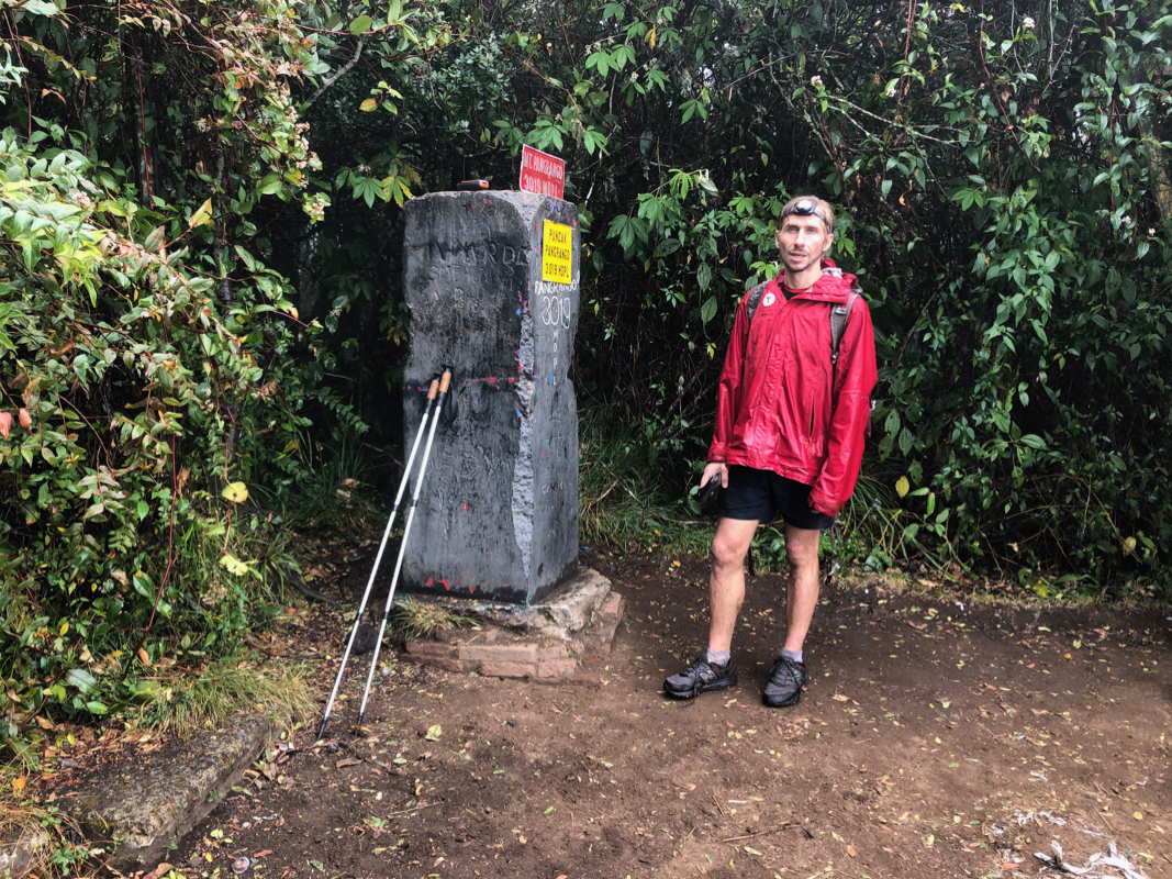
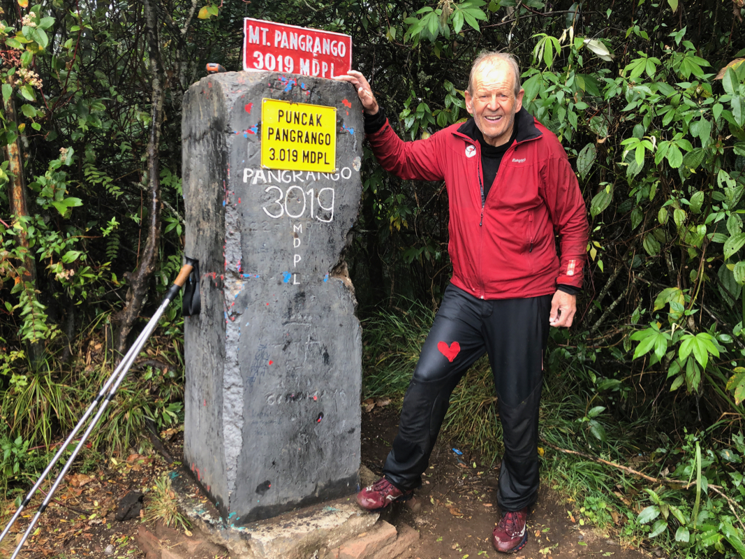
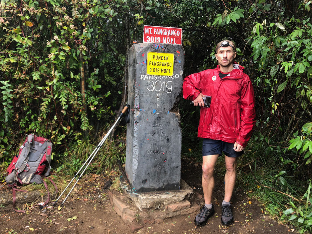
itb is very unobvious when returning. We arrived at the summit marker
at 0950. For the first time on this trip, there were other people. They did this
climb as a multi-day trip We stayed around
for 15 minutes, then headed back down
the same route. The return hike was uneventful.
We took a short break near the main saddle
on the ridge. At the very end, We walked a bit downstream along
the small river, then followed smaller streets of the village to meet the
main street under a portal as described above. The time was now
1445. We were both soaking wet and looked forward to a shower at our nearby hotel.
Thanks to Mykhailo for great company!
onot