Location: North 39:49.313, West 111:45.627 (GPS at the summit)
Utah, USA
Difficulty: YDS class 2+
Climbed: July 23, 2008
Information:
How to get there:
From the south, a good point of reference is the small town of Nephi. The
Interstate I-15 connects here with exit 225. From exit 225, head east on Hwy. 132 for
about 4.5 miles. Look for a road that forks left, called Nebo Loop Road, or Salt Creek
Canyon Road. Continue 3.3 miles along this road, then stay on Nebo Loop Road, ie. fork right
where Salt Creek Road goes left. Continue approximately 10 more miles on Nebo Loop Road and
look for a parking area and general trailhead on your left hand side.
Once you have located this parking area, consider to continue along a small, but reasonable
dirt road that continues north directly from the parking area. This road runs through some
vegetation and emerges at a new, smaller parking area on your left side.
Park here, location N39:50.910, W111:43.335, elevation about 2820 meter.
(The dirt road continues, but this is the trailhead.)
Route description:
There are several routes, the one described here is probabely both the
shortest and the easiest trail to Mount Nebo.
From the trailhead, take the obvious trail that runs uphill on the right
hand side of a fence. This trail will traverse the nice meadows above, then
descend slightly in order to connect via the highest possible saddle, to the
Nebo North Peak. This peak dominates your view in the beginning. The main
objective, Mount Nebo, is hidden behind it when approaching from this direction.
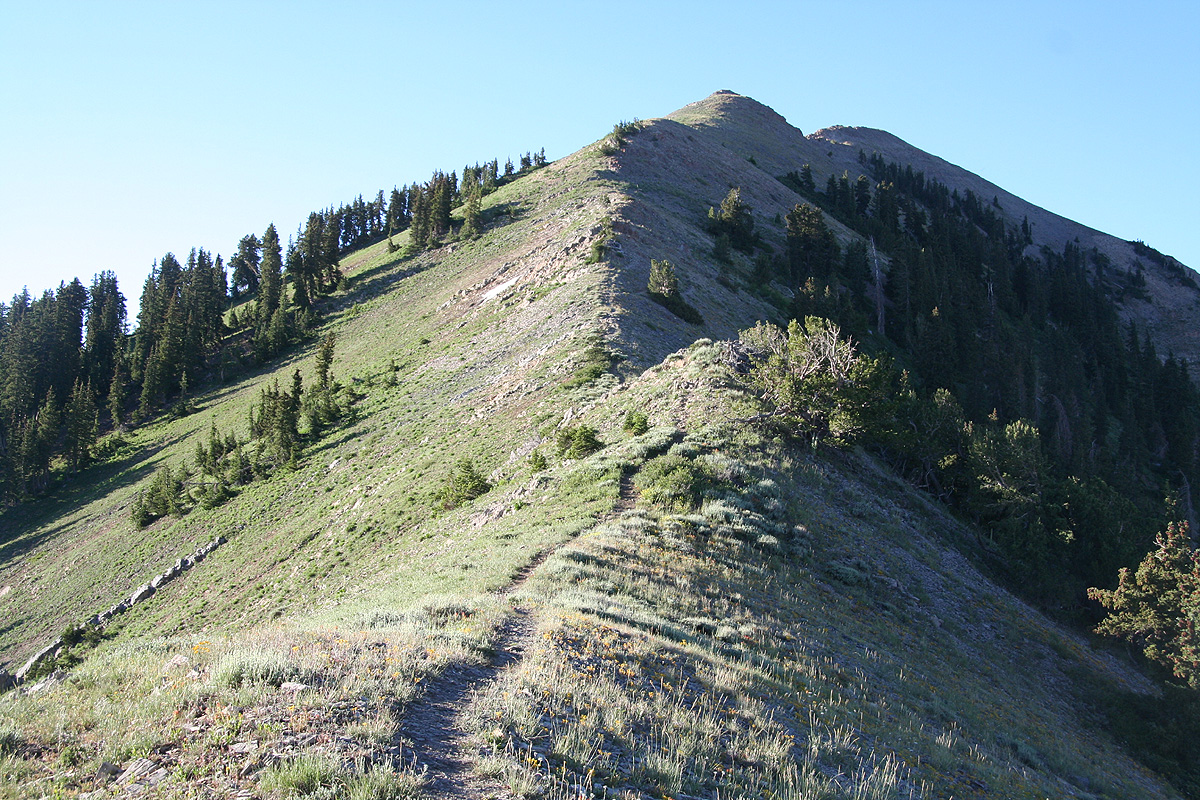
Next, the trail zig-zags up the hillside in order to reach the pretty distinct
north ridge of the North Peak. The trail initially
climbs along this ridge, then
leaves the ridge and traverses on the west side of Nebo North Peak, descending
gently to the very broad saddle
(called Wolf Pass) connecting the North Peak to the main Mount Nebo.
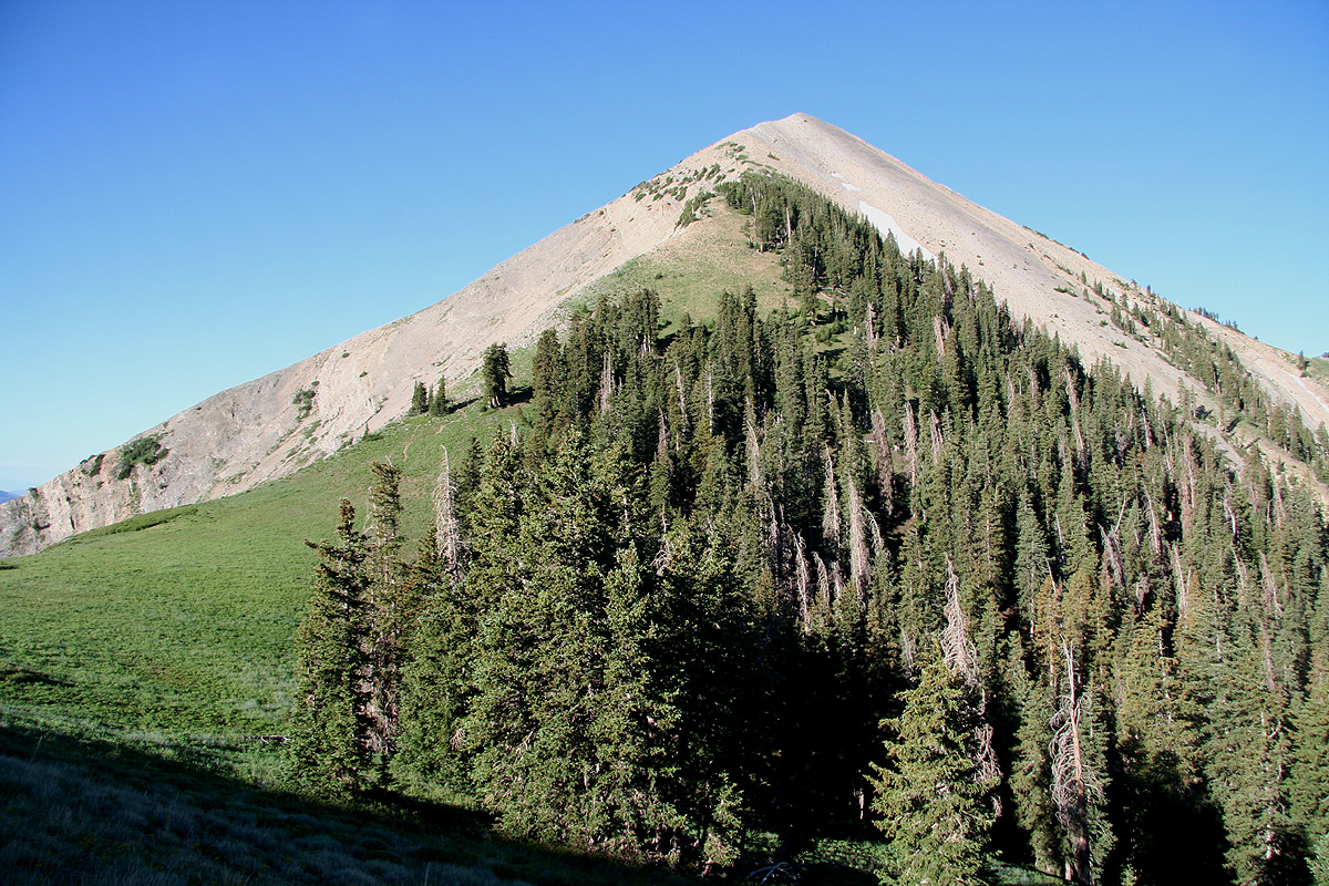
From this saddle, the trail climbs
to the foresummit that you easily see from
below. The route is (YDS) class 1 to this point.
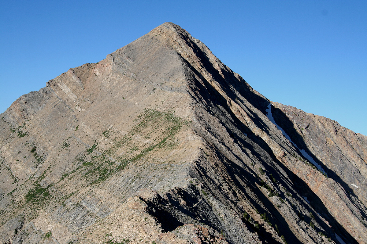
Arriving on this top, the route continues along the next fairly
horizontal section
before the final ascent along the ridge that connects to
the main summit. Along this section, one can easily get into (YDS) class 3 terrain, however,
by following the path of least resistance, the route remains at class 2+ all the way to the
summit.
Comments:
I did this hike with my son Pål Jørgen.
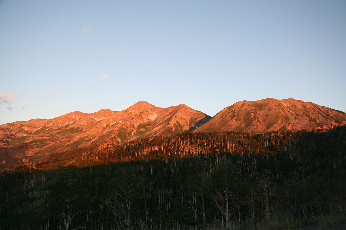
We drove up from Nephi and started out at 0645. Daylight came while driving
and the entire Nebo range
glowed in the morning sun. The trail was easy to
follow and we reached the main (north) ridge of Nebo North Peak in about
one hour. From here, for the first time one
has a very good view
of Mount Nebo as well as the small foresummit. As often is the case, the
mountain looks somewhat harder than it really is.
We wondered if the route would traverse the North Peak, but soon
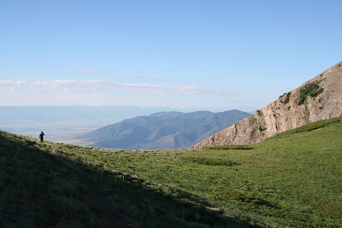
got the answer as we traversed the west side and arrived in Wolf Pass around 0815.
Along this section, we had a pretty good view down
to the flat area on the west side.
From here, the trail ran nicely up to the foresummit. The connecting ridge was
relatively flat, but the route changed from (YDS) class 1 into class 2, then class 2+.
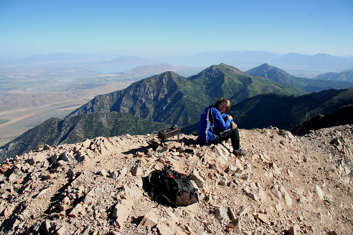
We reached the summit by 0910 and
stayed for 30 minutes while enjoying the scenery
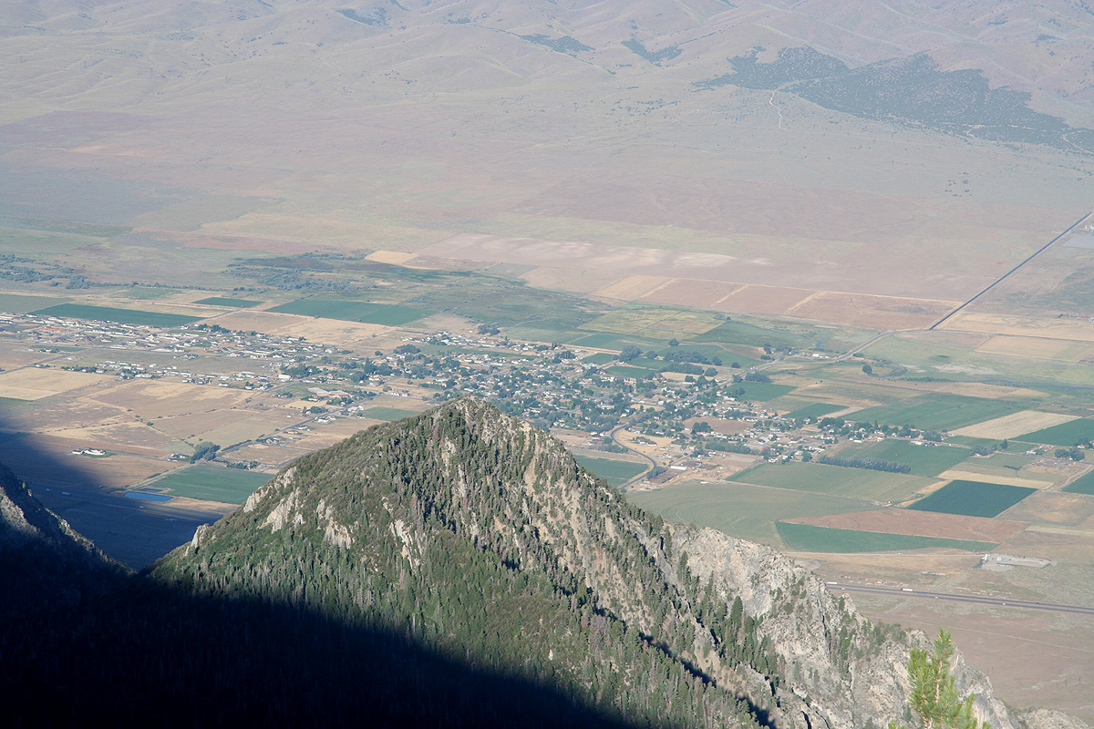
all around. The trucks down on Interstate I-15 looked like small toy trucks, this peak
really dominates the local area in a most impressive way.
On the return hike, we decided to traverse
across the North Peak. This climb is
very nice and highly recommended. No difficulties whatsoever, the ascent from the Wolf
Pass really defends a class 1 rating despite the lack of much trail.
We were at the North Peak exactly 4 hours after leaving our car, one more hour brought
us back to conclude a very nice trip on a very impressive mountain.
Resources:
Images
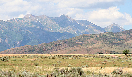
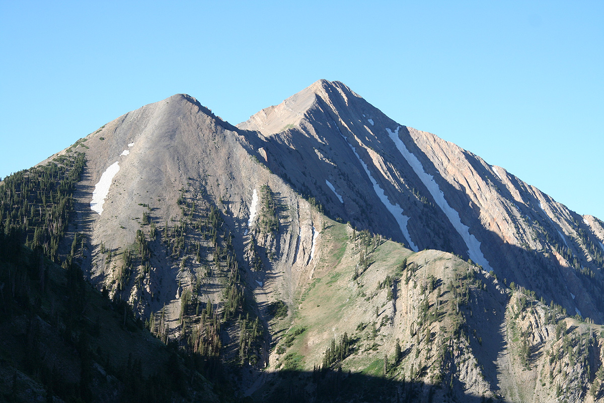
Mount Nebo, the south summit is left, the north (highest)
is center and the Nebo North Peak is far right.