Location: North 38.02767, East 037.48484 (GPS at the summit)
Turkey
Difficulty: YDS class 2
Climbed: August 31, 2021
Information:
How to get there:
A good "base camp" for this peak is the pretty big city of Elbistan.
From the city center, drive north-east to the big traffic circle located near
38.20683, 37.22404. Take the exit that heads south-east (first exit) the road is
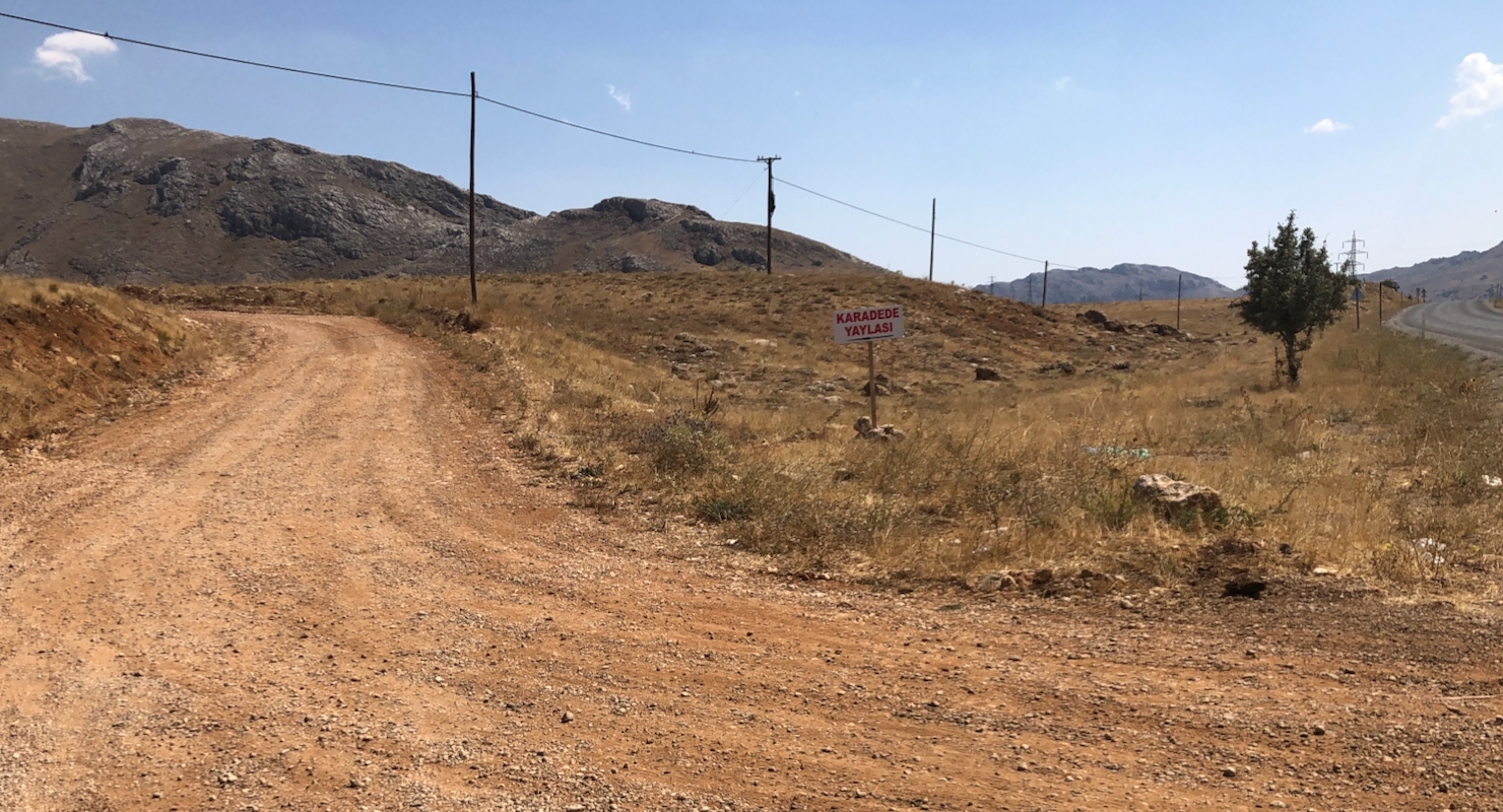
named Baris Yolu. Continue a bit more than 20 kilometer, you should locate a dirt
road that forks left, a short distance before the main Hwy. reaches a small hill-top.
The road looks like this, there is a sign that reads:
"KARADE YAYLASI" (red letters). Drive this road (OK for ordinary cars), 10 kilometer,
ignore side roads, you want to stay in the big valley. There are some signs and stuctures
as well as a small road fork at location N38.04440, E037.41112, elevaation about
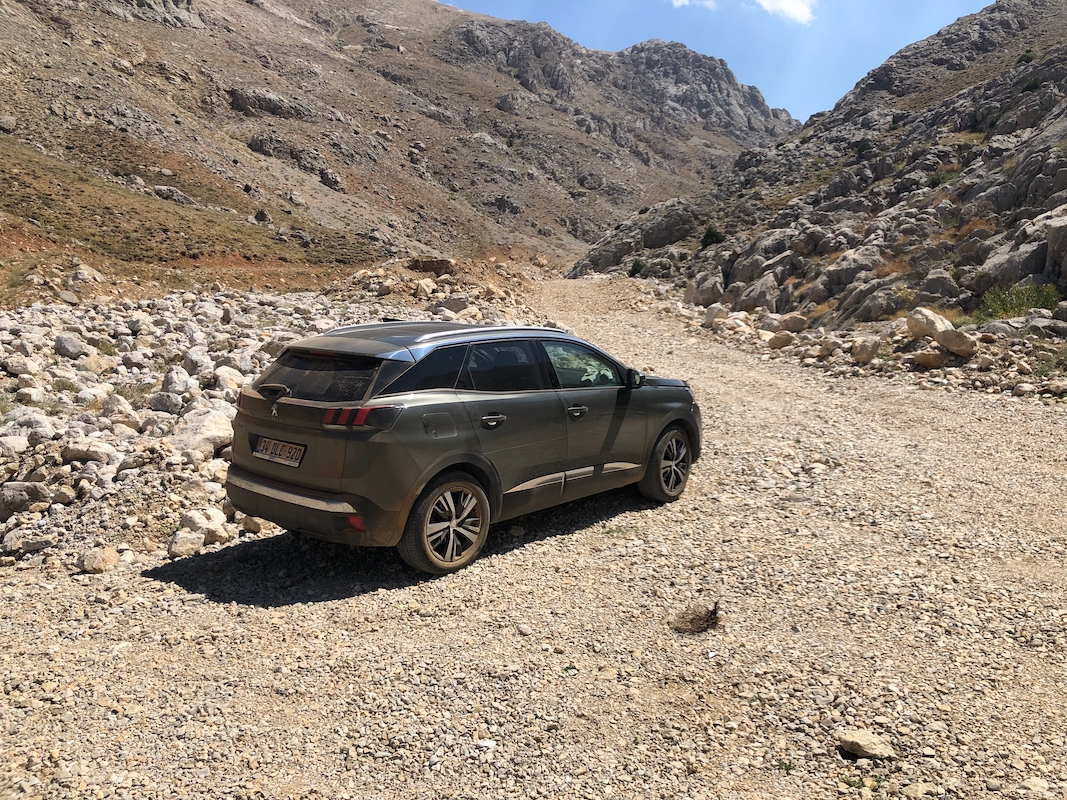
1960 meter. This is a good trailhead. If you have a high clearance car you may continue
a bit further,
there is parking at the left side at location
N38.03977, E037.41375, elevation about 1980 meter. The "road" continues quite a bit longer,
but it quickly gets much worse.
Only a very rough 4WD vehicle would possibly get
any advantage over walking on foot.
Route description:
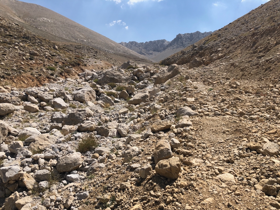
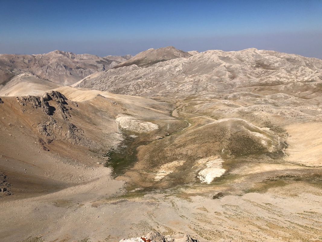
Continue along the track that heads up the valley next to the (dry)
river. Higher up, there is a trail running on the right side, then later, on
the left side. The valley forks, with the main branch going left, a small ridge
heads up the middle, at the base, location N38.02333, E037.42753, elevation about
2300 meter, the proper trail starts. Be sure to find it. This trail climbs gently
above (on the right side) of the main valley. Continue until you reach a vague ridge
at location N38.02779, E037.45440, elevation about 2715 meter. From here, the trail
is less easy to see, but the terrain is easy to walk. First, turn right and climb gently
up this ridge, you will have a small valley coming down on your left. When convenient, traverse
left and cross this small vally without any descent, then continue a gentle ascent traversing
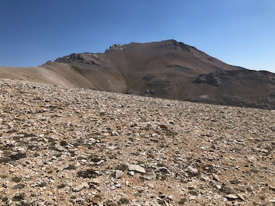
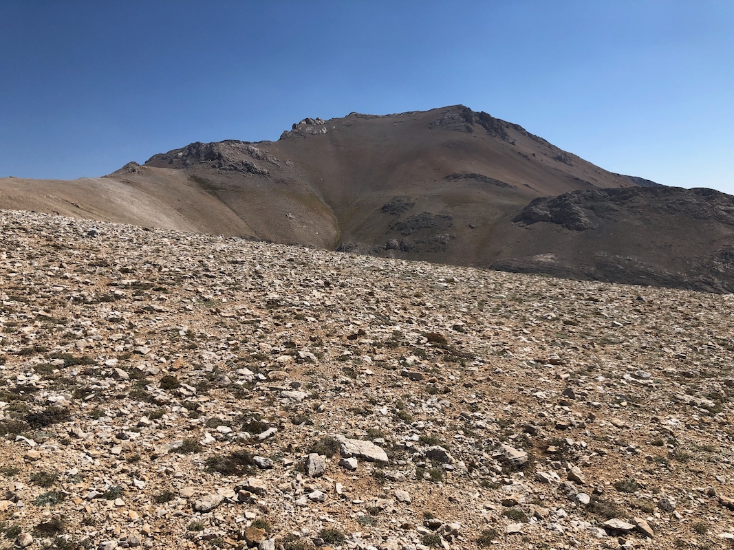
on the other side. The goal is now to reach the main crest. You will start seeing the
Killi Tepe mountain ahead.
When reaching the crest, you will recover a good trail
that runs slightly on the right (south) side
of the highest line. You will see a small
hump on the ridge followed by a larger one. The trail traverses on the right (south) side
of the first hump, a trail from the south will merge here. The route runs up a small step
right in the middle of the second hump. You should get to location
N38.02925, E037.47350, elevation about 2930 meter. There is an easy, very short passage up
here where you need support from using your hands. This is the ONLY (YDS) class 2 part,
otherwise this route is class 1.
Turn a bit right and continue uphill (clear tracks from other people) to near the top
of this hump. You will then see the trail that continues from a very shallow saddle.
The trail runs up slightly right of a false summit point, once you reach this
ridge-line you will see the Killi summit beyond a somewhat wider, but very shallow
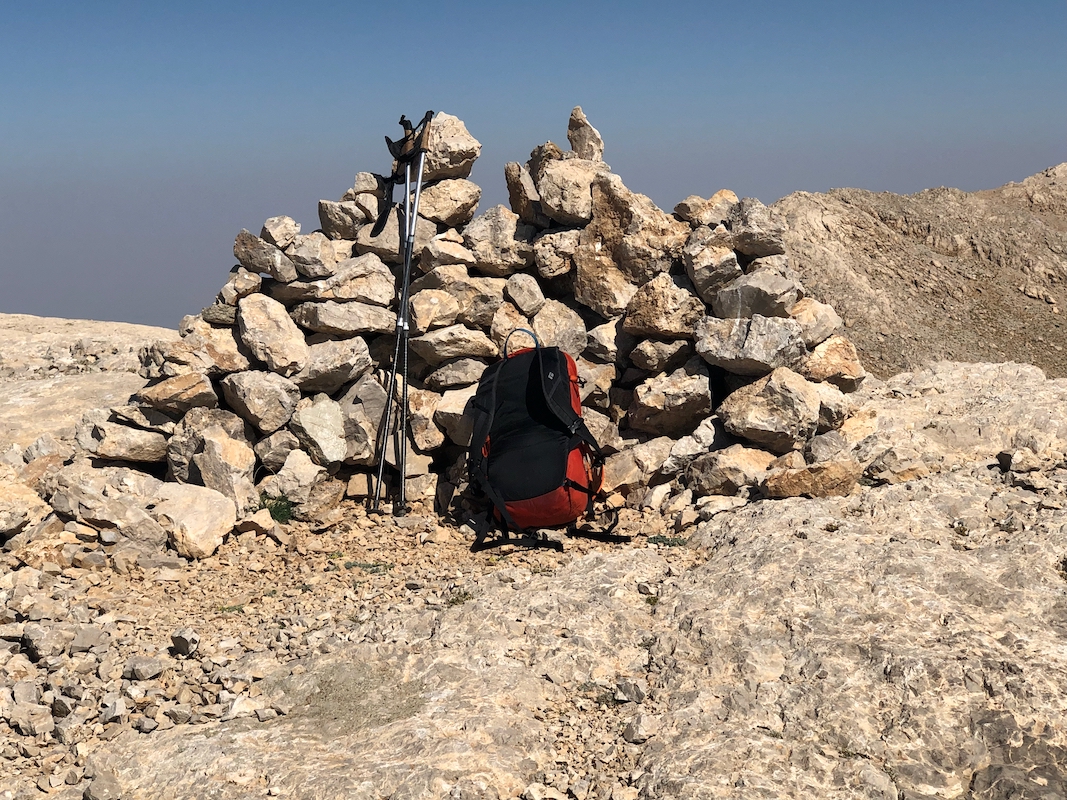
saddle. The summit is a pretty big, fairly flat area with a cairn.
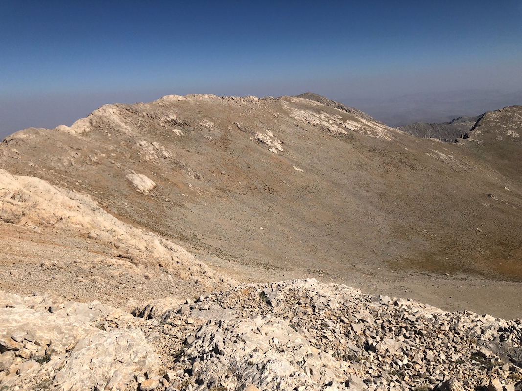
Note that the north ridge of Killi Tepe,
only a few minutes walk from the summit, has a couple
of points that are quite close in elevation. I measured these to be about 2 meter lower
than the main summit.
Comments:
I knew that I needed a bit of research to find a good route on this mountain.
It seemed that the shortest route might go from the north side, however, I had
no idea of what quality (if a road at all) the access roads would be like.
Arriving in early afternoon in Elbistan, I therefore drove to explore the
possibilties for the next day. I first tried driving towards what would be
a good trailhead on the north side. Indeed, a dirt road does go up a valley
in the correct direction. It became fairly rough and I decided to turn around
at location N38.08582, E037.40941. A slightly better 4WD car should have no
big problems to drive longer, but who knows if the road will be of similar
quality all the way.
I next, drove to a dirt road that forked towards the big valley that runs
west from the Killi Tepe mountain. This turned out to be a very positive
surprise. I could not even find this road on my maps, still it was very nice.
One may drive it about 10 kilometer to a very natural trailhead. I drove a bit
more and located a spot for parking that I decided would be my starting point the
next morning.
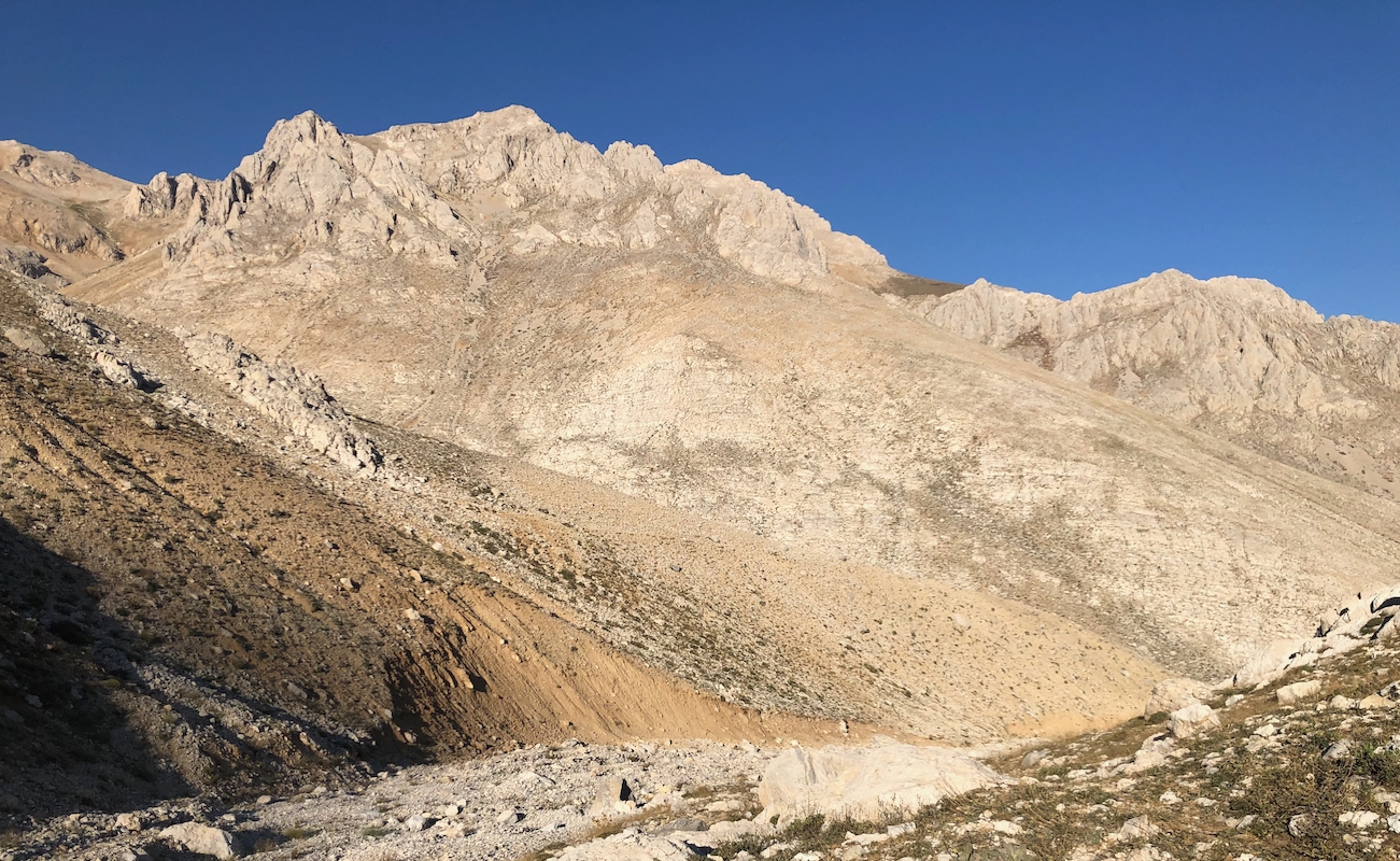
Back at this trailhead at 0640, as I ascended the valley, the sun was hitting
the peaks up on my right.
I had a very enjoyable walk, arriving at the
summit in precisely 3 hours. After resting a bit, I walked across to the north ridge,
it looked very similar in height. My GPS measured 2 meter lower, so close and
well worth a visit as you have a nice view down on the west side.
Returning from the summit area at
1025, I had an equally nice hike back down, arriving at my car after 2:15, for a total
trip time of 6 hours.