Location: North 39.79155, East 039.77056 (GPS at the summit)
Turkey
Difficulty: YDS class 2+
Climbed: September 7, 2021
Information:
How to get there:
The nearest big city is Erzincan. However, the approach from there
to the north side of this peak is a bit problematic. The obvious
route is to just continue north along the main street. This road climbs
the mountains and all "look well" until the elevation has been gained.
Quite surprisingly, the road turns into a gravel/dirt road. Some sections
are actually quite bad. Thus, driving this route easily takes 1.5 hours.
An alternative is to take the main Hwy. E-80 east from Erzincan to Mercan.
This is a high quality 4-lane road. From Mercan, one can travel North-west
on a good paved road. This option is more than twice the distance, but one may
drive much faster, so the difference in time is not great.
Either way, you need to locate the turnoff road that serves the small
village Yaylalar. This road forks at location N39.87978, E039.85833.
You first drive through a small village on the north side of the river, then cross the
river and fork right at N39.86612, E039.85260.
You will next arrive in Yaylalar, here you should turn right between buildings at location
N39.85329, E039.80752. Exit the village and finally turn left (uphill) at location
N39.85880, E039.80509. The road climbs steadily into the basin, you may park shortly after
the third time you cross a stream. This location is at N39.80727, E039.75526, elevation around
2920 meter. There is a larger parking area just a few meter onwards.
Route description:
Walk back across the stream (big stepping stones), then turn left (uphill) and ascend on
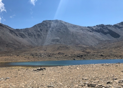
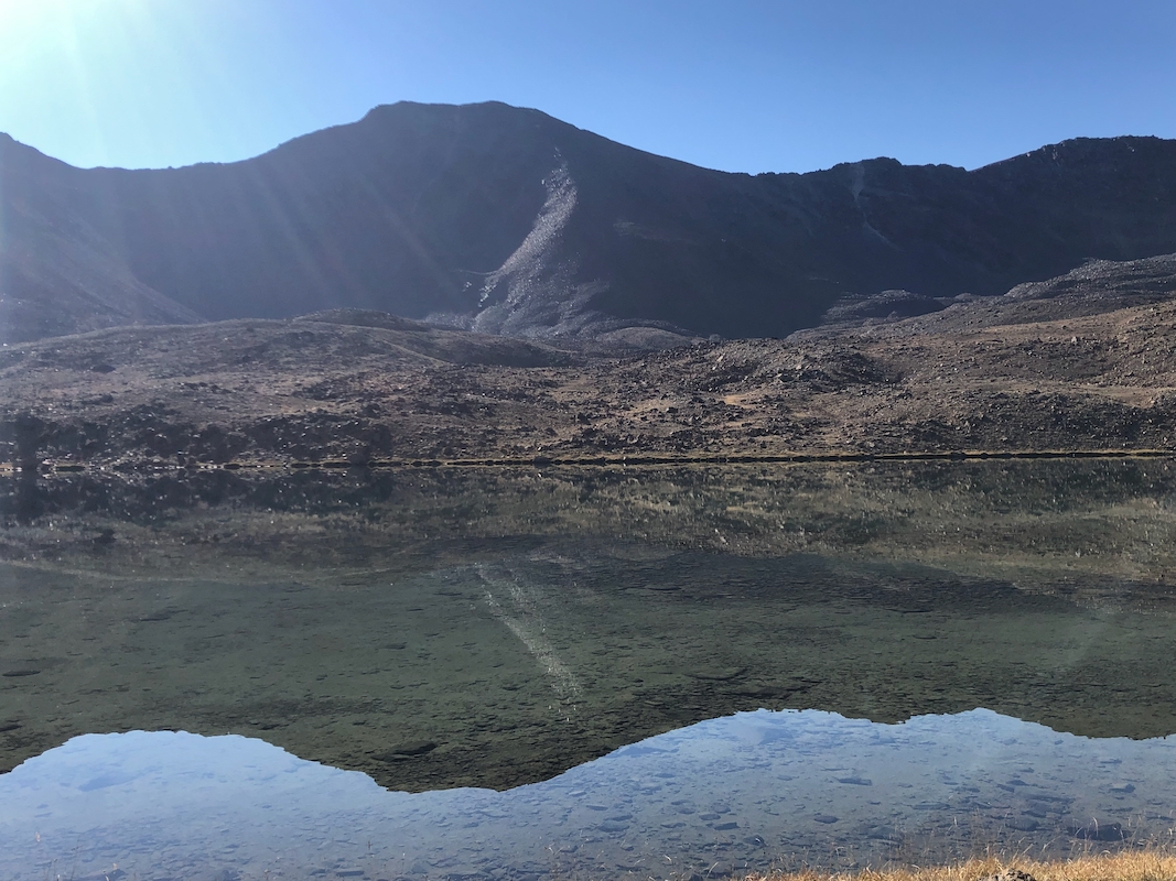
easy ground keeping the stream on your left hand side. You will reach a mountain lake that
you turn, keeping it on your left side.
From the end of the lake to the base of the mountain,
there seems to be no well defined path.
The terrain consists of several local ridges, pick a line that aims for the lower horizon ridge
to the right of the summit, avoiding too many ups and downs.
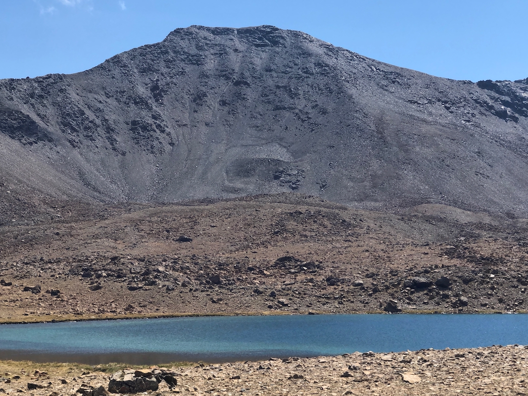
You will see the scree slope that
can be ascended. As you get onto the slope you should find a climbers trail, there is even
a wooden sign fairly low on the slope.
Follow the trail uphill, there may be some variations. Higher up, the slope is steeper
and a short section earns a (YDS) class 2+ level of difficulty. One should be careful to
avoid causing rocks to roll and possibly hitting other people. The slope quickly eases
and makes the main crest. From here, it is an
easy walk to a false summit, with the
proper summit located about 100 more meter onwards.
Comments:
I had arrived in Erzincan the day before and stayed in the small Eriza Boutique Hotel
near the center of town. I left before dawn and drove what appeared to be the obvious
route, about 55 kilometer to the final road fork. However, somewhat to my surprise,
the paved road that climbed out of Erzincan soon turned into a dirt road of pretty
poor quality. Thus, the drive took considerably longer than expected.
I had also (wrongly) noted that the mountain road should originate in a village called
Esendoruk. Thus, my Google navigation made me turn off the main road about 6 kilometer
too early. I had memorized that one should continue on a (good?) dirt road after the
village. This all worked, except that the dirt road was not good and getting worse
after I crossed the local river. At this point, I understood the mistake and after
a bit of (extra) driving, I was back in Yaylalar and on my way up the correct mountain road.
I left my car at 0830, the hiking was quite easy. Arriving at the summit after 1:45.
Nice views, I spent 15 minutes on the top, then returned in 1:25, at 1155.
I decided to take the long way home, more than twice the distance, but only about
15-20 minutes longer in time.