Location: North 40.88354, East 041.23515 (GPS at the summit)
Turkey
Difficulty: YDS class 1
Climbed: September 5, 2021
Information:
How to get there:
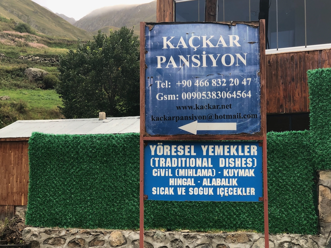
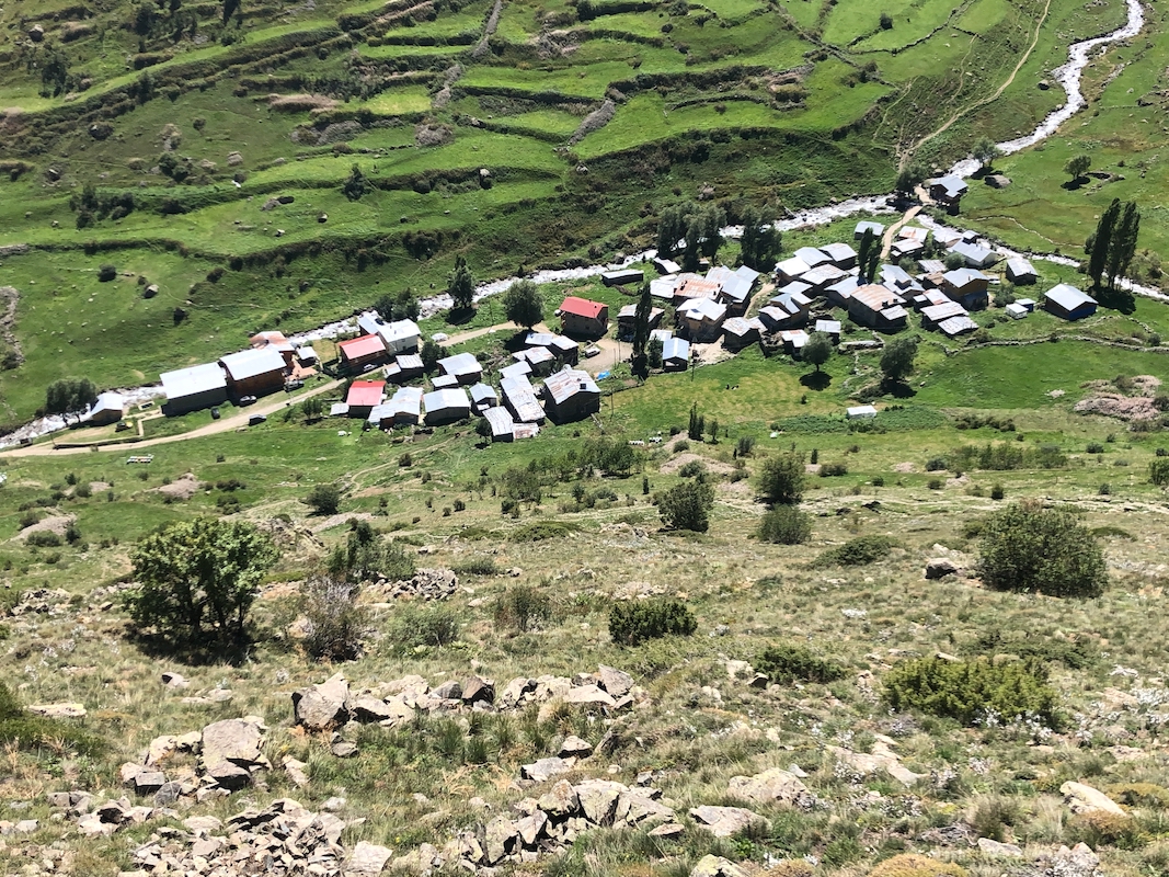
The starting point for this climb is the tiny village of Olgunlar.
Olgunlar is located at the end of the road at location N40.85950, E041.24192,
about 2115 meter of elevation. A very nice accommodation is located there.
Kackar Pansiyon is highly recommended.
See contact information on the sign,
this link may also work. Route description:
The easiest route is to walk directly uphill from the hut and continue
uphill until you reach the summit. The entire route is on grass.
Comments:
I now had an extra day since the original plan for Kackar was 2 days.
Gorgeous weather, so I needed to make a walk. I explored the trail that runs up
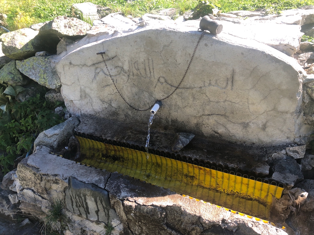
on the right hand side of the river that comes down the Dibe valley (from the north).
The trail even had a nice water drinking station,
complete with its own cup.
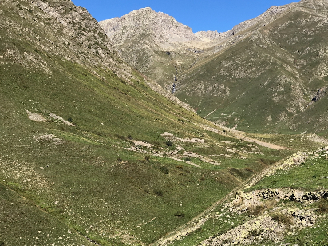
I followed this nice trail until it (and the valley) started to curve left. The view
of Ceymakcur Tepe at
3415m, was nice and it was certainly tempting to try climbing it
However, I knew this would be a pretty big project and thus I resisted. Instead, I
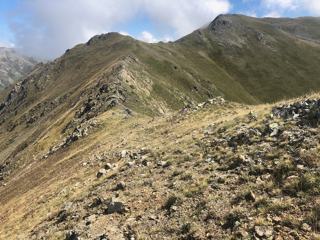
climbed right and ascended this ridge all the way a bit over 3000m of elevation.
A very good view into the Dibe valley
and yesterdays Kackar from the other side.
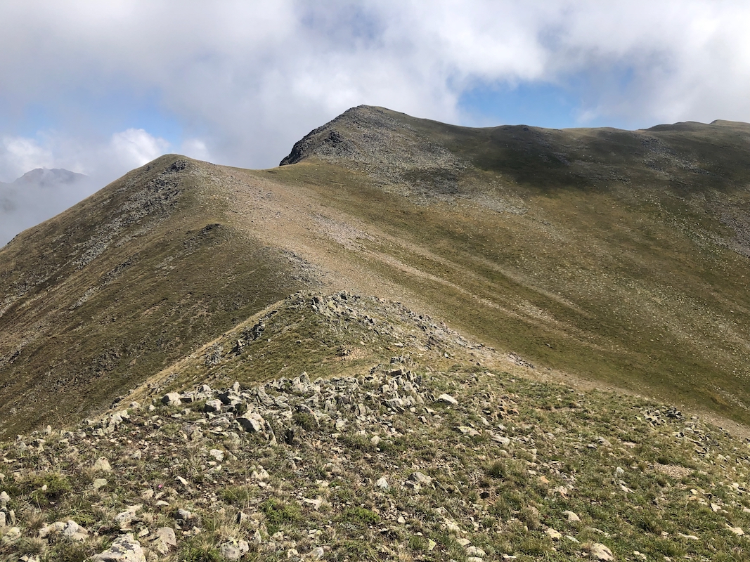
My plan was now to visit both the key saddle and
then the highest peak going east
along this ridge. The maps of the area were very much in disagreement.
Descending slightly to the lowest col, I first measured it with my GPS
to 2994 meter. Proceeding along the ridge one first crosses a hump
that measured 3075 meter, then after a small descent,
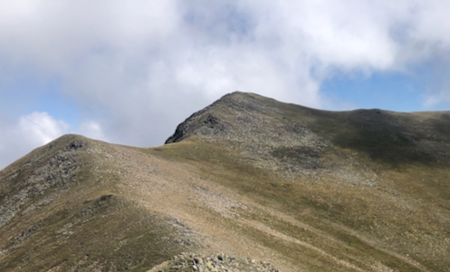
an easy climb to
the summit. It measured in at 3114 meter. I was there in slightly less than
2 hours. The summit had a small cairn.
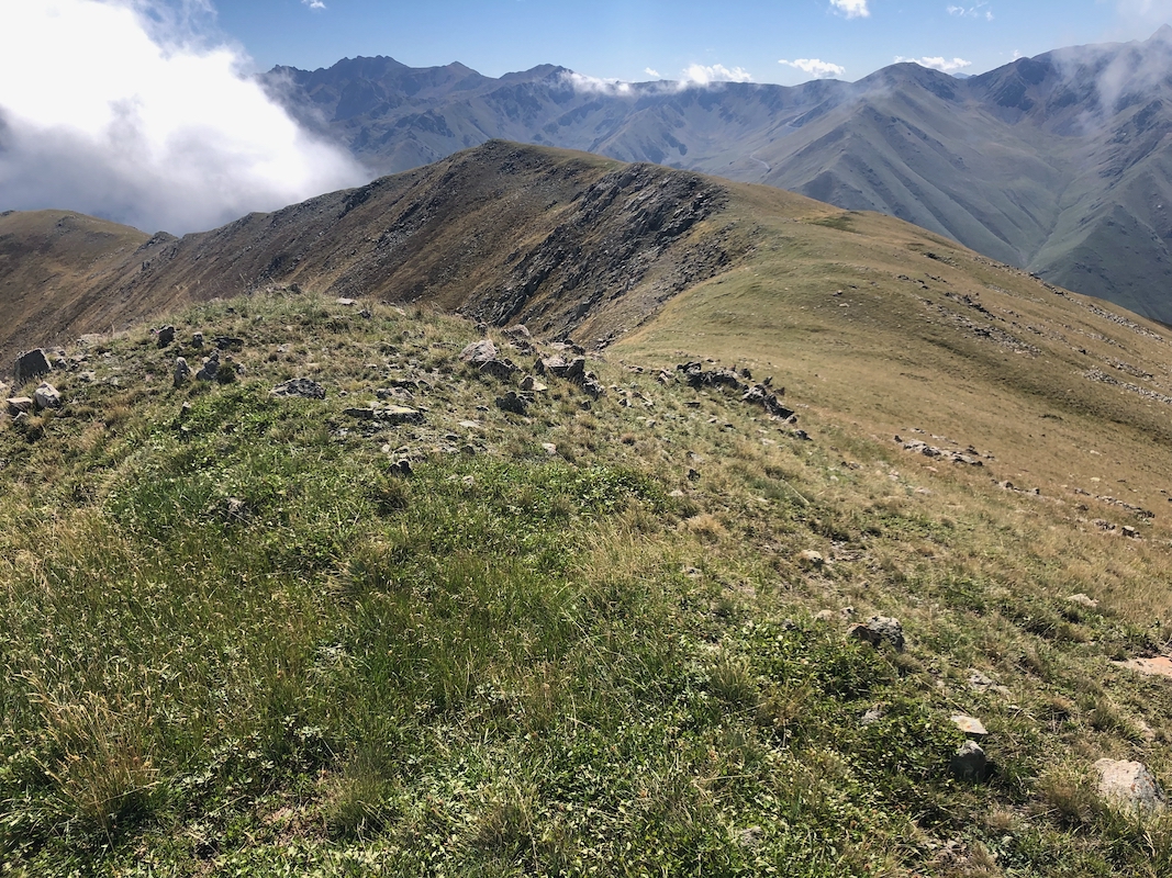
Happy with having climbed a "bonus" 3000 meter peak, I returned directly
down the ridge to the mountain lodge.
The main ridge
turns more east, but a smooth branch runs south. Near the end
one has a good birds eye look at the Olgunlar village.
I was back at 1220, about 1:20 to descend this pretty direct way.