Itkolbashi
|
Elevation 2600 meter, N43:15.492, E042:31.853
Elevation 2848 meter, N43:15.703, E042:31.890
Elevation 2902 meter, N43:15.748, E042:31.938
Elevation 3134 meter, N43:15.903, E042:32.106
Elevation 3390 meter, N43:16.166, E042:32.372
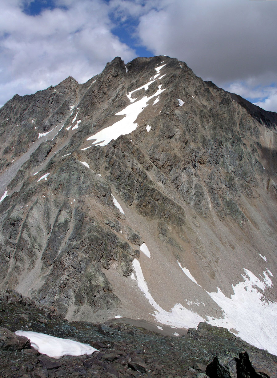
The point 3134 is a distinct, local hump along the ridge, while the 3390 elevation
marks the last grass, above there are rocks and gravel only.
Continue up and aim for a point slightly to the right of
the highest point on the horizon. As you reach the top ridge, you will find
that it provides easy access to the highest point, to the left. This point
has a small cairn and is also marked with a pole. The elevation is
3531 meter, location N43:16.278, E042:32.425.
At this point one discovers the summit ridge going north towards
Soldatsky pass (3383m) connecting to the higher peak Sarykolbashitersak, 3776 meter.
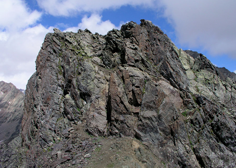
The next high point along the ridge, that I will call the middle summit, is clearly
higher. A short (YDS) class 3 pitch up a steep, but relatively easy rock will get you there.
The elevation of this point was measured to 3540 meter with coordinates N43:16.304, E042:32.429.
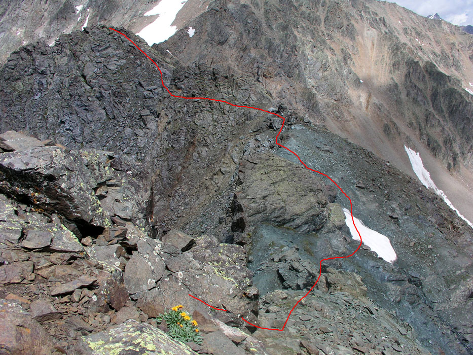
However, once on this top one observes that the next summit, which I will call the
north summit, seems even slightly higher. The route there looks a bit tricky, but
turns out easier than it looks. Descend to a big block on the ridge, bypass this on the right
side in stable, but interesting terrain. Regain the ridge, then continue slightly
on the left side of the top ridge before reaching the summit. This point is marked
with a wooden pole. One can see directly down into Soldatsky pass, so there are no more
high points along this part of the ridge. The elevation was measured to
3543 meter, coordinates N43:16.344, E042:32.447. Thus, this point is taken to be
the true summit of Itkolbashi.
Comments:
This was my last day in the Caucasus, a good climb with
limited time available.
The climb took 3 hours up and 1.5 hours down. I spent about
30 minutes exploring the three local summits along the top
ridge.
It is likely and consistent with the GPS measurements that
the lower summit point (the south point) at 3531 meter is
the elevation marked on the map. This makes some sense, as this
is the highest point that can be seen from Terskol and the Baksan
Valley. The three summit ridge elevations have been adjusted downwards
by 5 meter compared to my actual GPS readings, as the GPS seemed to
show a bit high in the area and in order to match the map elevation
of 3531 meter.
The route to the south end of the
summit ridge is (YDS) class 2. The (YDS) grade of 3 has been
assigned because of some easy scrambling along the summit ridge.