Mount Hector
- Mount Hector
- 3394 m
- Primary factor 1759 m
- Canada
- Location: North 51.57452, West 116.25948 (GPS on the summit)
- Difficulty: YDS class 3-4, depending on conditions.
- Climbed July 29. 2018

Mount Hector
|
|
How to get there:
Starting from Lake Louise, drive 2km north on Hwy-1, then exit onto Hwy. 93,
direction towards Jasper. Drive about 20 kilometer and locate a turn-out / parking
area on your left hand side near the bottom of a pretty long uphill. This location is
at N51.60258, W116.30992, with an elevation of about 1860 meter.
Route description:
The trail starts on the opposite (uphill) side of the
road. Note that it starts on the right hand side of
the creek, that is, one must walk a short distance right
along the road
when leaving the parking area. Ignore other small trails.
Follow this very clear trail gently uphill in the forest,
staying on the right hand side of the creek. Soon, you will
see a waterfall up ahead. The trail now enters the creek for
a few meter, then crosses to the left side.
Continue up the trail as it zig-zags and gets appreciably steeper.
Higher up, this main trail forks slightly left and enters an area
with cliffs, climb up where you find an easy passage, this section
is still YDS class 3 terrain. Above these cliffs, the trail resumes
and traverses right to enter the basin above.
As you enter the basin, the main trail climbs left, leave this trail
and cross the small creek to the right side. Pick up a smaller
trail that ascends on the
right hand side of the small creek. That is, you aim for the smaller
valley, uphill right, rather than the bigger valley that is more left.
You will see a nice trail cairn as soon as you have ascended a bit
up along the creek. This is a good place to cross the creek (from the
right hand side to the left side), then continue ascending on easy
terrain. There are smaller trails and possibly some cairns. The step in
the valley a bit higher up, is easily climbed on a trail that ascends
from the base of the cliff and to its left side. Continue uphill to
the (horizon) ridge that runs across your little valley higher up.
You will pick up a trail
on top of this morraine (possibly, this is the trail that ascended
left when you entered the basin.
Follow this trail as it zig-zags up to the very top of your local
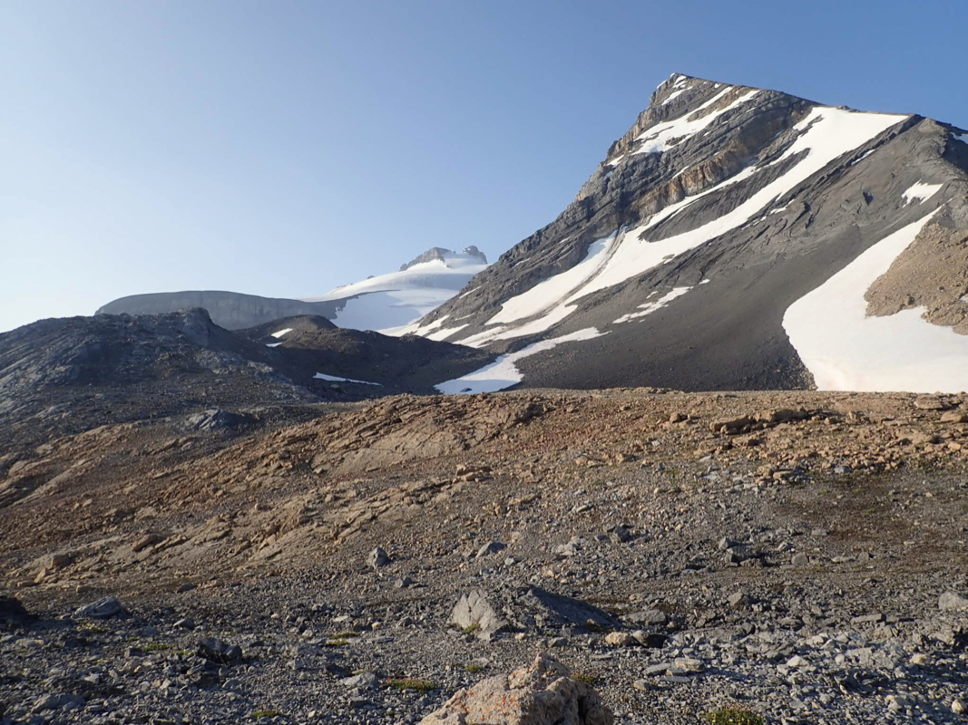
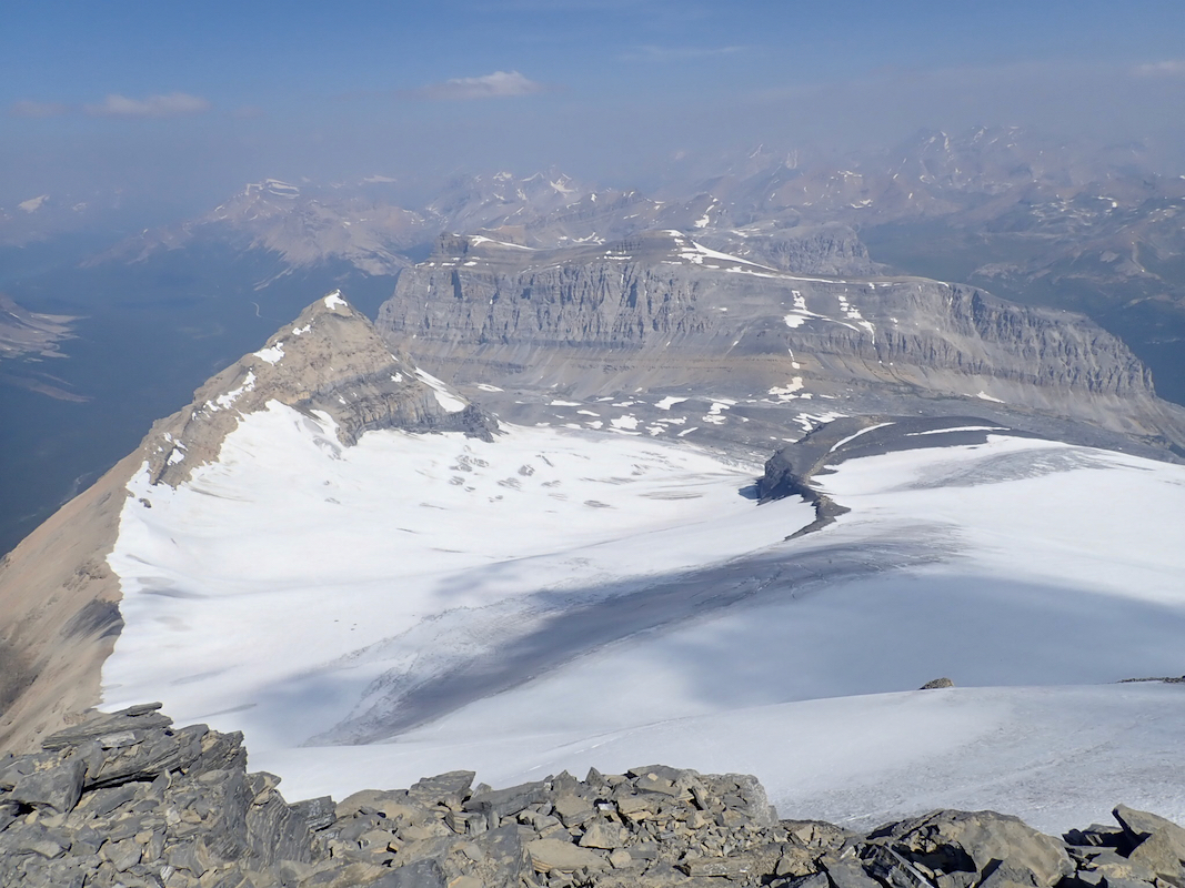
hill. You will (at first and in the end) see Little Hector up behind.
As you gain the top of this hill, the terrain becomes level and you
see an obvious little valley possibly with patches of snow, that extends
pretty level below Little Hector. Follow this little valley as it
contours slightly right and connects nicely
with the glacier that comes
down from Hector.
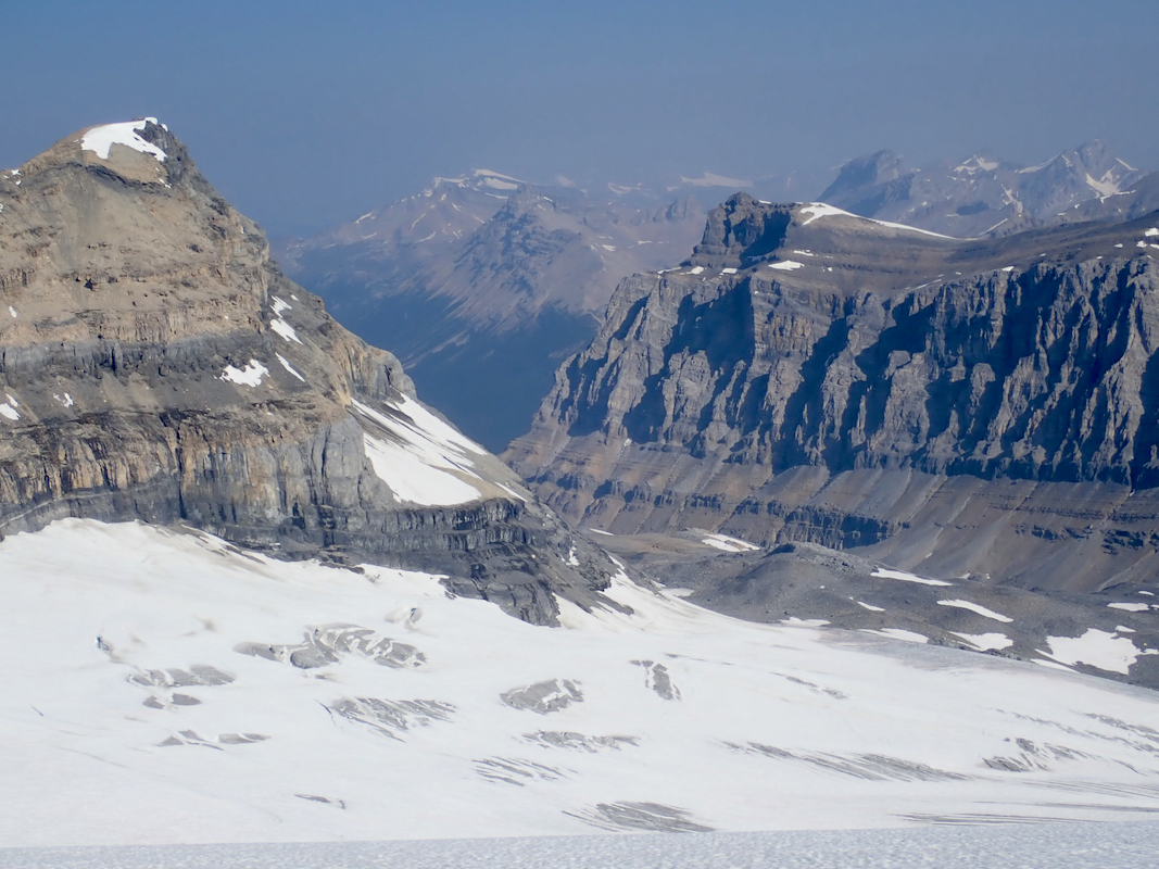
Walk up the glacier, initially on a course that is a bit
right of Hector.
There are crevasses both
right and left. Gradually turn
left while ascending and pick a line parallel to the crevasses that you see
going left uphill to an area with rock
visible left of Hector. The slope is
never steep and you will gain a small area with rocks at location
N51.57553, W116.26077, elevation about 3280 meter.
This may be a good place
to put on crampons unless needed earlier.
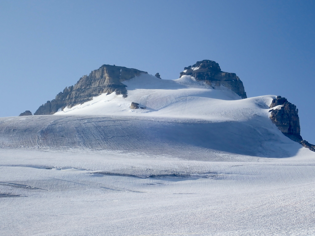
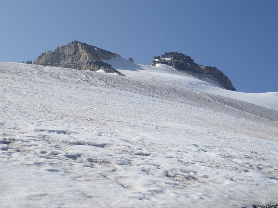
Now ascend slightly left of Hector,
then traverse right to reach an area
from where one again may go left/uphill to reach the summit block of
Hector. This is the best line, not very steep with reasonable conditions.
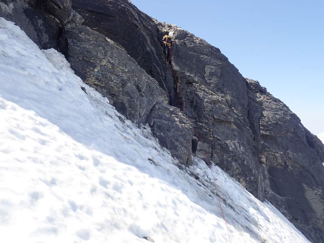
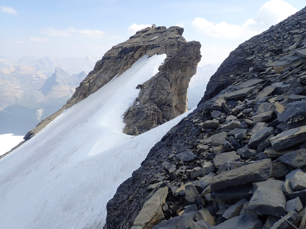
You should see a very distinct crack
in the rock off to the right side.
With good snow, it will be trivial to walk across to it. If the slope is
icy then more care is needed, perhaps an ice screw for extra protection.
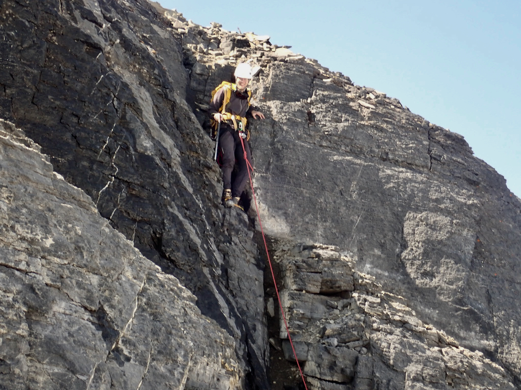
Enter the crack and scramble up,
there are no difficulties. As soon as you
reach the top of this cliff band, zig-zag uphill on natural ledges. Be aware
that there are tons of loose rock in ´case you have climber(s) below. There
are no more issues and you will soon be on top of Hector.
Comments:
Pål Jørgen and I started out from Lake Louise shortly after
0500 and we were parked at the trailhead by 0535. Hiking at 0545, the
morning was clear and crisp, it looked like a very good day.
We were soon up by the waterfall and noticed that the trail went straight up
some class 3 cliffs, but only a very short section. We were soon in the basin
and followed the main trail, then realized that we most likely should ascend
up the smaller valley on the right side. We descended back down, crossed the creek and
continued uphill. Nice terrain and easy going.
We made the top of the small ridge near the base of Little Hector, in slightly
less than 2 hours. we left our bear spray and then arrived at the glacier.
Roping up, we continued along a nice line to the rocks at 3280 meter. A bit
of postholing, but mainly easy going gaining elevation.
Here, we put on crampons, as the next slope
was ice with no snow on top. The slope was generally less steep than expected
all the way to the rock band that guards the summit. An obvious weakness, a big
crack, was our next goal. The last 3-4 meter before this crack were a bit
tricky as the surface consisted of ice mixed with smaller flat rocks in such
a way that our crampons did not get a good grip. Minor issue really, we were soon
up on top of the crack. From here, easy going, but in a somewhat unpleasant
mix of loose rocks everywhere.
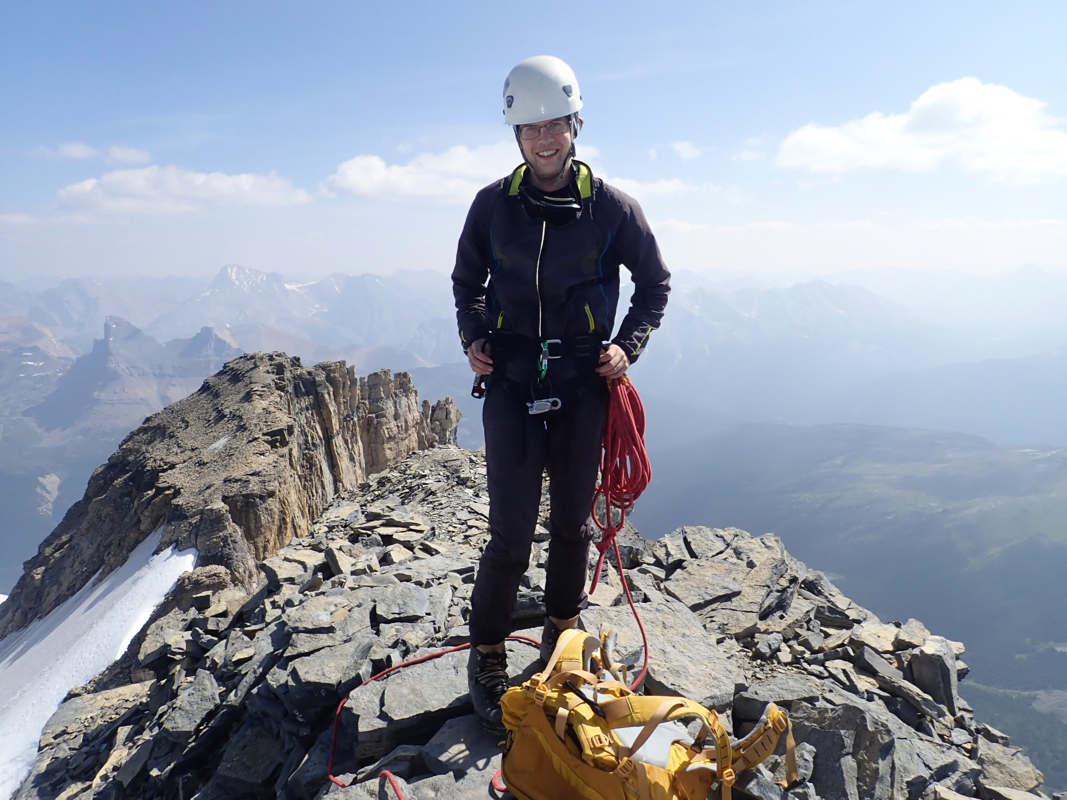
We were at the summit by 1120,
nice weather and impressive views. Our first
day in the Canadian Rockies.
We rested and took pictures.
The summit register had no pen, so no trace of
us left behind. We started down after 25 minutes.
Except for the same 2-3 meter
from the crack to more reasonable ice,
where we walked rather carefully, the
descent went down the same way
- easier to walk in the snow when downhill.
Just as we were about to leave the glacier, two men came uphill. The time
was already 1400 and I thought they were a bit late, but I guess they would still
make it down before it got dark.
We returned to the car at 1440, so just below 9 hours in total trip time.
Thanks to Pål for good company, the first real Canadian peak for both
of us.