How to get there:
The nearest big cities are Grenoble, Torino and Geneve, the latter two having international
airports. The closest city of some size is Briancon, near the Italian border. The distance from Geneve
to Briancon is about 250 kilometer and about 3 hours of driving.
From Briancon, drive south on Hwy. N94, and fork right onto Hwy. D4 (signs for Pelvoux/Vallouise) after approximately
7 kilometer. After 11 kilometer, you should go more west and north-west, leave D4 and follow signs for Vallouise.
Continue up the valley, drive past Vallouise and to the very tiny place called Ailefroide. From here, a paved, but
narrow road continues up the valley to a large parking area named Pré de Madame Carle (about 5 km beyond
Ailefroide). Park here, this is the trailhead. Location N44:55.010, E006:24.912, elevation about 1880 meter.
There are a couple of hotels in Vallouise, and perhaps more modern lodging up at the ski area called Puy-Saint-Vincent.
We stayed at this place, the road there forks left just before entering Vallouise from the south. Route description: To the huts:
This is a very popular area, expect a lot of people at the height of summer and on most weekends. The trail heads north
from the parking, crossing a river on a nice bridge. This trail is wide and well developed pretty much all the
way to the first main hut, the Refuge du Glacier Blanc. After a few switchbacks, you arrive at a trailfork. The left
fork leads up along the top of a moraine to Glacier Noir, our route forks right and continues with Zig-zags climbing
the face in order to reach a shoulder further up.
From here, turn the corner and descend slightly to the river that can be crossed on a sturdy bridge. Next, the trail
becomes slightly steeper as it gains the shelf above before heading more directly towards Refuge du Glacier Blanc.
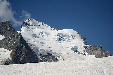
This refuge is located on top of a nice cliff, obviously commanding an excellent view back down the valley. The trail climbs
the lower slope, then ascends up and left of the cliff before a final, short (steep) uphill to the hut.
This location is N44:56.242, E006:24.698, elevation 2560 meter. The refuge phone is +33-(0)492235024.
It is possible to stay at Refuge du Glacier Blanc, however, this makes for a long summit day. Most people try
to get reservations at the highest refuge on the route, the Refuge des Ecrins about 600 meter higher.
From Refuge du Glacier Blanc, head uphill along a fairly well marked trail (there are some variations). Higher up,
the trail traverses high above the glacier in such a way that the route connects with the permanent snow along the
edge of the glacier, as soon as the glacier has a more gentle slope. Continue on snow along the right hand side of
the glacier, then gain the main glacier which is now pretty flat, and proceed until more or less below the refuge.
You will then be at location N44:56.716, E006:22.884, elevation about 3080 meter.
The refuge is situated high above the glacier on a cliff. Thus the final ascent is more steep and one will need to
descend this section before proceeding to climb Barre des Ecrins.
The refuge phone is +33-(0)492234666. Comments / Trip Report: Attempt, July 13th 2009: