Gunung Arjuno
- Gunung Arjuno
- 3339 m
- Primary factor 2811 m
- Java, Indonesia.
- Location: South 07.76460, East 112.59257 (GPS at the summit)
- Difficulty: YDS class 2
- Climbed August 3. 2019

Gunung Arjuno
|
|
How to get there:
This excellent web-site on climbing
Indonesia peaks should always be consulted.
This peak is located near the town of Batu just outside the city of Malang.
I discovered a really nice trail, that I highly recommend. Drive about 15 kilometer
(as the crow flies) up the valley directly north of Batu. You will see Arjuno on your
right hand side. Near the col, you pass through a small village. Continue to
location S07.74924, E112.53480, elevation near 1740 meter. This is close to the main col.
Turn right here onto a smaller road that serves the farm above, this road still has a hard
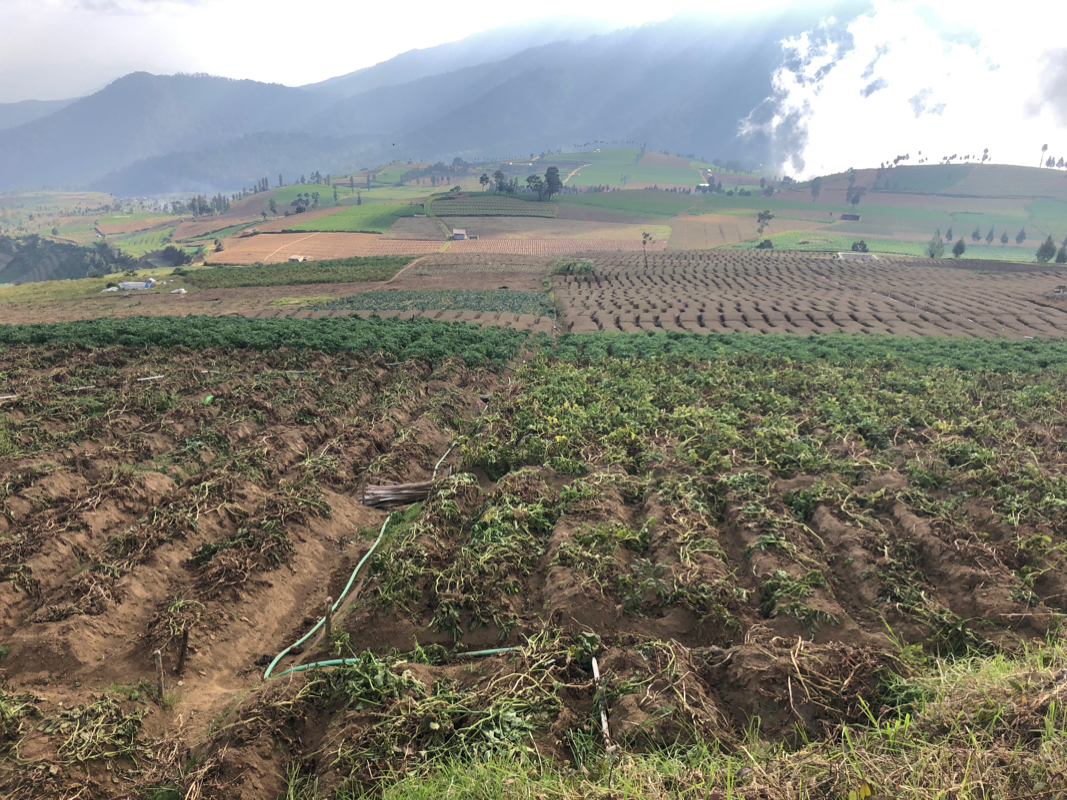
surface. Ascend to the higher plateau with farm land.
The road now turns into dirt and becomes
rougher. My taxi stopped at a local road fork at location
S07.75553, E112.54299, elevation about 1900 meter. Any car should easily make it here. The road continues
uphill to location S07.75460, E112.54868, elevation near 2000 meter. This is the trailhead.
Here is a summary and quick reference to the climbs on this trip.
Route description:
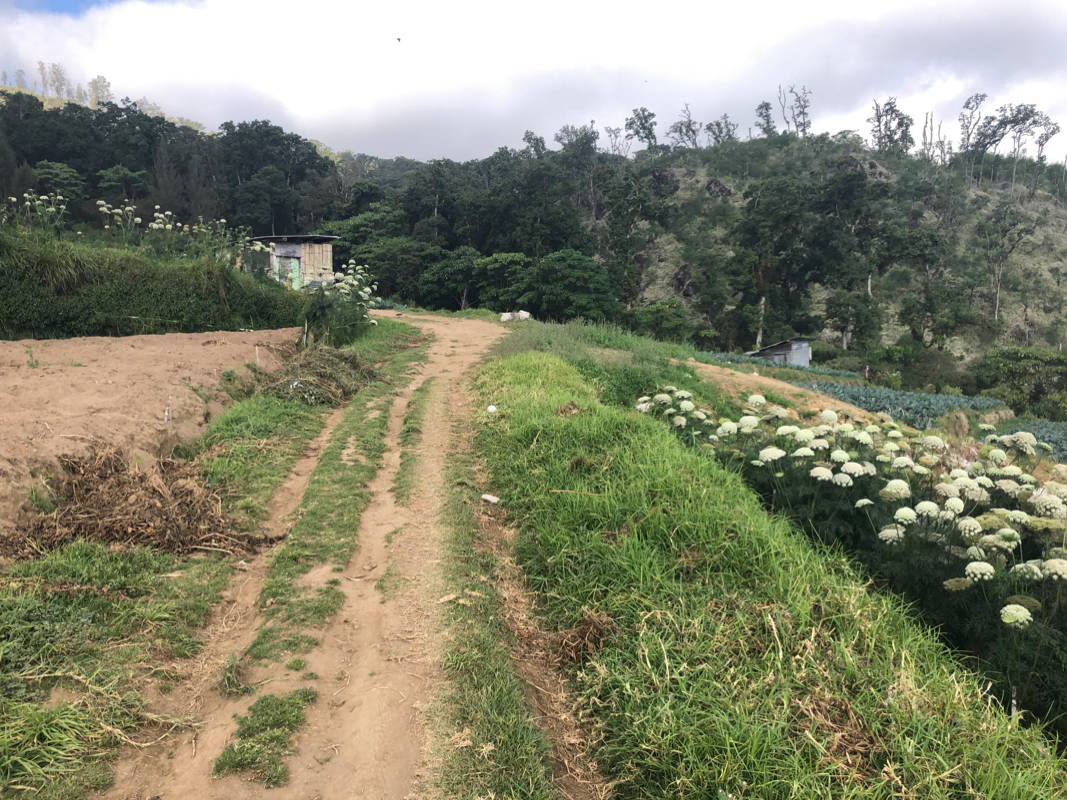
The farm road ends near a small building.
Look right for some trail marking ribbons.
You should descend slightly (right) in order to get to the lower right corner of
the farmed area. The trail then ascends next to this upper piece of farm-land on its
right side (looking uphill). Shortly, you arrive at a small clearing where another
trail (coming from below) merges. Continue uphill along a clear trail. Follow this
as it gently ascends, a very nice change from what are often very steep uphill
climbs in Indonesia.
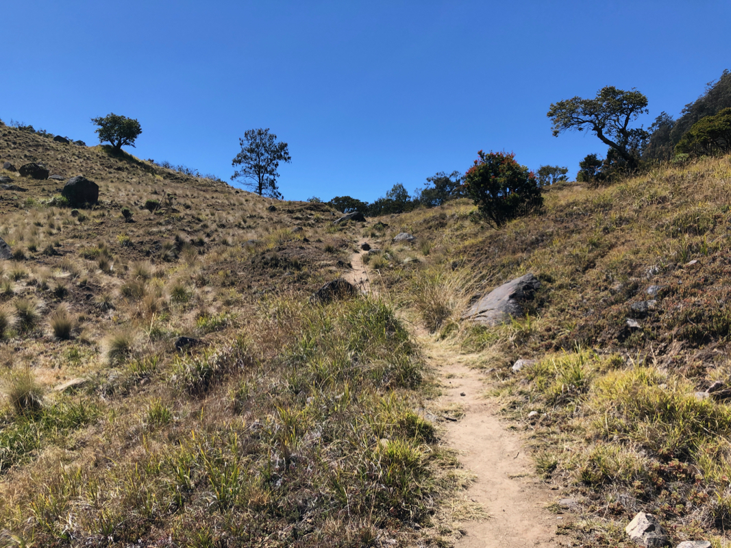
After a bit more than an hour (from the trailhead) you should arrive at a
clearing, location S07.74617, E112.56953, elevation about 2580 meter. Take the trail
that climbs right from here. You will soon pass a sign saying Puncak Arjuno, confirming
that you are on the right track. This trail
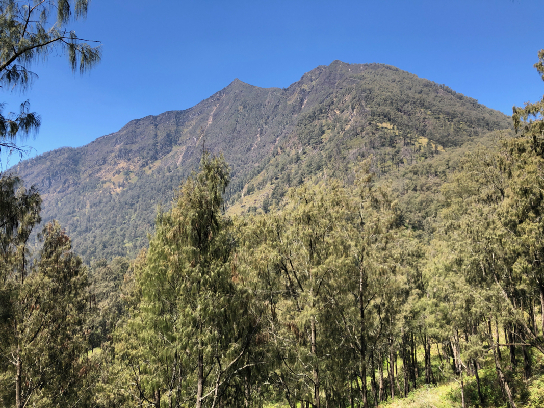
continues to a very nice col
at location S07.74605, E112.57942, elevation about 2900 meter. The peak on your right is fairly
low, but prevents the view of Arjuno. The trail now contours around this hill, loosing about 100
meter of elevation in the process. You arrive at a small
meadow and finally see the peak in front
of you. Ascend to the ridge and follow this to a first summit.
The last part of this ridge is
almost horizontal with big drops on either side.
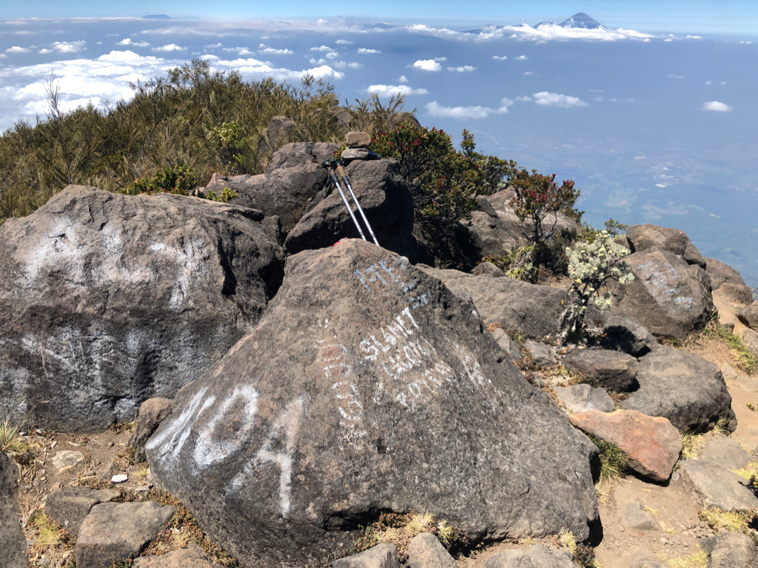
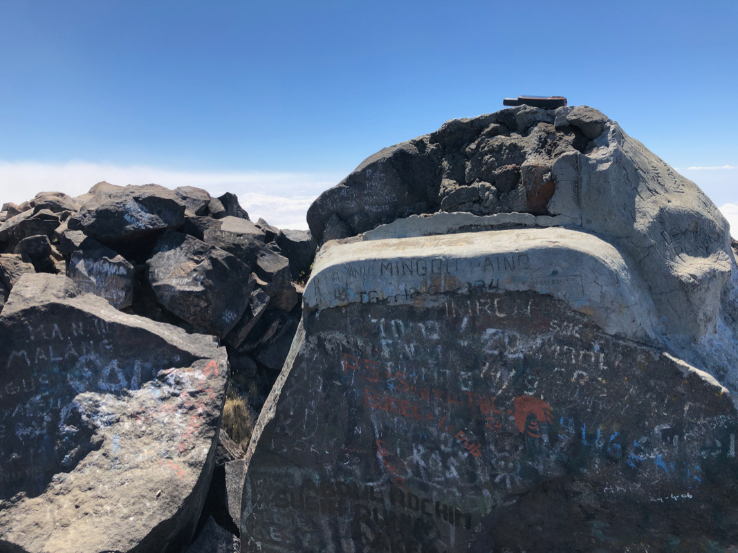
Arriving at the summit, you will immediately notice that
there is a second summit further onwards
connected by a shallow saddle, perhaps 30 meter deep. GPS measurements cannot determine which is
higher, they seem to be within one meter, so one should really visit both. Fortuneately, this is
a short (10 minutes) walk.
Comments:
I climbed this the day after a pretty hard day climbing Butak. There was one trip report
on Peakbagger and I decided to try that route since it looked short and pretty straightforward.
My taxi driver that had waited longer than expected for me to return yesterday, was happy to
get a new assignment.
We drove up to the temple/monastry called Pura Luhur Giri Arjuno, passed through a big gate and
stopped to talk to some local farm workers. They informed my driver that the gate would
close at noon and that they (at least this is what he told me) did not want anybody hiking
the trails there. Appearently, guide Sam had made some special arrangements when the Peakbagger
reported ascent had taken place.
I then switched to plan B, ascending the peak from the col at the upper end of the main
valley. This turned out to be a very fortunate decision. I initially thought that I would
have to hike from the main Hwy. however, it looked easy to drive at least part way up the
first hill. My taxi did not object and soon we were at 1900 meter, a pretty high trailhead.
Here, the road turned a bit rough and it made sense for the taxi to stop.
I started hiking at 0815. To my delight, the trail was really nice and not just a steep
uphill. It did climb, but very gently. I carried on and noticed a sign saying Puncak Aruno,
always nice to know. I crossed the nice saddle and then contoured around the hillside that
obstructed any views of Arjuno. Finally, the peak came into view. Still, quite a bit of
vertical ascent. This part of the route was by far the steepest, still pretty good. I arrived
at the (first) summit exactly at 1200, so 3:45 up.
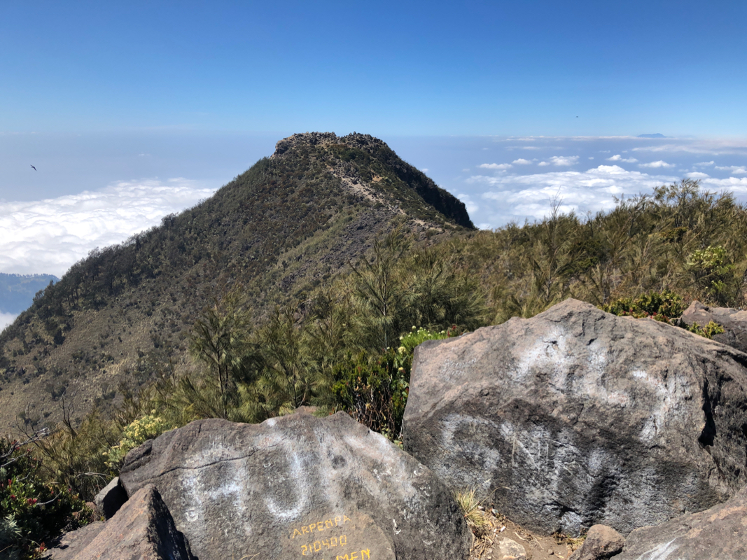
I looked across to the second summit and headed over there after about 5 minutes.
As it turned out, these two summits are indeed very close in elevation. A GPS is not
able to tell any difference. The second summit is more
rocky, a couple of large boulders
competing for being highest. I next returned to the first summit,
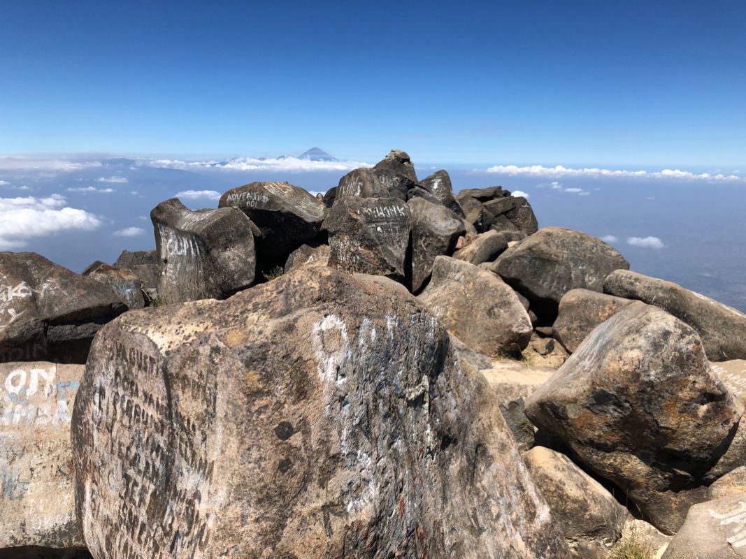
enjoyed the view
as well as some water to drink before descending.
I left the summit at 1235 and had a good hike back down to my taxi (waiting), arriving there
after 2:45. Perhaps surprisingly, I did not see anybody on this trail. Quite different from
the high peaks further west where quite a few people always would be present.