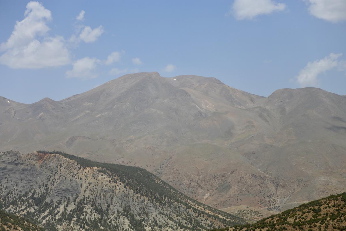
Adrar Bou Nasser
- Adrar Bou Nasser
- 3340 m
- Primary factor 1642 m
- Morocco
- Location: North 33.56221, West 03.88555 (GPS on the summit)
- Difficulty: YDS class 2
- Climbed June 20. 2017.
Adrar Bou Nasser
|
|
How to get there:
The city of Fes is a good point of departure.
Drive east from Fes on Hwy. N6. This road climbs across a sizeable hill
and eventually crosses the (toll road) main motorway. From here, your direction
should be roughly south-east. The road will subsequently be more narrow, typically with
a paved middle section and dirt shoulders that must be used when meeting traffic.
The road should go through Zaoula Bougrine, then continue to Ahermoumou. This location
is roughly at N33.82632, W04.41465, may also be called Ribat El Kheir.
From here, the road climbs into the mountains and becomes more narrow, the remaining
distance to the trailhead is more than 80 kilometer.
Route description:
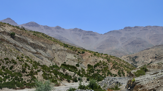
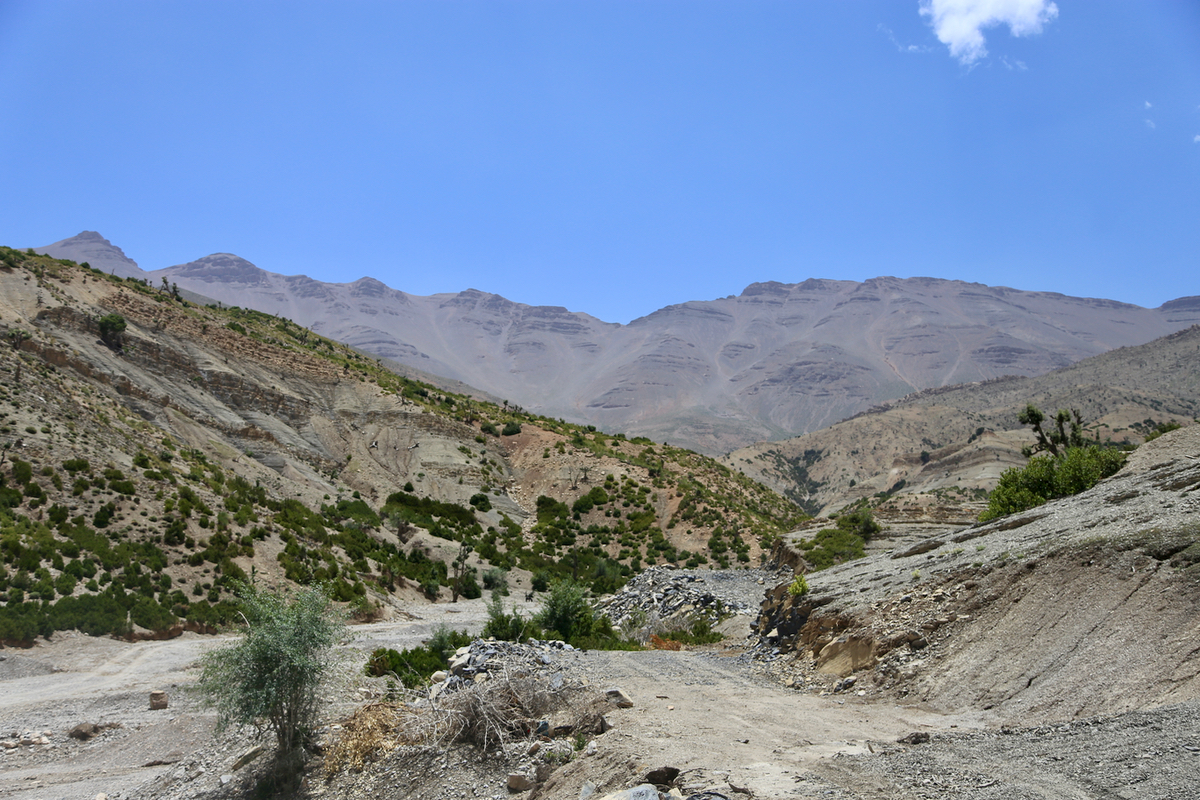
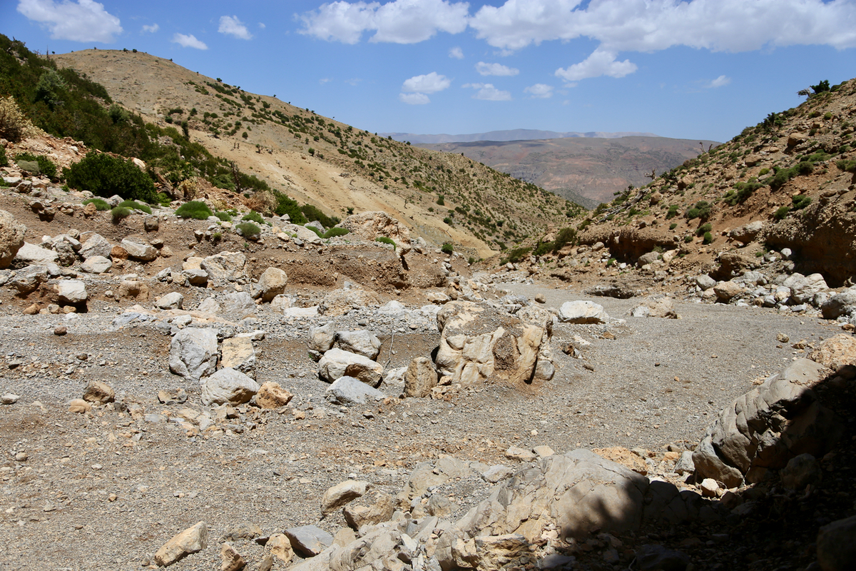
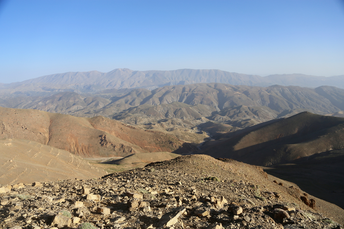
From the road, follow the main (dry) river.
This is quite wide for
several kilometer. There is a small road running along the right
hand side. If you walk on this, be careful as it may lead you out
of the main river bed. Stay with the big dry riverbed.
The route next follows a narrow,
dry river (branching left when facing upstream),
most of the way this
is still easy walking with only a couple of short, slightly steeper
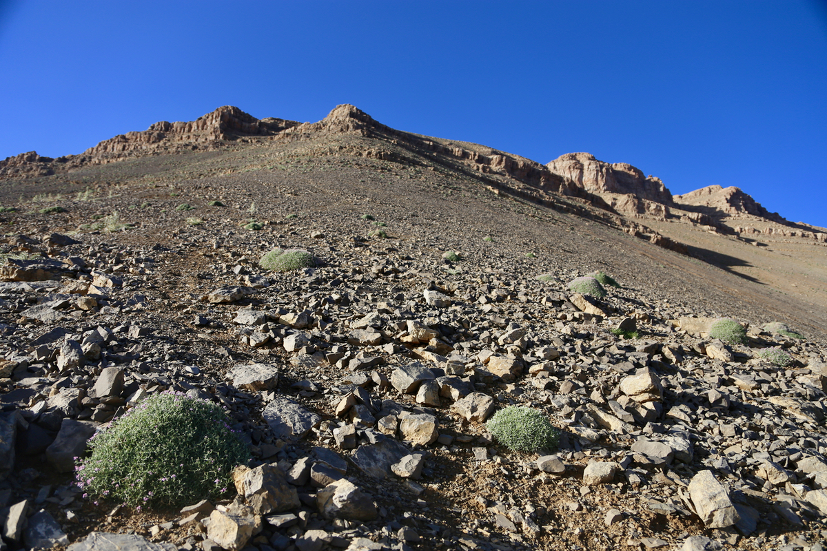
sections. When you finally exit this small gorge, the route climbs
right - there are multiple tracks here. You will observe an old
shelter near the top of the cliff. From this location you will
see a broad, shallow valley
that climbs towards the peaks near the
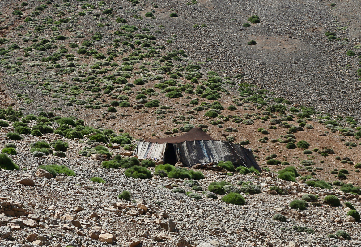
horizon. Near the middle and at the lower end, one should see a
shephard camp
with several huts.
Head directly uphill towards these huts passing nearby on the left
hand side. Continue uphill,
there are clear tracks here. Pretty high up,
the route (and the path) makes a long traverse to your left. As you enter
a fairly broad ridge, go only a short distance uphill, then follow the tracks as
a second, long traverse left is what one should do. At the end of this, the
trail finally climbs to a very distinct col. This is an important waypoint.
From this col, du an ascending traverse on your left side. it pays to contour
around here rather than getting into more steepish and cumbersome terrain.
Once you are up this slope, the remaining distance to the more flat terrain thet
connects several local high-points is quite short. In order to reach the
highest point, keep left and descend slightly. Finally, when you are on the
correct local ridge, just follow this to the very highest point.
Comments:
I knew that this might be a very long day if attempted as a roundtrip from Fes. Thus, I started
from Fes around 1500 on June 19th. The plan was to drive to the trailhead, sleep in the car and get
off to an early start the next morning. Thanks to excellent information from Denise and Richard McLellan
navigation should not be a problem.
I left our hotel at 1500 and as I drove south-east towards the mountain, it almost immediately
started to rain rather heavy. Still, navigation was easy and by the time I started up the mountain
road, the rain had ended. This part of the drive is certainly a part of this adventure. The road is
overall in good shape, but narrow. The drive takes you across several mountains and the views along
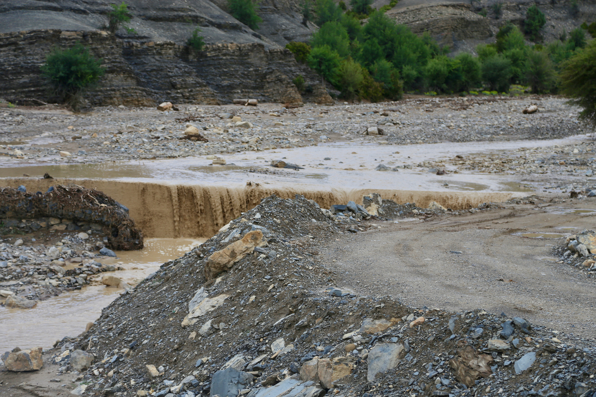
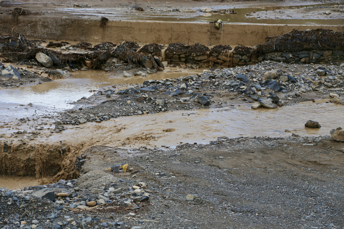
the route are excellent. About 10 kilometer from my intended trailhead the
road had flooded in quite
a serious way. After looking closely and knowing what a
Cherokee is capable of, I crossed with caution.
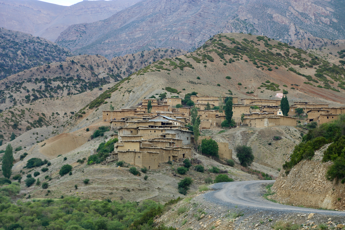
A second river needed to be crossed, this looked so unlikely that I first ended up the wrong
valley, having a local village.
I drove back down and now found the second crossing.
I was finally parked at 1900, very well timed as it got dark around 1930. I made a comfortable
bed in the back of my Cherokee and was soon asleep.
Somehow, I woke up already at 0100. It was pitch dark aside from the brillant sky filled to
capacity by glittering stars. Having a good head torch, the idea of a super early start was
attractive. I would then return to the car before any afternoon rain and hopefully be able
to drive back across the rivers where bridges were missing.
Thus, I started hiking already at 0130. I followed the road that went parallel with the (dry)
riverbed. This turned out to be a big mistake, the road (that I followed) turned away from the
main valley/river and entered a much smaller valley that went much more to the right.
When I realized this, I should of course have turned back. My second mistake of this early morning
was clearly facilitated by not having contour lines on my GPS map. I (incorrectly) assumed that the
correct route followed the ridge up left while I was in a valley. I therefore aascended the ridge
only to find that the correct route most likely was on the next ridge left, but then with a (deep) valley
in between. The third mistake was my assumption that following the ridge I was on would eventually
connect me to the correct ridge. I continued according to this theory until I at daybreak realized that I
was about to climb an independent peak, separated from the mountain I intended to climb.
Thus, after spending half the night off-route, I finally approached the shepherds huts just as
daylight was coming. The rest of the climb
went according to plan and route.
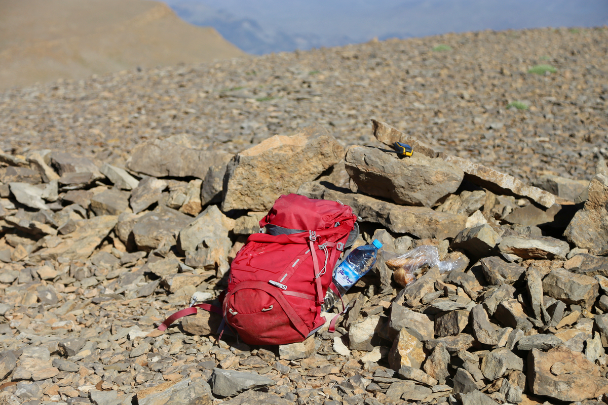
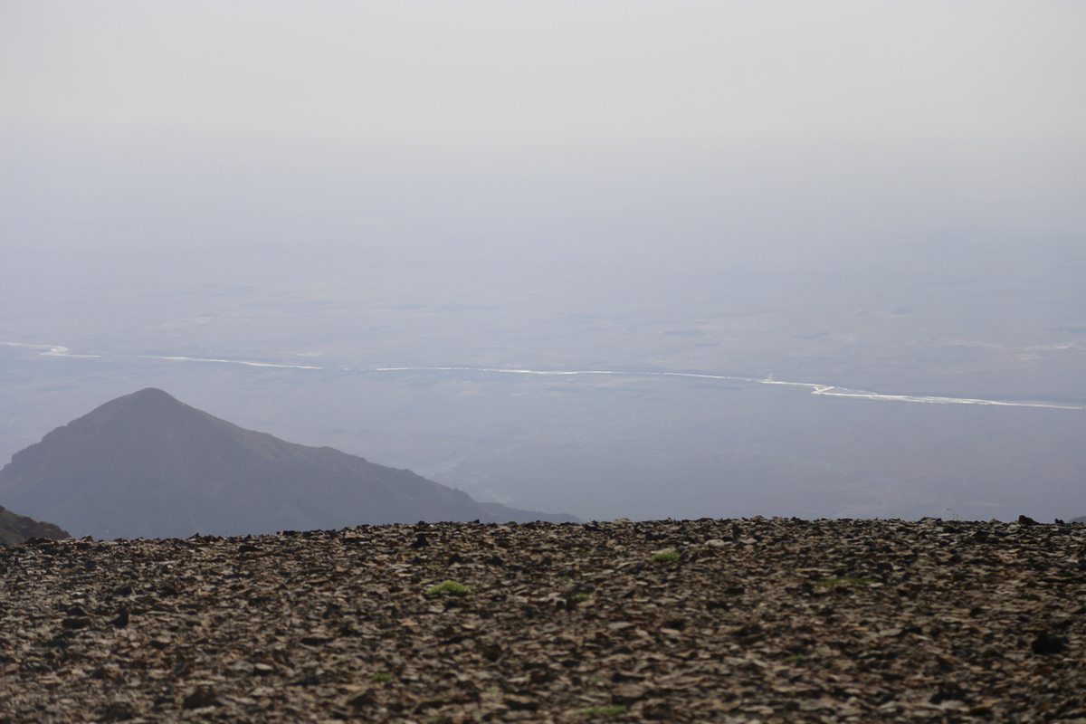
I arrived at the summit at 0800, felt
that this had been hard work and allocated 30 minutes
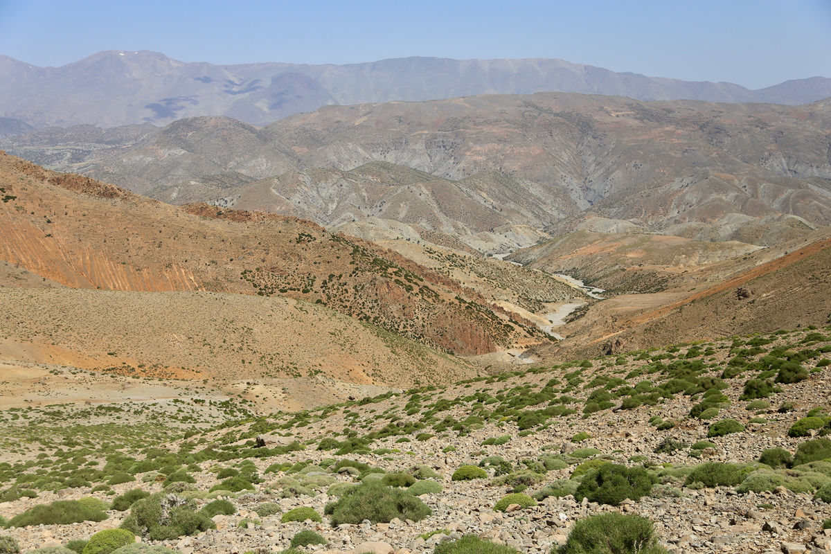
to a long rest. A bit of haze, but I could see the Moulouya river as
well as nearby peaks quite well.
The return descent went more smoothly. As I stopped to drink water a few hundred
meter below the shepherds huts, two young girls came down to me and offered about a liter of
goat milk. A nice gesture, but I politely thanked them without drinking. Hiking down the small,
dry river was fun and this one joined the large, dry river below it. The last part of walking was
surprisingly long and I was a bit more impressed with my wrong route uphill, it was kind of
impressive that I had been able to connect back at all.
I was back at my car by 1145, still this trip had taken more than 10 hours. The drive back
went just fine. The water level was down since yesterday. I was back in Fes by
1530.