How to get there:
This peak is located quite far away from major roads. First, locate the small
place Gold River on Hwy. 28, about 60 kilometer (as the crow fly) south-west of
Campbell River (on Hwy. 19). Next, take Gold River road heading north and north-west
from Gold River, to near location N49.8595, W126.1141. Shortly thereafter, fork right.
Stay on the main dirt road keeping the river on your right hand side.
You will pass a small lake (on your right) near location N49.9916, W126.1435.
Fork right near location N50.0085, W126.1528. Again right near N50.0139, W126.1453.
Continue uphill to near location N50.02186, W126.12999, elevation about 900 meter.
Most cars should make it to here. The road forks left here and continues uphill as a 4WD,
minimum high clearance road to location N50.02586, W126.11755, elevation near 1140 meter.
There is parking near the road end. This is the trailhead.
See this summary of climbs in BC, August 2022.
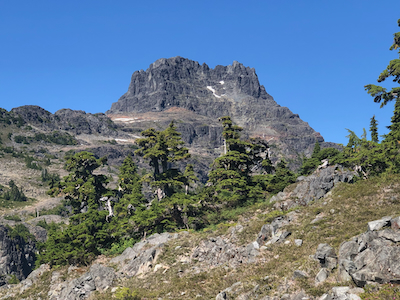
Route::
From the south.
The path goes directly uphill at the end of the road. Very steeply
at first, then slightly more gentle. There are a couple of ropes along
the path here, possibly useful if wet and slippery.
The trail reach the connecting ridge above, then turns left and follows
this ridge across a few local humps. A small descent and you cross the
last saddle before the terrain starts
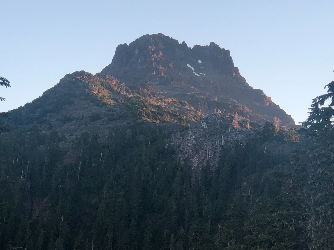
a gentle rise towards the peak itself.
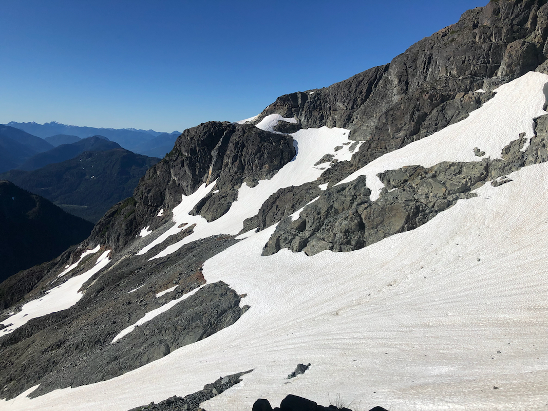
Higher up, the route will gain a broad ledge on the right hand side of
the main crest and follow this, still gradually gaining elevation until
you descend slightly to reach a small shoulder.
From here, a snow traverse
is normally required. (Picture is looking back) Descend on
snow that quickly gets less steep, then traverse across
to the other side. Rocks on the snow show that one should be alert and get this
crossing done without too many stops. A small snow field extends uphill on the far side,
next to scree. Later in the season,
there may be no or very little
snow here. See this picture.
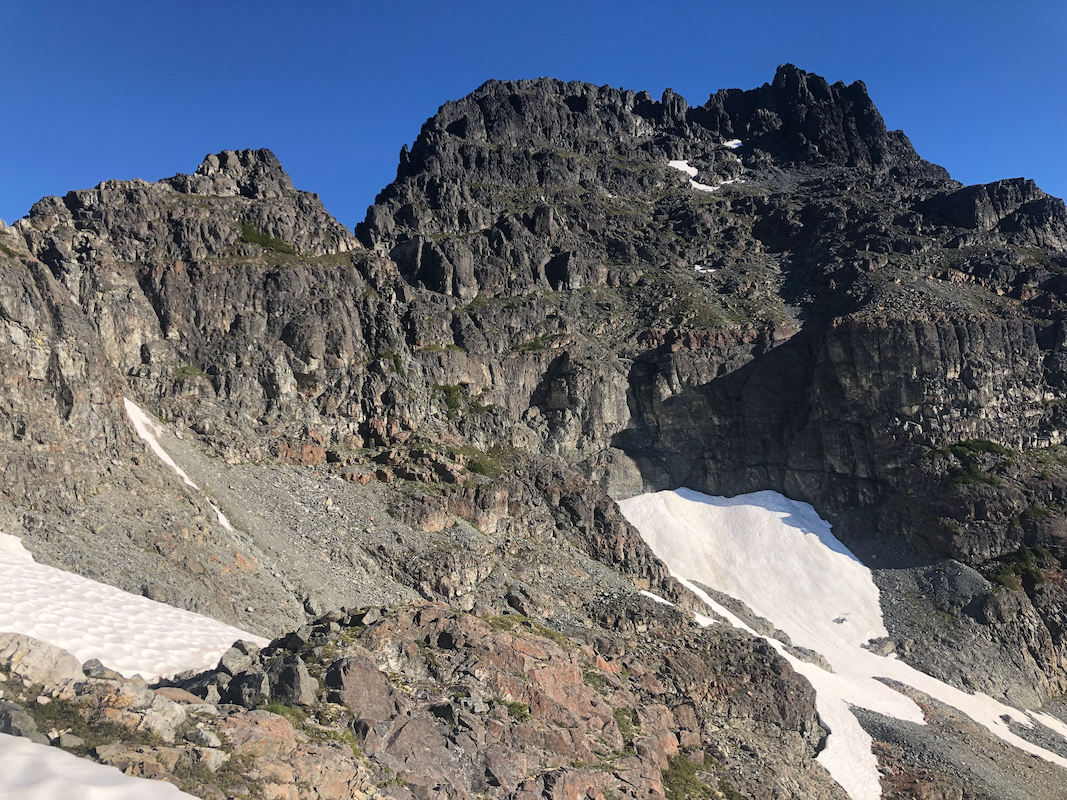
Ascend scree (to the right of the snow patch) quite high until you see the "hidden gully" going
up to your right hand side.
The gully is pretty easy,
a single choke-stone being a small crux. A ledge now continues
along directly under steep rock, all the way to a point where a tiny notch signals the
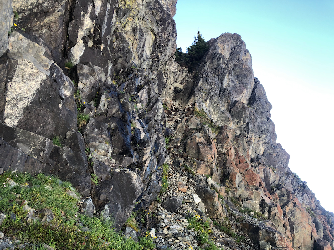
end of the ledge, a steepish ravine being the continuation.
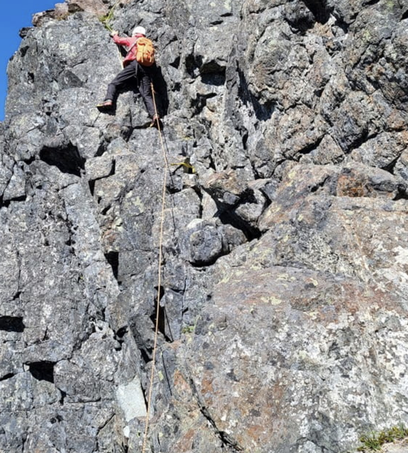
The short rock climbing section starts here. There are a few variations. Ascend a ramp
that runs left. Continue up steeper rock (limited footholds!) to gain a larger ledge.
Move right from here around a corner (exposed, but not very hard) to reach the main
anchor used for abseiling.
From here to the summit, the route never exceeds (YDS) class 3. Follow cairns and climbers
trails ascending while generally moving left. A small gully completes the ascent and only a few
steps right along a short summit ridge remains.
Comments:
Adam and I arrived in his Subaru, Dave drove his van. We arrived at a pretty big
water bar and decided to camp there. The road had a small fork here, elevation
near 900 meter. The next morning we could all drive
higher in Adam's Subaru car.
General wake-up around 0500, we started driving shortly after 0530.
We were able to drive all the way to the road end at location
N50.02586, W126.11755, elevation near 1135 meter.
We started at 0600, steeply uphill to the ridge. Thereafter, a nice morning
hike with gradually better views of other peaks.
We continued across several humps on the
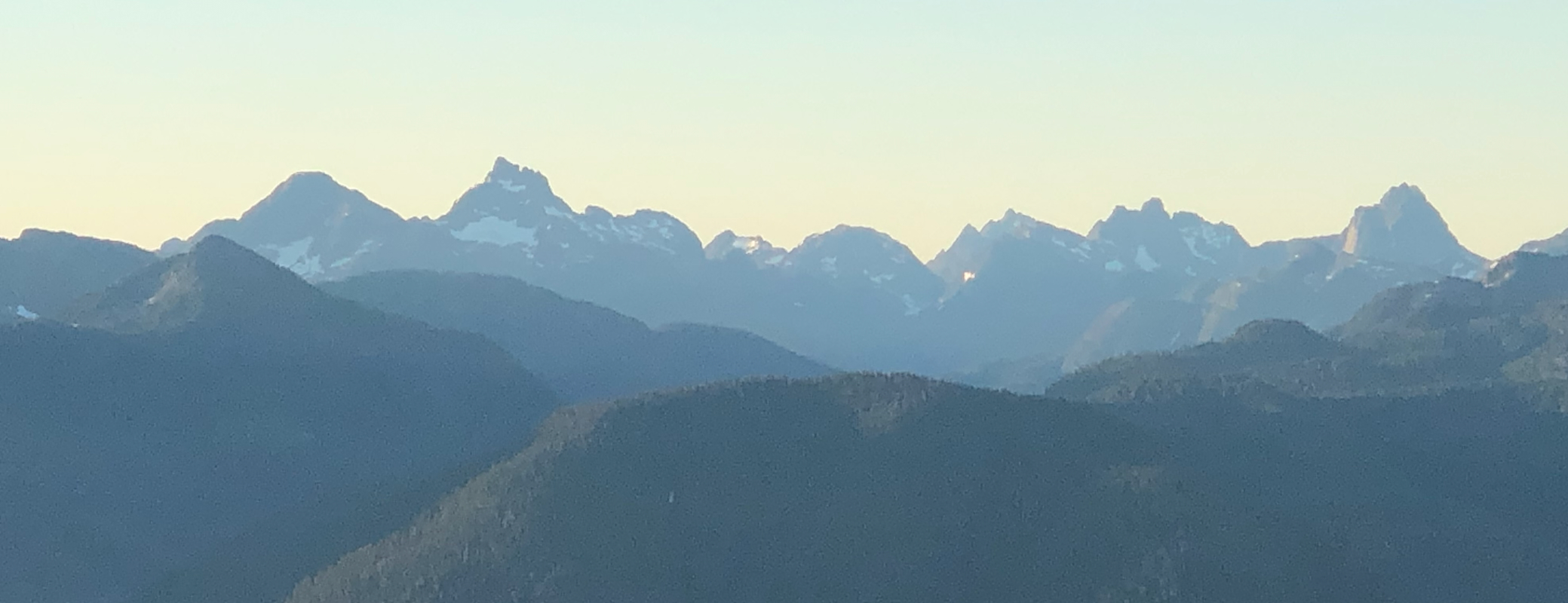
ridge with Victoria coming into view.
There were also other peaks that caught our attention.
The snow field finally showed up, steep enough near the top to require crampons
and an axe. Looking across, it was pretty easy to see the entrance to the "famous"
hidden gully. We were soon at the base of the rock climbing section.
Dave did an expert lead while I belayed him. I did notice that he used a couple of
really tiny footholds, with trail shoes - clearly not what I could do. My turn, I got
to the crux move without much problems, put my left foot way out on a good
place to my left. Then what?
It took me a short pause here to figure out a continuation.
The move went fine and I was soon up with only the exposed corner on my right to turn, this went
fine when doing things in the correct order.
From here to the top is still a pretty long way, but no more climbing. Some passages of easy
(YDS) class 3 scrambling. There were many variations and cairns, but generally one follows
the terrain uphill while keeping left.
We were at the summit shortly at 1050, so roughly 5 hours from the trailhead. A very nice
summit with good views in all directions. We stayed around for 40 minutes, as we were about
to leave 2 climbers came up a more technical route. The return hike went fine, a 15 meter
absail is enough to bring you down to the initial ramp. Thus a 30 meter rope is ok for this
route.
We were back at the car by 1600, so about 4:30 for the return. Thanks to Dave and Adam
for a very nice day in varied and interesting terrain.