Location: North 61:25.606, East 008:09.019 (GPS at the summit)
Difficulty: YDS class 2 (easiest route), YDS class 4 (south ridge)
Climbed August 6, 2006.
Information:
How to get there:
From Oslo or Bergen, take E-16 up towards Norway's main
east-west water divide and locate the intersection called
Tyinkrysset where a road heads north to the nearby lake Tyin.
There are signs for Årdal and Eidsbugarden. This road climbs
up to the lake Tyin (only a few kilometer). Immediately, as you
get to Tyin, there is a new road fork, to the left, the main road continues
to Årdal. Take the right fork, this road is not paved, but wide and well
kept. Follow this road along the east side of lake Tyin to the mountain hotel
Tyinholmen. Just in front of the hotel, a much smaller and quite rough road
continues along the lake while the main road heads inland across to Eidsbugarden.
Take the smaller, rough road and continue for 7 kilometer. You are now next to
Koldedalsvatnet (1177m) approaching a small hill named Raudehaugen (1270m).
Look for a small turnout in order to park, there are several possibilities.
This is also near a bridge where the road crosses a river. This is the trailhead,
I parked at location N61:22.683, E008:09.742, elevation 1213 m. Route description:
Locate the T-marked trail that heads uphill from the road just north of the
bridge (south of Raudehaugen, 1270m). Follow the trail to the signed trailfork
south of lake Uradalsvatnet (1316m), take the right fork and cross the river that
drains the lake (easy crossing on stepping stones). Leave the trail and head up into
the distinct bowl slightly north-east. There are a few cairns and traces of a trail,
but it may be hard to follow. Climb towards the (map) marked point 1487, then head more
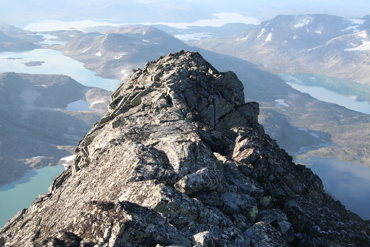
east and get onto the highest ridge. This section is YDS class 2, easy off-trail hiking.
Follow the gentle ridge as it climbs to 1800 meter. From this point, the ridge climbs more
steeply to what looks like a summit. (It is not as the ridge just has a flat section before
its last step to the South Summit.) Scramble up this ridge. It gets steeper the higher you
go and ends with a short, near vertical section. This last move is YDS class 4, you step
on a rock then lean left and haul yourself up while putting one leg on a smaller foothold
further left.
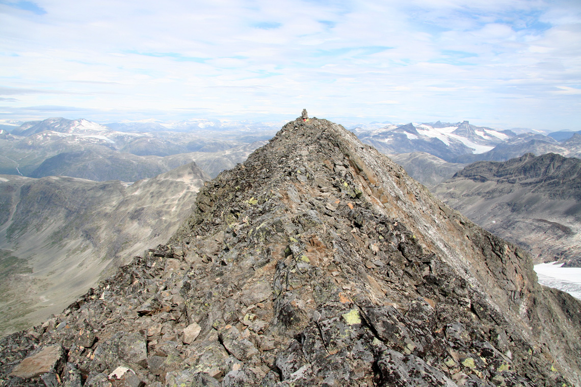
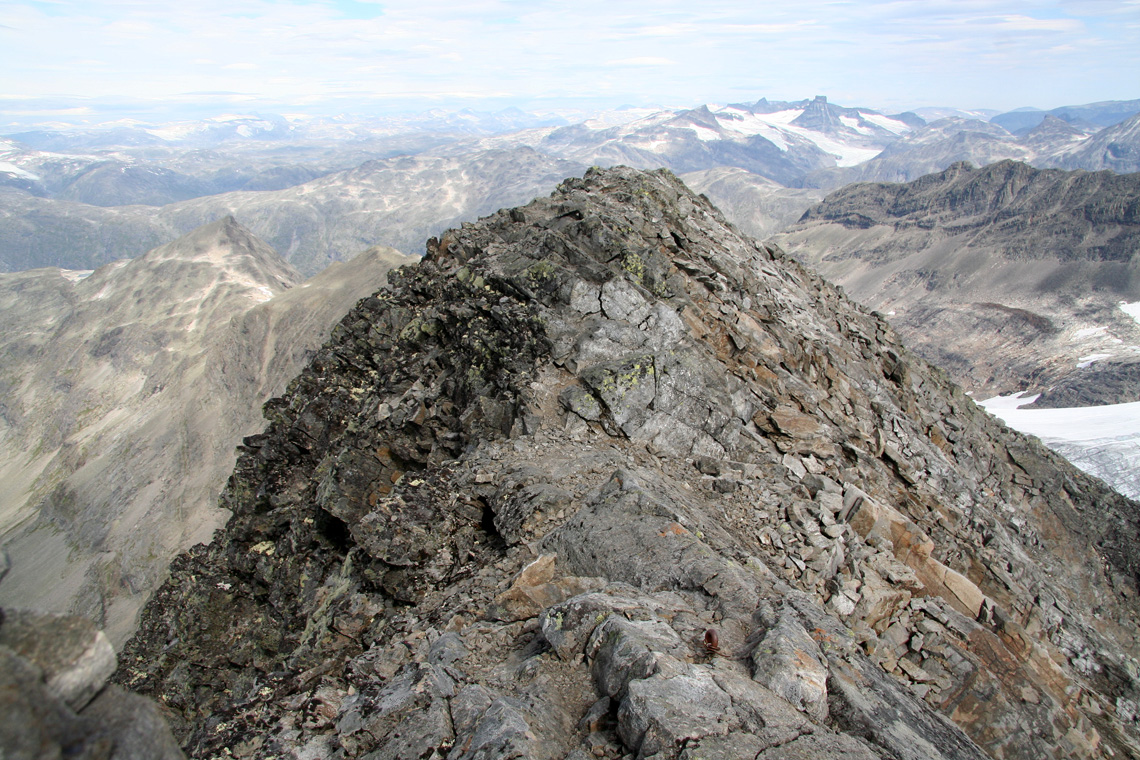
Beyond this point the ridge is more flat and gentle before you arrive at a second
"crux point" just below the South Summit.
This point is at location N61:25.207, E008:09.218, elevation 2043 meter.
As I turned back at this point, the South Ridge
traverse description is incomplete and ends here. However, upon return I read a description
that indicates that the remainder of the route can be done with similar or less difficulty,
possibly provided that one climbs a bit on the left side of the top ridge in a few places.
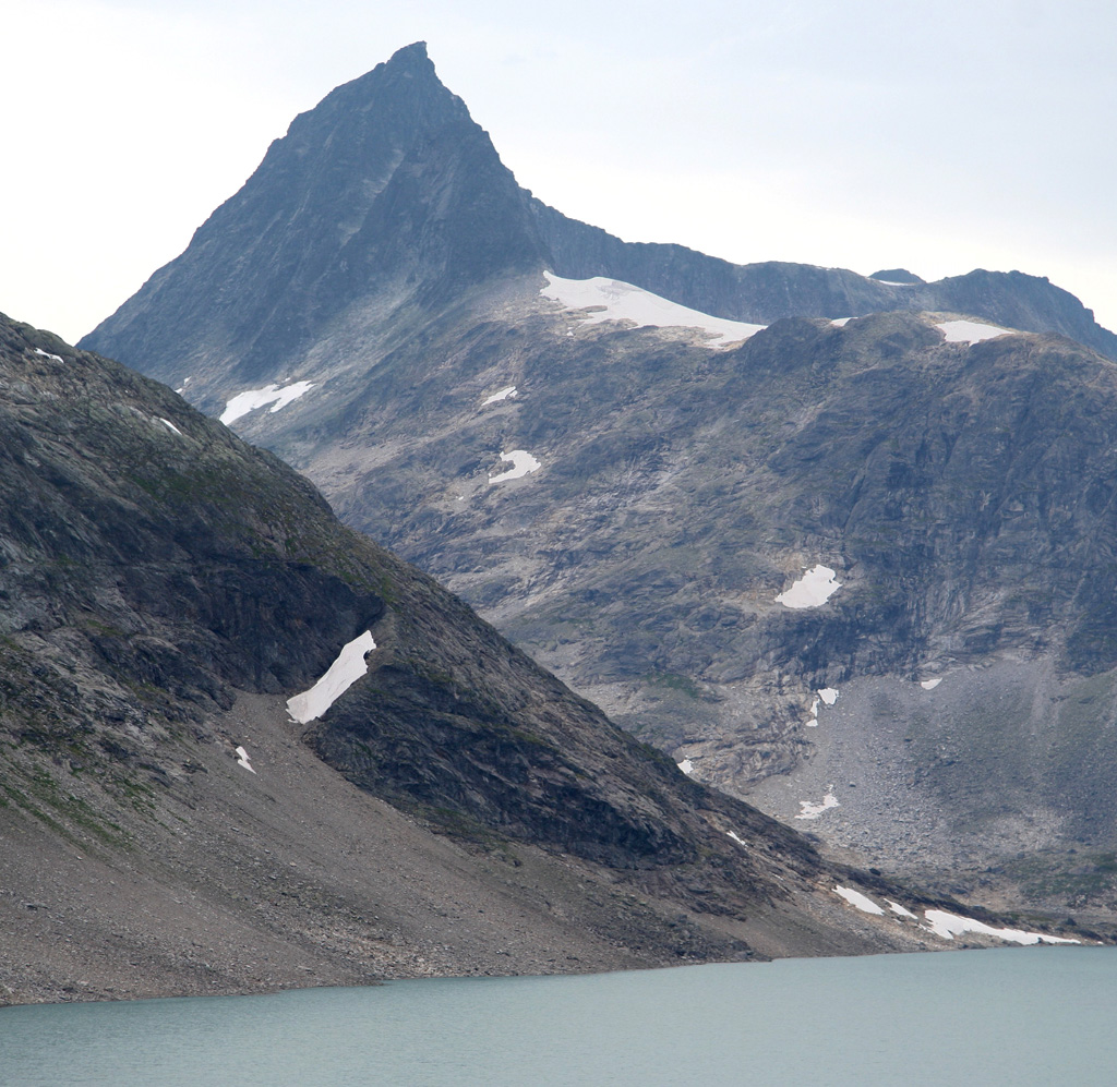
See also below, the picture of the entire ridge connecting the two summits as taken from
the north. West side route: One can climb both the South Peak and the main Uranostind
summit via the west side. This approach can, however, not be recommended. The entire side
is a mix of steep rock slopes, slippery surfaces and, mainly, boulder fields. The boulders
are often quite unstable and the entire west side is generally an unpleasant place to be.
If climbing (or descending) Uranostind from the north, then it is important to traverse
sufficiently far south of the north saddle while staying in the boulder field before descending,
since the terrain gets worse further north. There are some red rock quite far down and a line
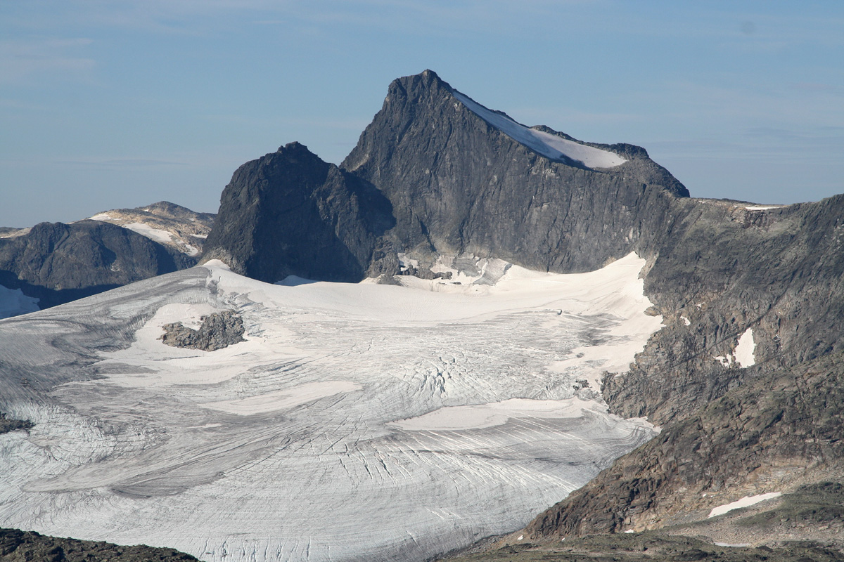
of ascent/descent should go more or less straight up/down towards this red rock area. Normal route: The normal approach is across the glacier on the
east side with access to the north col, then an easy ascent up to the top ridge.
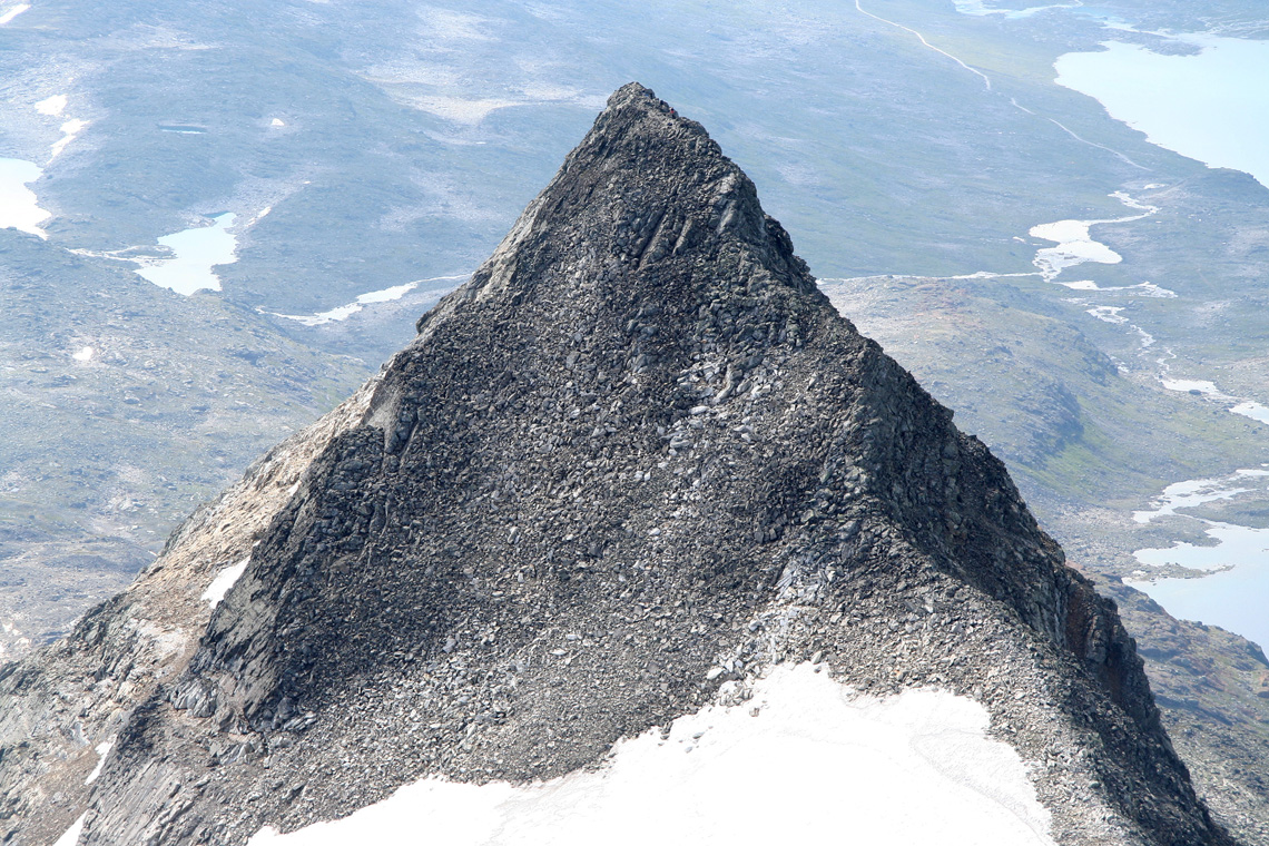
The summit ridge is quite long and quite narrow, in particular just north of the summit
cairn.
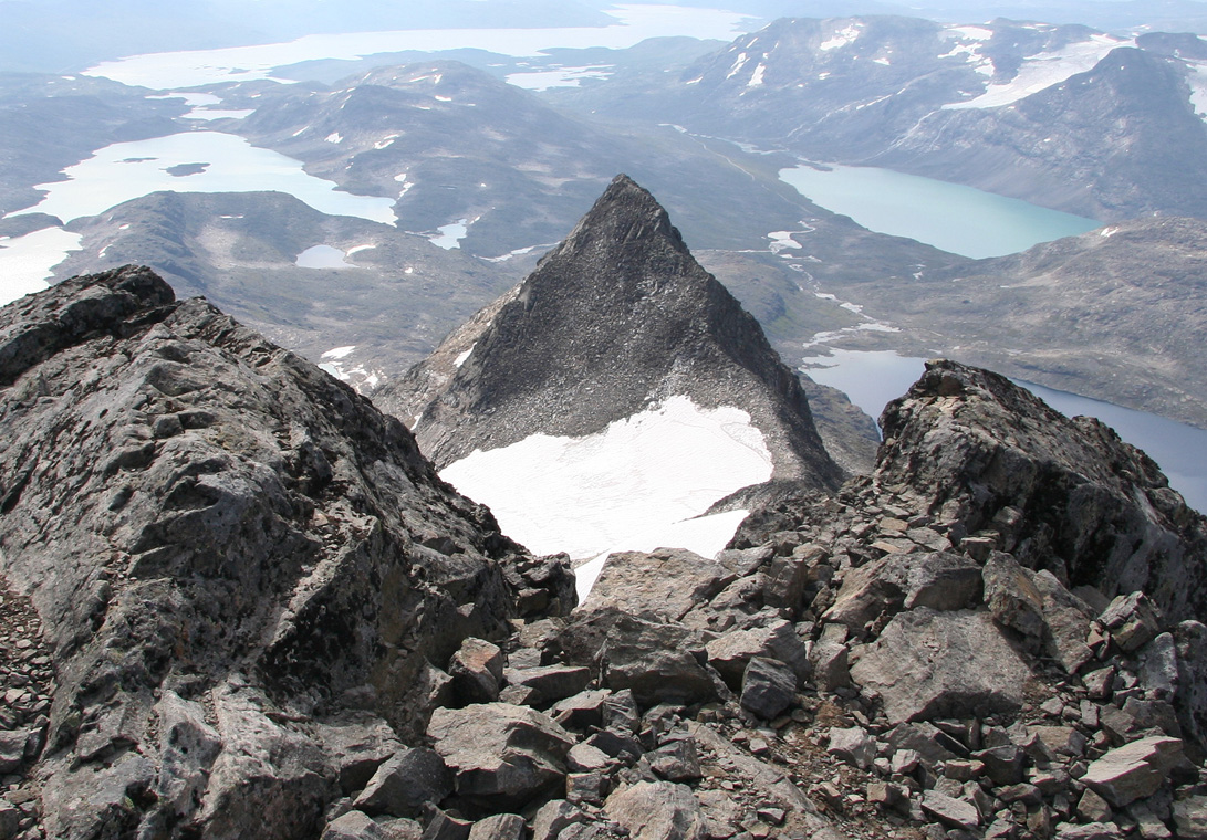
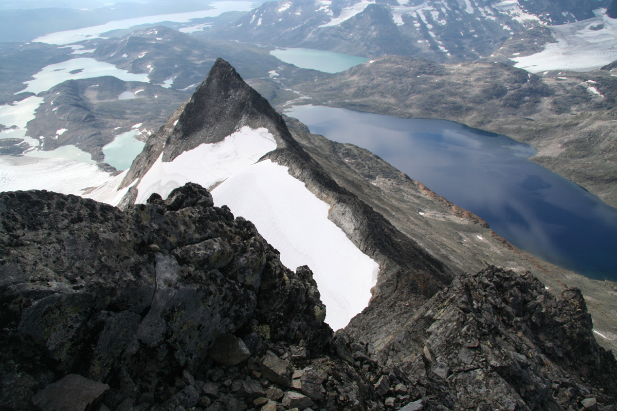
Just north of Uranostind is a small, subsidiary peak named
Slingsbytinden. It is just a 15 minute
climb and worth visiting if one already is in the saddle north of
Uranostind.
Trip Report/Comments:
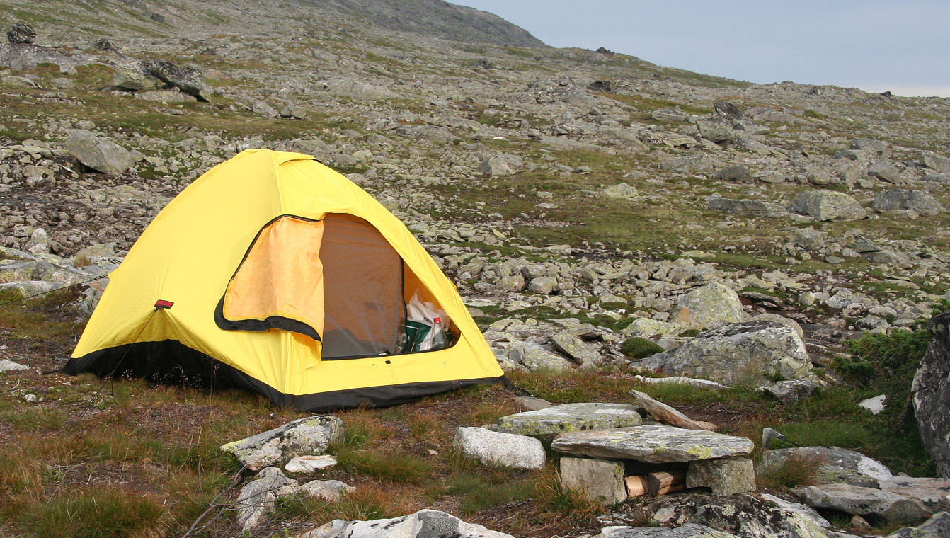
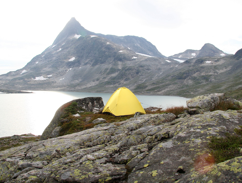
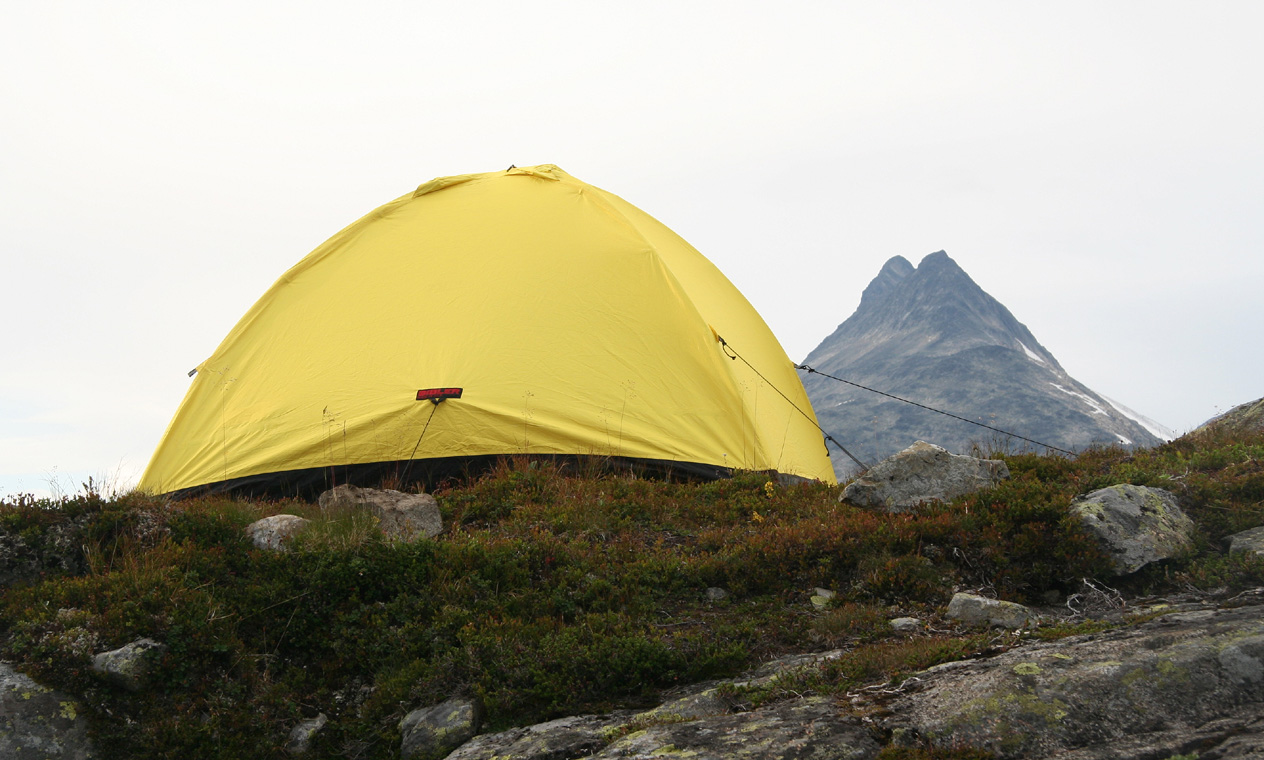
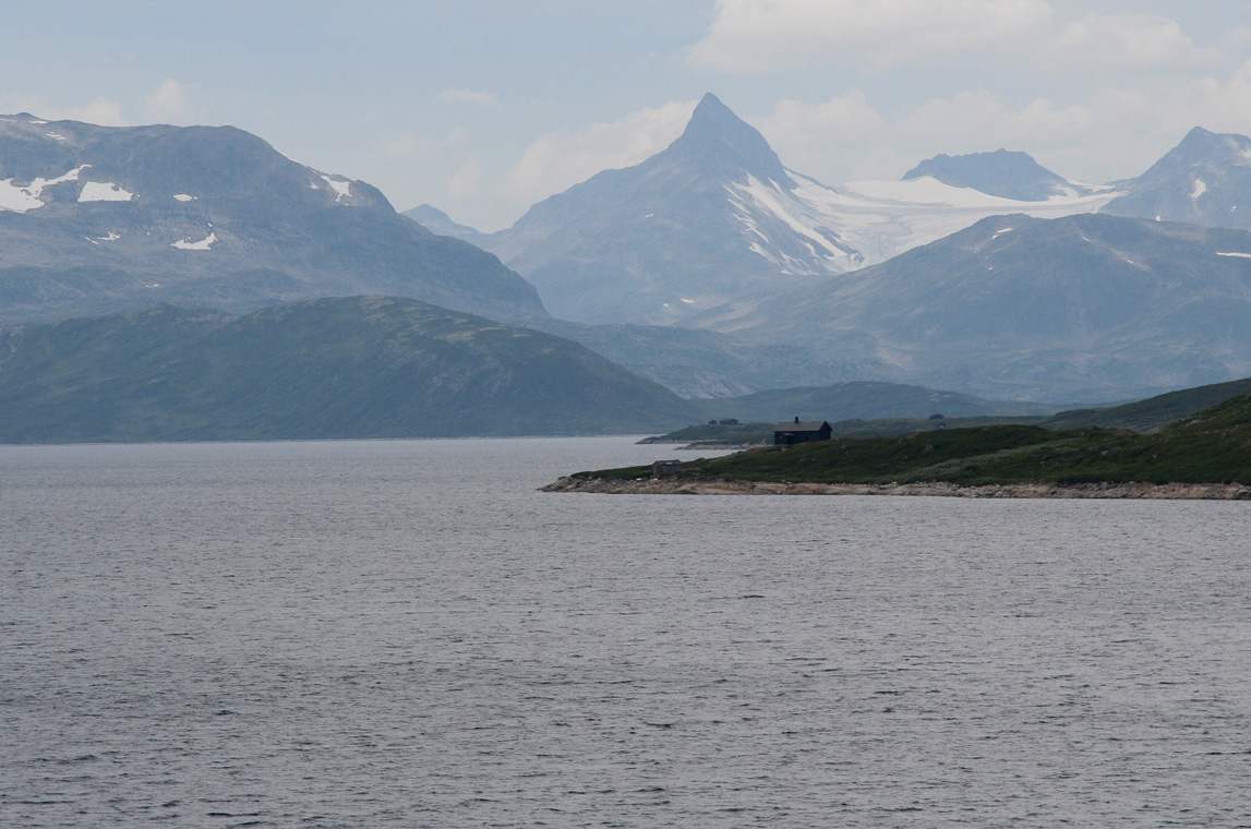
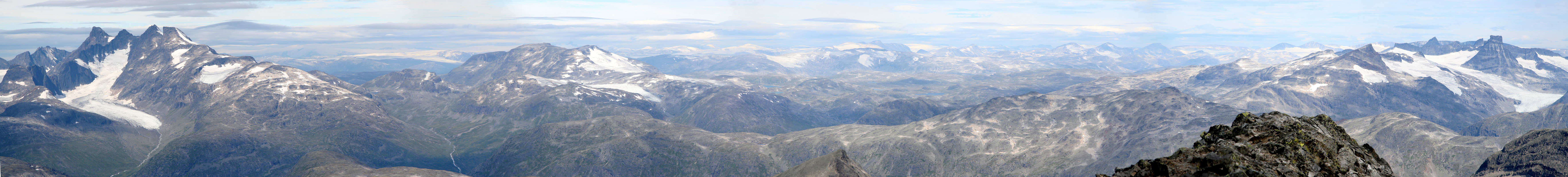
I arrived at the trailhead around 1800 and found myself an excellent camp site with
fantastic views of Falketind as well as of my goal,
the very pointed Uranostind.
Another party was camping nearby and the young man in this group had completed the
South ridge traverse with a return hike down the glacier. He had been on Store
Austabottind a couple of years earlier and believed that this south ridge was a somewhat
less challenging trip. Consistent view with the guy I met while descending Austabottind.
I slept early and planned an early start in order to get back home for a not too late
Sunday dinner in Bergen.
At 0500, I had finished breakfast and packed up the tent, ready to go. I quickly hiked
to the lake Uradalsvatnet and crossed the river. The continuation up along the ridge to
1800 meter also proceeded without much delay. It was a fine day indeed. Yesterday was a bit
hazy, while today promised to be sunny mixed with a few clouds that would come and go.
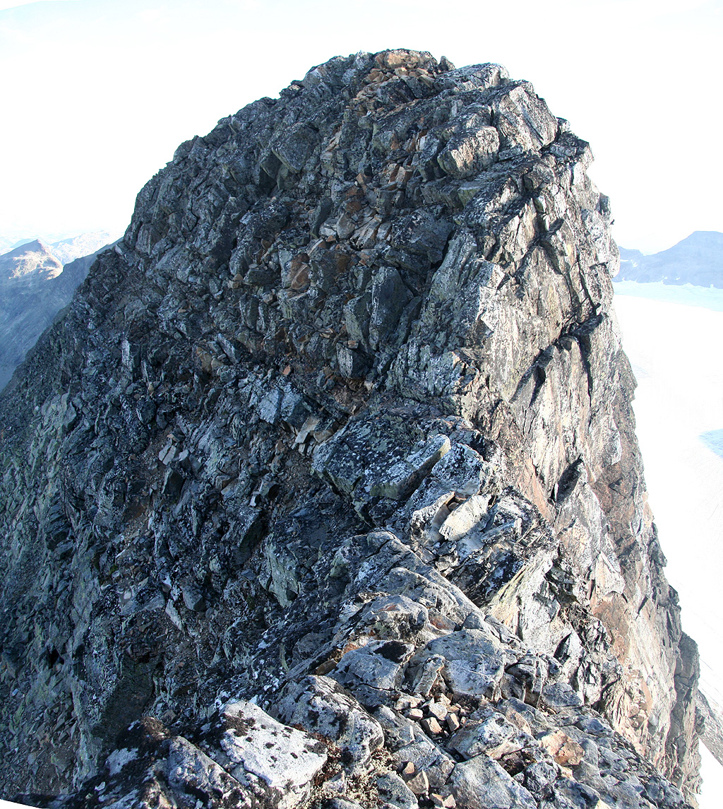
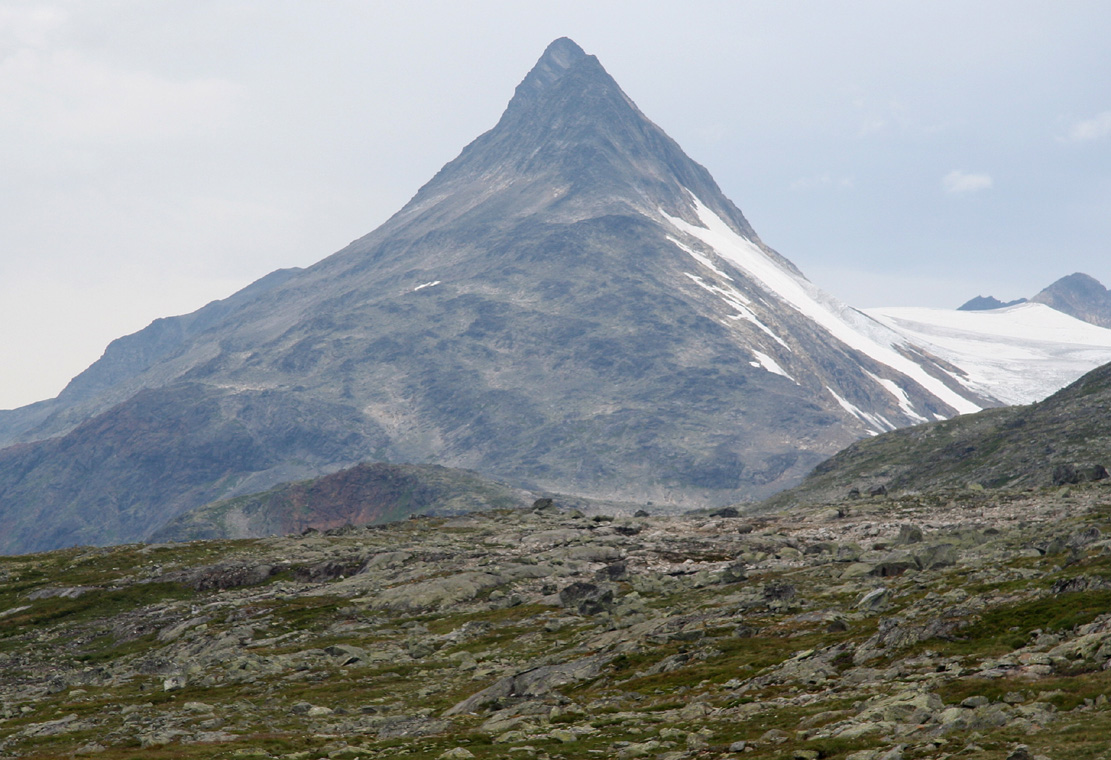
As I looked up ahead, what looked like the south summit
was certainly quite steep in
the upper section. I scrambled up and came to a more difficult "last move" just 2 meter
below what appeared to be the top. Here was a (YDS) class 4 move
and I was not even at the
first summit. My memory could not recall any route descriptions that mentioned any difficulties
before the first summit. Anyway, I quite easily moved up and realized that a somewhat
sharper ridge
continued ahead (the picture is in the opposite direction).
Following this, I came to a flat section with what now certainly
was the South Summit just ahead.
However, here was another small "dip"
in the ridge that
narrowed significantly. Somehow, this caught me by surprise and I did not like the look
of the terrain ahead. With perfect hindsight, I do believe that there was a combination
of several factors that got me a bit "off balance". Firstly, I expected the more exposed
part of this route to be between the two summits, not before the south summit. Second,
the change from a wide, level ridge to a narrow exposed point was rather abrupt, ie. no
"getting used to time". Thirdly, the fact that the point involved a dip in the ridge, most
likely made it look much worse than it really was.
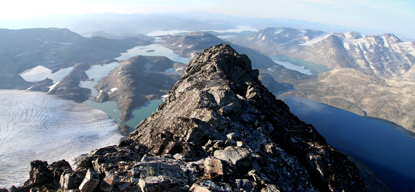
The time was 0730 and my GPS showed an elevation of 2043 meter.
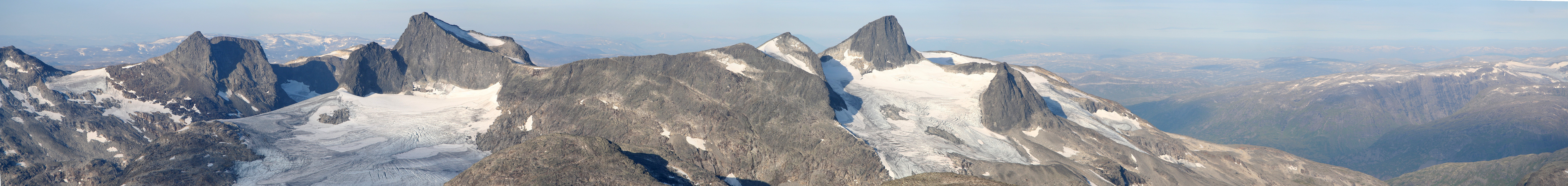
The view from this top ridge
is quite remarkable and I got busy taking pictures.
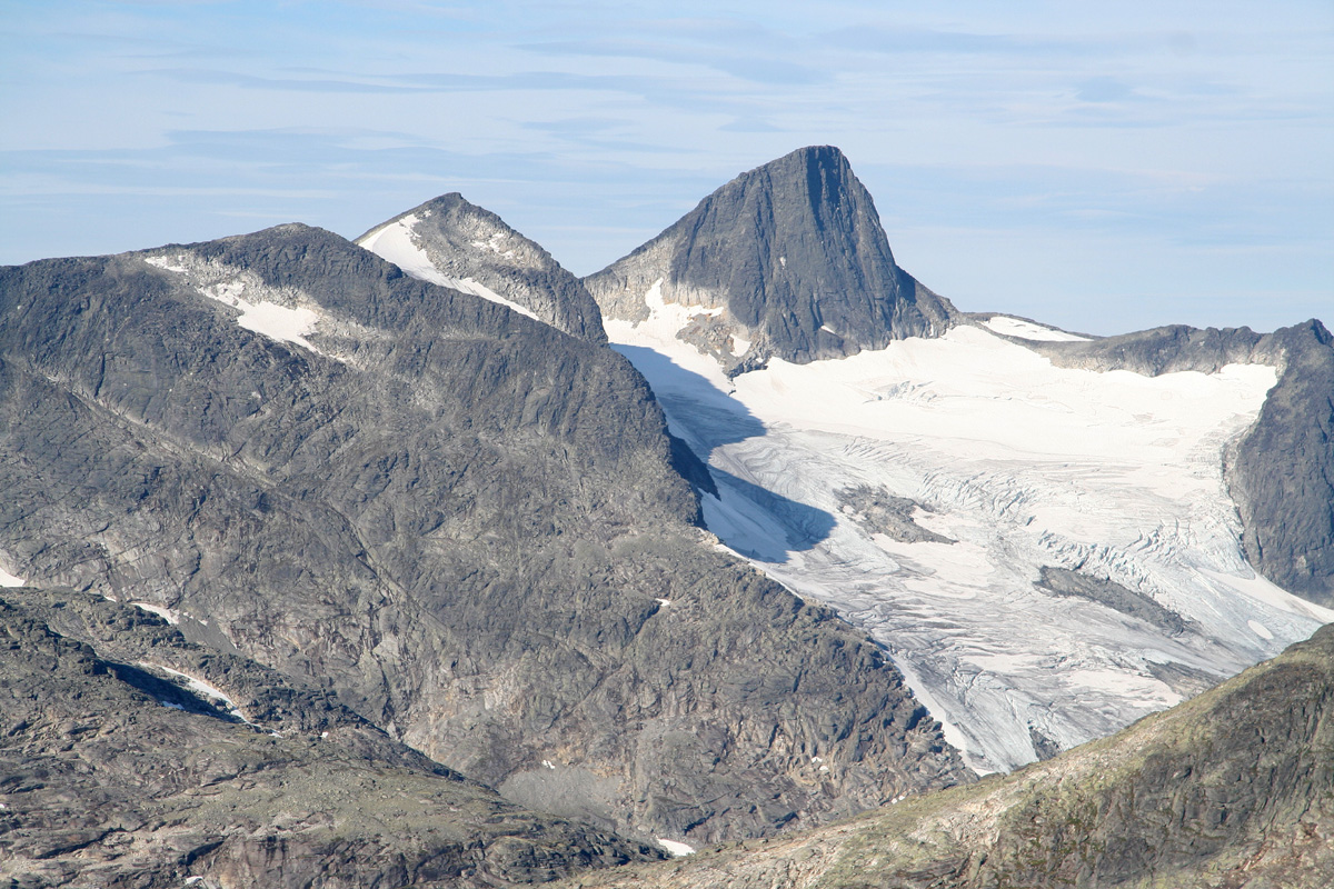
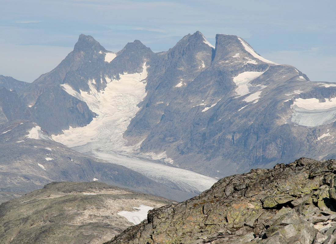
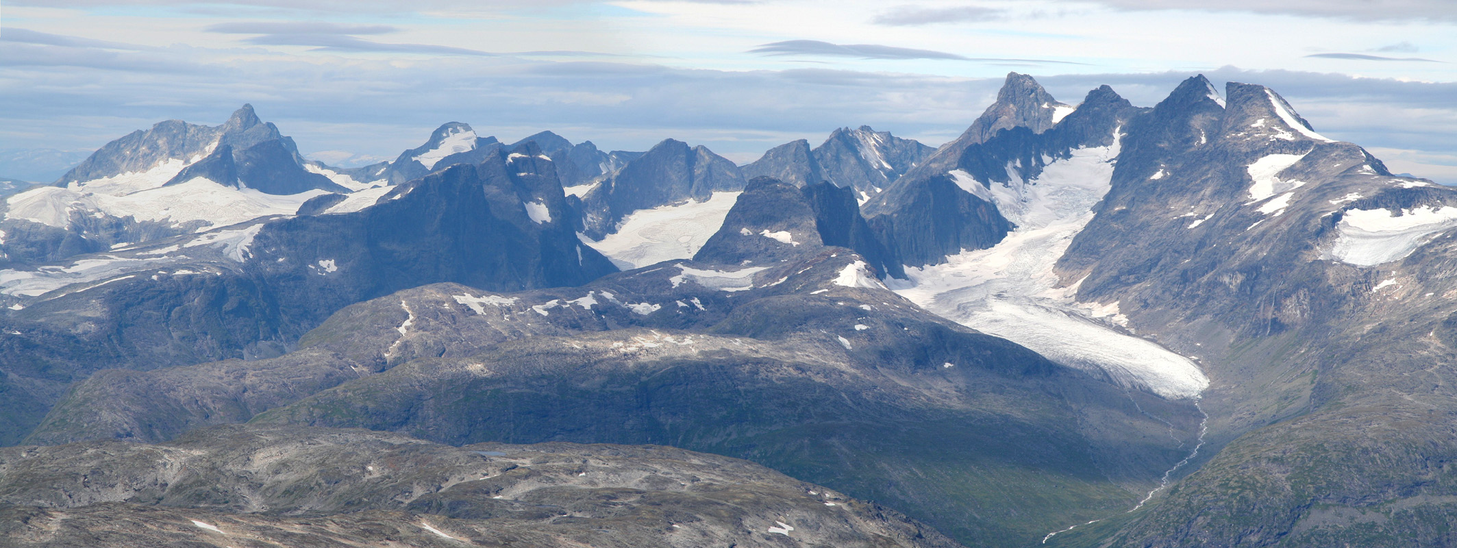
Falketind,Stølsnostind,Austabottind where
I was yesterday, and as the crown in the jewel,
Store Skagastølstind and its impressive ridge
across Centraltind, Styggedalstind and Gjertvasstind.
I did not even explore the "crux point" carefully, (big mistake!), just turned and climbed back
down to the 1800 meter level. From here, I traversed while descending somewhat into
the west side of the mountain. A continued traverse carried me all the way to a place
below the north saddle of Uranostind. The climb back up to this saddle was unpleasant in
the lower sections, with running water and rather slippery terrain. Higher up, I got back
into boulders and could proceed more easily. I made the north col and continued with less
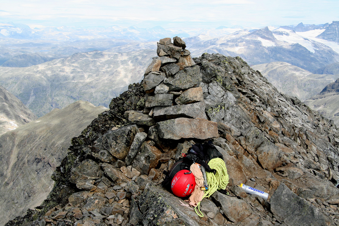
trouble up the north slope. The summit lies on a north-south ridge
that is rather distinct.
The cairn is closer
to the north end of this ridge,
but the ridge is also most narrow on
a short section just north of the cairn.
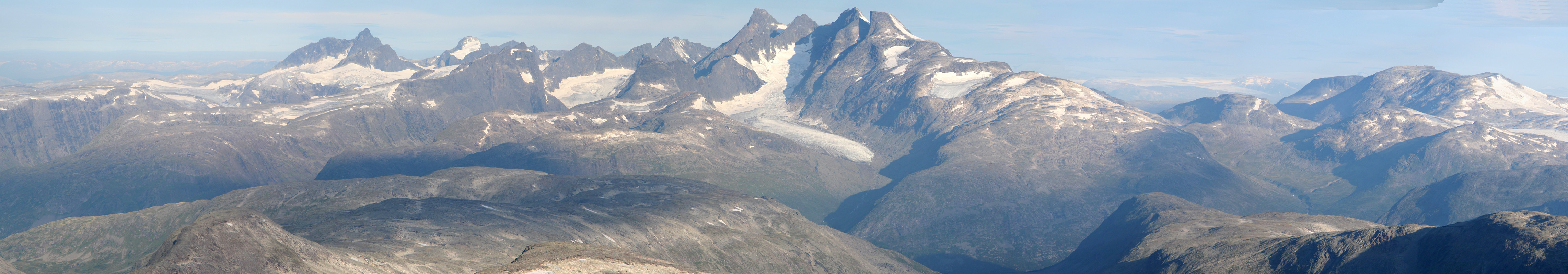
Arriving at the summit at 1130, the west side traverse (in very bad terrain!) had taken
4 hours. I had a (well deserved) lunch at the summit, enjoyed the nice day and
the good scenery.
Pictures were taken and I explored the entire summit ridge in order to get
a good view
of the south ridge traverse.
It did not look all that bad when viewed from here.
I already regretted that I (most likely too quickly!) had decided to abandon the ridge and
rather spend the day in the misery of the west slope.
I headed back down to the north col around noon and decided that I still should pay a short
visit to the Slingsbytinden
summit, a small, subsidiary summit north of Uranostind.
I was absolutely not looking forward to what was to come: more west slope descending. If I
had only brought my crampons and I could have hiked back out on the glacier east side.
No such luck and my destiny was several more hours in this bad west side slope.
At least, I did see that my route could be improved. By staying higher, and traversing more south,
I could descend the mountain without all the smooth,wet slippery slopes that I had encountered going
up. Still, the descent was seemingly endless before I finally hit the trail just north of the lake.
An easy hike (on tired feet) got me back to the car at 1600. Eleven hours of walking with about
eight in a notoriously loose sloping field of boulders that mostly kept moving was much more
of an effort than anticipated.