Le Taillefer
- Le Taillefer
- 2857 m
- Primary factor: 1490 m
- Location: North 45:02.363, East 005:55.450 (GPS at the summit)
- South-East of Grenoble.
- Difficulty: YDS class 2+
- Climbed July 12, 2007
Le Taillefer
|
|
How to get there:
The nearest major city is Grenoble. From Grenoble, take Hwy. N-85 south to
Vizille, then Hwy. 91 about 9 kilometer east to the small village of Sechilienne, exit right here in order to
get on to Hwy. D-114 climbing to the ski area La Morte. Measure from this intersection.
Head uphill, after 2.1 kilometer a side road connects to Laffrey, ignore this and curve left as you continue
to climb in many switch-backs. At kilometer 13.8, you are about to enter La Morte, make a sharp left and get
onto Road D-114E. Continue along this road, first uphill, then a section with downhill before a final uphill
gets you to a large parking area at kilometer 22.3. This is the trailhead, park here. This location is
N45:03.175, E005:53.893, elevation about 1670 meter.
Route description:
From the trailhead, head right and cross the creek, locate the trail leading to Lac Fourchu. Follow this
trail as it climbs the slope on your right hand side, heading fairly eastward. Gradually, the trail leaves
the forest behind and climbs slightly more steeply. The trail to Le Taillefer forks right before you
reach the top. This location is N45:03.211, E005:55.304, elevation just below 2000 meter. This fork is
somewhat obscure and there is not much of a detour to continue along the main trail until you reach
a proper, signed trailfork at location N45:03.212, E005:55.582, elevation about 2060 meter.
However, the two trails that are signed are BOTH wrong, look right and locate the obvious route in order
to climb south. There are a number of small trails, proceed uphill and the trails will converge to a
very visible trail marked with cairns.
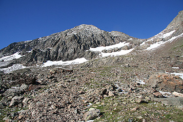
First, a small step is climbed, then two more sections of slightly steeper terrain.
You will see the peak further uphill.
In order to reach the Col du Grand Van, a final section of very easy scramble
(YDS class 2+) or possibly a section of moderately steep snow must be climbed. An ice axe and
crampons may be useful if you climb on the snow. Before reaching the broad col, the terrain becomes
quite flat and one should head left and climb the mountain along an obvious route. You will soon arrive
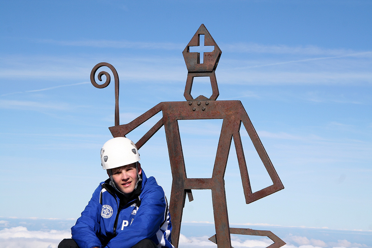
at the summit with its fine iron symbol.
Comments:
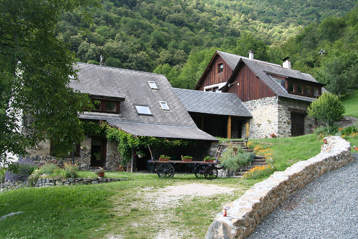
I climbed the mountain with my son Pål Jørgen, age 18. We had stayed in a rather
special Bed and Breakfast
place about 3 km uphill (north) from the village of Séchilienne.
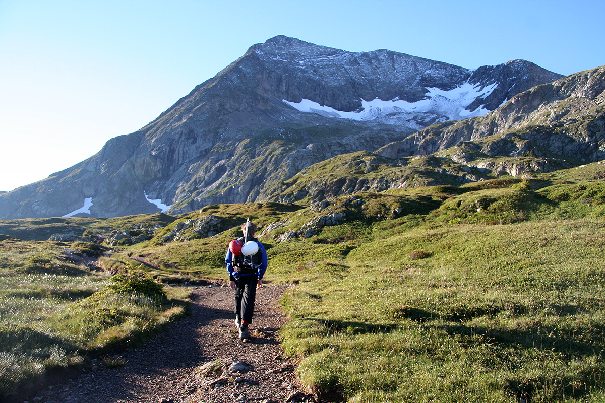
An early drive back up to the trailhead and a start at 0630. The sun was hitting the
lower sharp cliffs further east.
After 50 minutes with a good pace, we
arrived at the signed trailfork. Here we concluded that we had missed the trailfork on the map,
that we were a bit too high and that we were outside of the map (3336 OT, Mure) that we carried.
However, this caused little concern as it was obvious where we had to ascend and that this "detour"
really did not cost anything in time or effort.
We turned uphill and soon joined the trail leading uphill. The weather was brilliant today.
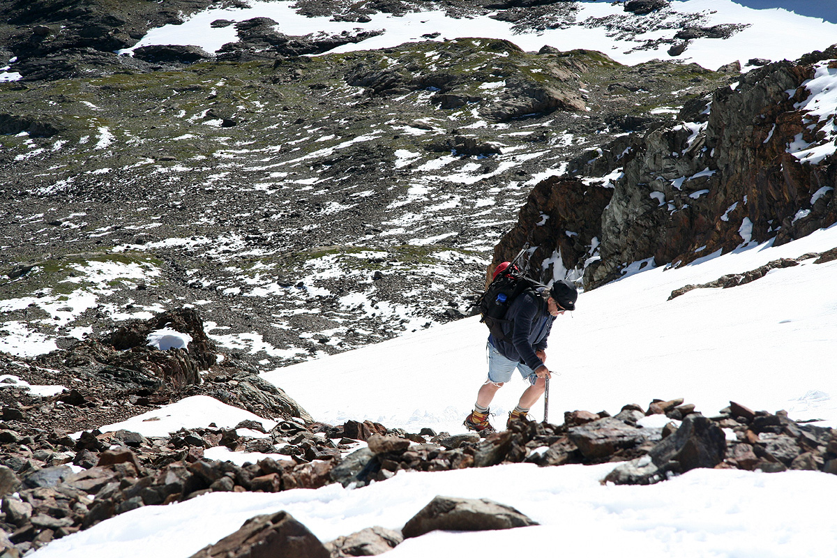
Higher up, I made use of my crampons and ice axe while ascending the snow,
while Pål Jørgen
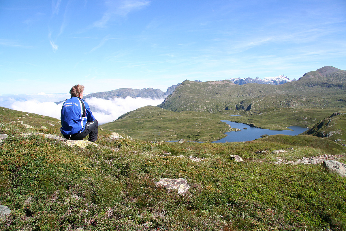
enjoyed some light scrambling up the rocks next to the snow. Not unexpectedly, he made it up ahead
of me and spent the time taking a couple of pictures of the nice scenery that unfolded.
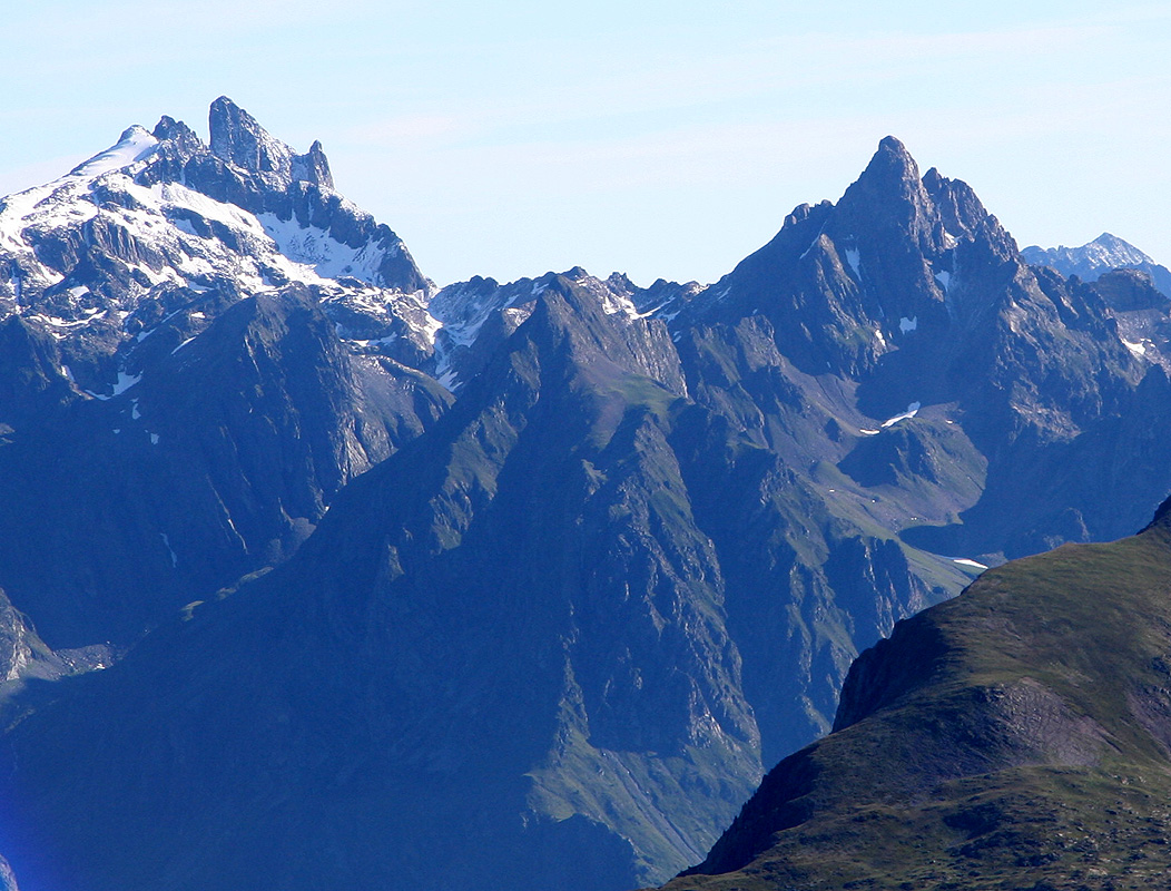
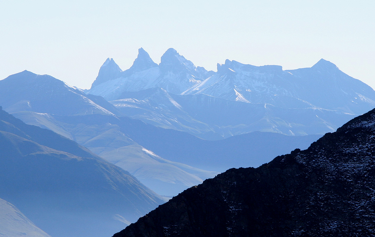
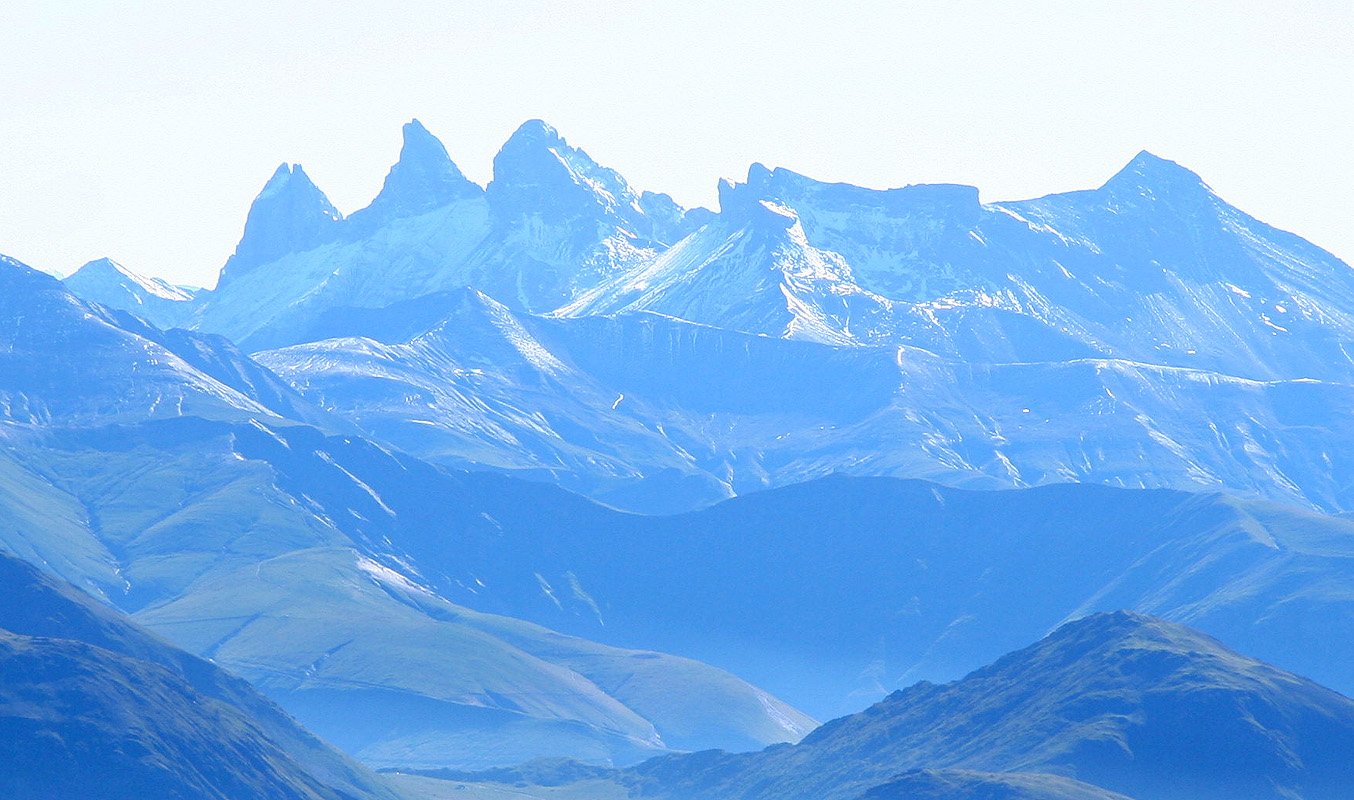
Sharp peaks as well
as the three very characteristic peaks further away.
We quickly completed the climb by 0915 and
decided that a long rest with lunch was called for.
The cairn had a rather nice metal figure (religious)
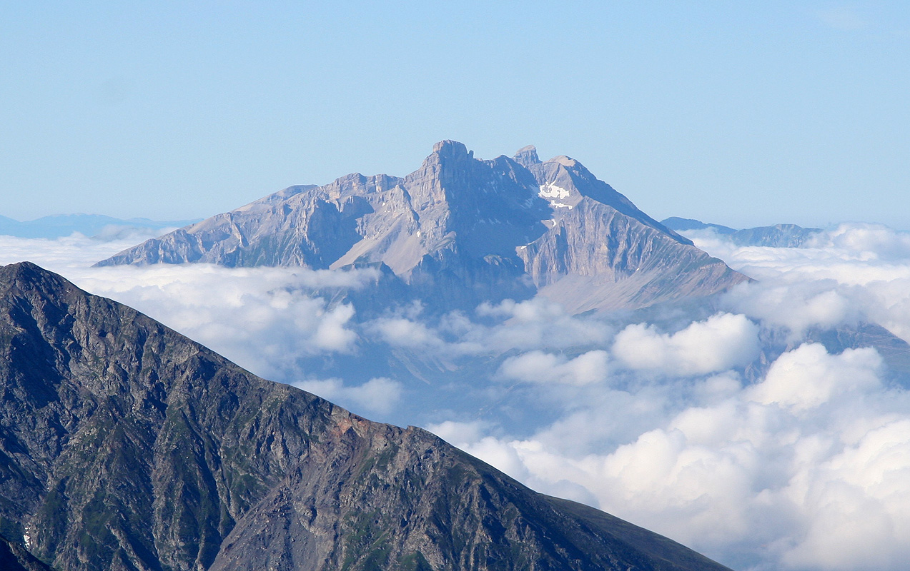
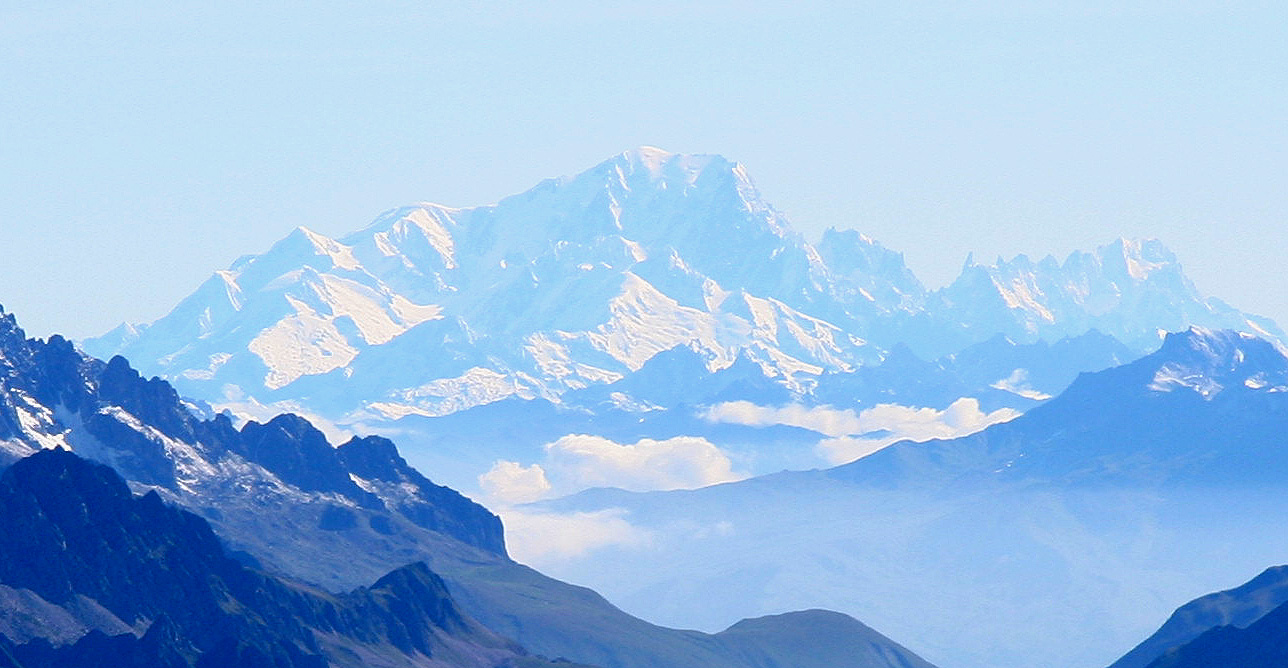
on top. The view all around was outstanding. We could see Mont Blanc, the glacier further south as well
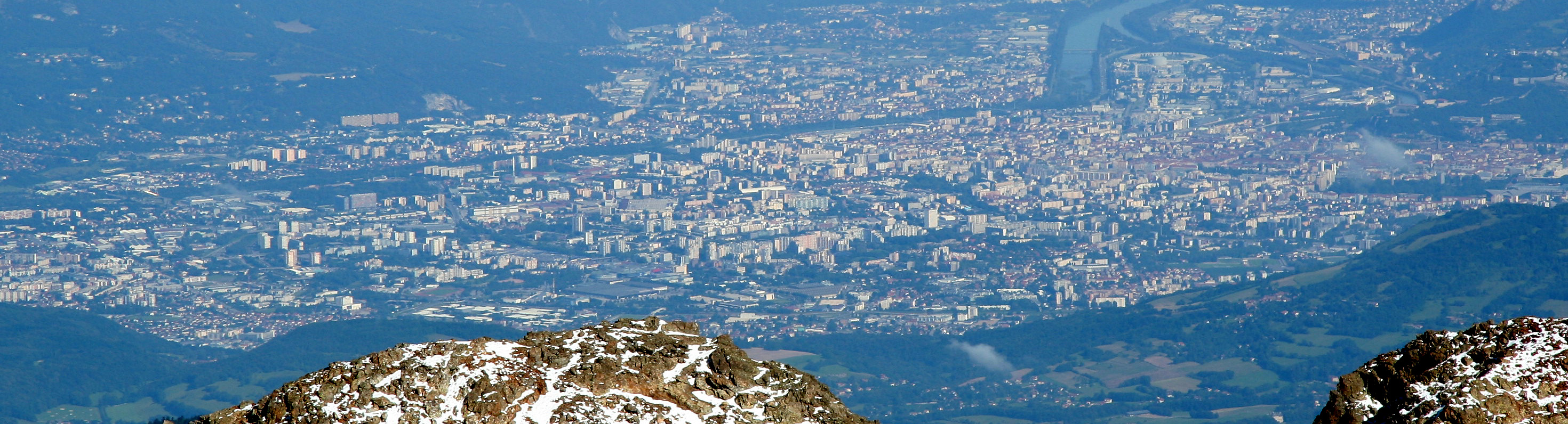
as back to Obiou from yesterday. The city of Grenoble
seemed right below us, despite the fact that we
spent last night in a valley separated by what seemed like a high ridge from the Grenoble area.
Suddenly, a French guy appeared, the first other hiker we had seen all day. He came up from the opposite
side of the mountain. He pointed out a number of mountains
around the horizon and seemed quite pleased
to have met two "tourists from Norvège" on this prominent summit. After 15 minutes he told us goodbye
and descended the same way he had ascended. We left at 0945 and hiked back down to the car in 1:30.
By now, the trailhead was quite busy with many cars and hikers in the vicinity of the parking.
We moved to a nice hotel (La Chataigneraie) near the southern end of Lac D'Annecy, in order to climb
Pointe D'Arcalod the next morning.