Location: North 09.84776, West 084.13801 (GPS on the summit)
Costa Rica
Difficulty: YDS Class 2.
Climbed March 17. 2022.
Information:
How to get there:
This mountain is the highest on the south side of San Jose.
First, locate and get onto Hwy. 209, heading south from San Jose.
This road will climb and cross the south hills, shortly before it
reaches the main crest, turn sharply right at location
North 9.83173, West 84.10614. Follow this much smaller road as it climbs, then
follows the crest (mainly a bit on the south side. Continue to location
North 09.83900, West 084.12652, this is a nice viewpoint with parking space for
a few cars. The place is called Mirador Cedral. Note:
There is an alternative approach (see text below). In this case, continue along the road as
it heads downhill, then turn right at the first side road, this is at location
North 9.82959, West 84.13021. The road will turn more rough as you drive first more downhill,
then steeply uphill towards location North 9.83977, West 84.14386. Find parking before if desired
and continue on foot.
Route description:
A quick summary of the peaks climbed in Central America.
There are 2 different routes to this summit, they each have both advantages and disadvantages.
Read on and decide what seems most preferable.
Route 1:
Park at Mirador Cedral. Walk back a short distance
to find a forest road that
runs steeply uphill. Follow this road, the slope eases and you will arrive
at a road fork.
Take the left fork. This road now runs nicely near the crest,
before descending to a local col, shortly thereafter it ends near location
N9.84713, W84.13408, near elevation 2350 meter.
A somewhat steepish trail continues to the summit straight ahead. This summit is
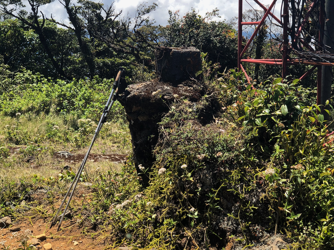
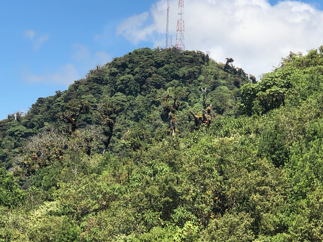
Cerro Pico Alto, elevation about 2410m (Note the error on several maps and also on Peakbagger).
There is an antenna on this top as well
as a smaller building structure.
Next, one needs to traverse across to Cerro Rabo de Mica. This involves about 70 meter
of stepish descent on a very muddy and slippery trail. The ascent from the connecting
col is also both steep and muddy. Definitely (YDS) class 2 terrain.
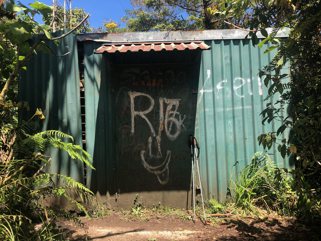
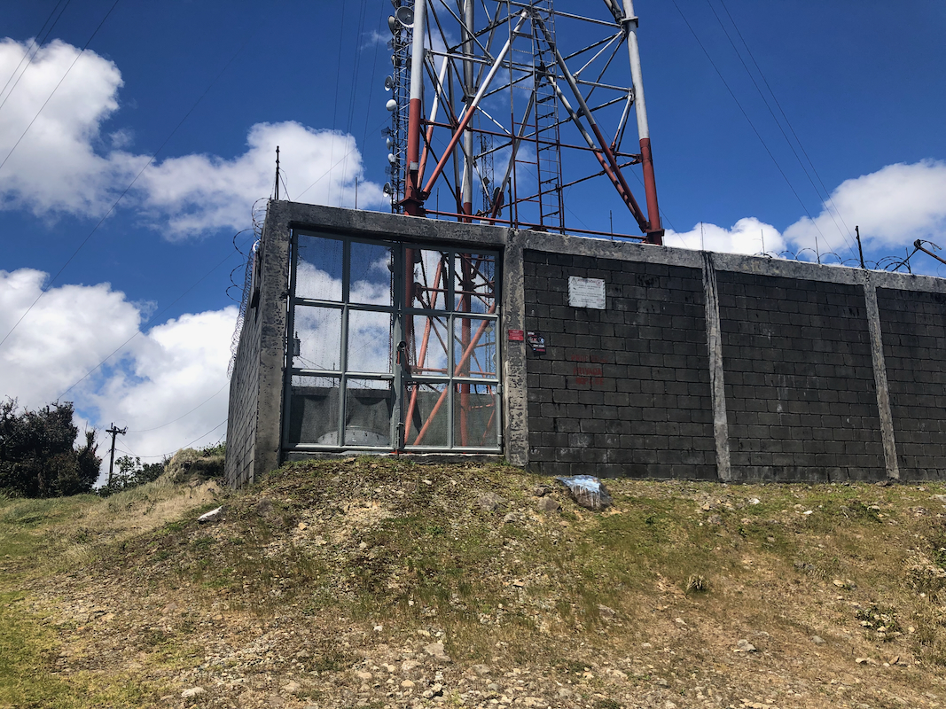
The summit is dominated by a large antenna tower as well as some concrete structures.
The highest point has some old summit marker.
A road serves this summit from the north-west side.
Route 2:
Drive as described above. This route follows a road all the way to the top.
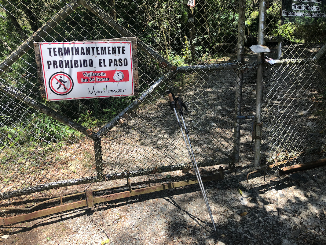
There is, however, a serious problem. This road is
blocked by a big, tall gate with a sign
indicating that access is prohibited. The gate / fence is at least
3 meter high and there are coils of barbed wire running aong the top. The fence
runs out into the jungle on both sides of the road. With some effort, a person that
is not too big may be able to squeeze through under the gate in the place where the
two parts of the gate meet. Above the gate, one will encounter a single road fork
where you should go right (uphill). Except for the gate/access issue, this route
is clearly much easier and also shorter.
Comments:
This was an unplanned bonus peak trip. The peak was only 10 km away from our hotel, but
driving there still involved about 30 kilometer with the typical San Jose traffic implying
about one hour. Heidi came along for a (hopefully) nice walk on the part of the route that
followed a forest road. We walked from the car around 0945.
The initial uphill was a bit steeper than Heidi appreciated, but higher up the road was nice.
We split and I proceeded
towards the summit with an antenna that I could see from the road.
The road ended at the base of the hill, but a trail continued. The project looked pretty
straightforward. The uphill trail was pretty steep and fairly typical for jungle trails with
a few igger steps as well as some roots and smaller obstacles. No big deal, I was soon at the
summit, next to some old structure.
At this point, I realized that I was on Cerro Pico Alto, and that my target peak was still
about 400 meter away, separated by a pretty deep col. After searching a little, I found a trail
that went downhill. This trail was steepish and slippery. Lots of wet mud as well. I had
a pair of running shoes and shorts - not ideal for this type of terrain. The col was about
80 vertical meter below the summit and the ascent was as cumbersome as my descent.
I arrived at the summit at 1050, quite a bit more time than planned/expected.
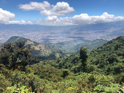
Good views of San Jose from here.
Otherwise a pretty ugly summit with concrete structures
and a big antenna. Still, what looked like a summit marker at the highest point.
The summit had a road coming up from the north-west. No what? It looked extremely
tempting to explore the road. This would take me down on the far side, but the map showed
a pretty acceptable road connection back to the car. Obviously, there would be a loss
of elevation. A good trailhead for this route would be much closer to here.
I headed down the road around 1100, thinking that I could move much faster on a road such
that the overall time would be comparable. This worked well until I came to a huge locked
gate. They obviously did not want anybody to pass. Coils of barbed wire along the top -
very unpleasant looking indeed. The problem was that I already was on the inside, I needed
to cross in order to continue my planned route. I had already descended many hundred
vertical meter, to turn back was not really an option.
Taking a closer look, it looked barely possible that I could squeeze through below
the gate near its middle. A few iron bars with 90 degree bends made even this a pretty
complex undertaking. I decided to try, legs first, facing up. Not easy, a twisting
move about half-way and I knew this would work.
Still a long way and more loss of elevation than expected. I got down to about
1800 meter, the car being parked a bit above 2100m. The sun was hot and my hat was
left behind at the hotel. Anyway, more exercize than planned, I arrived back up
at the car around 1220. Heidi was waiting nearby and we had a reasonable
drive back down to the hotel where lunch and a cold beer was very welcome!