How to get there:
Locate the town of Kelowna on Hwy. 6, continue north, then east just south of
Vernon. Pass the tiny town of Cherryville, then a small campground called Gold Panner
on your left side. Locate the Monashee Creek Road forking left roughly 2 kilometer after
the campground. The road becomes South Fork Forest Service Road. Turn right at
location N50.2092, W118.34597. From here, the road gets a little rougher, still ok with
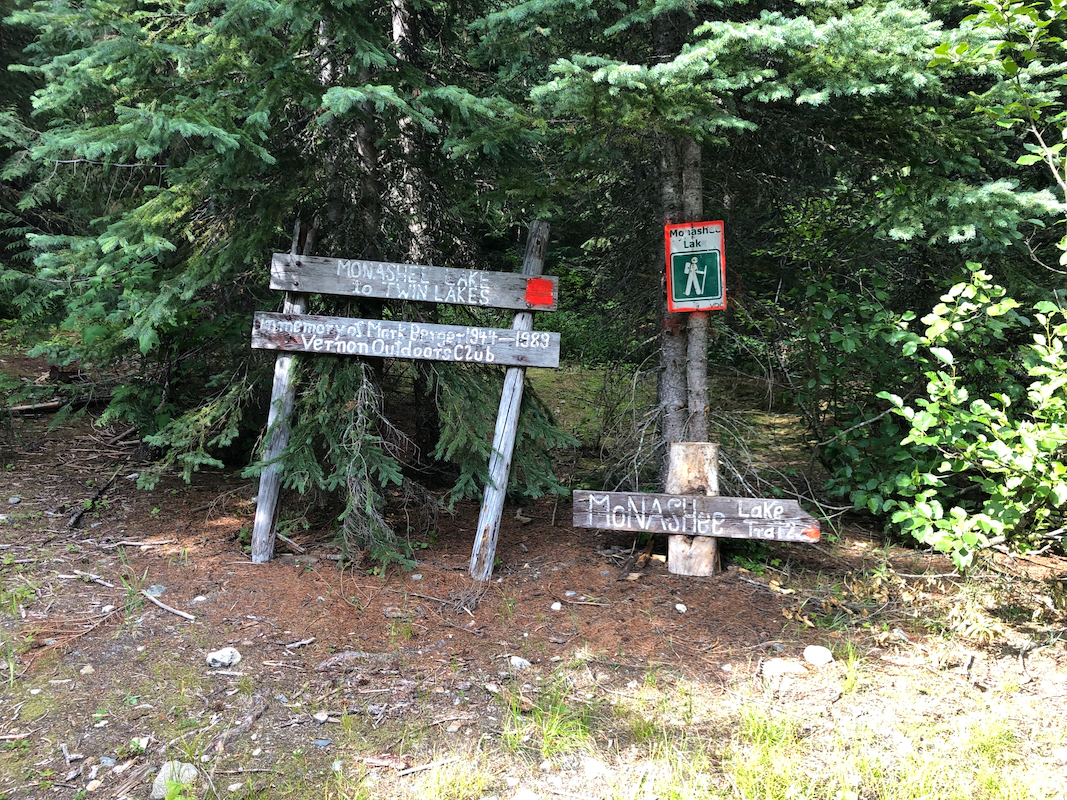
high clearance. Drive to the end of the road, an open grass area with signs on a nearby
tree. This is the trailhead, location
N50.21783, W118.29882, elevation near 1320 meter.
Here is a summary of climbs in Canada, August 2022,
Route::
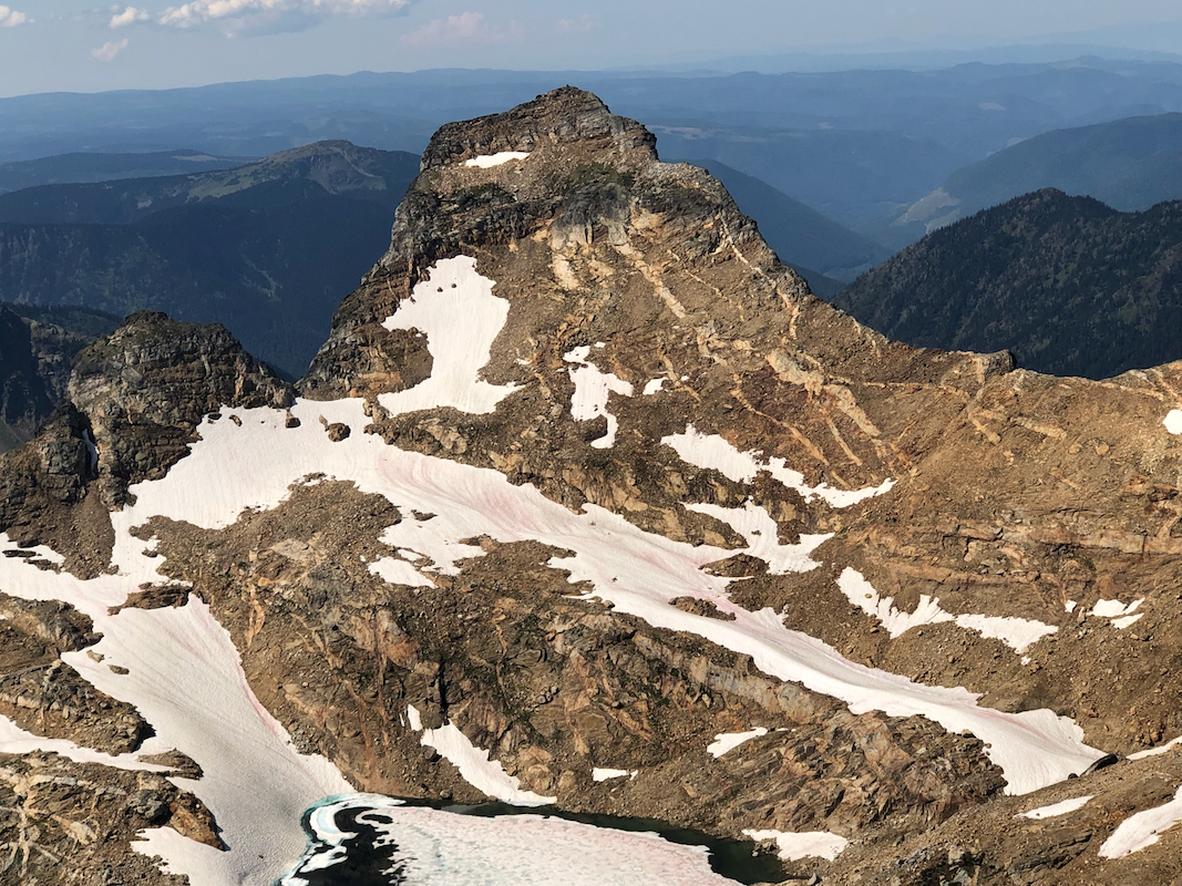
This is a nice route to a fine peak.
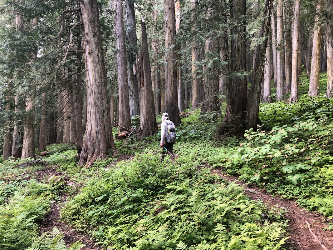
Follow the trail, well marked by ribbons
through the old forest,
then breaking into
lower vegetation at the inner part of the valley. The trail turns left and ascends some
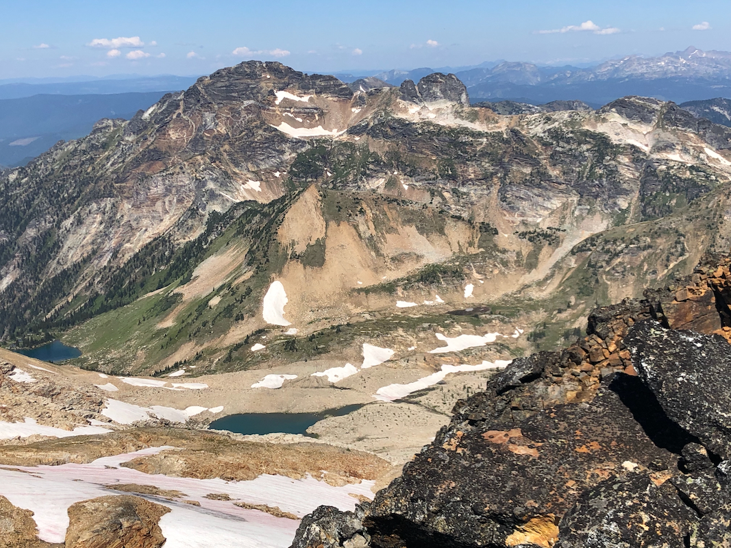
tiny ridge-lines next to what appears to be a dry creek. Looking ahead, it is clear that
one must ascend in order to turn an area with cliffs above. There is considerable elevation
gain here, mostly pretty easy, with a few slightly steeper sections. Pay attention to the
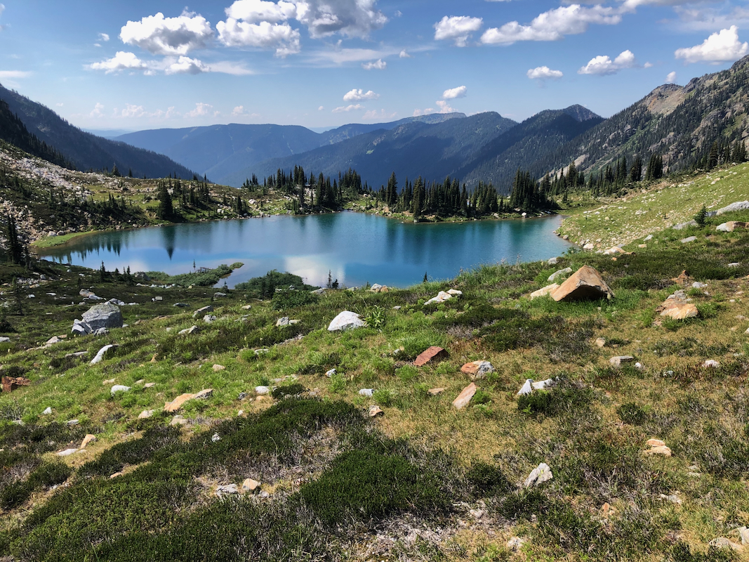
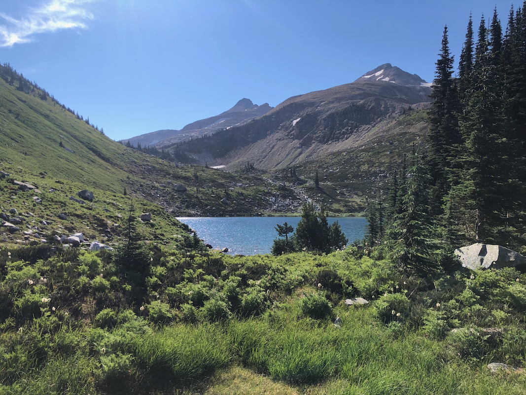
flagging and stay on the trail. The trail will
lead to a very nice lake located
above 2000 meter.
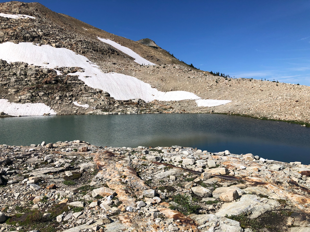
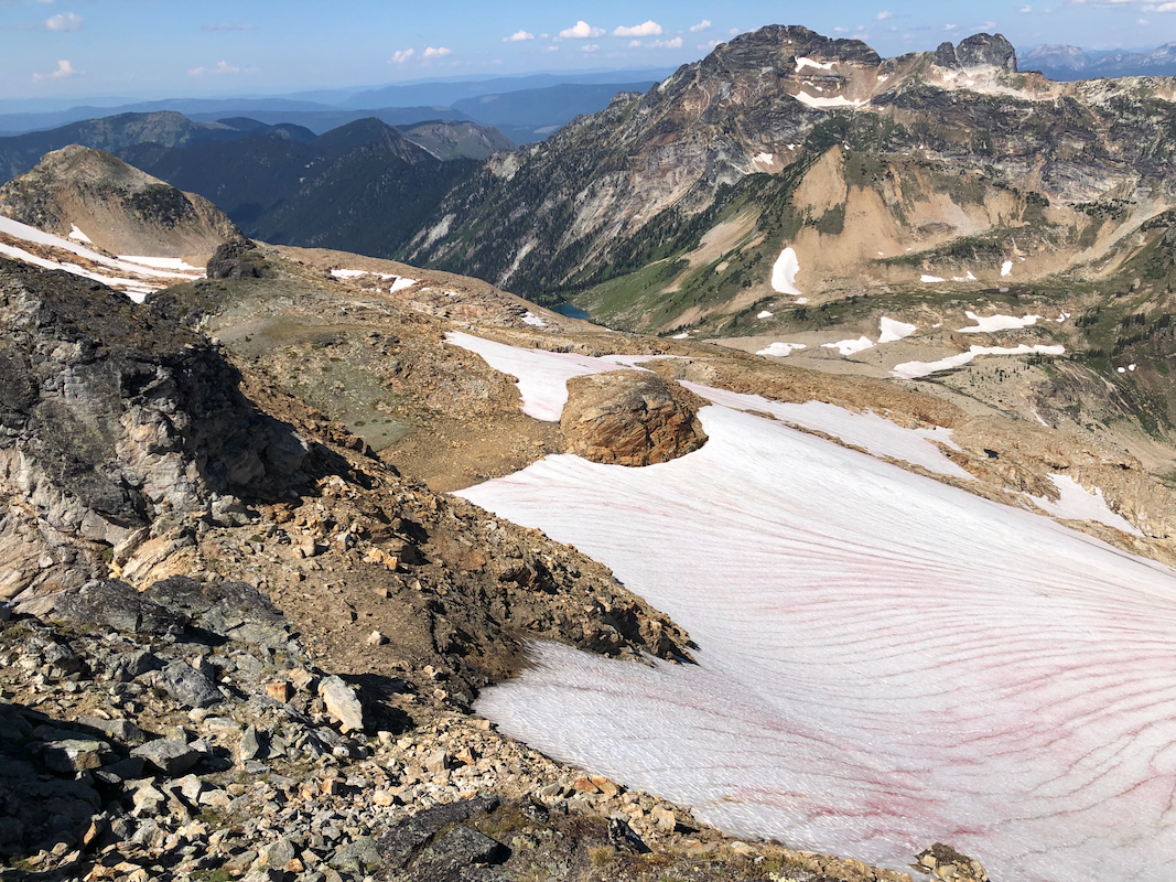
From here, the trail is less visible. Continue
on the left side of the lake.
Stay on the left side and ascend a small step. The terrain gets more alpine with
small moraines. Cross over and locate a small lake.
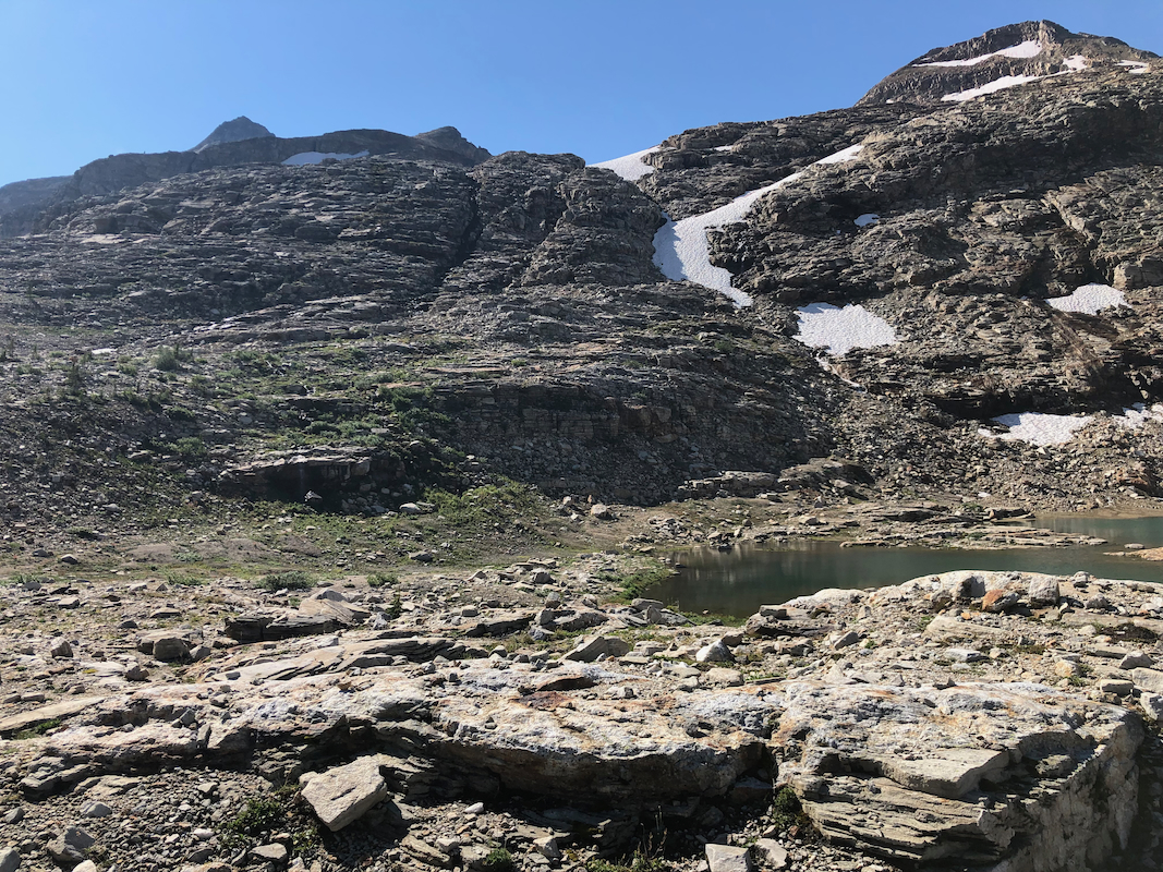
Cross this on the left hand side,
there are nice stepping stones for getting across to a small outcrop right next to
the lake.
From here, it is easy to see the next stage.
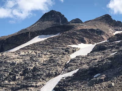
Ascend a very broad ridge with broken
rocks. The rock makes nice steps and ascending is easy. Higher up, this route narrows a
bit - one must stay a bit right in order to pass around a corner. You have some snow and
cliffs on your left. Turn the corner (left), ascend gently terrain, then turn left and gain
the higher ridge that will lead towards the peak.
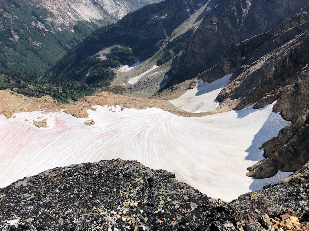
Cross easy snow, but stay above the larger/steeper areas of snow/ice.
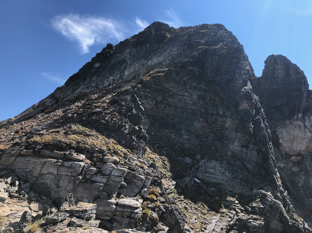
Next, ascend a slightly steeper slope with some loose rocks to
gain the last proper col along this main ridge. Continue into the next slope and
ascend towards steeper rock ahead.
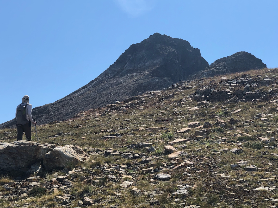
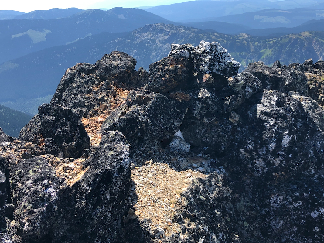
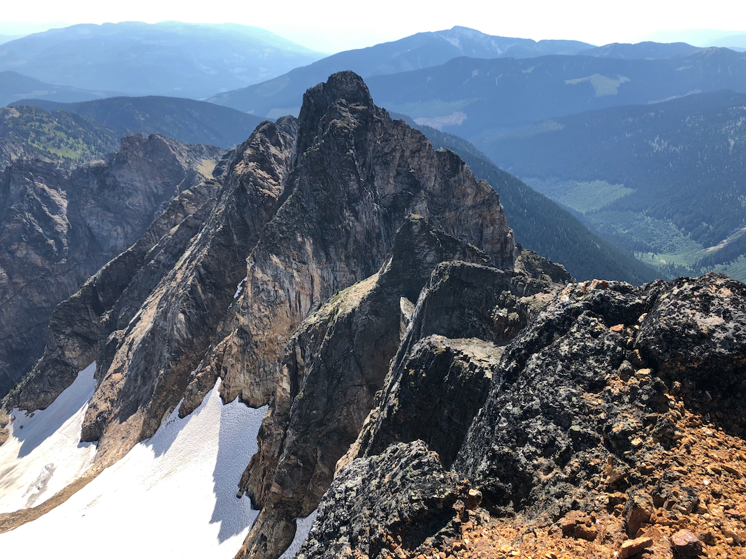
Now there are 2 options: A) Go right
and ascend the top ridge in an obvious place near its right end. Easy (class 3)
climbing. Then follow the top ridge, somewhat narrow to its highest point. Move
around/over this point (exposed)
and descend a little to reach a small col
on the ridge. B) Go left until you find a quite big, somewhat steep gully. Scramble
up this gully directly to the same col.
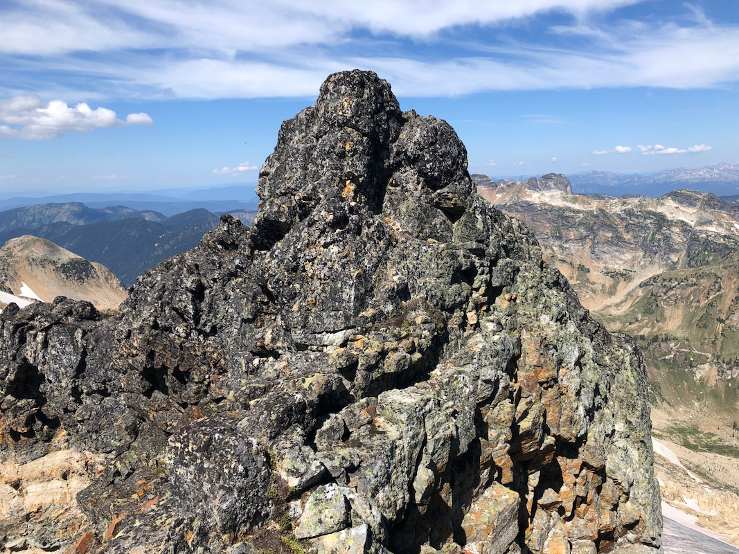
From this small col, there are again 2 options: A) Climb the ridge directly. This
is easier than it looks,
and gets you directly to the summit. B) Descend a little
in a new gully on the right hand side of the main ridge (looking upward), traverse
some loose area and get into a final gully located directly across from where
you descended. An easy scramble will now lead to the summit. Comments:
We had just hiked out from Albert Edward, it was
already late afternoon. What next? Dave had offered to drive me to the Vancouver Airport.
There I could rent a car and drive to The Pinnacles. Adam could not go there due to
his sensitivity to smoke from wild fires. McLellan texted Adam that they were on their way
to Silvertip, an ultra that he had done, but not me. He kindly proposed that he could climb
some smaller peaks and that I might join Denise and Richard. We said goodbye to Dave and
hurried to catch a ferry.
On the ferry, Denise texted that the access road to Silvertip was closed due to flooding and
that they therefore had abandoned the project. Adam had discovered that The Pinnacles were
free of smoke, but that this might not last long.
Considering all this, we ended up with a plan that implied driving to The Pinnacles, then
ascend it the next morning before any (new) smoke could cause problems.
It would be a long drive, but taking turns at the wheel, we figured it could go.
Thus, we arrived at the forest road shortly before 0300, drove a few kilometer and
spotted a good place to camp on our right. The time was past 0300 by the time we had
the tents up.
We woke up to a beautiful morning around 0630. Tents packed and ready to drive to the
trailhead. Getting organized, then waking by 0745. It was a lovely hike on a nice morning.
We came to the end of the lower valley, ascended left and made a brief stop at the
main lake. As we carried on, we soon arrived at the higher lake, making a first long
stop for the day at 1030. We had crossed a small branch of the lake on stepping stones and ascended
the tiny ridge beyond, a good place to rest.
We resumed our climb at 1045, what a good decision we had taken! Perfect weather, no mosquitos,
no wind, very nice landscape. We ascended towards the peak, nice staircase type blocks of rock.
Turning the corner, the route continued with few difficulties. Soon, we were in the last major
col - what remained now was the peak.
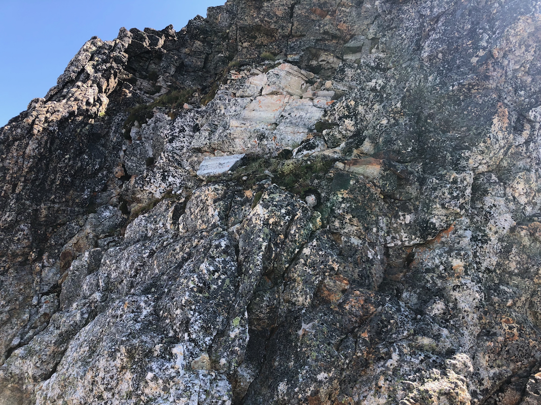
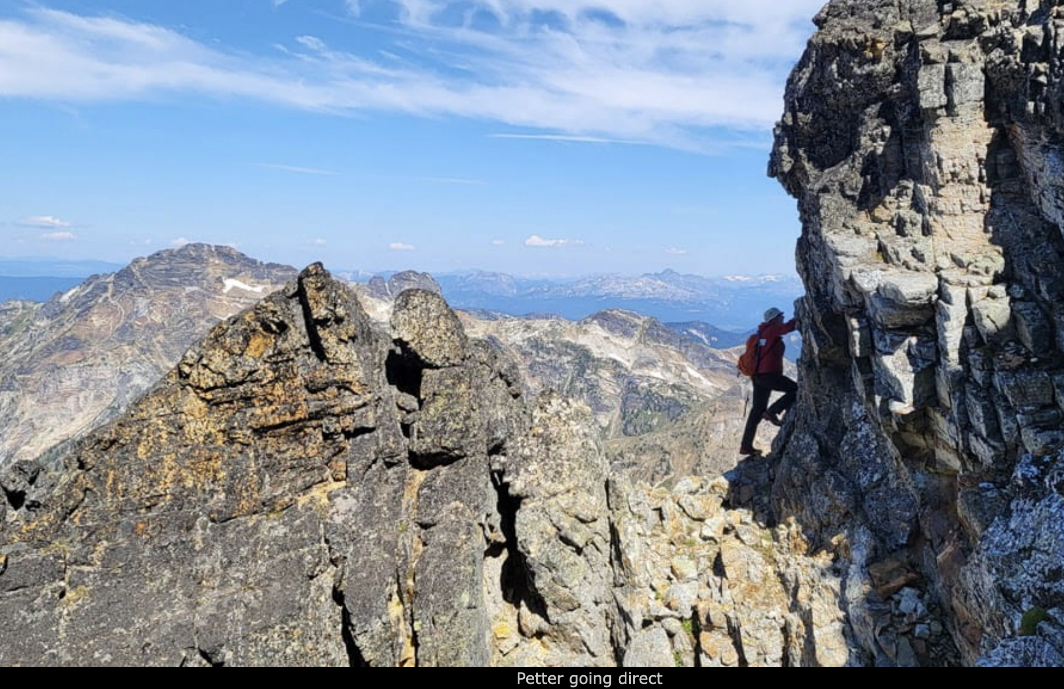
Ascending loose, but not troublesome rocks, Adam and I took different routes. I went a bit
right in order to ascend the ridge above in a pretty obvious place, very near the
end of the ridge. Adam continued his traverse to reach a major gully, then ascended there.
The climbing (class 3) was easy and soon, I walked up the ridge to reach a small local top,
a small but distinct saddle just behind and below. Adam's gully reached this saddle and
he was waiting there as I carefully
turned the small top in order to reach him.
Again, our routes parted. I continued
directly up (photo: Adam)
the ridge from this small col, while
he descended a little down on the right hand side, then crossed loose terrain in order
to ascend a second gully. My climbing was fun, good holds and ledges, class 3, then easier
directly to the summit. Adam came up from my right hand side and we could congratulate each
other with a fine peak, good weather, no smoke! Our gamble to drive all night and do an
immediate ascent had paid off!
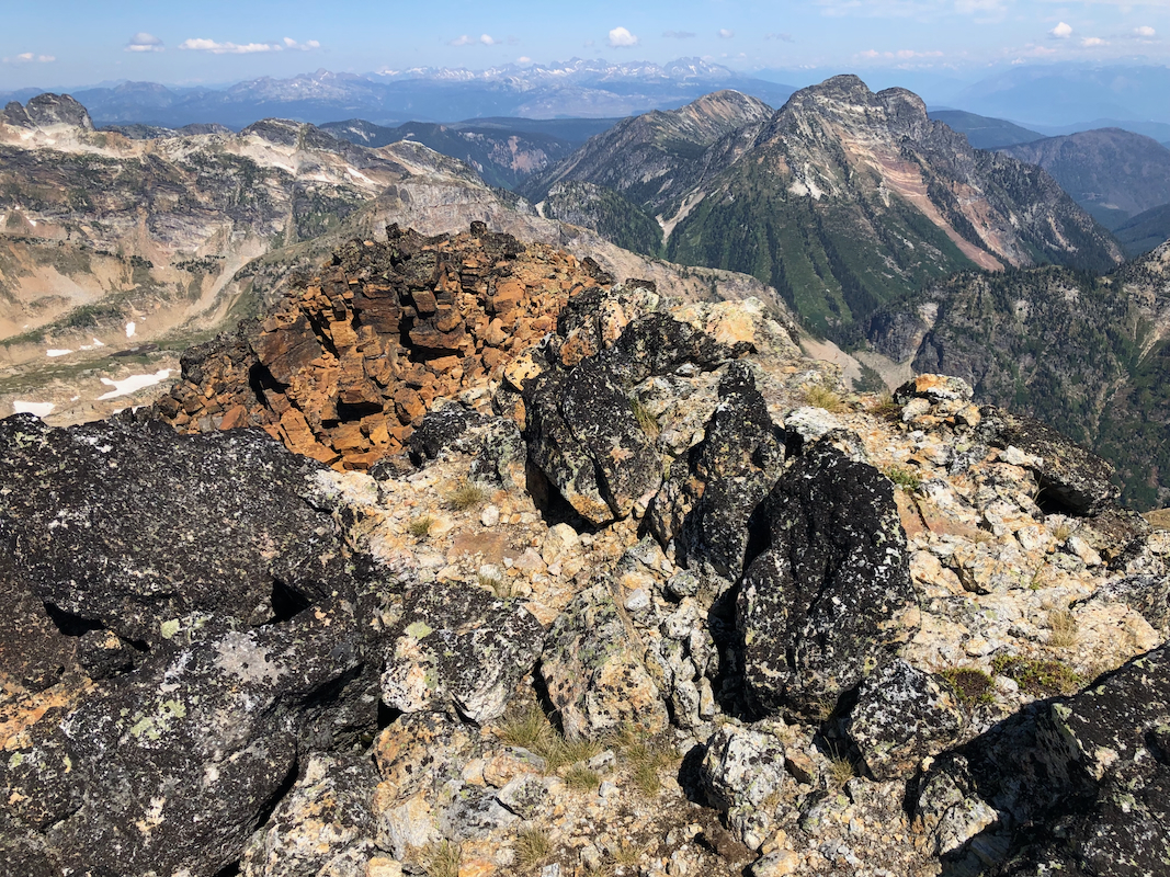
The time was 1200 - Noon, we lingered on the summit,
enjoyed the views, signed the
summit register - had a good time! Time to leave around 1215, we were back at the
car by 1600, having had another long break by the upper lake.
Thanks to Adam for being an excellent partner. Thanks for having the guts to
believe that we could do this and that smoke would not roll in and destroy our
plan.