Location: North 42.17928, East 023.58521 (GPS on the summit)
Difficulty: YDS class 1
Climbed July 5. 2013
Information:
How to get there:
The starting point for this climb is the resort village (mainly for skiing
in winter) of Borovets. Borovets is about 10 kilometer south of the larger town Samokov.
Samokov is served by Hwy. 82 going south from Sofia, or alternatively, going east from
the city of Dupnica located along Hwy. E-79 (also south, but slightly west of Sofia.
The gondola starts from the middle of the village, right hand side of the main road, essentially
opposite from the largest hotel in town.
Route description: Note: In order to ensure that you have a minimum of 600 vertical
meter ascent (difference between start and summit), consider descending a few meter by
going left from the gondola. Such a small detour will only add 10 minutes to the hike. The description by my friend Arnt,
with pictures from a sunny day, can be recommended. If I had read it before leaving, much adventure
would not have happened (see comments).
Head right as you exit from the gondola building, then immediately after you descend a small hill, notice
the trail fork just beyond another building (on your right).
The route to Musala forks left here, then follows
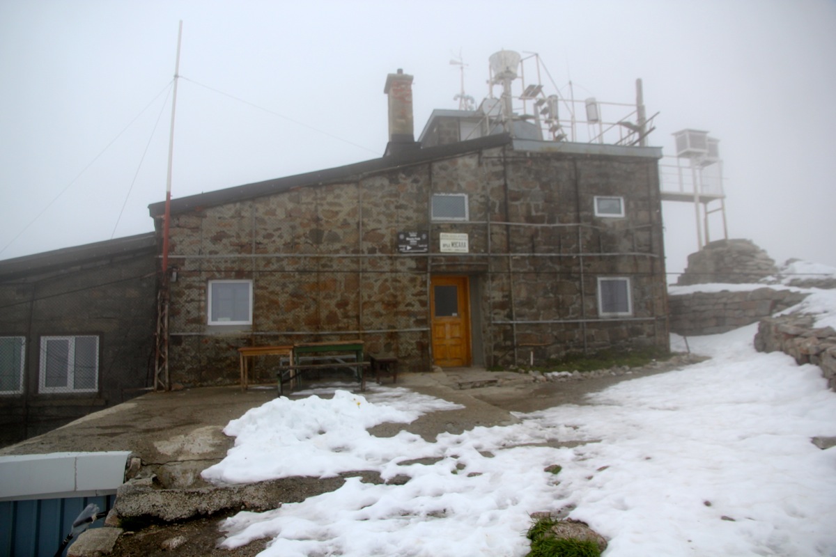
the (service) road as it leaves the ridge. The route will lead into a basin with a lake and several huts, among
them what seems to be a large lodge under construction, that
is nearing completion (July 2013). Onwards, the trail
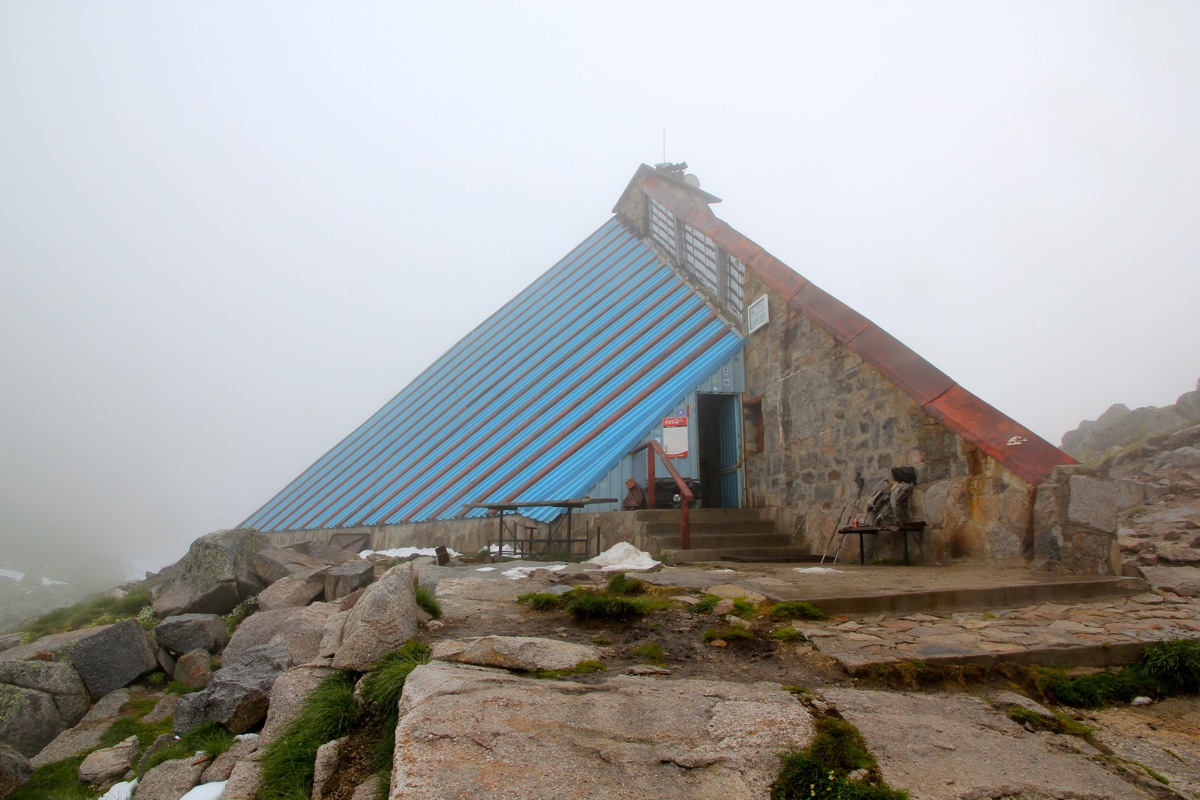
climbs gently to a higher shelter located
just below the final slope to the summit of Musala. From here, the
route has a lot of ugly metal poles and cable, completely unneccesary, as it is mainly a burden. The best way
to walk involves crossing this cable several times.
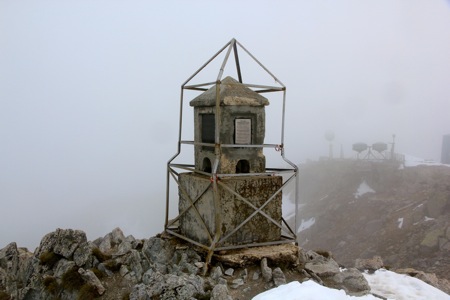
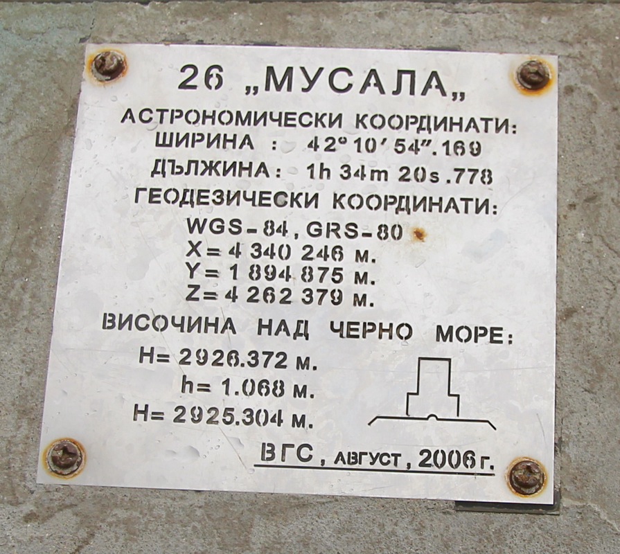
The top of Musala is also, unfortunately, quite ugly with
many antennas and a few buildings. There is
an official geographic marker on a small, concrete pillar.
Comments:
I started out from Bansko (our "Base Camp" in Bulgaria) shortly after 0700 in the morning.
Breakfast opened at 0700 and I dropped by and has a few glasses of juice and some bread.
I drove the same way as we had driven from Sofia, but then took Hwy. 82 east just north of Dupnica.
Arriving in Borovets around 0900, I wasted some time figuring out where the gondola was located, then
where to park my car. I ended up parking in a slot where a clear sign announced that this was
metered parking all day. However, as I could not see how to pay, I assumed that the signs only applied
in winter time. A round-trip ticket for the gondola was 10 local currency units, about 5 Euro.
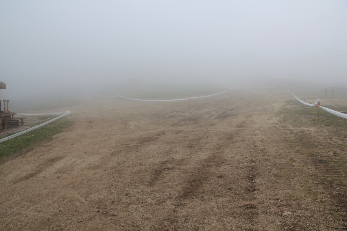
The gondola soon lifted me into dense clouds/fog and upon exiting, the visibility was only a few meter.
I hiked 5 minutes downhill in order to drop at least 600 meter below
the summit, then started my ascent at 1000 sharp.
They prepared for a European championship in mountain running and had laid out guiding lines all over the place.
Still, with near zero visibility, I do not think I picked the wrong way due to this. My mind was set on
following what I perceived as a broad ridge from the gondola to the summit. Thus, I hardly considered
the road that forked left going off the ridge.
This being a downhill skiing area, that road looked like a service road
serving the skiing slopes.
I followed my road along the top of the ridge and passed several top stations for ski lifts coming up
from my left hand side. Eventually, the road faded out and I continued on a smaller path. Crossing a first
little hilltop, I decided that the main trail most likely ran a bit further left. I walked a bit off the
top ridge to the left, but found no trail. Descending more looked very steepish and would certainly take me
off the mountain. Everything was clouded in fog. Seeking back uphill got me entangeled into dense vegetation
of dwarf pine trees. Very cumbersome indeed. I realized that what had to be a pretty well used trail to Musala
somehow had disappeared. The only reasonable option seemed to be to continue along the ridge, my GPS told me that
good progress was already achieved. The ridge was broad and easy to walk and it finally was high enough to not
having this pine tree trouble anymore.
The route, however, looked more complex. Shear cliffs that dropped into the fog on either side. Complex towers
on the ridge that needed to be bypassed. I scrambled by a big obstacle to the right, then ascended what looked
like a summit. The next passage seemed best on the left, then up a broad, grassy gully. Lots of big, slippery
boulders. I realized that my running shoes and my Lewis pants were highly inappropriate. My GPS had told me that
this complex looking ridge was more than 1 kilometer. The big concern being that some subsidiary ridge peak up front
would cliff me completely out. Well, to worry about such things served no purpose, it was pretty clear that I was
committed to reach the Musala summit via this ridge route. To make things slightly less pleasant, the fog was now
supplemented by hail from above and new snow on the ground. The cliff was vertical to my left, but now more gentle
dropping right. It became more and more evident that this route would go.
I joined the main trail about 100 meter from the summit and summited at 1300 sharp. What had seemed a very long
time was actually only 3 hours. The summit was ugly and heavily poluted by all sorts of metal junk. I walked around to
make certain that there was no other higher point hidden in the fog. After 15 minutes, I descended to the
shelter, bought myself a coke and rested another 15 minutes. The hike back was
exactly as easy as I had
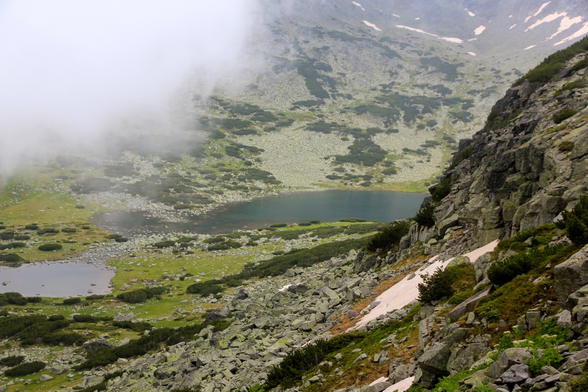
imagined. The fog lifted for a few minutes and
I could see the ridge that I traversed high up. This basin is likely
quite nice with some visibility.
I returned to the gondola by 1515, so a gentle hiking time from the summit and back was 1:45.
Here is a map showing waypoints along the route I did.
Here is a brief summary of the peaks climbed on this trip.