How to get there:
From the traffic circle in Lom, drive 7.7 kilometer towards Otta (Hwy. 15). Pay attention,
the side road is rather small. There is a sign saying Soleggen 6. Turn right (dirt road), then
immediately more right going parallel to Hwy. 15 (but in the opposite direction). If coming
from Otta, this (left turn) is about 5.5 kilometer after you pass a small, white church (on your
left) in the small village of Garmo.
About 150 meter after you turn onto this road there is a self serve toll payment station
on your left. Pay toll (NOK 40 in 2008), then continue 5.6 kilometer uphill where you locate
a road fork just before Soleggen (you will see the large Soleggen building up ahead). Take the
left fork about 150 meter across a small bridge and locate parking on your right. This is
the trailhead, location N61:49.427, E008:37.662, elevation about 948 meter.
Later in the summer, it may be possible to drive further along this road, possibly to the place
called Sålell. This will make the climb considerably shorter.
Route description:
See the description for Kvitingskjølen.
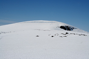
From the summit of Kvitingskjølen (2064), ski down to the broad, connecting ridge.
The key saddle is quite close to the west summit. Ascend the slope on the south (left) side then curve
north (right) and gain the summit. Note that this summit has an overhanging cornice facing east.
From this summit one may ski directly down towards the lower part of the valley Kvitingsgjelet,
then return back to the trailhead.
Comments:
I arrived at this summit around 1235, about 20 minutes after
leaving the (main) Kvitingskjølen summit.
I subsequently had a very nice downhill ski on near perfect crust all the
way back to the lower end of the Kvitingsgjelet valley.
I left this summit at 1245 and arrived back at 1100 meter where the skiing ended in
45 minutes. Thirty nice minutes of hiking downhill on the road brought me back to
the car by 1400.
This trip to Trondheim (Para08), now continued to Oppdal and Gjevilvasshytta where
I checked in to the self-serve unit. The next goal was to
climb Blåhøa.