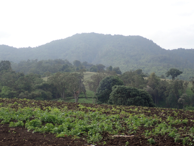
Mount Kitumbeine

  • Mount Kitumbeine
  • 2867 m
  • Primary factor 1779 m
  • Tanzania
  • Location NW summit: South 02.87938, East 036.21167 (GPS at the summit)
  • Location SE summit: South 02.89377, East 036.23227 (GPS at the summit)
  • Elevation SE summit: 2864 m
  • Difficulty: YDS class 1, SE summit: class 2.
  • Climbed January 9. 2019.

Information:


How to get there:
Starting from the Masai village of Bomba Gelay, drive down to the(main) road, then turn left then drive approximately 9 km to find a roadfork, continue on the main road (keep right) for another 10 kilometer to location S02.75628, E036.25114. Find a road that forks right near this location. Take this side road, initially flat, then more steeply uphill with several switch-backs. The road is rough and rocky, a sturdy 4WD with high clearance as well as a low mode on the transmission is needed.
Reaching about 2000m of elevation, the terrain is agricuture. A number of Masai lives up here. Continue uphill (towards the mountain) to a single hut at location S02.85234, E036.20678, elevation about 2260 meter. From here, the 4WD road first turns 90 degrees left (follow the fence), then 90 degrees right. (around a corner of the fence.) The road now heads uphill among trees and we drove to location S02.86314, E036.21202, elevation slightly above 2400 meter. A 4WD track coninues passed this point to location S02.87567, E036.21525, elevation about 2720 meter.
Route description:
The route starts quite high thanks to the Masai people that live up in this area above 2000 meter. First, follow the 4WD track as it continues uphill to location S02.87567, E036.21525, elevation about 2725 meter. Continue on a good trail. It will climb onto a ridge, staying well right of the crest. Locate a trail that forks steeply uphill (to your left) shortly after the main trail has crossed a short section with rocks in the path. This trail will reach an open, grass area with trees along its left side. Continue what is almost level, then locate a short side trail going left to the summit location.
Traverse to the SE summit: This mountain has a second summit of almost equal hight located about 3 kilometer to the sout-east. The summits are connected with a somewhat bushy ridge that never drops much more than 50 meter.
There are two reasonable routes. The first alternative descends slightly, crosses an open grassy area, then descends more to the edge of a large grassy plateau where buffalos may be seen. Follow the low area, passing near location S02.89266, E036.21118, approximately elevation 2715 meter, then ascend along a pretty good trail that traveses right while gaining the crest. Enter a grassy area with the summit rising across. It now paays to contour left and gain the north-west ridge. A good trail made by buffalo can the be followed to the summit, it runs very near the steep drop off to the north.
The alternative is to stay closer to the connecting ridge, a reasonable trail runs a bit down on the west side of the broad ridge. The last part of the route follows the route decribed above.
Comments:
We left Gelai Bomba around 0640 and arrived at the higher hut at 0800. The uphill section of the road was very rocky and quite steep, the landcruiser needed to shift into low mode. It then became clear that we should have a guard along in addition to the guide. He showed up, nice smile on his face. It turned out that he was unarmed, but I guess a guard may just be a second pair of sharp eyes that will detect any danger sufficiently early.
We set out at 0825, the first part of the route following the 4WD track that continued beyond where we agreed to park. Overall, quite a short hike as we made the summit in 55 minutes from the car. I did a careful measurement of the elevation while informing my party that we were to continue to the SE-summit. No visible complaints about this, clearly to return from here would mean a hike of only about 1:30, more was needed to make this a full day.
We set out after a 15 minute break and deviated from the track that Rob had used, he stayed on the connecting ridge while we descended to the large grass plateau off to the west. We soon spotted buffalo, but this time at a safe distance unlike yesterday. To walk in this area is like a walking safari, perhaps a bit more exciting as you do not have the safety of a car. Buffalos as well of a range of other wild animals in this area are potentially very dangerous to humans.
We spotted several more animals along the route and then finished the final grass as well as ridge, arriving at the summit at 1125. This summit is a bit ill-defined, a pretty flat area overgrown with bush and generally unfriendly plants. I did a careful averaging with my GPS and it settled at 2870 meter, thus only slightly less than what I measured at the first summit. The trees here appeared to be slightly taller as well. We rested about 15 minutes before heading back. This time, we followed the west side of the connecting ridge, staying a bit below the top pretty much all the way. Back at summit I around 1310, I did a continued averaging of the waypoint I collected a few hours earlier. The result was a very stable 2873 meter. It is good reason to believe that the north summit is about 3 meter higher than the SE summit. This is pretty consistent with Rob's findings earlier.
However, the hike to the first summit is really to short given the investments made in transportation and general travel. Thus, I strongly recommend that also future hikers bag both summits. Besides being a more reasonable hike, the opportunity to see Africa wildlife while walking and not from the safe harbor of a car, is an experience that one should not miss.
We descended at 1325 and were back by the car, Sam waiting, at 1400.
The previous peak on this trip was Gelai, the next peak is Loolmalasin.

Resources: