How to get there:
There are several possible trailheads. Possibly (not checked!) the best is to
drive up the mountain road starting in the town of Brissago. The maps indicate a
public parking area on the very top of the road near location 46.12744, 8.68308.
This would be near elevation 1060 meter, considerably higher than the trailhead I used (below).
One may also find a good trailhead on the north side of this mountain.
Another, good trailhead (that I used), is located high on the road that climbs the hillside
shortly south of Brissago. This road has a small, public parking area located at
N46.10926, E008.68288, elevation near 925 meter. The parking is signed, but has a very sharp
left turn, the easiest approach is to drive just past this exit, then go in reverse.
(backwards into the parking area.)
Route description:
A quick summary of the peaks climbed in Italy 2022.
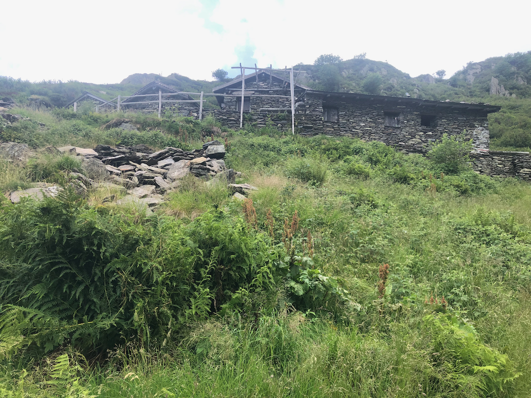
Continue up along the road until it ends between som small traditional style
buildings. The path turns left and you will see a trail sign for Monte Gridone
pointing left again, crossing the creek on a small bridge. The trail has the
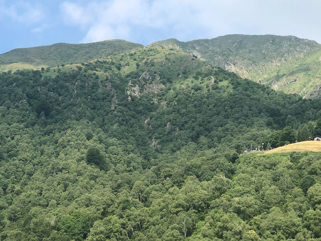
normal red/white painted stripes. It zig-zags uphill,
then tends a bit more
left towards a larger drainage,
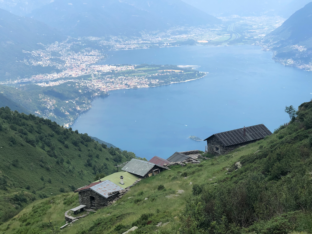
climbing on the left side. You pass some
traditional mountain farm buildings.
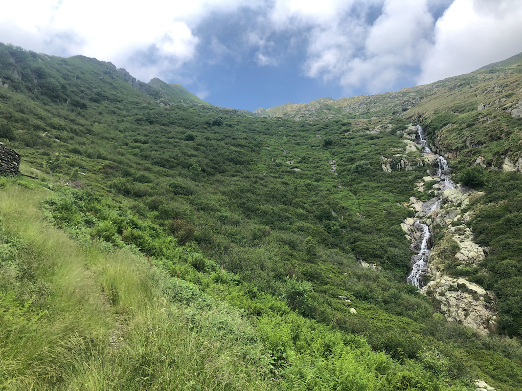
Heading more across you will reach a second
set of buildings. From here, a short cut trail (poorly marked) runs directly uphill
to the saddle Bocchetta di Valle.
The better option is to continue a more gentle traverse on a bigger trail that will
reach the small, but nice Rifugio Al Legn.
From here, another nice trail runs uphill
and across to Bocchetta di Valle.
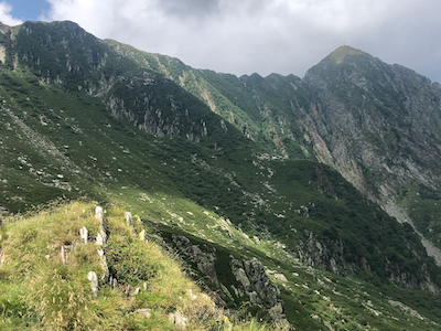
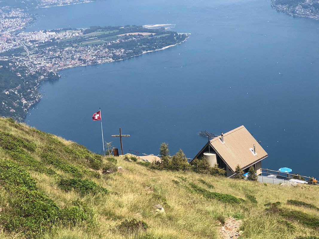
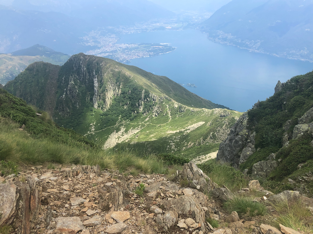
From here, you will see the summit for the first time..
From Bocchetta di Valle, the route continues directly uphill to gain the main crest which
also forms the Italian-Switzerland border. Turn right on top, then follow a clear trail
passing a small top with a big square rock cairn, descending slightly to a final col, before
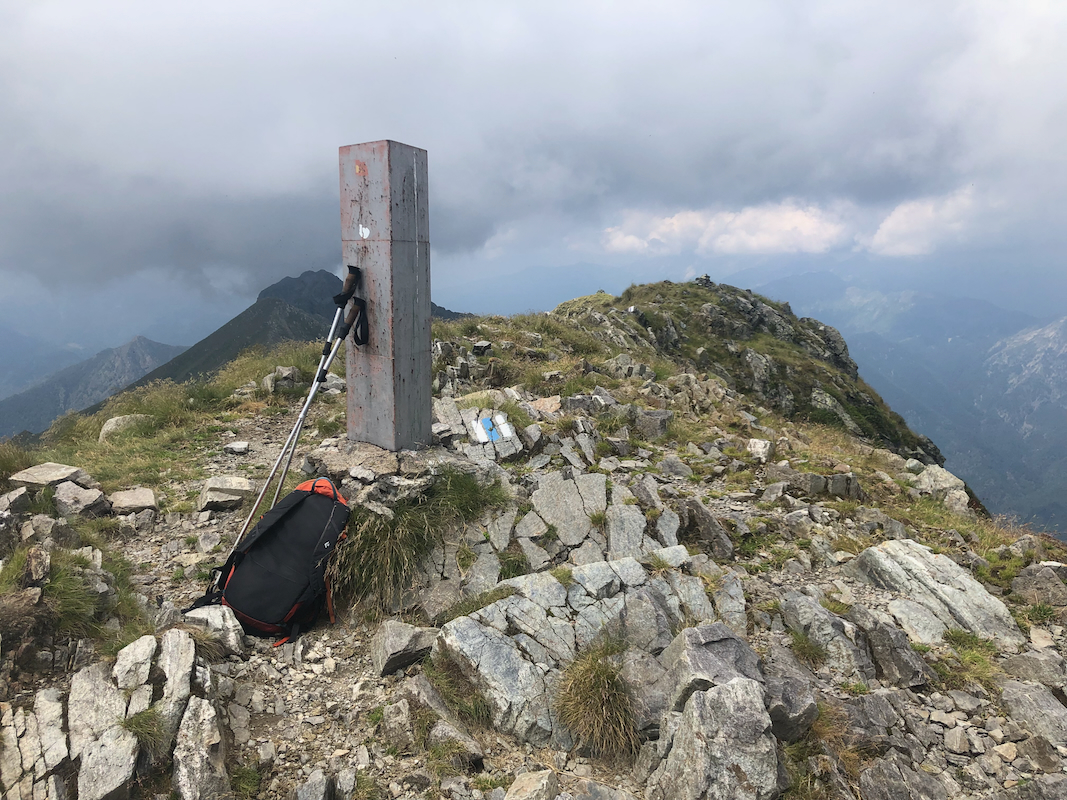
a slightly steeper ascent to the summit marked
with a trig. pillar and a huge metal cross. Comments:
I was ready to go around 1015. It was a Saturday and I noticed that the 3 remaining slots in
the small parking area filled fast. In fact, there was a gathering of people having a day with
skeet shooting only 2 turns higher on the road. They had already started and the event was still
going strong when I returned nearly 6 hours later.
The trail was nice and likewise the day, sunny, but not uncomfortably hot. I walked up to the
upper mountain farm buildings. Here, I realized that one could take a smaller route directly uphill, but I
decided to take the bigger trail that traversed to my right. This was a good decision, since I then
also discovered the small Rifugio Al Legn. I immediately started looking forward to a cold beer here
on my return hike.
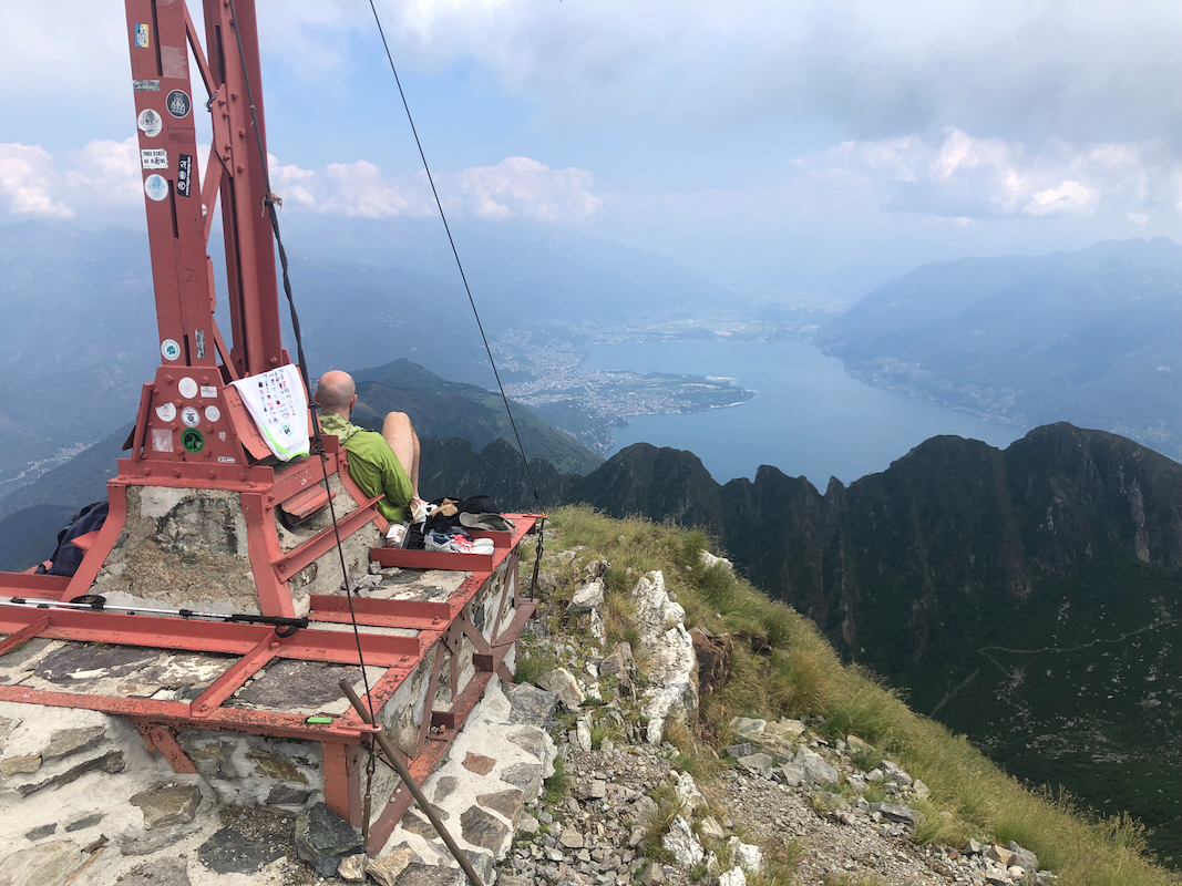
I arrived on top after about 2:45. There, I met two guys from Germany enjoying the views and the
day while resting at the base of the big cross. We had a good chat and 45 minutes passed quickly.
Descending, I stopped by the rifugio as planned and got myself a cold beer. The hut keeper could
inform me that this rifugio was open, based on self serve, all year. After another 30 minutes, I
finally completed my descent, arriving back down by my car around 1600.