Location: North 47:33.700, East 012.18.152 (GPS at the summit)
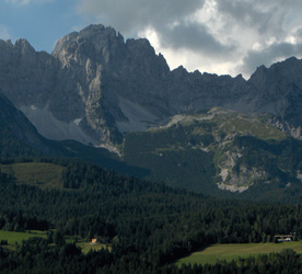
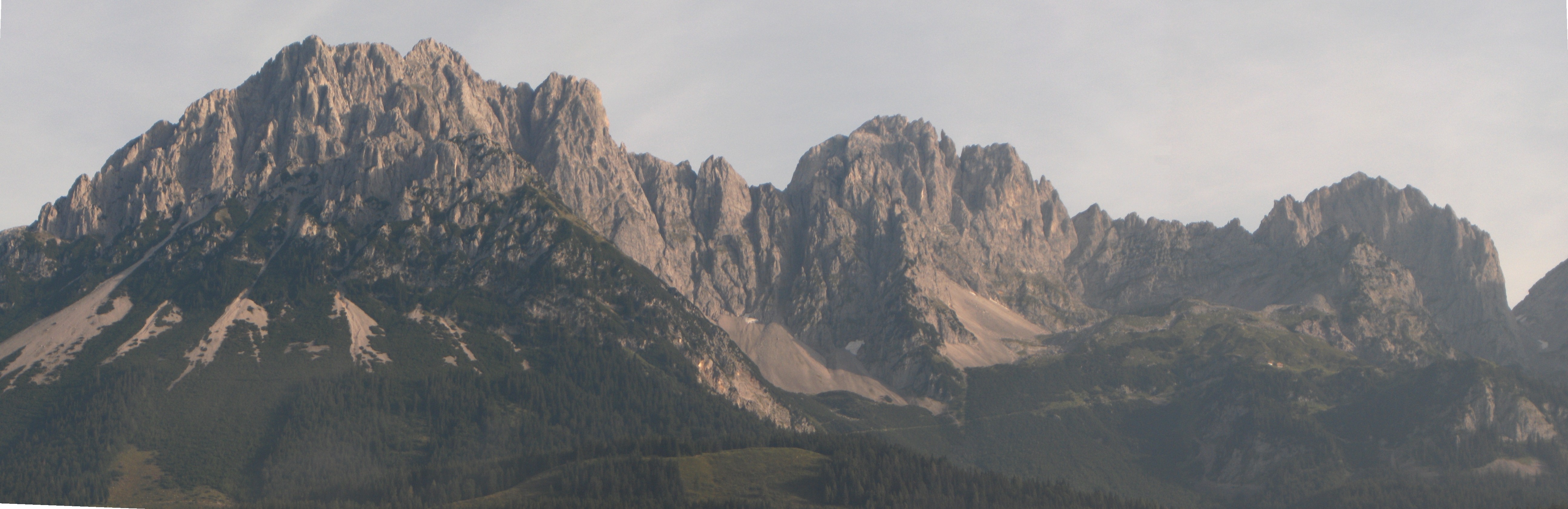
Highest in Kaisergebirge, Austria.
Difficulty: YDS class 3 (with cables).
Climbed August 13. 2005.
Information:
How to get there:
The natural starting point is the small village of Ellmau, located along
Hwy. 178 between Worgel and St. Johan. Hwy. 178 forks from the main road
A12 (also named E45 and E60) that provides connection to Munich.
Locate the Intersport store in the centrum of Ellmau and take the road
(slightly downhill) between this store and the Alte Post Hotel
that heads towards Hwy. 178, however crosses this road
in an underpass. Immediately after this short tunnel, turn right following
a sign for Wochenbrunner Alm. Immediately after this turn, turn again left,
this time the sign says Kaisergebirge. You are crossing a golf course while
making these turns. Continue this road as it heads towards the mountains and
climbs in several sharp curves until reaching its end at Wochenbrunner Alm, this
is 4.5 kilometer from Ellmau. There is parking available in several areas here.
This is the trailhead, elevation 1085 meter, location N47:32.478, E012.19.198. Route description:
From the trailhead, locate a big and clearly marked trail that heads uphill into
the forest. This trail has signs for the Gruttenhütte mountain hut. The trail takes you
uphill on a steady climb, sometimes in a few zig-zag patterns and eventually out of and above
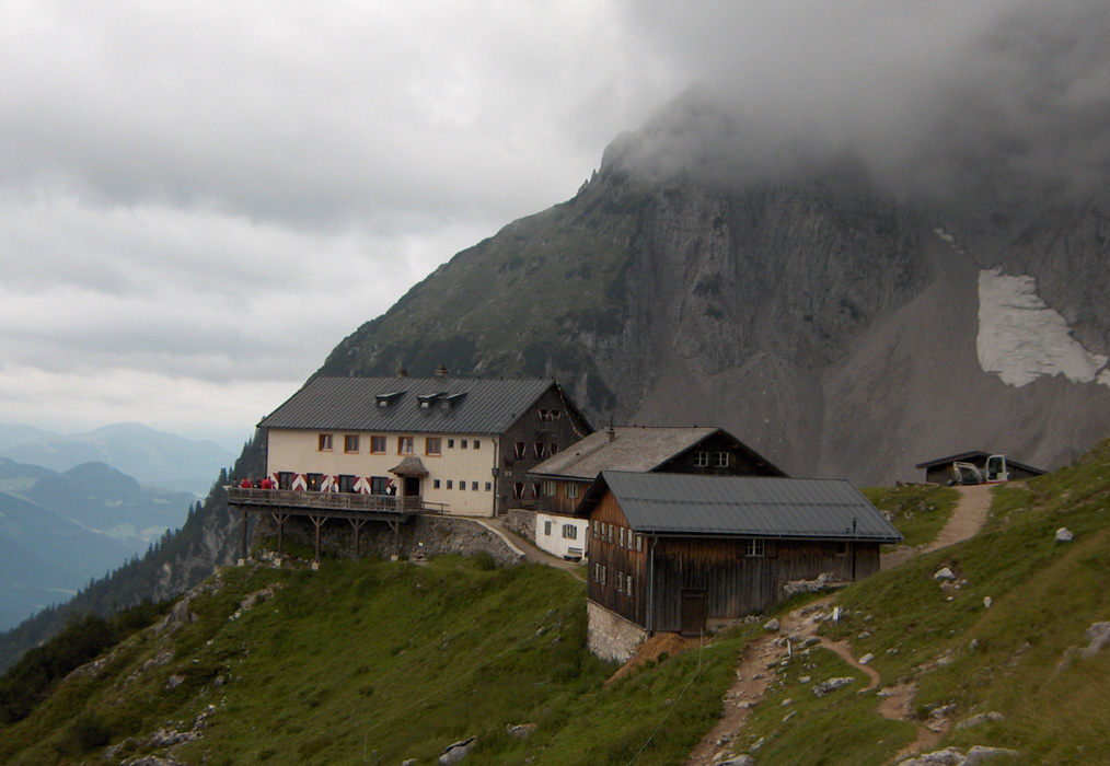
the forest. In about one hour you arrive at the Gruttenhütte, elevation
1623 meter, Location N47:33.213, E012.18.672.
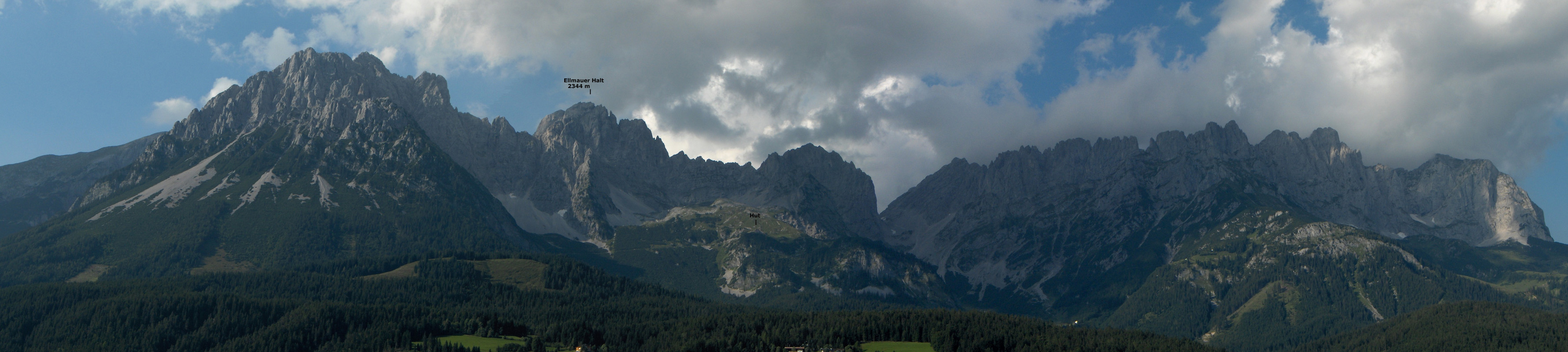
From the mountain hut, there is a continued trail up to a fairly flat area with a patch of snow
plus large boulders from where the steeper part of the route does start. This trail heads uphill
from the hut, initially on an ascending traverse towards left (as seen when facing uphill).
The route is called Gamsängersteig, there are a few signs with this name pointing in the proper
direction. This approach trail takes approximately 30 minutes as it climbs about 200 vertical meter.
The steeper and more exposed part of this route starts at elevation
1856 meter, location N47:33.651, E012.18.522 (this is a bit up the very first part of the slope).
From this point to the summit the route is protected by a Via Ferrata style cable on its steeper
and/or more exposed sections.
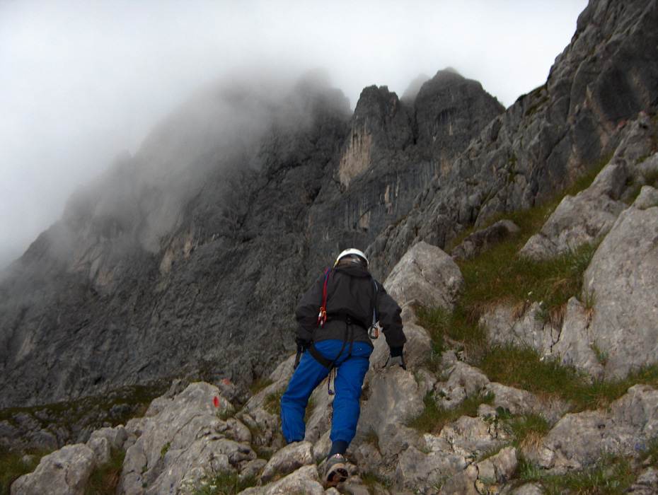
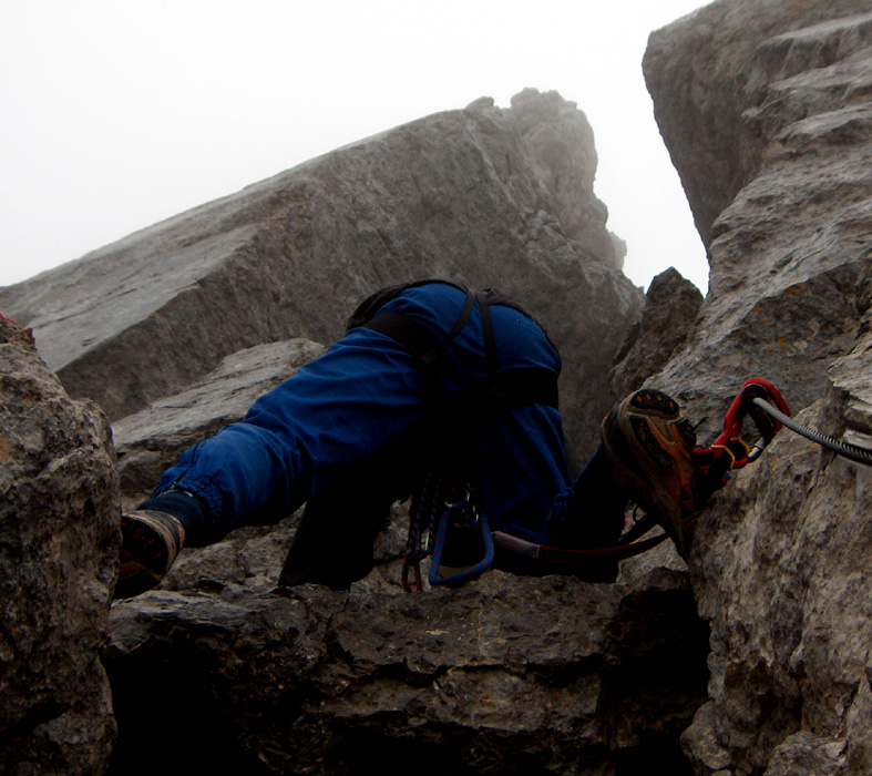
Initially, the trail runs left along various ledges. In some spots the passage is quite narrow
and the exposure is significant. After about 0.5 kilometer the route climbs slightly under a
vertical rock wall. This section is called the Jägerwand-Treppe because iron steps have
been set in the rock. You walk on these steps, however the ground is just below and it does look
as if a trail could have been made as an alternative. There may be rock fall and all climbers doing
this route are strongly recommended to wear a climbers helmet.
After the Jägerwand-Treppe, the route heads more uphill having a mix of easier (no cable) and steeper
(cable) sections. Eventually, you reach a spot where there is a choice between two options, either you
climb an upward slanting rock that is fairly narrow and has exposure to the climbers right, this is
the crux of the route, or you contour left and enter a very large crack in the rock. Quite deep into
this crack there is a slightly overhanging ladder that can be climbed in order to exit on the top
where the two variations of the route merge into a single path again. The next "milestone" is a small
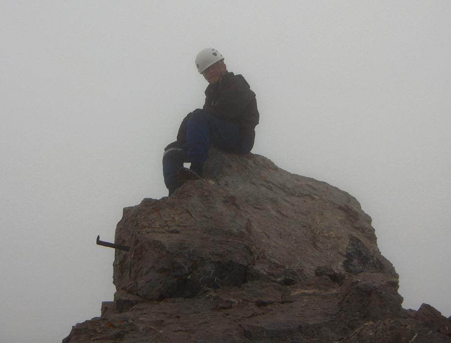
hut, called Baberstubenhüttchen located in a well protected area. From here to the summit
is a very short scramble. The summit cross is located on a fairly flat (small) plateau, while the
highest rock point is right next to it and requires a few more meter of easy scrambling (see picture
below).
The climbing part of this route is described in even more detail in the book "Klettersteige Österreich West and Süd"
by Kurt Schall. His book assigns the Via Ferrata difficulty as "B", with the crux (that can be avoided) as "B/C". The
rock climbing is assigned a grade 1+. The difficulty on the YDS scale is class 3 if the cables are actively used, while
the route is YDS class 4 without the use of the cable for hand holds and assuming that the "crux" described above is
avoided by using the deep crack. Comments:
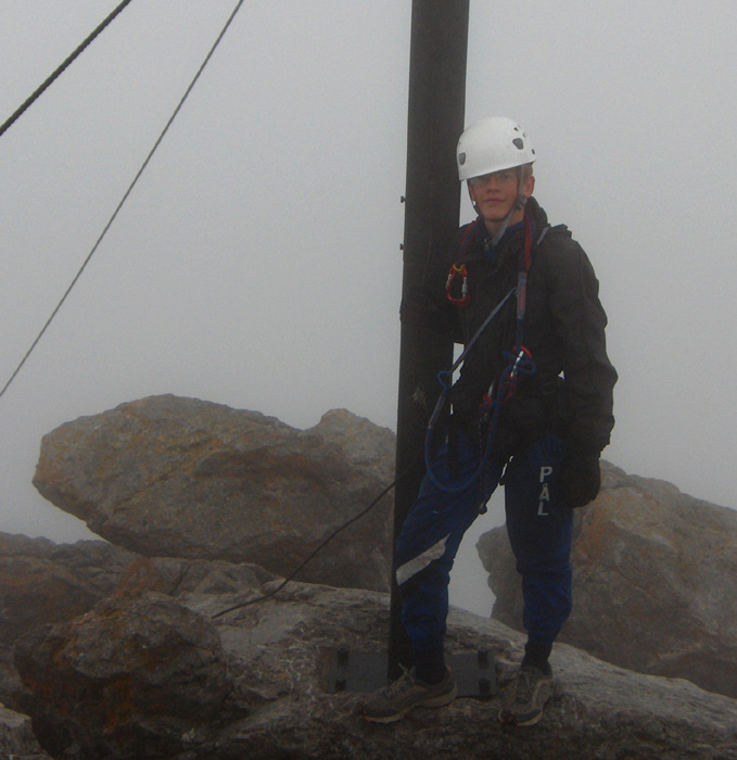
I did this climb with my son Pål Jørgen, age 16. Unfortunately,
the good weather from the day before had taken a change for the worse, clouds and
rain. We left the car at the trailhead at 0545 and hiked up along a good and well marked
path to the mountain hut Gruttenhütte, arriving there at 0640, 55 minutes with good
elevation gain. We stayed in the hut for one hour in order to see if the weather
would improve (or possibly deteriorate). The hut manager said the forecast called for
rain and clouds, possibly some sun, but no storm with thunder etc. Given this unclear
picture, we left at 0740, quickly gained the area where the climbing trail begins and
continued uphill reaching the summit at 0950. We stayed 10 minutes, taking a few pictures of
the wild landscape, rock spires vaguely visible in the mist and fog. We then descended
to the small hut called Babenstuberhuttchen, located just below the summit, and had
a small break with water and chocolate. Leaving at 1015, we carefully descended on very
wet and slippery rocks, reaching the Gruttenhütte at 1215 (2 hours), then continued down to
the trailhead, arriving back at the car at 1255. A well deserved lunch awaited us in Ellmau.
The climbing section of this hike was secured in Via Ferrata style with wire cables except for
easier sections along the way. We self belayed using our "Via Ferrata Kit", most of the way, mainly
due to the extremely slippery wet limestone rock. This way of moving is very safe, but somewhat time consuming.
Tired of heavy hiking boots, we both used jogging shoes, this was clearly a mistake on my part, as my
well worn shoes turned out to be sliding more easily than appreciated under the given conditions.
This climb is clearly much more enjoyable when the rock is dry and the sun warms.