Location: South 21.03064, East 055.45383 (GPS on the summit)
Difficulty: YDS class 4 (mostly class 3)
Climbed February 28. 2014
Information:
How to get there:
At the coast, start out from St. André, this is a bit more than 20 kilometer east of St. Denis.
Look for the exit signed for Salazie, this is Hwy. D48. Drive through Salazie and turn left and continue
on D48. A few kilometer from Salazie, turn right onto Hwy. D52, signed for Grand Ilet.
Grand Ilet is roughly
32 kilometer from the freeway exit in St. André. The road is paved, but care is needed, there are many
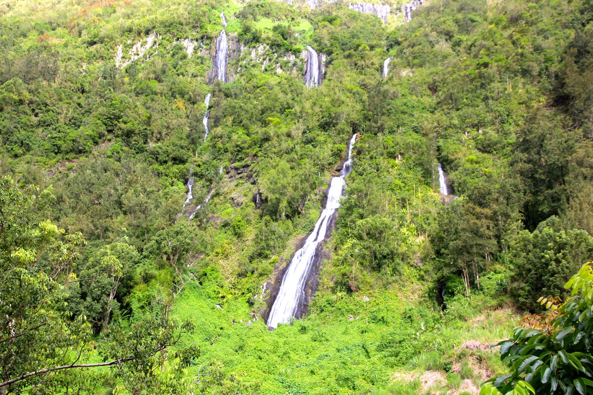
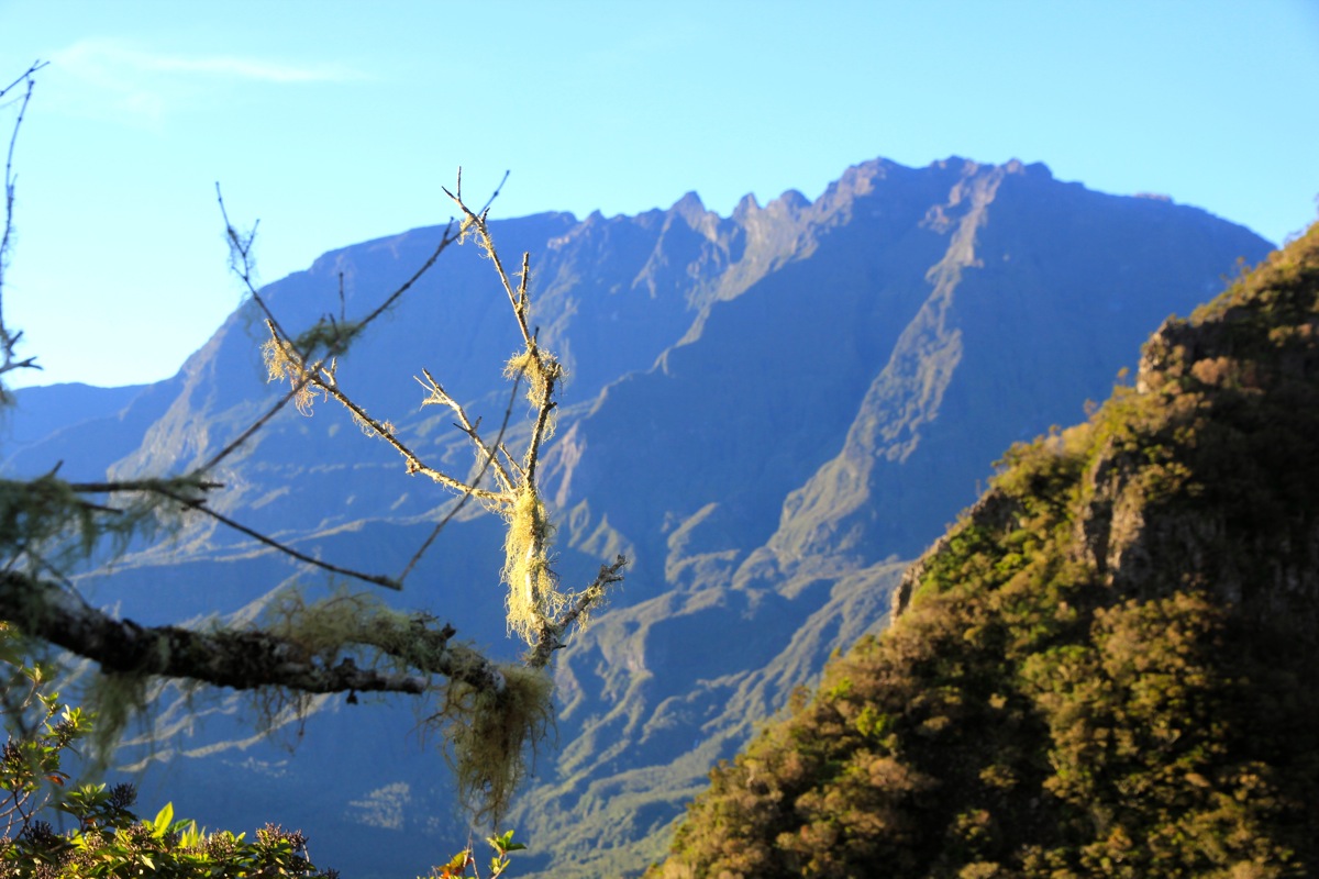
sharp curves and steep hills. The landscape
is fascinating, steep hills
with dense, green vegetation. A few waterfalls
may also be seen.
In Grand Ilet, Hwy. D52 makes a 90 degree turn left. Leave D52 here and go straight ahead. There is a sign saying
La Roche Ecrite. As you start descending in a left turning curve, there is parking for two cars outside the road on
your right hand side. There are some big poles here. This location is S21.02404, E055.47344, elevation about 1060 meter.
If you cross the creek, you have driven too far.
Route description:
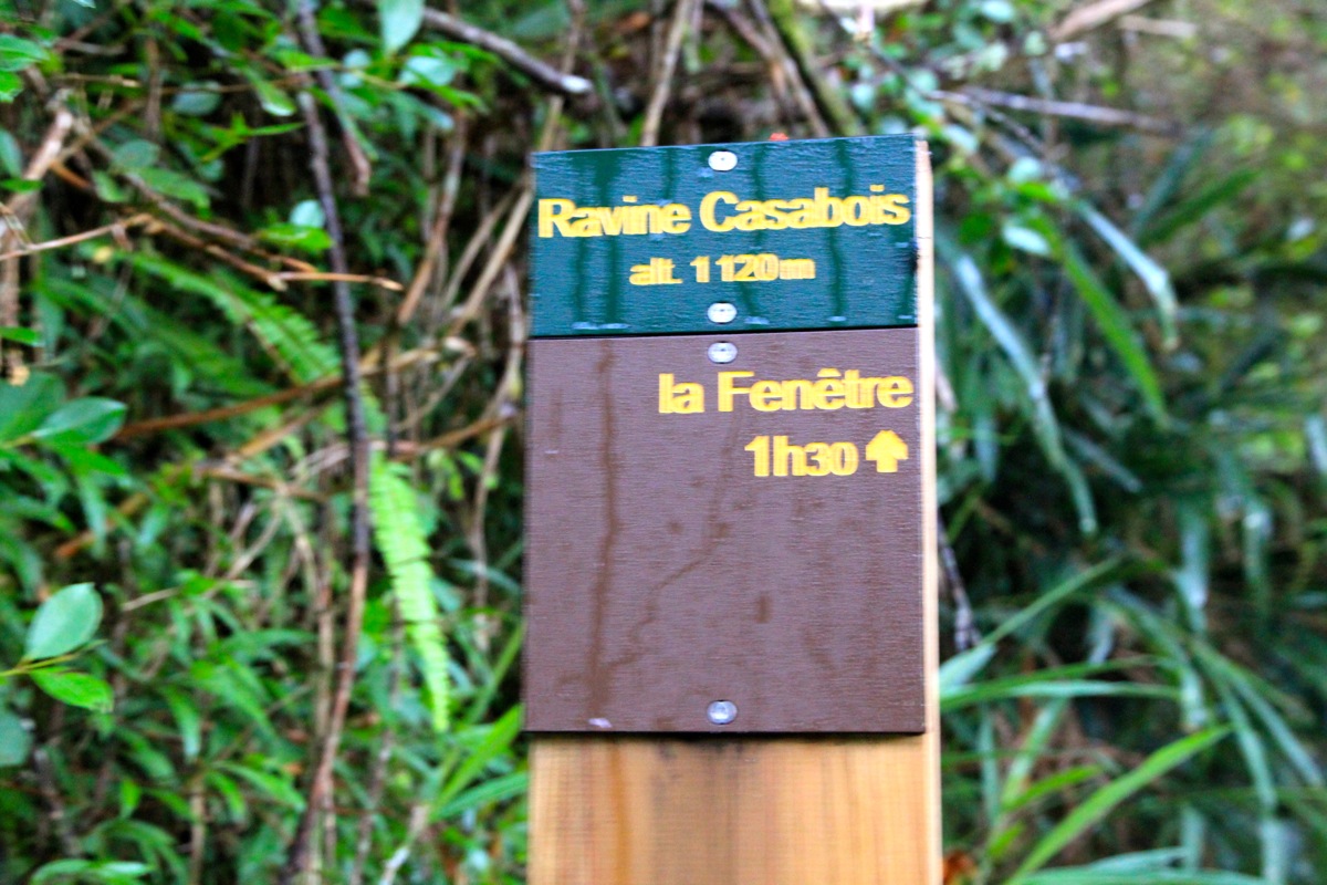
Walk a bit onwards down the hill from the parking described above. You will locate a small side road that
goes left. There is a sign that contains the word Fenêtre. This location is
S21.02414, E055.47206, elevation about 1050 meter. This is the trailhead. Follow this small road as it makes its way
passing a house on your left (as well as some cows on your right).
The mountain can be seen directly ahead.
The path looks like a forest road. Gaining a little
elevation, you stay initially on the left side of the creek, then cross it on a bridge. After perhaps 5 minutes of
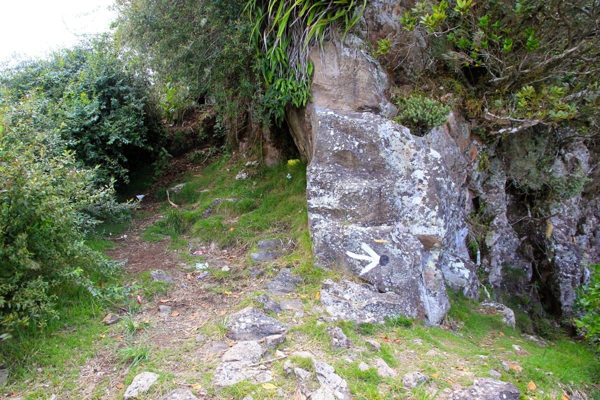
walking, you should note a trailfork.
The correct route forks 90 degrees to your right.
There is a trailmarker at this
point, location S21.02547, E055.46658.
A bit further ahead, there is a wooden sign for Fenêtre pointing across a small (dry) creek to your left.
Follow this, from now on, there is only a single trail that heads uphill with many zig-zag turns. This trail
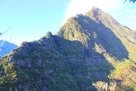
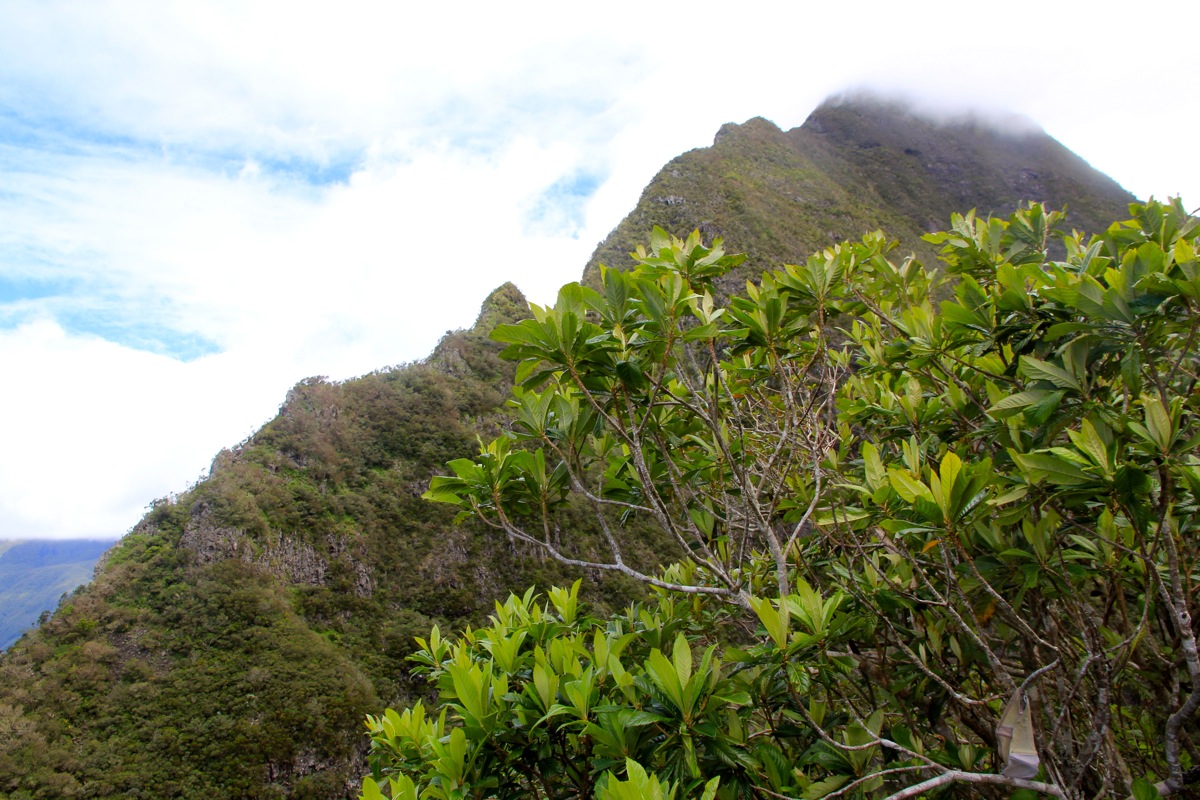
ends at a viewpoint from where one may see through the "window" (Fenêtre) to the west. The place
looks like this.
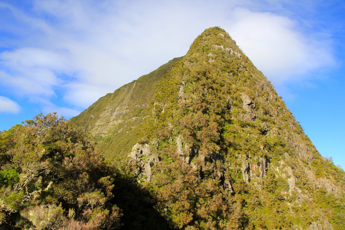
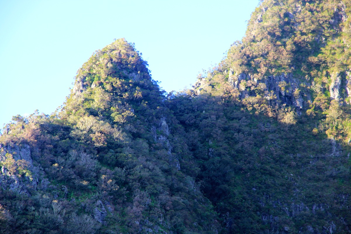
You are now about 50 meter above the col between La Roche Ecrite (up to your right) and
Le Cimandef (across to your left).
Unfortunately, you are on the wrong side of the col and a short downclimb will
be needed.
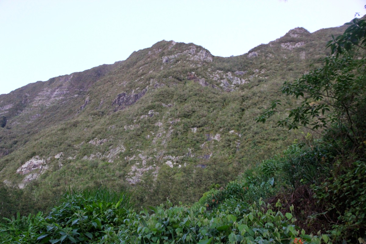
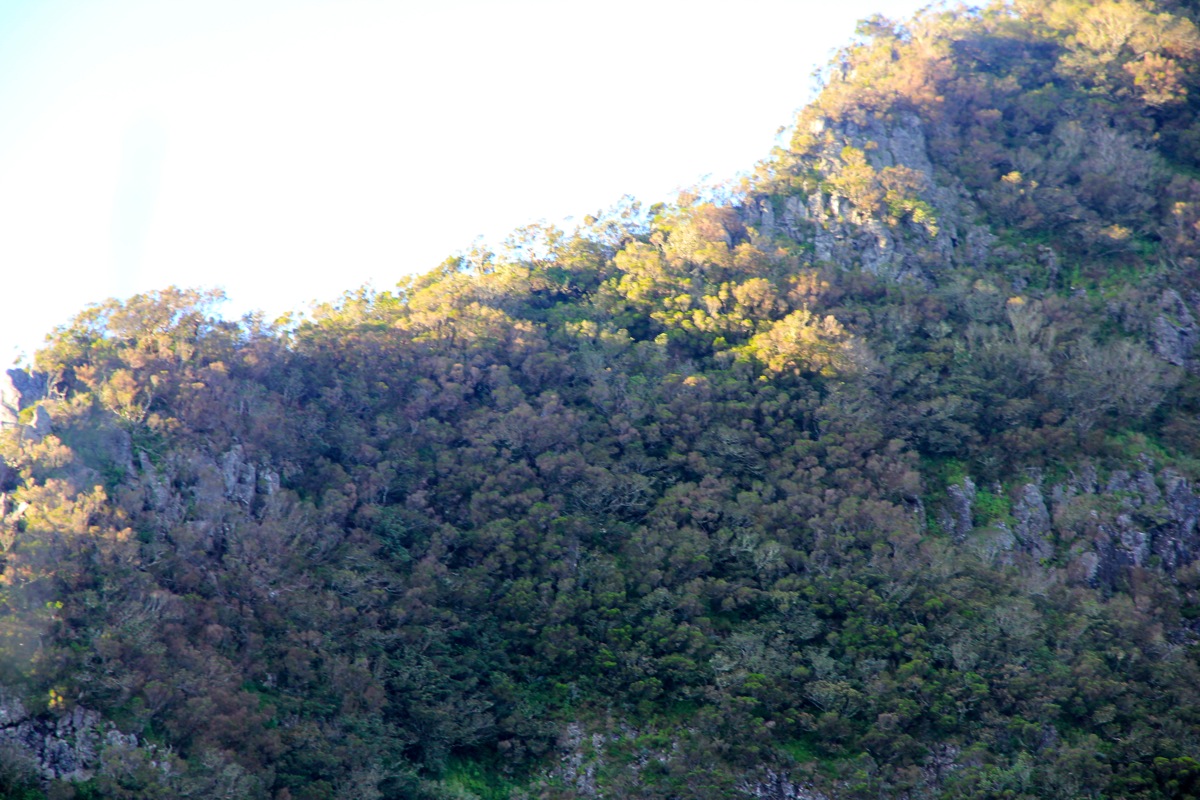
However, things are not bad. This peak must have seen a few ascents since a pretty decent climbers trail
will lead you down. The good news is that this vague trail is more or less visible between the climbing
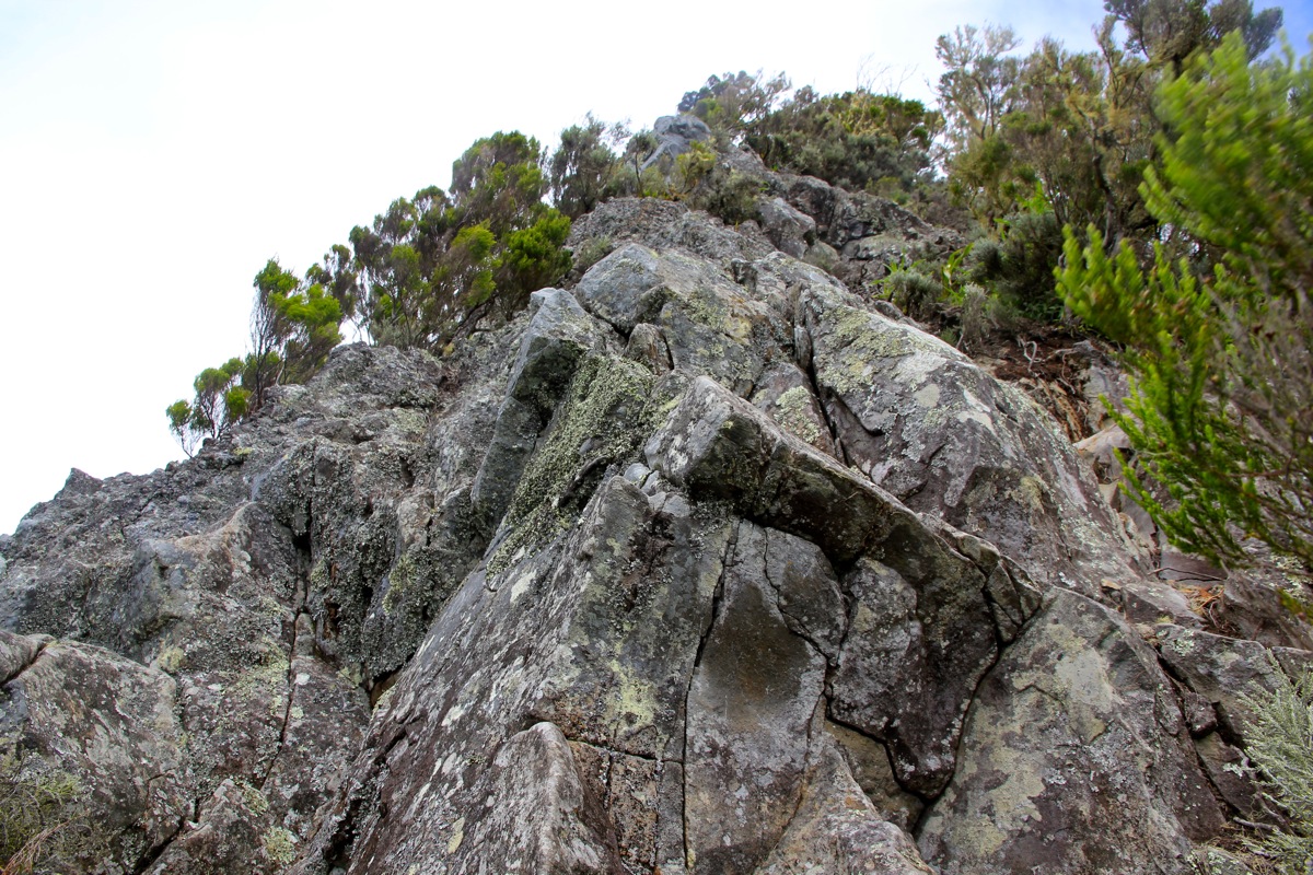
sections along the ridge all the way to the summit.
The route from the saddle to the summit stays right on top of the distinct ridge most of the
way. The faint trail will lead you off on either the left or the right side of the top ridge in a few
places, typically regaining the ridge as soon as an obstacle has been circumvented.
This climb is likley quite unpleasant in rain and wet conditions. There is considerable exposure most
of the way, do not be fooled by the vegatation, it may not be able to stop a fall. I would recommend to
carry a short rope on this route. People unfamiliar with a scramble in steepish terrain should
not start here unless in a group with an experienced leader.
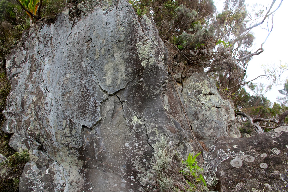
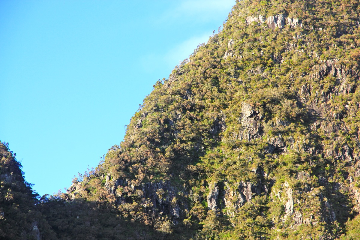
The rest of the route alternates between steep ridge and more gentle ridge several times. There is
some pretty good (reliable) rock,
but also sections with rotten rock where almost everything you
grab will move, perhaps still yield what you need, but I never like it.
The small trees that grow along most of the route are similar. Some feels like they are very well
attached to the ground others are more dubious. Still, these handholds are very valuable and should
be used, but conservatively.
Most of the climbing is (YDS) class 3 and much of it is quite enjoyable. Some short pitches border
on class 4. Almost at the top, there is a (YDS) class 4 pitch.
A rope with knots is hanging down.
Better not trust this entirely, it seems quite worn and old. There is also a steepish section where
it may look as if the bypass is on the left, however, the bypass on the right is definitely a
safer option. Near the end of the climb, the route stays to the right and climbs steeply on
mostly soil. Some small trees here may be used for additional support, be careful. The summit
ridge is fairly broad as you enter, it then narrows a
bit and turns more left. There is a small
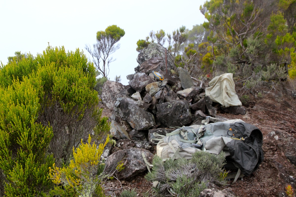
pile of rocks marking the summit.
Comments:
I knew that this would be a long day. I did not know if I would be able to climb this peak
solo and without any equipment. Anyhow, I decided to give it a try on our last full day on Reunion.
Thus, I woke up around 0330 and was on my way before 0400. The drive from our hotel to this trailhead is
approximately 2 hours. Perfect timing as I parked shortly before 0600 and left my car with a head torch
at 0600 sharp. I knew daylight would come very soon and actually turned off the lamp after only 10 minutes.
The trail that lead up to the "window" (La fenetre), was easy to follow and quite nice. I arrived at the end
of the trail at 0700, and had a very good view of the ridge leading to Cimandef.
Fortunately, I quickly discovered a climbers trail that lead down towards the connecting saddle.
As it turned out, this vague trail was visible more or less all the way to the summit, thus providing
some guidance on the route. The fact is that
one must stay on the very top of the ridge most of the
way and then there is not much room for loosing the route as the ridge was seldom more than 1-2 meter wide.
The route had pretty dense vegetation and
steeper sections that had good rock, poor rock or just
steep and slippery soil. The climbing stayed mostly at (YDS)
class 3 and was quite enjoyable. Unknown ridges
like this one are often entertaining as you never know what small problems will appear next. I got very
busy with my project, also thinking that I was fortunate that it did not rain. Moreover, it would be really good
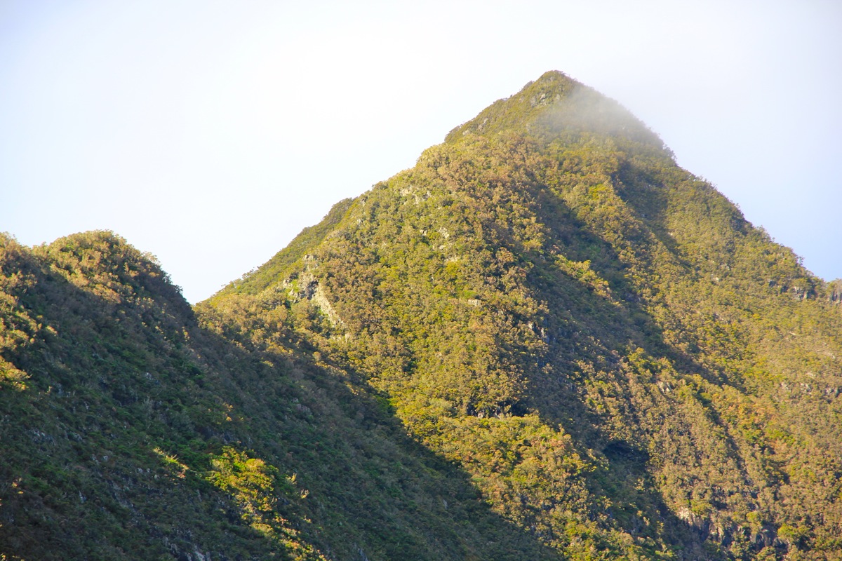
if it did not start raining before I was back off this ridge. The top of the upper ridge had disappeared into
a cloud, unfortunate, but not taking much away. I enjoyed the good views from my position on an airy ridge.
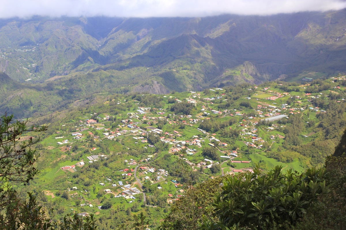
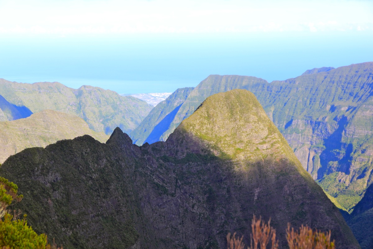
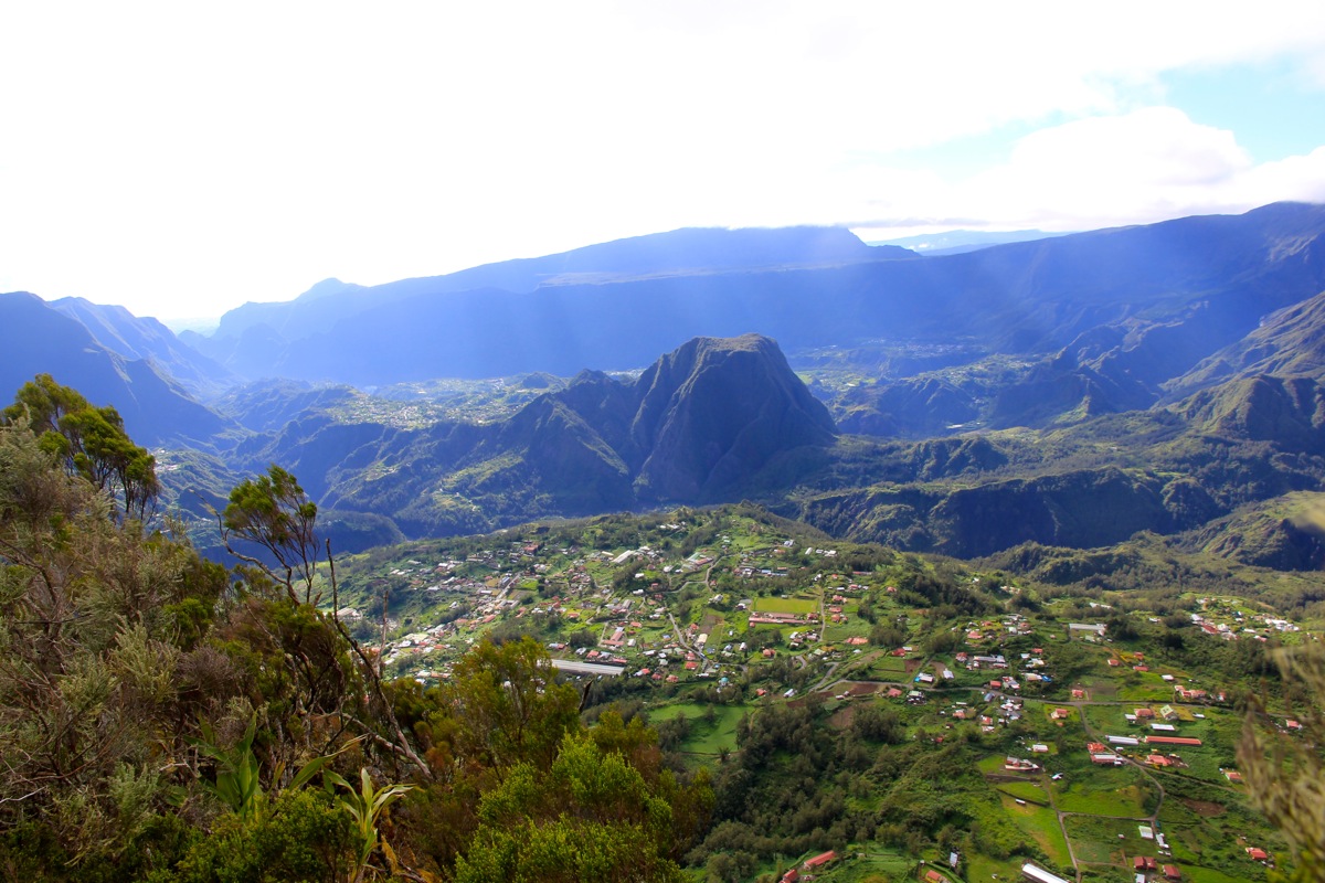
Fantastic view out west,
but also a very good view down to
Grand Ilet and the big circ on this side of the
island. The Piton des Neiges dominates the view
almost everywhere, I could also sense the
connecting ridge to Cimandef, defining its
prominence and separating Cilaos from Grand Ilet.
At the lower end of a steeper rock section, I noticed an old rope, clearly put in place to help people
climb this part. Since I did not know how it was attached and since it might be very weak from many years
of exposure, I climbed up without touching it. Well up, I examined the attachment point which looked good.
It seemed like a good idea tio use this rope to back up the downclimb when returning here. On this section of the
ridge I also scrambled up an exposed section with only soil and small trees that looked unreliable, I disapproved
of this pitch rather strongly and decided to investigate alternatives when descending.
I arrived on the top at 0930, quite a nice, horizontal top ridge.
I stayed around for 15 minutes and took
an accurate GPS reading. The fact that there was no visibility up here,
due to the top cloud, made me descend
a bit sooner than if the visibility had been great.
The descent is always interesting as some pitches will feel harder while others, now familiar, will
feel easier than when ascending. I found a nicer and safer bypass on the opposite side of the ridge
to avoid the steepish, exposed soil. The rope was used, but not loaded as I downclimbed the rock. Overall,
care and attention is needed all the time and descending takes as much time as ascending. I came out below the
summit cloud and could see one section at
a time of the ridge below me. Back at the end of the "window" trail
at 1215 - 2.5 hours up and another 2.5 to get back down.
The rest was easy, I hiked back down the trail to my car, completing this very interesting
ascent at 1305. In total, a 7 hour trip that served as a fine conclusion to my hikes and climbs
on the island of Reunion.
Here is a quick summary to my climbs on Reunion.