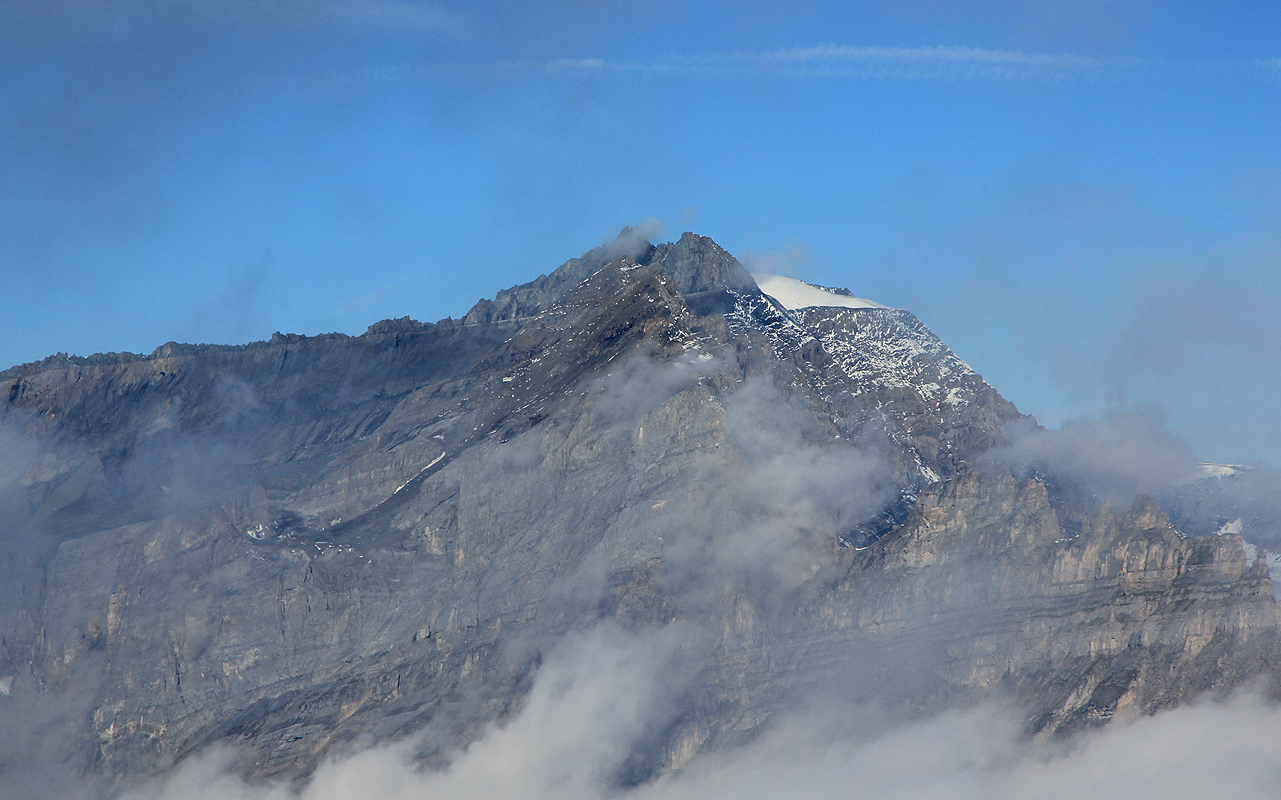
Haldensteiner Calanda
- Haldensteiner Calanda
- 2806 m
- Primary factor 1449 m
- Location: North 46.89992 East 009.46724 (GPS at the summit)
- Near Chur, Switzerland
- Difficulty: YDS class 2
- Attempted: August 30, 2011.
- Climbed: October 4, 2014.
Haldensteiner Calanda
|
|
How to get there:
This peak can be climbed from the small village of Haldenstein, located just
north of Chur (east side), or from the village of Vättis on the west side.
The east route can also use a mountainhut, the Calanda hütte, located above 2000 meter, perhaps
about 3-4 hours of walking from Haldenstein.
In fact, the by far easiest way to climb this peak is as follows:
When driving south on the autobahn towards Chur, after the merge of two autobahns (a short
distance before Chur), look for the exit that has a sign saying Untervaz. Exit here (this is a bit
before Chur) and measure from this exit. Follow the main road and cross the river at kilometer
0.6 (reset if you are a bit inaccurate). Continue across some open fields and enter Untervaz, the main
road runs gently uphill into the small village. At kilometer 2.6 (i.e. 2 kilometer from the river!), you
will have hotel Linde on your right hand side. Stop here, and buy a permit for the Alp-road (Berg-weg) at
the reception desk. The price in 2014 was 20 Swiss Franc. Next continue up the road that turns left outside
Hotel Linde, i.e. drive directly uphill with the hotel behind you. At kilometer 2.9, when one cannot continue
straight anymore, turn left, this is essentially the beginning of the "Berg-weg". The road now climbs in many
turns uphill. It is narrow, watch for oncoming traffic, but quite nice to drive. There are a few forks, follow
what looks like the main route. There may be (yellow) signs saying Calenda hutte, this is the correct way. As you
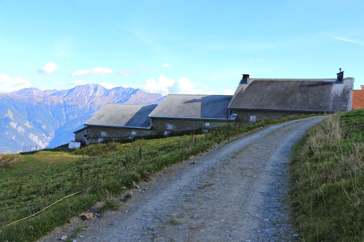
approach a mountain farm building turn
right into a good sized parking area. This is at kilometer 11.8. This location
is N46.90497, E009.50325, at elevation 1750 meter. This trailhead
has already a pretty nice view.
The approach from the west will be described in what follows:
Locate Bad Ragaz, about 23 kilometer north of Chur. The travel time from Zürich airport
should be about 1.5 hours (125 kilometer). Near the center of Bad Ragaz, locate signs that give directions
to Vättis. Follow the signs and drive uphill with sharp curves, then into the valley while the road
stays high on the left side. The distance from Bad Ragaz to the upper (south) end of Vättis is
close to 15 kilometer. As you enter the village, take the left fork and drive to a small open place with
a small gas station / grocery store and a bridge going left across the river. This locatíon is
N46:54.564, E009:26.406, elevation about 940 meter. Keep track of your distance from this bridge.
Continue across the bridge and stay right on Langgasse. After about 100 meter, fork left just before a
water fountain, onto Calandastrasse. This road will cross another small river on a bridge after about
300 meter. Take the second left fork after this bridge, the road has a sign saying Los. The road starts
gently uphill and the pavement ends at about 400 meter. Continue uphill through forest until emerging
at a farmers field at about 700 meter. There is a road fork and a sharp left curve here, also stacks of
fire wood. This is the trailhead, location N46:54.237, E009:26.324, elevation close to 970 meter. Find parking
off the road and without blocking any access.
The small village of Vättis has two hotels. I stayed at Tamina, a very friendly place that also served
good local trout for dinner. as an alternative to driving 700 meter, I just left my car in the hotel parking lot.
Route description:
From the east:
From the parking at the top of the "Berg-weg" from Untervaz, there are two different routes to the
Calanda Hütte. The lower one follows a small road most of the way, the upper variant is a trail.
The two routes are supposed to be similar wrt. hiking time.
I used the upper route, it can be recommended.
Head up on grass, there is a clear trail and it is well marked with red and white paint. The trail eventually
tops out on a small ridge, descends slightly and continues uphill to gain a small col.
From here, one may soon see the hut and the trail
traverses pretty much horizontally, before descending just a little to merge with the
road route. From here, the last short stretch is a trail. You have now arrived at the Calanda Hütte.
From the hut the trail (signed) heads directly uphill on gentle grass slopes, before the steeper mountain slope
higher up. Next, is a traverse uo to the right. This section is wide as a farm road and has clearly been
cut in order to provide good access to the higher (grass) slopes, possibly for cows.
Next, the trail climbs along the cliff (cliff on the left side),
before traversing more right, then zig-zag on a fairly
steep slope that eventually eases before making the main crest where there is a large cairn and a sign pointing
to the route that comes up from the west side.
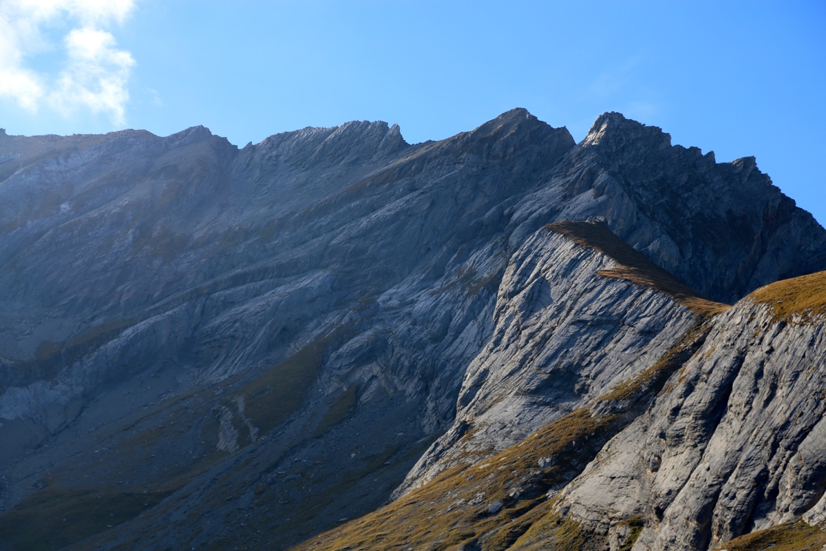
From here, just follow the main ridge to the summit. At one point, the route descends slightly down
a ramp on your left. Just before the summit, you arrive in a shallow saddle with a pretty
big cairn. There is a clear bypass route that again descends down on the left. It is also possible
to climb this last hump, then descend down a small gully (YDS class 3) and regain the trail.
From the west:
From a few meter up the road after the 180 degree left curve, you will see a sign on the uphill side of
the road saying Calanda. Pick up the very tiny trail and proceed uphill. The trail is marked with red paint
on trees as it clings to the unreasonably steep hillside. The trail is clear, but very narrow in places. The
slope that you traverse is mostly very steep, ie. one needs to stay on the trail at all times.
After 500 meter of vertical gain, you reach a somewhat more level plateau at location
N46:53.960, E009:26.528, elevation 1470 meter. Shortly, you will see a cabin on your right, while the trail
curves left before continuing somewaht more gently uphill.
However, the trail is soon back at climbing more steeply in order to reach the top of a small shoulder, from where
it can traverse a steep slope (uphill is now on your left side) and reach a rocky gully at location
N46:53.774, E009:27.168, elevation about 1815 meter.
Cross the gully and continue along a tiny, but clear trail ascending
the steep terrain to the right of this gully. The trail continues steeply uphill with zig-zags in grass terrain among
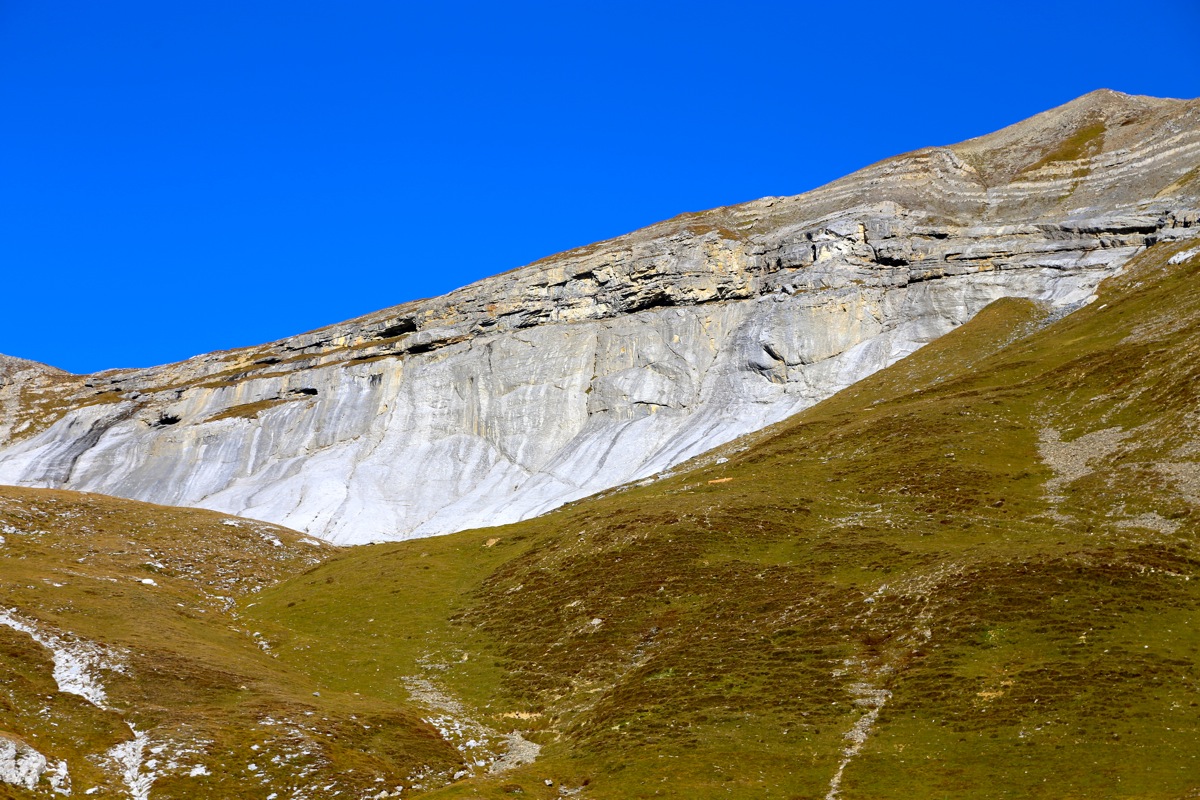
low pine tree vegetation. Higher up, the slope eases somewhat as you enter a sloping valley with rocks at the
upper side. The route traverses a bit right and runs directly towards the rock band where it seems lower. The
trail is well marked here and turns into (YDS) class 2+, the use of hands is convenient, but possibly not
absolutely needed. At the top you emerge at some sort of treshold to a flat, grassy valley with steep slopes
all around. There is a big pole with a solar cell panel and some sort of instruments (automatic weather station)
right in front of you.
Continue straight ahead along a trail that initially is very clear, but then fades out among grass and rocks and
completely vanish. Unfortunately (in 2011), the red paint showing the route is missing as well. There is a
steepish looking crack in the rocks at the far end of the valley, leading up to what appears to be the lowest point
on the horizon towards the east. Climb this narrow passage and reach the saddle. Around here, you merge with the trail
that ascends from the east side of the mountain (from Haldenstein). Turn north (left) and follow the marked
path to the summit, marked with a large cross.
Comments:
August 30. 2011
I had just climbed Piz Bernina and was on my way home to Norway.
Since we had climbed Bernina in only two days, but allocated three in case of weather or any other
possible issue, I realized that I might have time to climb a "bonus peak" on my way back to Zürich.
The obvious candidate was Haldensteiner Calanda, located near Chur and on my way back to the airport.
Unfortunately, I had limited information about this peak, but I knew a few things. The question was if
I should try to hike from the east (where most people go), or try the shorter route from the west.
One option would be to try getting to the alpine hut already on Monday evening. A climb would then
be easy taking into consideration that I needed to catch my airplane around 1400 on Tuesday. We had
lunch in Pontresina before splitting up and by the time I was in Chur, the time was already 1800.
I could hike to the hut, but would then arrive pretty late and long after dark. Taking my available
information into account, I decided it would be better overall to stay in Vättis. I drove there and
checked in on the local hotel Tamina. After an excellent evening meal (local trout), I got organized and
planned an early departure.
I woke up at 0330, packed my car and was ready to go by 0400.
The trail was narrow and traversed steep terrain, this much was clear in the light from my strong
head lamp. At one spot, I missed a sharp right turn and continued on a tiny trail straight ahead that
got so dangerous that I realized it likely was wrong. Reversing my hike, my flashlight quickly picked
up some red trail paint confirming my mistake. Higher up, I passed pretty close to the hut without
seeing it. The time was close to 0600 when I entered a rocky gully and again started to think that I
had lost the trail. This turned out to be right, I relocated the trail and noticed that daylight was
coming. Higher up, I again temporarily lost the trail before seeing that it went up the steep
rocky section that required some easy scrambling.
On top, the little green valley ahead looked very nice. A big pole with quite a bit of instrumentation
had been placed in the flat, grassy area. The trail led straight into the valley a bit up on its
left hand side. Unfortunately, the trail soon vanished and there was no red marker to be seen
anywhere. I looked at the crack straight ahead, but concluded that it could not be the route since
it a) looked bad, and b) there were no red paint markers. The only reasonable way to reach higher
ground seemed to be up a gully to the left of this crack.
Twice already, I had lost the trail, returned back to the last trail marker and carefully found the
correct trail again. Consequently, I descended back to the big pole, got back onto the trail with red
markers, then carefully tried to not loose it. However, this was again a failure. I finally decided to
investigate the left going gully in more detail. There was indeed some sort of (weak) trail ascending and
also some small cairns. Unfortunately, no red painted stripe on any rock. I was pretty sure that I would get
to the summit this way and decided to proceed uphill.
I gained elevation reasonably fast, but the terrain was unpleasant.
Loose rocks on a pretty steep slope.
The whole process slowed me down as I carefully picked my way higher. I realized that the time was closing
in on 0830, 4.5 hours from the start. Assuming that I would need 3.5 hours to descend, I would be back by
1200. Hmmm. My absolutely latest return time should be at 1300, otherwise I would risk not making my flight
back to Norway. It did not look very realistic to summit and be back at this point by 0930. I sat down
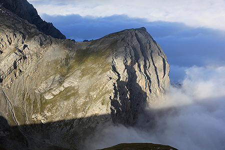
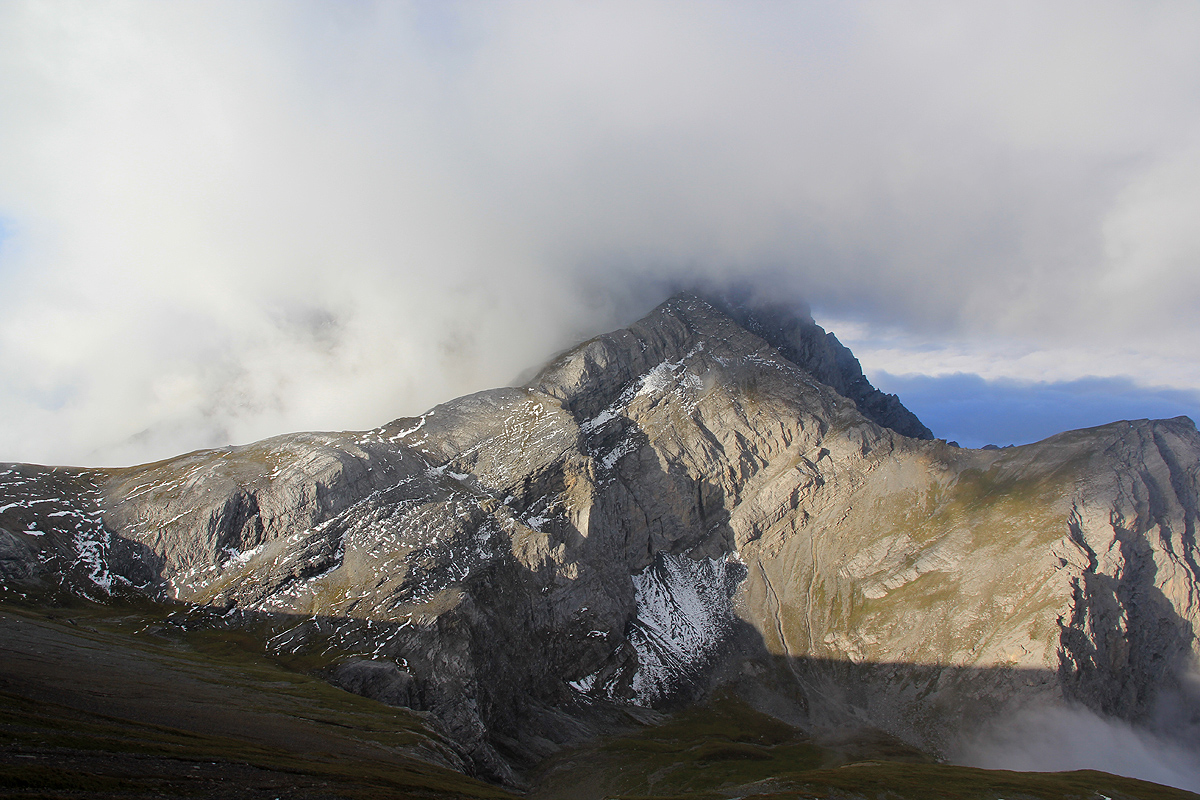
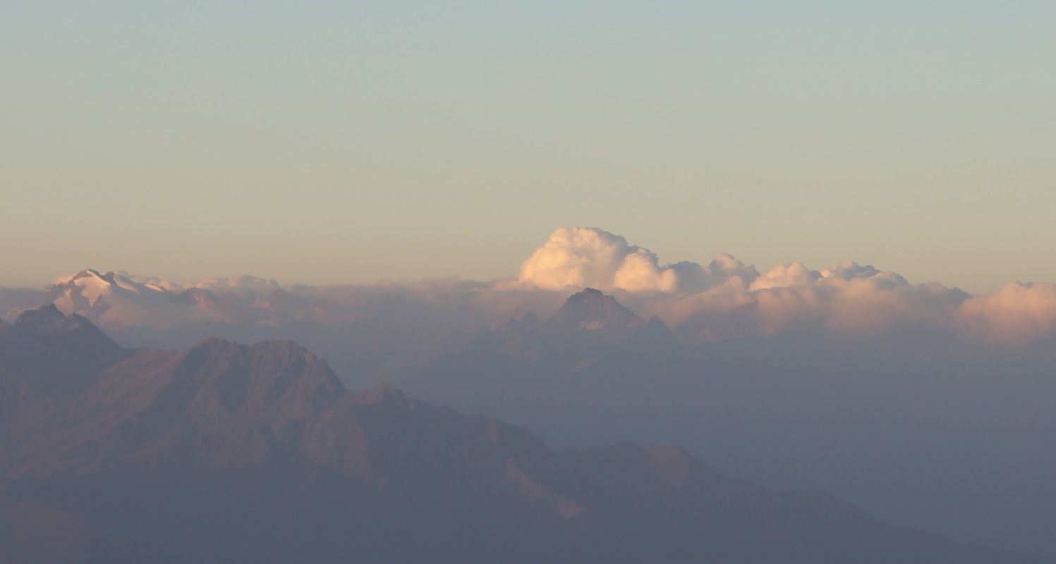
and looked around. The views were a bit obstructed by clouds,
but I could still see summits in several
directions.
After 10 minutes, I got up and started my descent. It was pretty clear that I had lost the route, that
making the summit would be unlikely and that my best option was to hike back down and at least make
my flight home. The descent turned out to be faster than expected and I was back down by 1100. Thus, in theory,
I could have continued my climb and perhaps found a route (off-trail) to the summit. Despite the lack of a summit,
I did have a good trip, all alone, in pretty wild terrain. I ascended about 1700 vertical meter and certainly got
a good dose of exercise before my flight back home.
After getting back, I consulted more with various trips described on the Internet. This made it
clear that the impossibly looking crack, must have been the correct route. The lessons
to be learned are not surprising. A map would have been useful. I tried buying this the day before, but
even the local hotels did not have it. More careful research of the route on the internet before leaving would
have helped. Yes, but this being a bonus peak, my focus had been on the main objective, Bernina. More careful
reasoning when the trail vanished. Yes, with hindsight, I should have attempted the impossible looking crack,
there may very well be some red paint there as soon as you get really close into the place. Yes, one should
remember that there are many examples of routes in the Alps that look "impossible" from a distance, then they
somehow work after all. Here is a map documenting my hike.
October 4. 2014
I left the conference in St. Wolfgang shortly before lunch, but after giving my invited
lecture, then drove via Innsbruck towards Chur in Switzerland. I even got a speeding ticket along
the way. Fortunately, the Austrians are more reasonable than in Norway - it cost me approximately
one Euro for each kilometer above the speed limit!
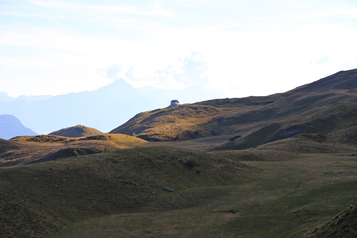
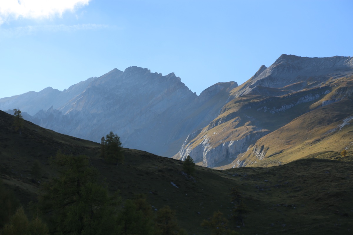
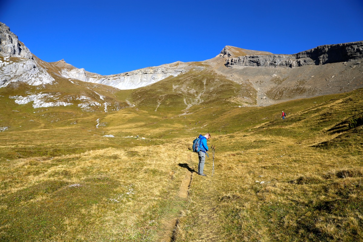
I started hiking at 1600, took the upper route and arrived at the Calanda hut by 1650.
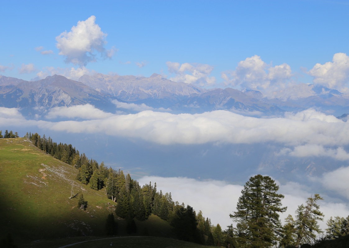
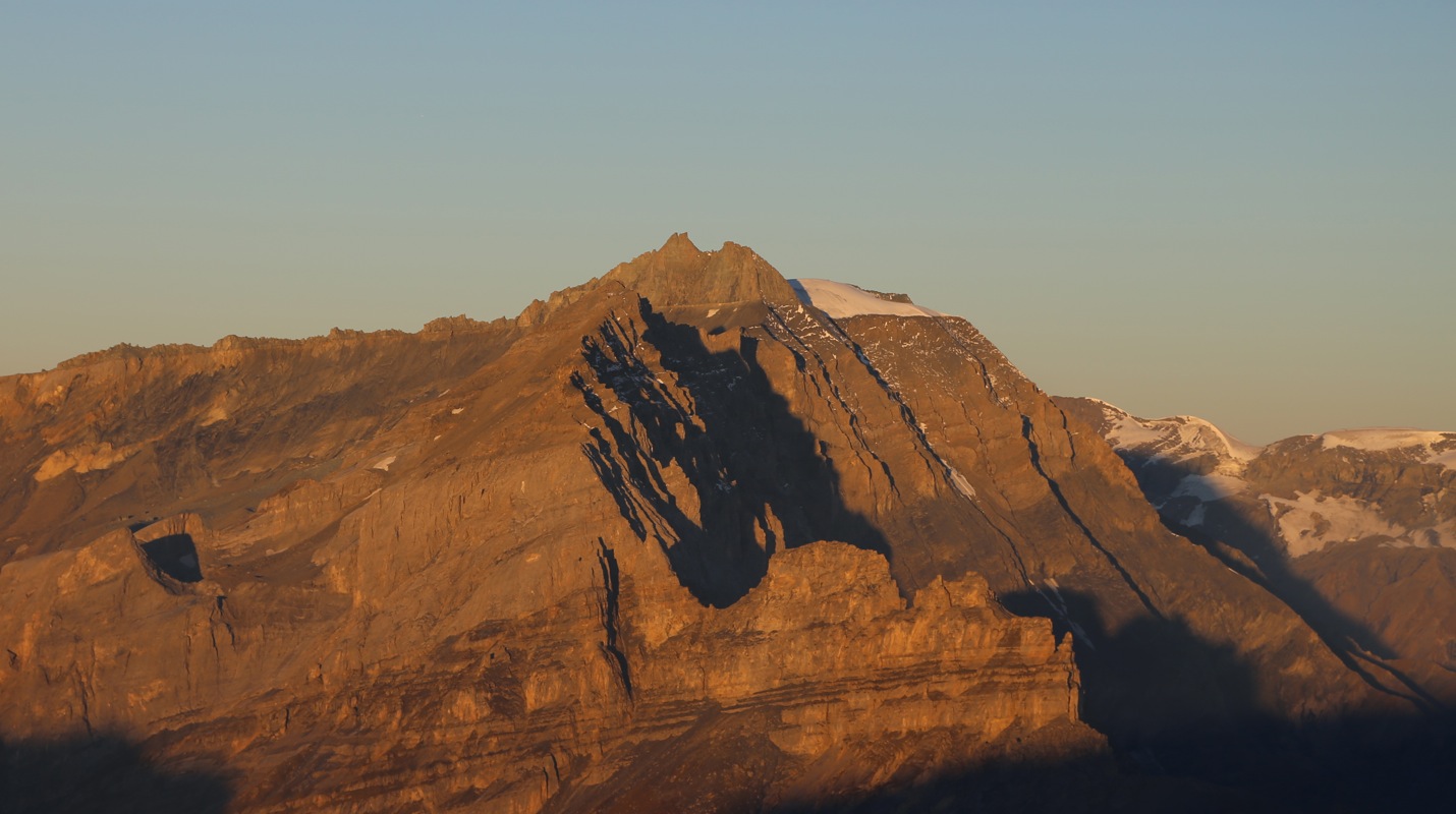
The weather was nice and one sees the mountain ridge while hiking
from the parking to the Calanda hut.
Few people and
a very friendly hut staff. I enjoyed a beer, then a nice 3 course dinner followed by a nice evening
talking with a young couple from Munich and a more senior Swiss man. The hut staff strongly recommended
an early start and sunrise at the summit. Since everybody seemed to go with this idea, having breakfast
after returning from the summit, I also decided on an early start. In fact, in order to make one more
summit and a flight from Vienna, this suited me quite well.
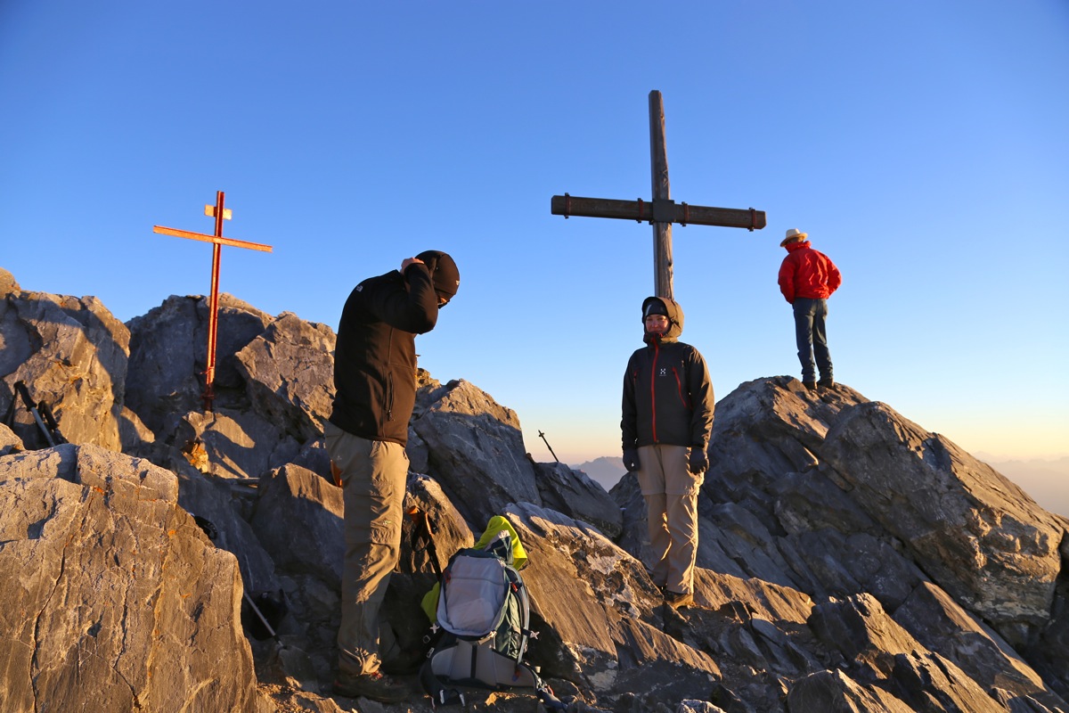
I left the next morning at 0545, a few minutes ahead of the other climbers.
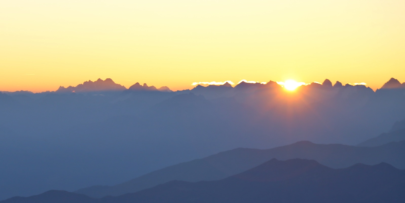
I made the main crest with
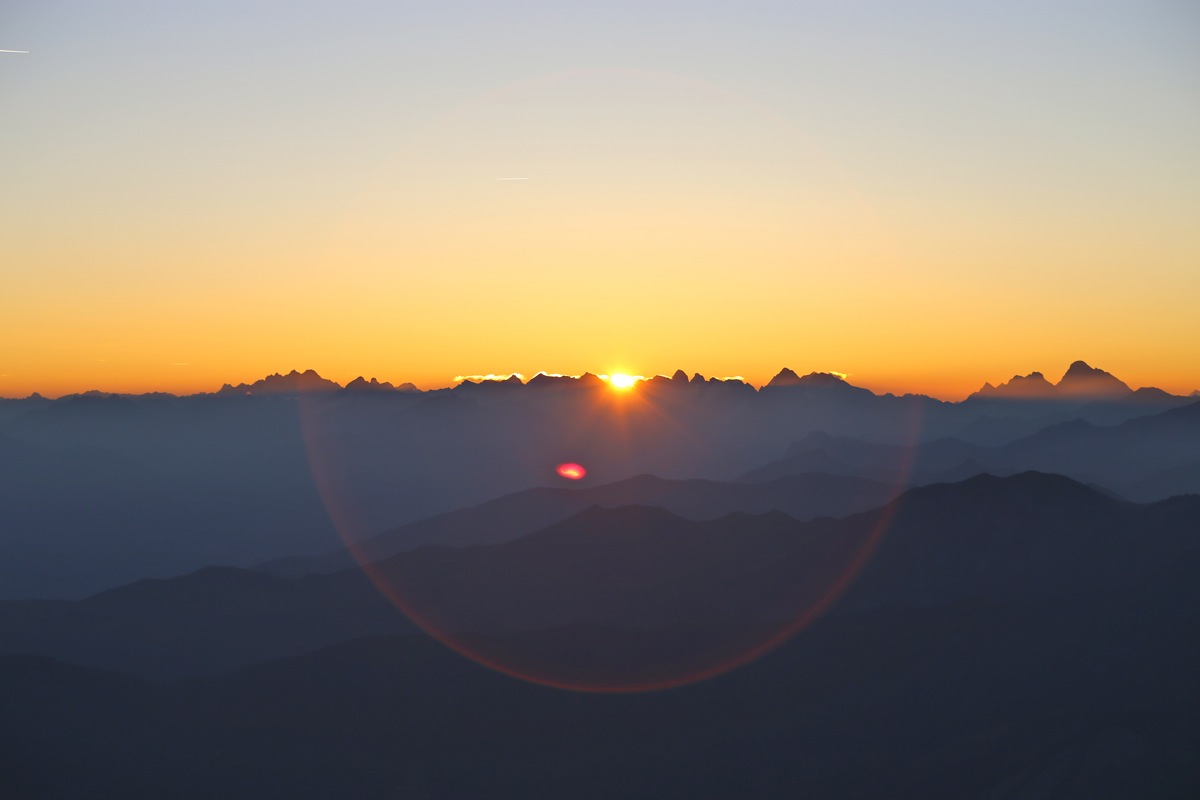
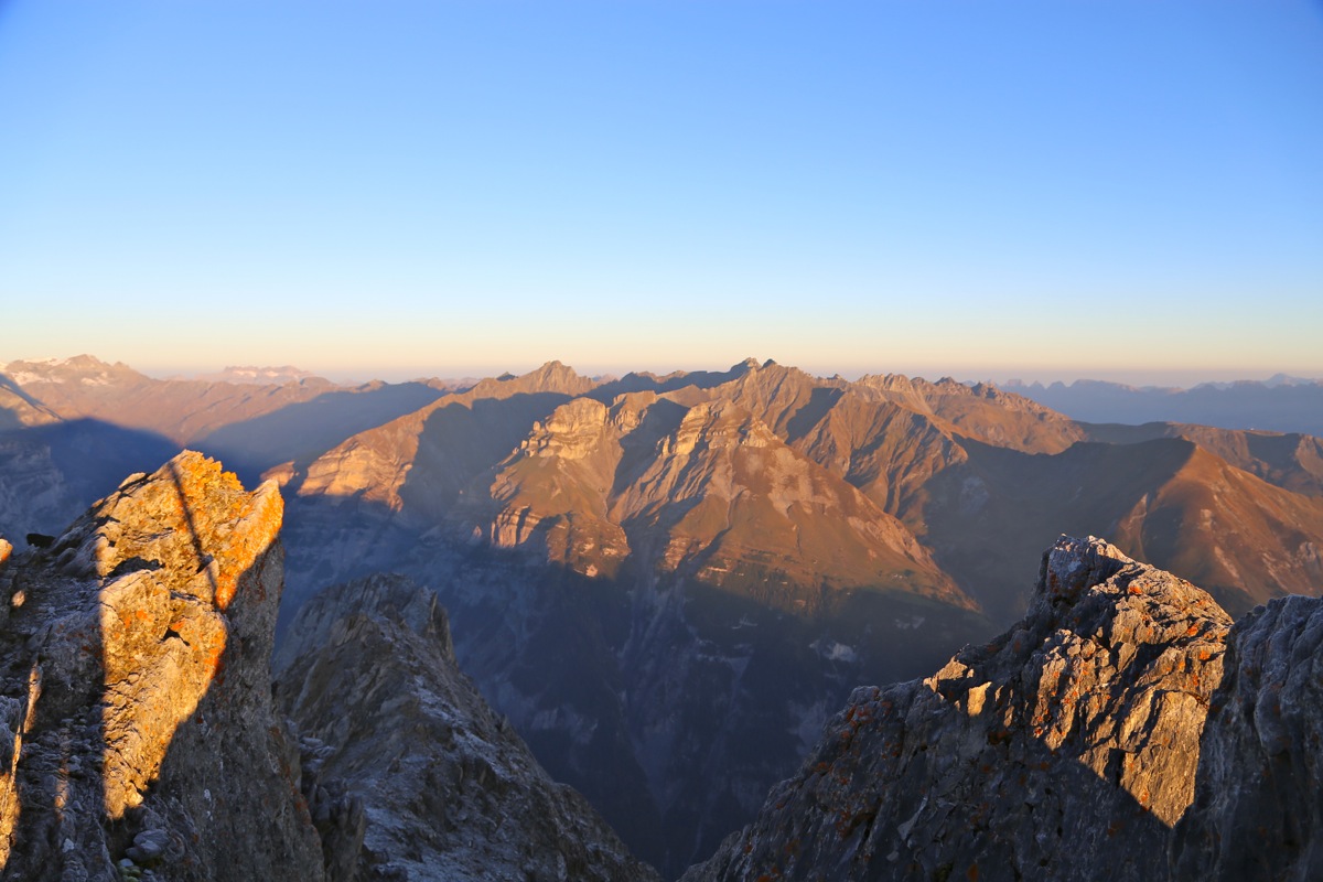
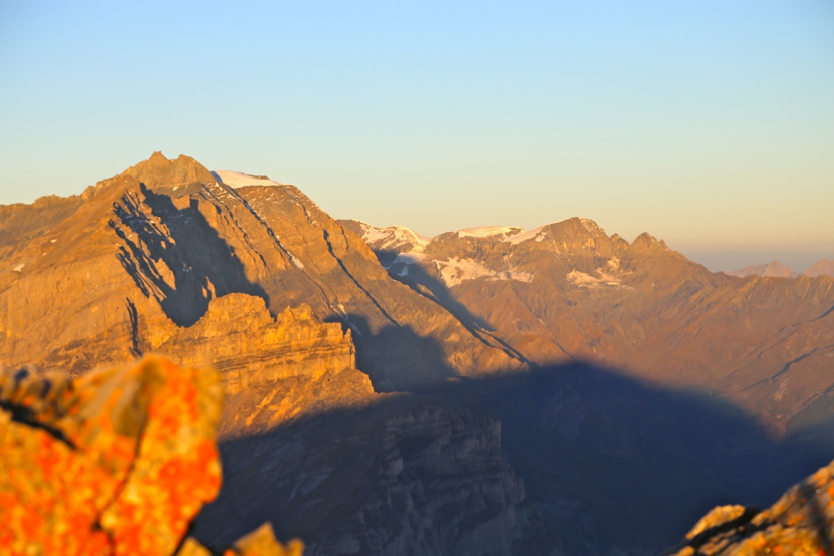
a large cairn at 0645 and arrived at the summit
at 0705, well before sunrise that came shortly before
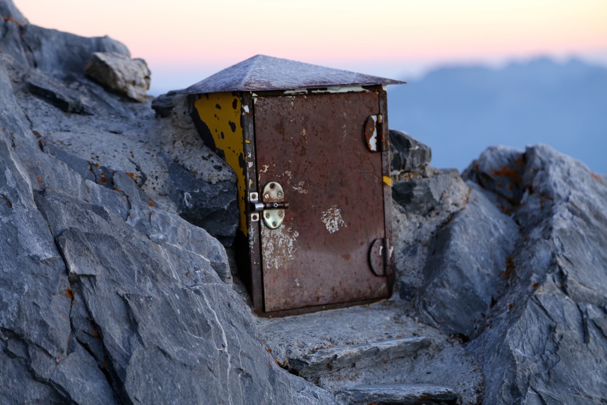
0730. I signed in to the register,
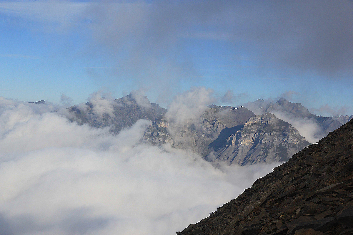
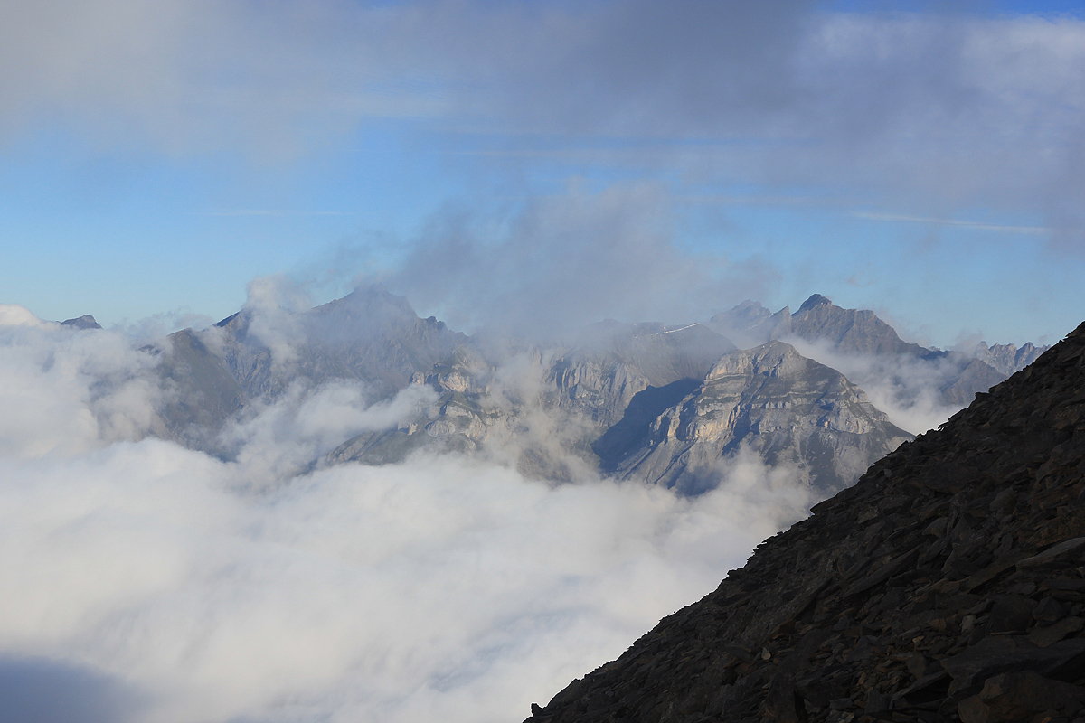
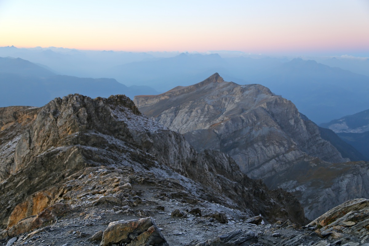
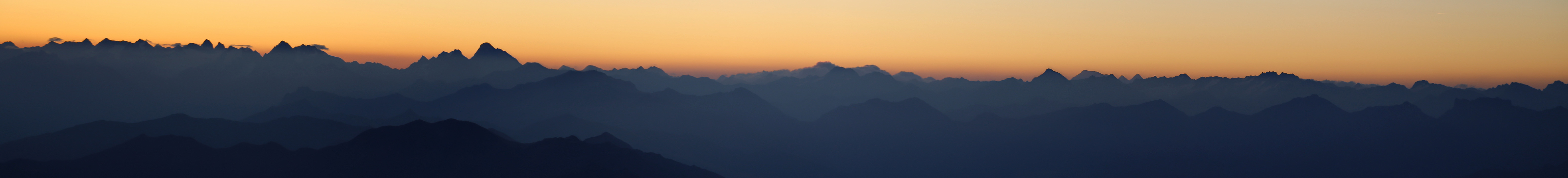
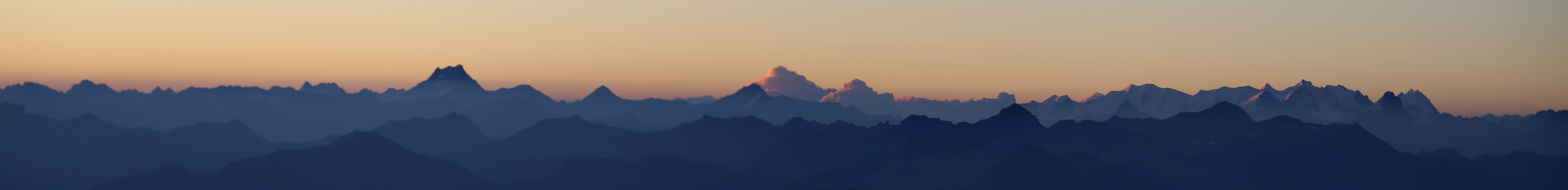
then took some panoarama pictures before the sun would "destroy" the
details of the mountains in the east. There were no signs of other people when looking down
the ridge that I had ascended.
The other party watched the sunrise from the last small
col before the summit, then joined me
around 0740. I finally started descending
together with the couple from Germany at 0810.
We were back at the Calanda hut by 0930. A very nice breakfast outside in the sunshine, October at
2000 meter and the sun really made us warm!
i told everybody goodbye at 1015 and walked back to my car in 45 minutes. Leaving at 1100, I had
ample time to drive back to the base of my final peak on this trip.