Gunung Butak
- Gunung Butak
- 2868 m
- Primary factor 1673 m
- Java, Indonesia.
- Location: South 07.95522, East 112.46515 (GPS at the summit)
- Difficulty: YDS class 2
- Climbed August 2. 2019
Gunung Butak
|
|
How to get there:
This excellent web-site on climbing
Indonesia peaks should always be consulted.
Locate Batu, near the city of Malang. The normal trailhead is only a few kilometer
(west) from Batu, near a village named Toyomerto.
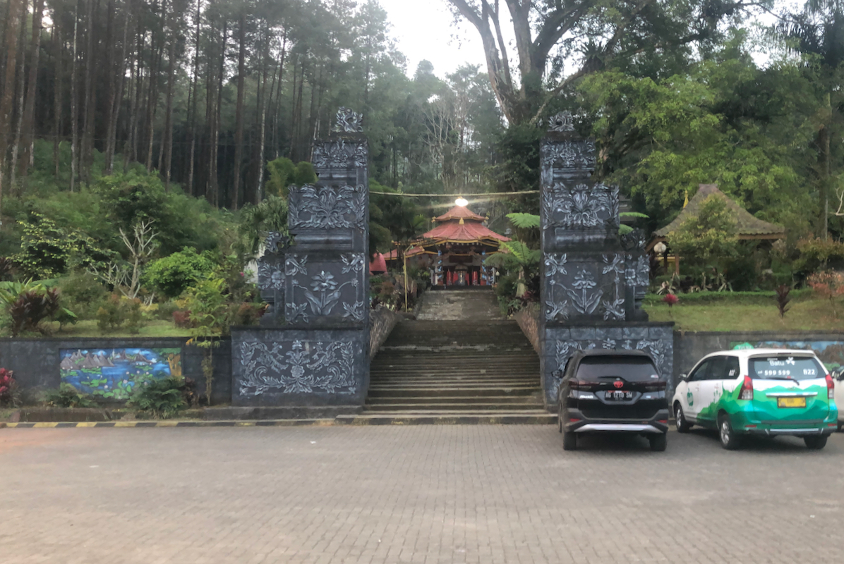
However, I did this climb from a different trailhead (see comments below). This trailhead is
next to a small temple. The location is named Gunung Kawi Bike Park, Jawa Timur.
The location is S08.00307, E112.48588, elevation about 1170 meter.
Here is a summary and quick reference to the climbs on this trip.
Route description:
The trail starts uphill just left of the temple,
ie. exit the parking area left
(when facing uphill). Follow the biggest, most visible trail, there are several
smaller trails in this lower area. The trail runs steady uphill, first fairly gently,
later somewhat steeper. You will notice that the trail climbs a ridge as you
move higher.
After what might seem as a pretty never-ending uphill, (almost 1400 m vertical gain)
one finally tops out
on a small summit at location S07.97532, E112.47690, elevation about 2540 meter.
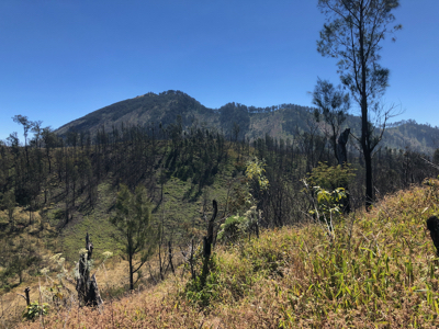
From here, you see Butak, the highest peak
due left as you look uphill.
The trail becomes quite overgrown from here and the rest of the way. However, there is
a trail all the way and loosing it means a lot more trouble. If off-trail, immediately
back-track and regain it. There are places where it is virtually impossible to
move without a trail.
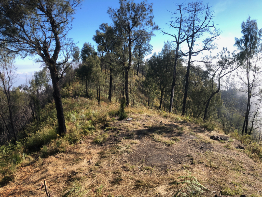
Descend to the small col, the trail turns right (bushy!) before ascending the next slope.
The next summit is actually part of a short ridge
extending to the right. There is a nice
trail heading that way where you will gain
the summit of Gunung Pitrang, well worth the
short side-trip.
From here, the trail (very overgrown in 2019) continues across, then descends to a small
valley with grass, runs right and contours (left) nicely (less overgrown) around a local hill
before descending to the main col before Butak at location
S07.96470, E112.47621, elevation about 2470 meter.
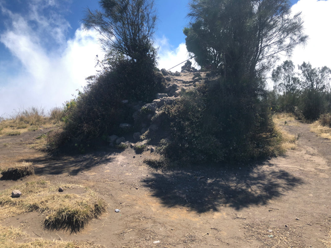
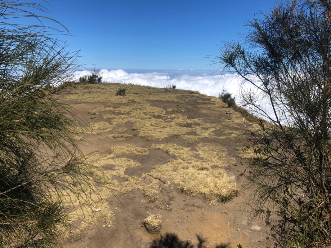
From here, the trail ascends to the east ridge of Butak, then follows it as it curves right (north)
crossing a small hump along the way, before reaching a pretty flat summit
plateau with a single higher point defining the summit.
Comments:
We arrived at our hotel in Batu as planned (via train from Madiun to Malang) and
I immediately tried to organize transport to the trailhead the next morning. This was going
to be easy, no hike on my trip to Java would have a shorter travel, the trailhead located
only 8 kilometer from the hotel.
However, I was quickly informed that they had recently (last week) had a big forest fire in this
area (Pandermon mountain) and that officials had temporarily closed all trails in this area.
Bad news that called for some immediate change of plans. After a bit of hectic searching I was
able to locate a possible trailhead on the south side of the mountain. No information about
the quality of this trail. This also meant a longer drive, there were no roads connecting
across, it seemed like I needed to travel via the city of Malang both to and from the trailhead.
A taxi was booked for 0615 the next day. Suddenly, this climb looked much less clear than
what I had assumed.
I departed by taxi as planned,
the morning traffic in Malang about as bad as I guess
it is most of the time. The last part of our drive was not without complications.
We came up into the upper village and there were several signs for parking. I asked the
driver to ignore this, but eventually we were stopped by some locals on motor-bikes and
guided to a parking area. This was not my intended trailhead. I asked if I had to continue
by ojek (motor bike) and everybody nodded. OK, the driver agreed to wait here. The bike took
me to some sort of temple very nearby. When I told him that this was incorrect, he started
driving downhill, obviously for later again to go uphill. I realized that this would mean
BIG trouble when returning. I finally ended this story by asking the guy to drive me back to
the taxi, insisting that I needed to continue travel by car. So after waisting about 30 minutes,
we finally could continue driving.
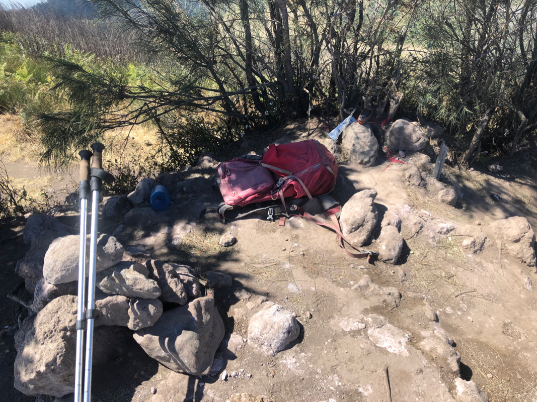
This time, we drove all the way up to a nice small parking just in front (below) a nice looking,
small temple. Again, I told the driver that he had to wait until I returned, it was quite a bit
uncertain how long this climb would take.
I finally was on my way at 0850. In the beginning, I picked a couple of not so good trails leading
uphill, there were several options. After fighting some bush with trails that sort of faded out,
I got onto the correct trail climbing more or less straight uphill. The slope was quite reasonable and
the trail fairly good.
I gained 620 vertical meter in the first hour, then 630 meter in the second hour. What a seemingly
endless uphill. After about 2 hours, I top out on a small hump on top of the ridge I have been
climbing. The trail certainly got steeper in the higher section. From here, I can see across to
the summit of Butak.
I have gained most of the vertical and only spent 2 hours - things are
looking good.
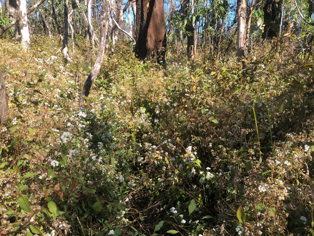
However, this outlpook quickly changed as the trail now
became excessively overgrown.
Yes, if looking carefully under all the vegetation,
one would see the narrow path with dirt.
Walking right on this line would also mean that the vegetation would split aside and not
block your legs. It still was very easy to get like one meter off the track since there
was no easy way to actually see the path hidden below all the vegetation.
Thus, progress slowed down considerably. It also turned out that I would have to loose
more than 100 vertical meter here in order to cross the saddle separating
Butak from the area my trail was crossing. All this took time before I finally at
1315, arrived at the summit.
The ascent had taken 4:25, thus with a somewhat late start
I realized that I would be down only shortly before dark.
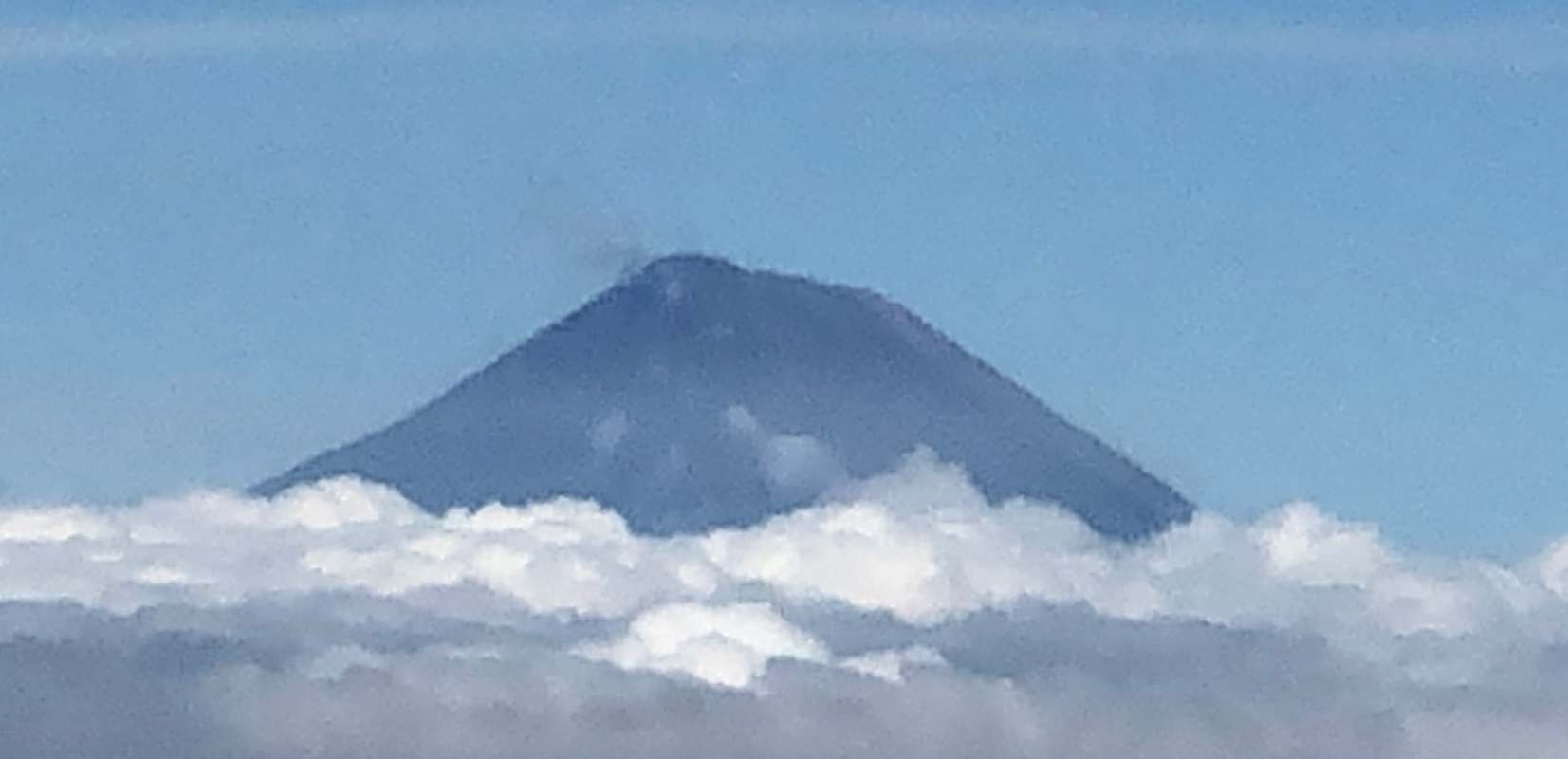
Still, a brief rest was in order. The view across
to Gunung Arjuno was nice.
The summit was a small hump from a fairly large,
flat summit plateau.
I left at 1330, took the extra time to visit the summit of Gunung Pitrang, but
otherwise pushed on in order to not get my taxi driver too worried. I arrived
back down at 1715, not much before dark. The driver had been waiting there
since before 0900 and certainly wanted to get back home. Friday evening
traffic was (as always!) pretty bad and we did not get back to the hotel
before 1900.