Location: North 38.32380, East 028.10245 (GPS on the summit)
Difficulty: YDS class 1
Climbed July 3. 2016.
Information:
How to get there:
The city of Ödemis located east of Izmir, is a good point of reference.
Travel east on D310 (the main street) through the city. Shortly after leaving the main part of
town, turn left on the road signed for Birgi (and Salihli). In Birgi, go right across the bridge
(dry river), then turn uphill and drive a long street, nicely lined with trees. On the top,
go left where the road forks, the next village higher up is Kxx
Route description:
From the trailhead, just follow the 4WD road as it zig-zags up the slope. The road tops out
on the main crest and the summit is a very short stroll to your left.
Comments:
We had arrived in Ödemis after driving from Bursa, and checked in to hotel Guven in the
center of town. I left around 0600 and parked at the trailhead shortly
before 0700.
Leaving at 0700, the hike was straightforward. I noticed a herd of sheep higher up, but could see
no shepard and, more importantly, no sign of dogs. Arriving at the summit at 0745, what is special
here is the chairlift that comes up from the north side and has its top station at the very
summit. Obviously, one can hike this mountain easily from the base on the north side. The access
by car is most likely also more direct. In winter, perhaps this peak can be ascended by chairlift!
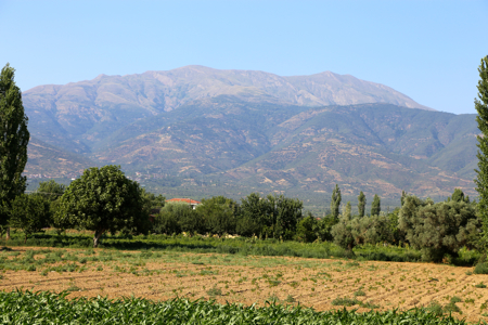
I spent about 15 minutes looking around. The city of Ödemis way down on the valley floor.
The mountain continues with a ridge going east, having two minor summits. I left at 0800 and was
down by my car at 0830.
Here is a quick summary of peaks climbed in our trip to Turkey.