Cerro Botella Azul
- Cerro Botella Azul
- 2950 m.
- Prominence: 260 m
- Baja California, Mexico
- Location: North 30.97134, West 115.39462
- Difficulty: (YDS) class 2
- Climbed December 17, 2022.
Cerro Botella Azul
|
|
How to get there:
Drive south from San Diego to the border at Tijuana, cross
into Mexico and continue south on Hwy. 1. There are 3 toll stations
on the road to Ensenada, 124 pesos in 2022. Continue south to location
N30.9667, W116.1547, where the road serving the national park Sierra De San Pedro Martir.
Driving time from San Diego to here should be about 4 hours, add time for the
border crossing.
The drive from Hwy.1 to the park entrance is on a good paved road, allow about 2 hours.
At the park entrance, you will need to register and pay a park fee per day and per
person. This was 64 pesos in 2022. Note that the park road close at 1700 in the winter,
it also may close when there is snow.
Continue to drive on the main park road to location
N31.02252, W115.47421, where you turn sharp right onto a dirt road.
This road requires high clearance and preferably 4WD. There is a sign
saying Mirador shortly before this turn.
Drive this dirt road to location N30.99889 W115.44959, where it ends. There
is a campground here. This is the trailhead, elevation about 2460 meter.
Route description:
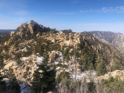
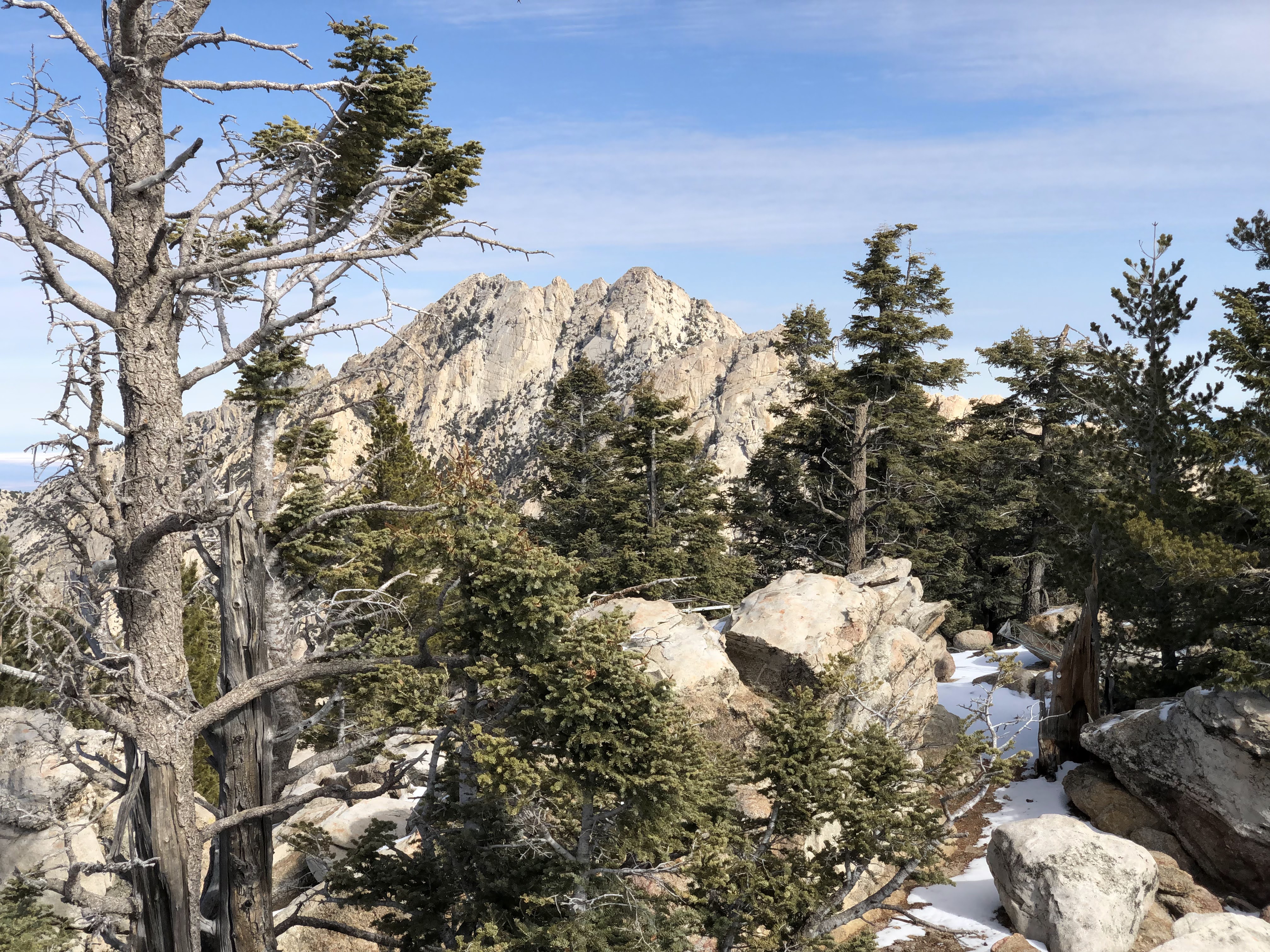
The first part of this route is getting to Blue Bottle Pass, at location
N30.97311 W115.39610, elevation about 2830 meter. There is a trail more or less
all the way, however with several location where it is easy to loose it. It is
highly recommended to download a GPX track for the route. A good one can
be found on Peakbagger,
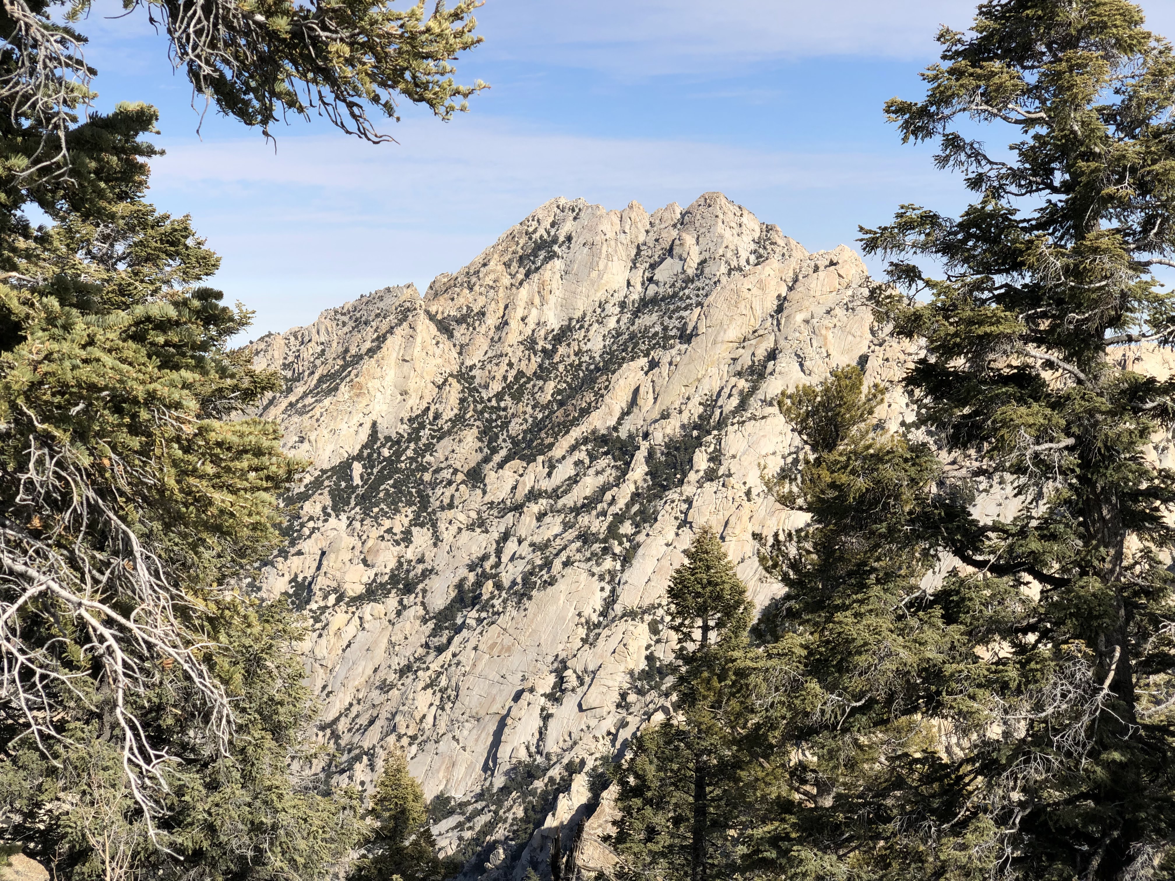
Once in this pass, the summit is up to your right when looking across at the imposing peak
Picacho del Diablo. The terrain is easy (YDS) class 2, ascending slightly more than 100 meter
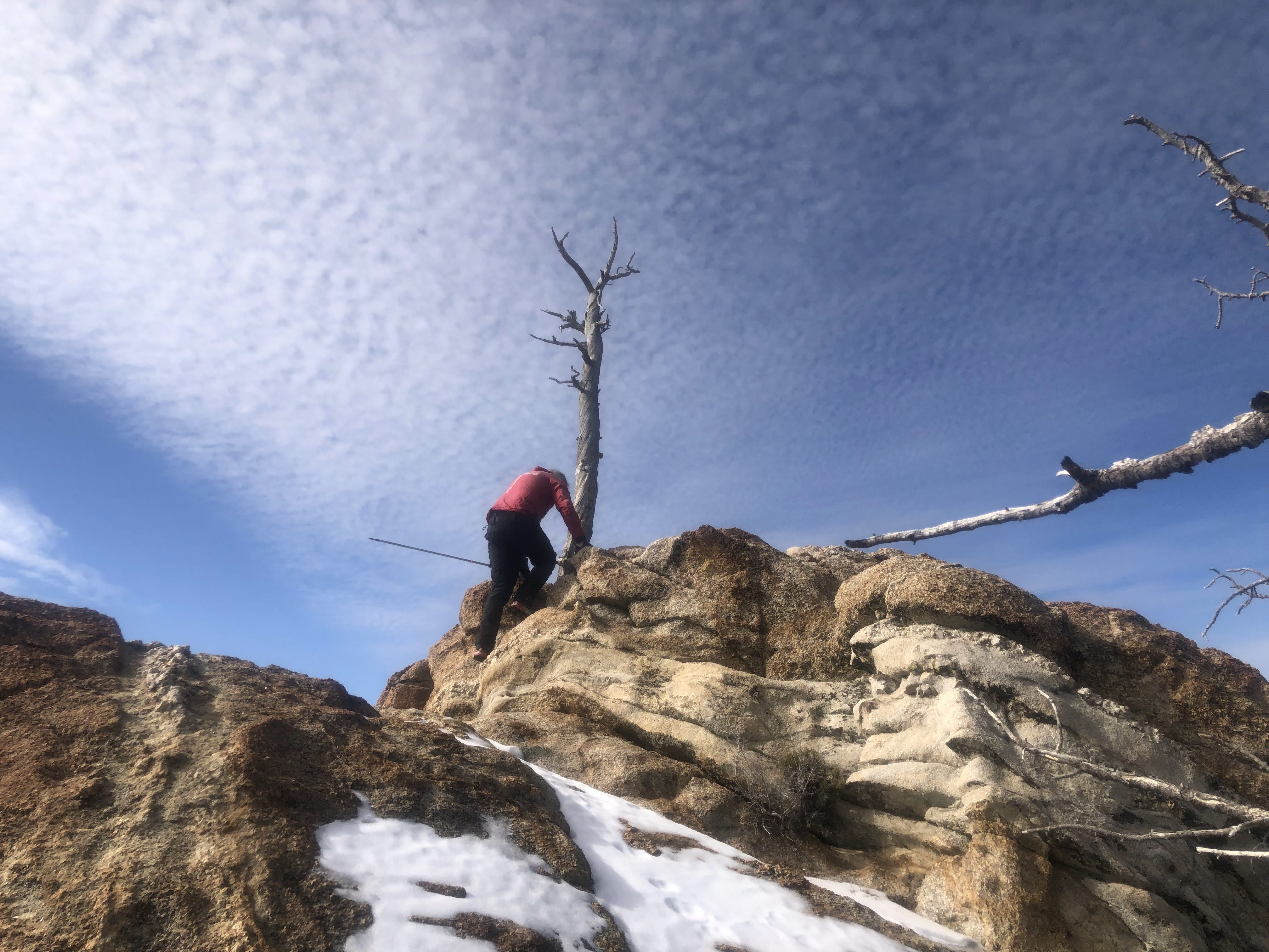
vertical. The summit is located on a rock,
an easy scramble gets you
to the very top.
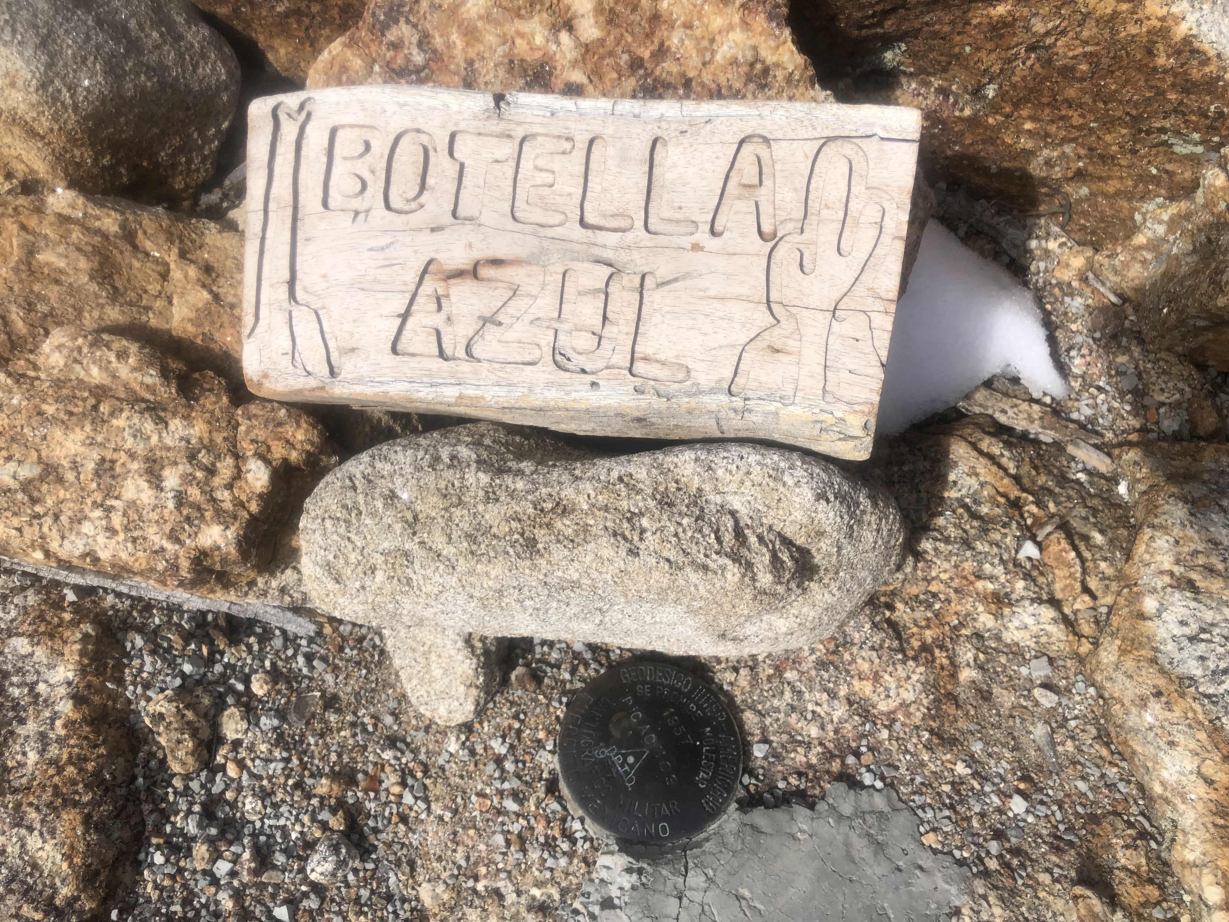
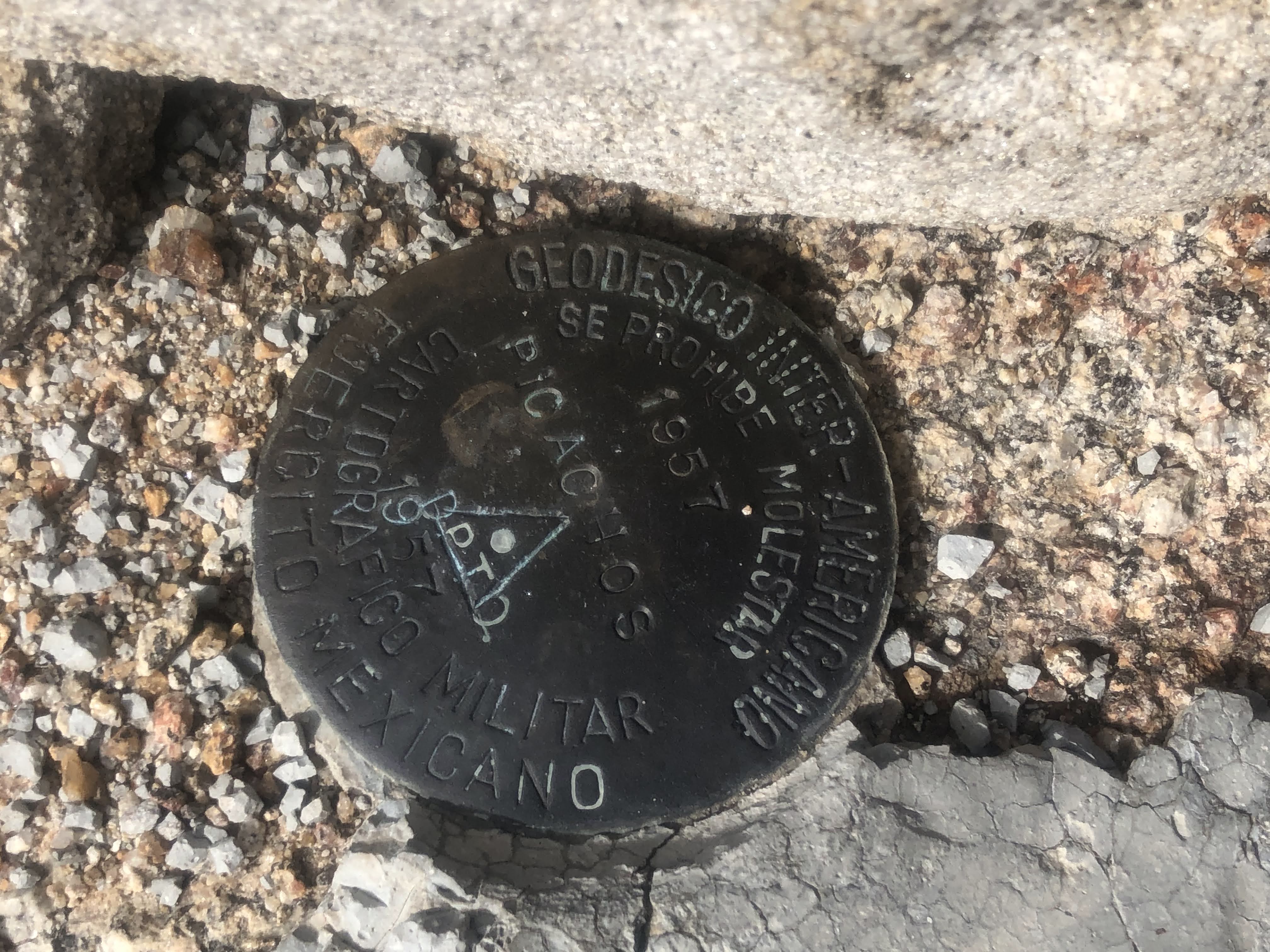
There is a wooden summit marker right
next to a trig. survey emblem. This summit
is only 145 meter lower than Diablo,
but the route descends more than 1000 meter
in order to get there.
Comments / Trip report:
See my report for the peak Picacho del Diablo.