Location: North 39.39402, East 020.99341 (GPS at the summit).
Difficulty: YDS class 2.
Climbed October 15. 2021.
Information:
How to get there:
A point of reference is the city of Ioannina. Head south, you cross highway A-2 (may exit from this major road).
Drive across some interesting landscape (the road runs on top of a huge, steep hillside) to location N39.41713, E021.01000.
(Enter this coordinate into Google Maps or some similar navigational tool.) A narrow, paved road heads directly uphill
right next to the wall of the church. Continue up this road until a T-fork (loc. N39.41866, E020.99275). Turn left,
the paved road ends shortly at location N39.41441, E020.99460, elevation about 790 meter. Continue on a pretty
good dirt road (normal cars should be able to drive here). The road traverses the hill side, continue to location
N39.39804, E21.00453, elevation near 1130 meter. A road forks sharply right at this location. Normal cars should
park here, make sure not to block any access.
If you have a 4WD vehicle, you may turn sharply right and continue uphill. This road is somewhat steeper and somewhat
rougher, sizeable rocks are sometimes on the road surface (mostly avoidable). There is good parking (my trailhead)
in a right curve at location N39.39584, E020.99999, elevation near 1370 meter. One may also continue to the highest
point of the road where at least one car may park off the road.
Route description:
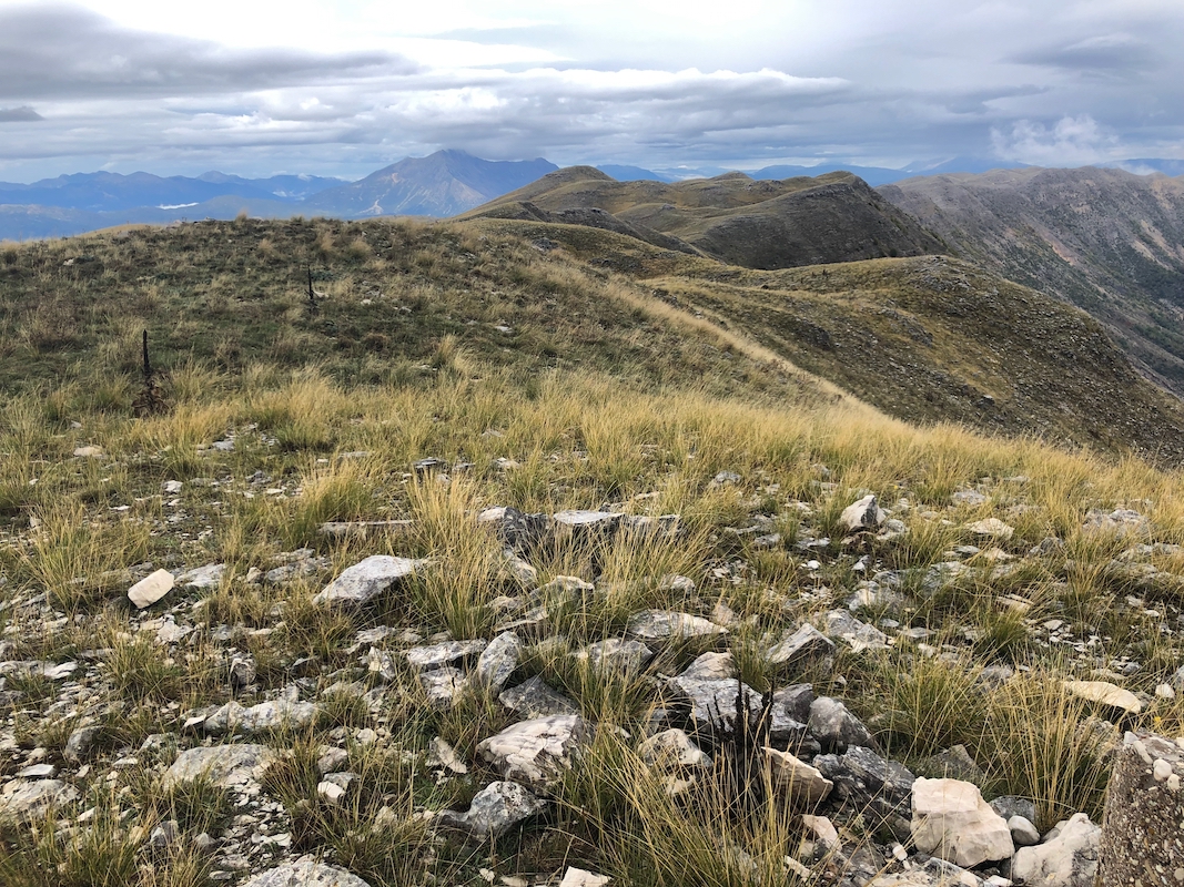
Follow the road to its highest point, near 1450 meter of elevation. Walk 10 meter past the highest point to
find a small trail that turns the fence. Follow the ridge to the summit. There are pieces of a trail in a few
places, but the terrain is good to walk anywhere.
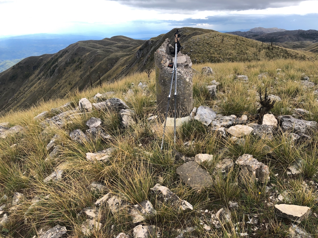
The summit is marked by a concrete cylinder.
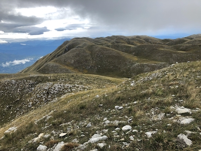
Note that there is a competing summit off
to the North-West. This summit is 1 kilometer to the NW (as the crow flies).
Follow the natural ridge across, the lowest point on this walk is near location N39.39855, E020.98742, elevation
about 1590 meter. Until more accurate measurements are possible, one should visit both points. It is a nice
walk with good views - recommended.
Comments:
I drove to about 1370 meter. The weather was not nice, it had been raining since early
morning. I parked at this location because I did not know if there would be any good spot
higher up. At least, here I knew that my car would be well parked. The road is sufficiently
airy that one should drive with care and make conservative choices.
I left at 1110, quickly gained the highest spot of the road, noticing that there was a safe
spot for parking also there. The remaining climb was easy and I arrived on the summit at 1130.
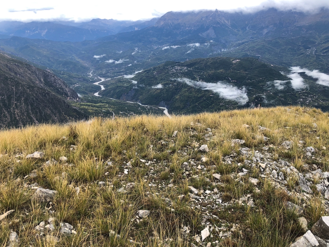
Fortunately, the rain had stopped and I even had some good views.
The view down into the valley
is quite impressive. Looking north-west, I immediately noticed the competing summit almost
exactly one kilometer away. The walk over there was straightforward. I arrived at 1200.
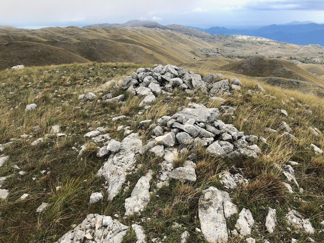
The summit is marked with a pile of rocks.
My return walk being equally pleasant, back at the
first summit around 1225.
GPS measurements confirmed that the summits are too close to call. Finally, descending in 20 minutes back
to my car at 1245.