Location: North 65.97995, E014.21585 (GPS at the summit).
Difficulty: YDS class 4.
Climbed September 18. 2021.
Information:
How to get there:
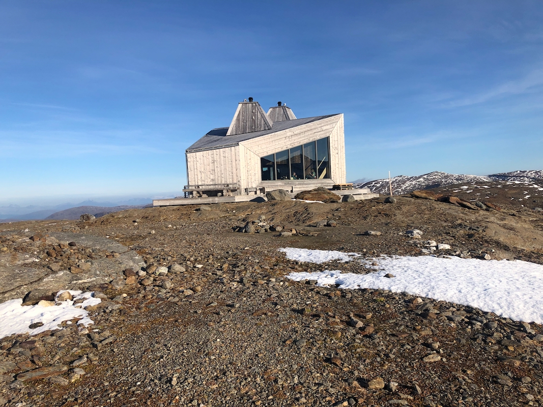
The natural starting point is the very nice DNT Rabothytta.
This hut is located next
to the glacier at N66.00606, E14.13949, elevation 1188 meter.
In order to get there, locate the small village of Korgen on Hwy. E-6. This is just
north of the long tunnel between Mosjøen and Mo i Rana. Take Hwy. 7352 east into
Leirskarddalen. The road changes to dirt and climbs the hillside. Find parking near the
trail head, there are signs and red T marking. The location is near 650 meter
of elevation near N66.018, E14.0987.
From here, foillow the well marked trail to the Raboyhytten. This is about 5 kilometer
and should take less than 2 hours.
Route description: From the hut, head directly towards the glacier, descending slightly in order
to reach the ice. Ascend a pretty gentle slope to reach the main plateau, where you
turn a bit left and head directly towards the peak. Gradually bear left without loosing
(much) elevation, then approach the peak just left of some visible rock. There is a
crevasse here that should be
crossed on a safe passage. Ascend the slightly steeper slope,
keepa bit left for the best (low) angle and head for the skyline ridge going left
as seen when ascending. Turn right and traverse while staying well away from the ridge line.
(there is a big, steep drop just beyond the ridge.) Traverse into the rock face, descending
just a little. Traverse right on the lower rocks along a pretty natural route that will
get you to a pretty obvious gully
that runs up to the north ridge. (That is, this gully
will connect to the ridge well to the right of the summit as seen from below.)
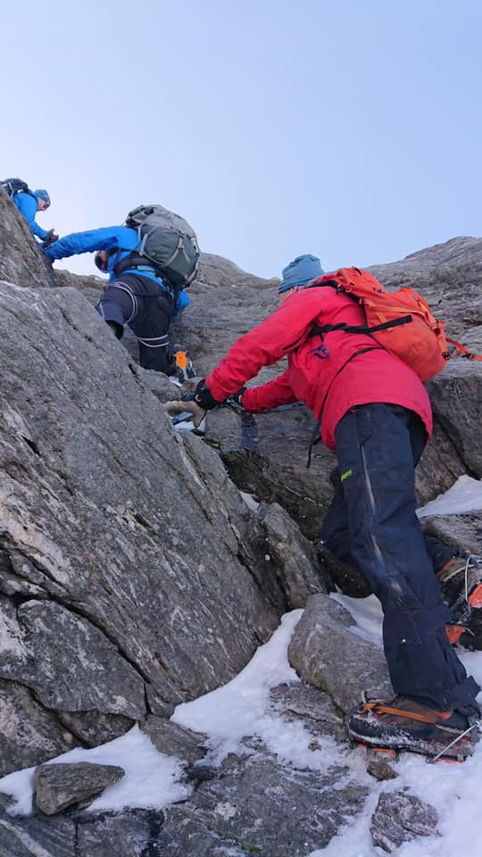
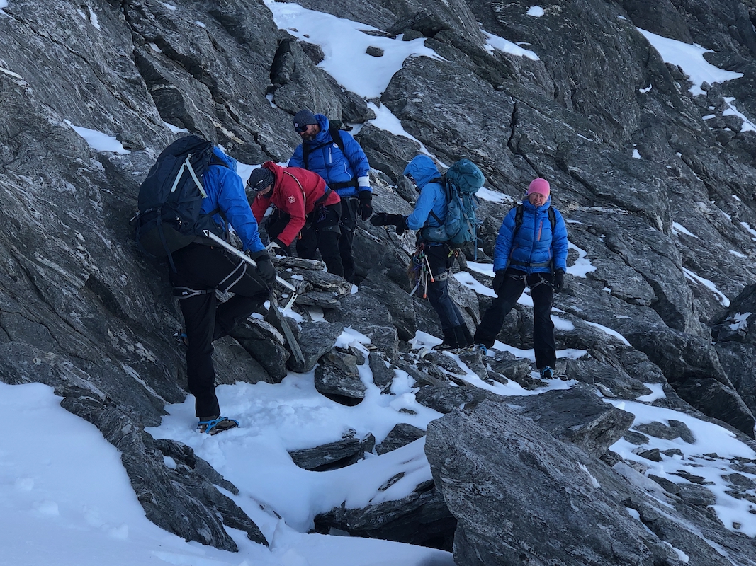
Scramble up this gully (YDS class 3) to reach the main ridge. Turn left and continue
uphill on slightly easier terrain. You will then arrive at the crux, a single class 4 move where
some stepping stones have been placed on the ground to make the uphill move somewhat
easier. There is a single very good handhold on top, but this may initially
be just out of reach.
Above, the slope is more gentle and the climb ends with
a short walk
to a nice summit. Comments:
This was the annual fall meeting of the Board of Erling Bjørstad's Stiftelse.
DNT came with Dag Terje, Anne-Marie and Tor. Berit was elected to the board just this
August, while Thomas also served last year.
We had hiked up to Rabothytta the previous (Friday) day and enjoyed a nice
dinner prepared by Dag Terje.
The weather promised to be better than the original forecast.
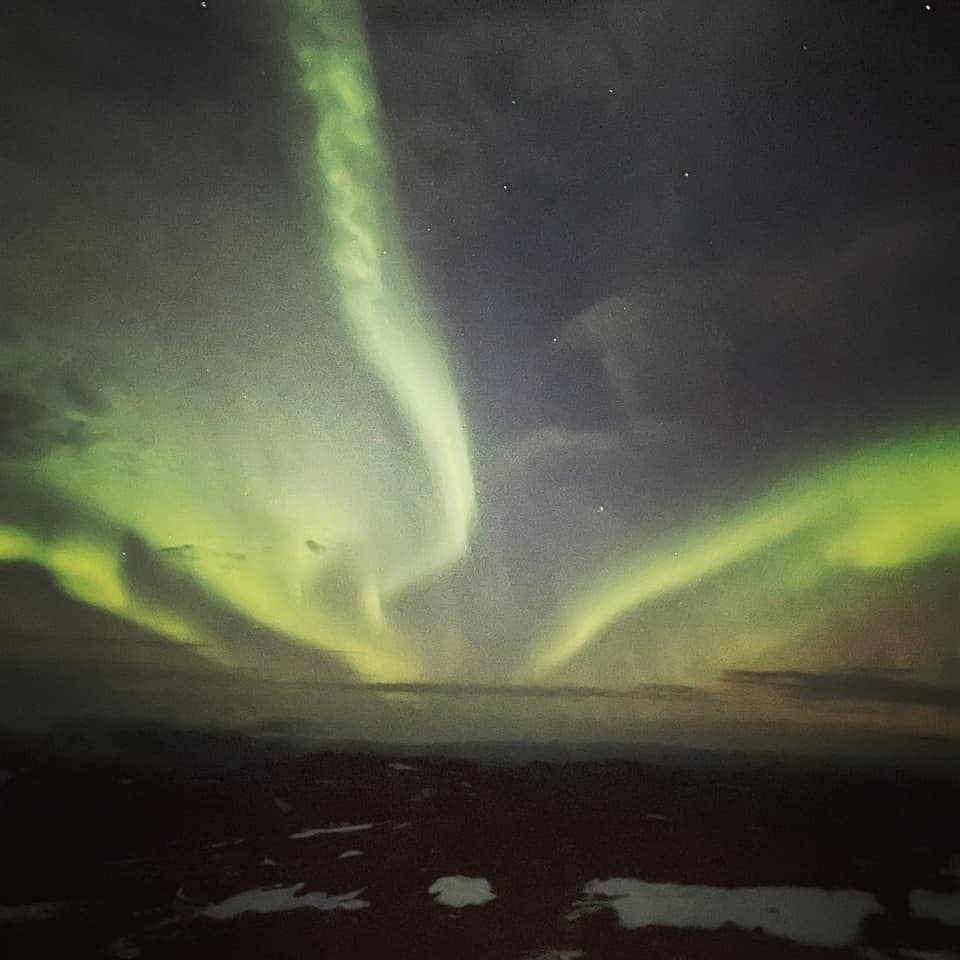
The sky was filled with Northern Light
as we prepared for bedtime.
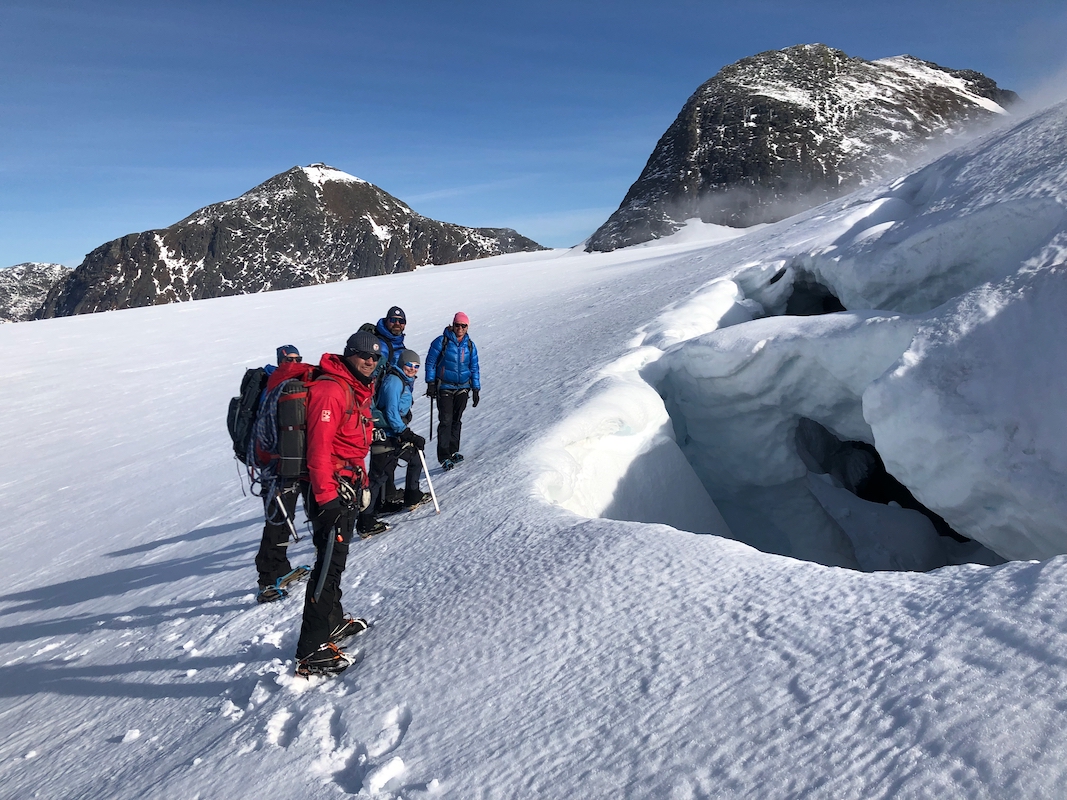
Today, Saturday we should first have a mountain trip,
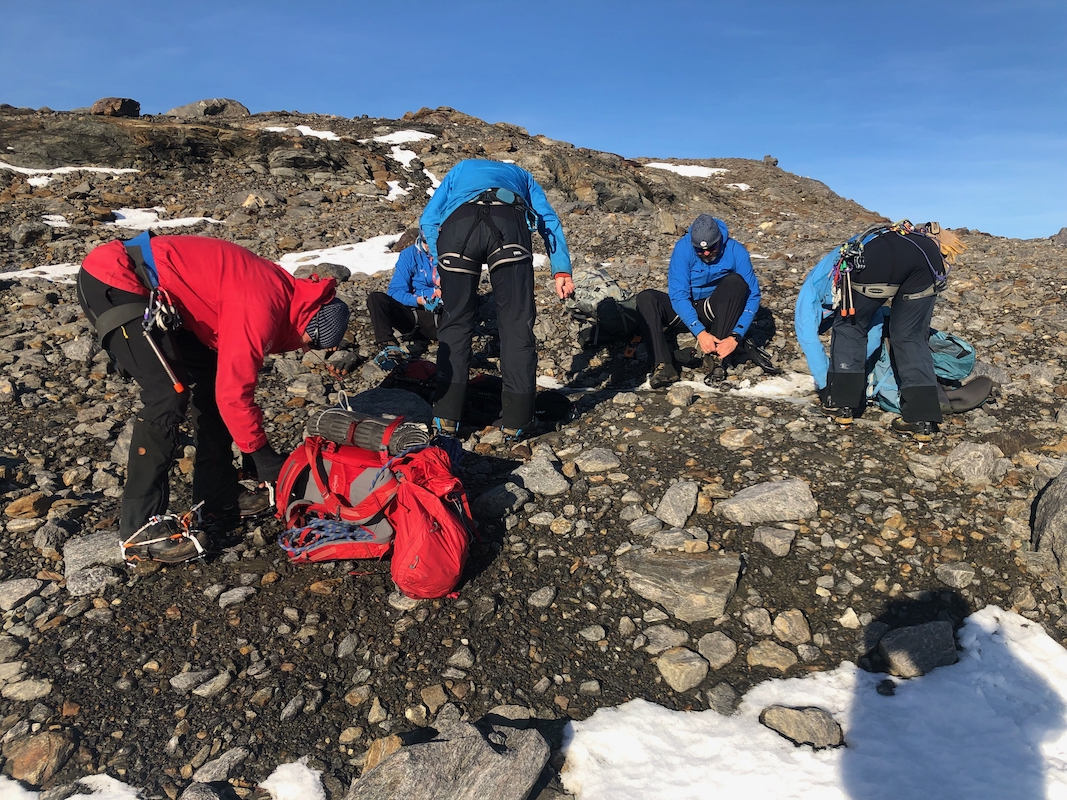
then the meeting of the board. We all put on crampons
shortly after leaving
the hut around 1000. The glacier was essentially crevasse free. There was no
snow layer on top, a very safe glacier hike.
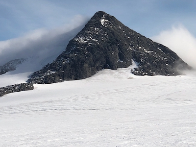
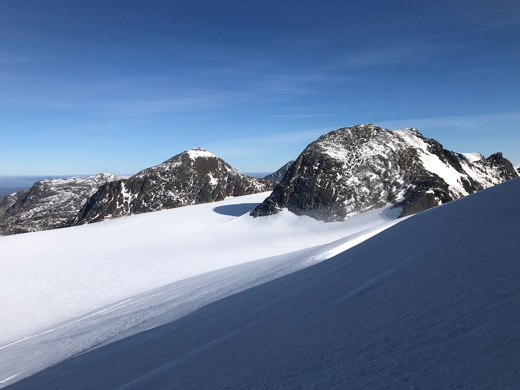
We soon set course for Vesttinden. It looked
like a good route to ascend to
the snow ridge that extended north-east.
We gained elevation on the snow slope, avoiding one pretty large crevasse before
arriving at the base of the rock pyramid. I spotted a gully that appeared to offer
a pretty non-technical route. A short scramble brought us into this gully and moving
up was just as easy as promised. Higher up, frozen water on the rock surface
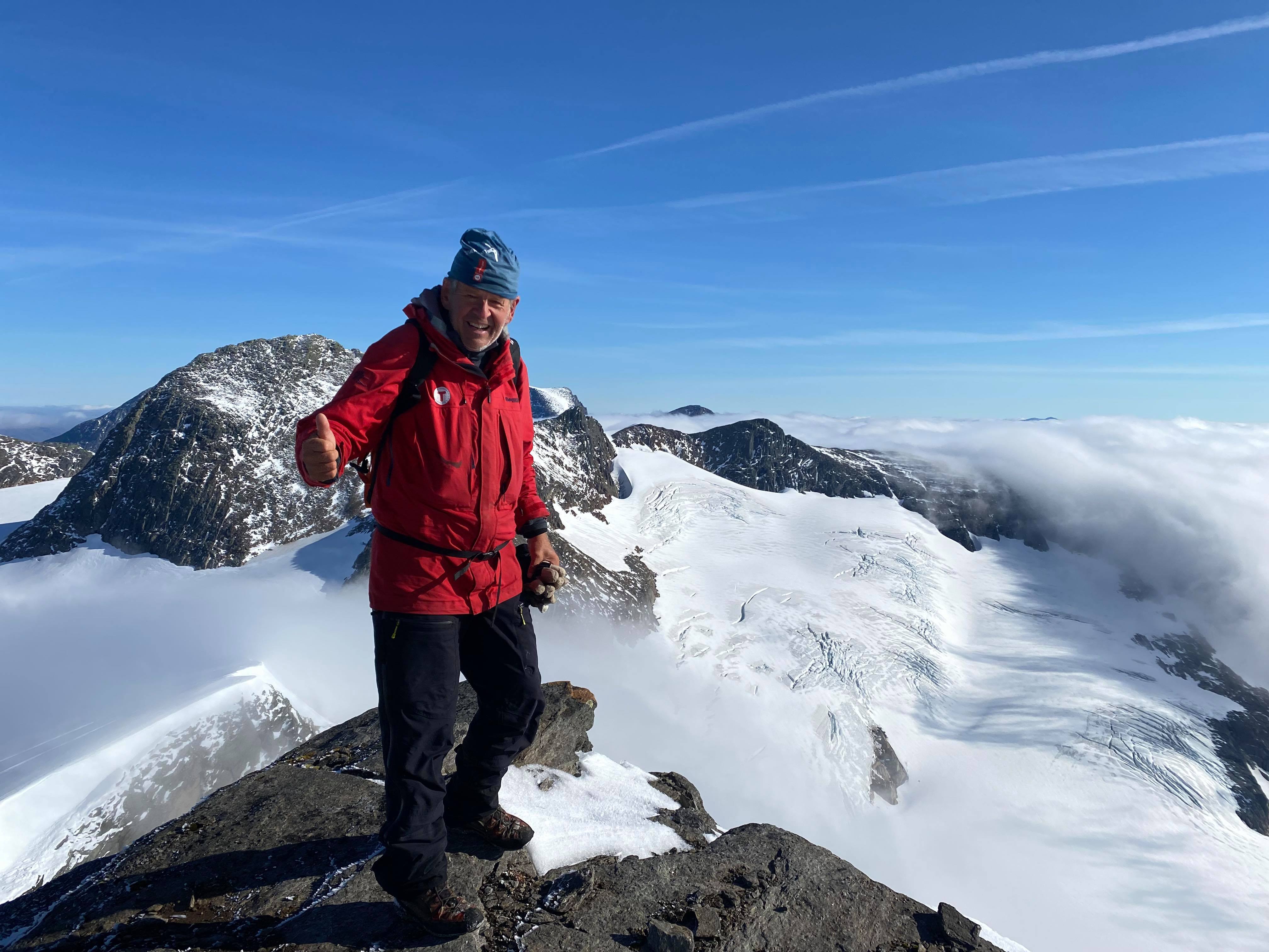
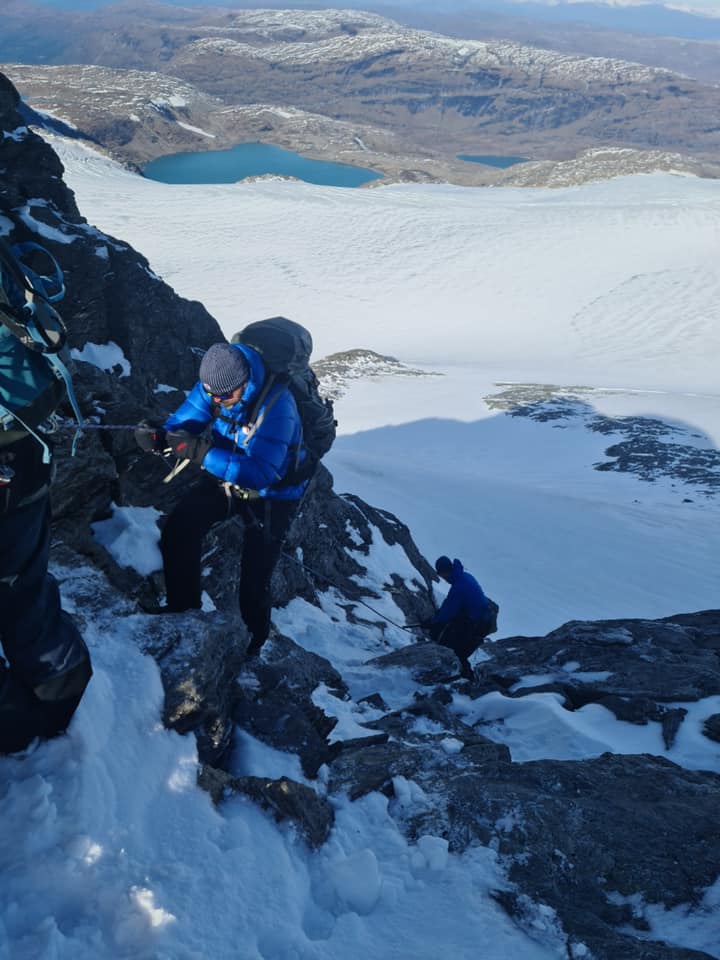
called for care. Then, on the main summit ridge, a vertical step came into view.
Previous climbers had built a small "platform" (stepping-stones) in order to start
from a slightly higher point. I got an uneccessary awkward start and struggled a bit
with getting up, arm strength is below expectation. We then proceeded the last few
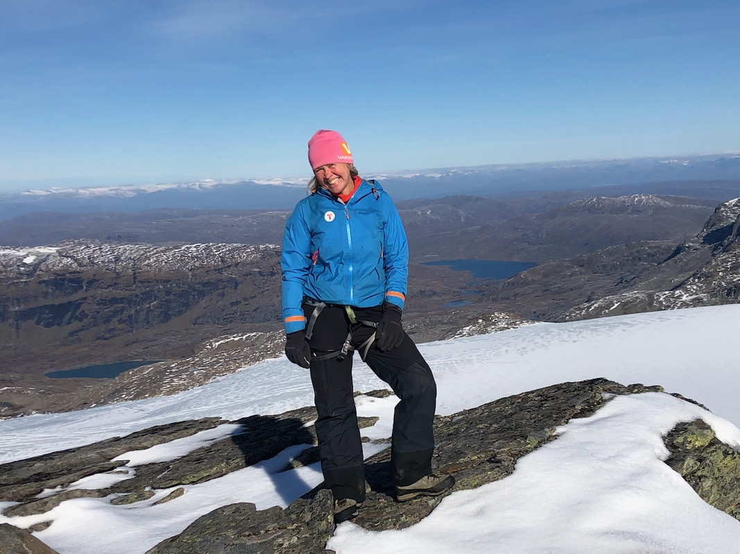
meter to the summit. Very nice views all around
There is a pretty vertical slope on
the east side.
Since some in the group felt slightly insecure about going down, we made a solid
top anchor, our 60 meter rope would cover the full descent. People could then
descend using their prussik attached to the
rope - good practice for everyone!
We put the crampons back on and prepared for the
glacier walk back to Rabothytta.
The return hike followed more or less our route of ascent. We were back at the Rabot hut
around 1400. Thanks to everybody for making this a very nice hike and a good
preparation for our board meeting.