Location: North 66.73217, East 014.41683 (from map)
Difficulty: YDS class 3.
Climbed August 10. 2020.
Information:
How to get there:
With the city of Bodø as a point of reference, there are two options.
One can drive Hwy. 80 towards Fauske, then E-6 to Rognan and then fork right on Hwy. 812 about
2 kilometer south of Rognan. The alternative is to turn right on Hwy. 17 shortly
after crossing a big bridge while leaving Bodø on Hwy. 80. Continue on Hwy. 17 just past
the bridge across Saltstraumen, then fork left on Hwy. 812.
Either way, you arrive near the small plase Kåsmo, where Hwy. 813 runs west at the north
side of lake Kykkelvatnet. Follow Hwy. 813 across the local mountain to Storjord. Immediately
after crossing the river, turn left on Hwy. 7454 which will take you into the Beiarndalen valley.
This is a pretty long valley, you will eventually continue on a slightly rougher road and
cross 2 gates in place because of goats. (Open and close these gates manually.)
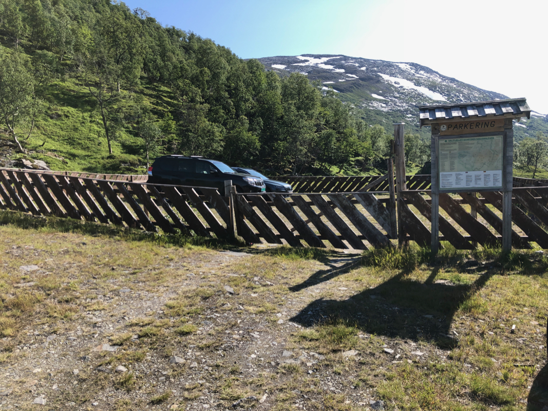
Continue until near location N66.7125, E14.5050, where a bridge crosses the river to
your right while you find a fenced
in parking area directly
ahead. Open the small gate
and park inside the fence, this protects your car against the goats in the area.
Route description:
The main challenge of this climb is to find a good way ascending the first 400 vertical
meter to the neighborhood of a small lake (with a small concrete dam).
Cross the bridge from the parking and head uphill while moving right. The best route is
to move up into the small valley formed by the Fonneelva creek. Most likely, some
pretty unavoidable bushwack among birchtrees as well. As you gain a couple of hundred vertical
(meter) the terrain improves and one may turn more left and ascend west as soon as this is
feasible.
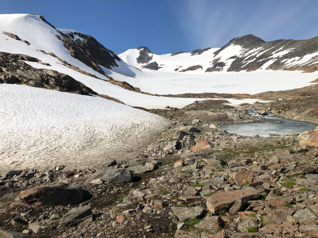
The river feeding the small lake may be crossed (check and be careful!) on a snow bridge.
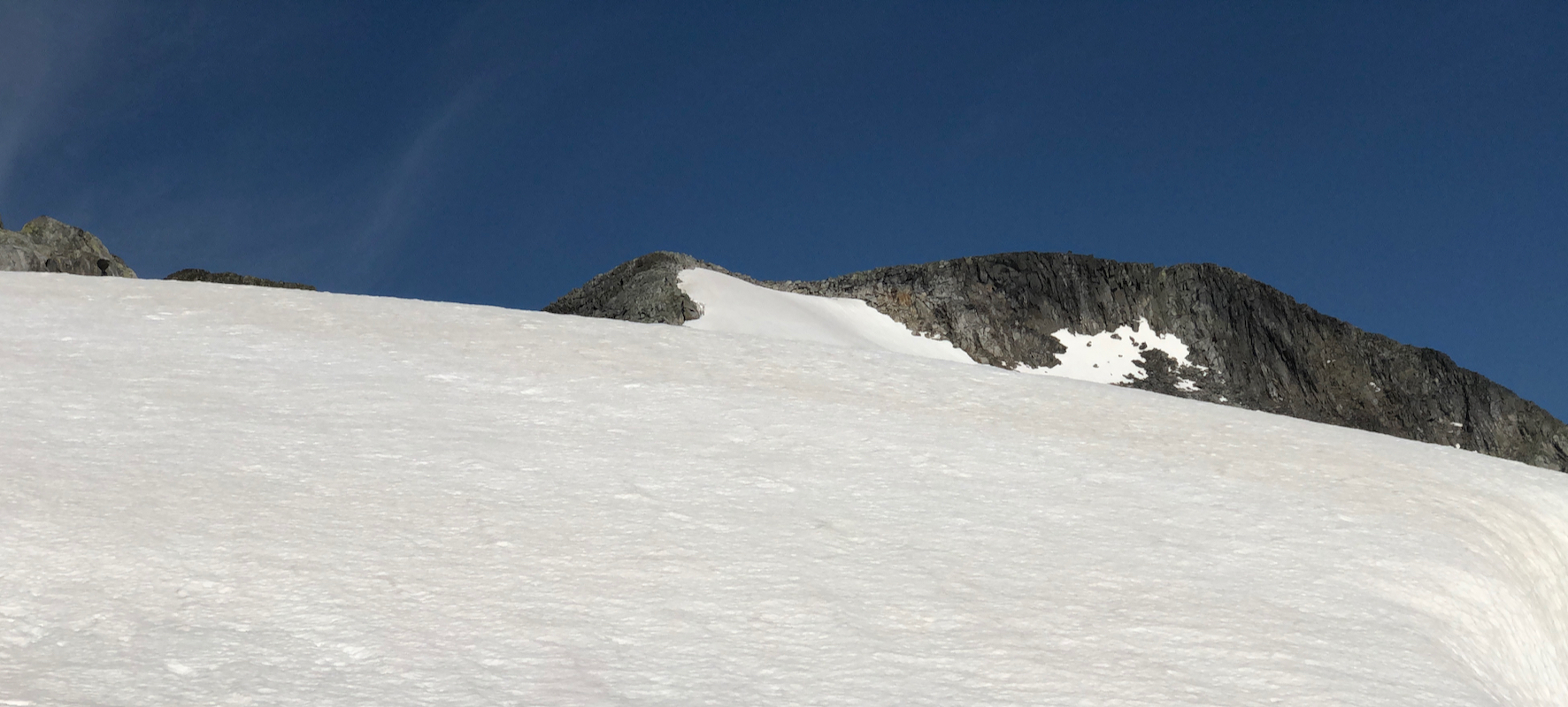
Next, ascend the ridge to point 1185m.
Finally, a first view of the peak.
The terrain is easy and very nice to walk. Continue
to point 1341m, from here you will
see the rest of the route.
First, descend to the
saddle, then continue along the rocks
on the ridge to the summit.
An alternative, that may be somewhat more convenient
is to follow the snow, staying slightly
right of the ridge. This is a glacier
and there are a few crevasses. Care and
experience needed. In this way, one may avoid almost all the rocks, however crampons and an
ice axe should be carried.
Comments:
I stayed in the nice DNT hut Beiarstua, a perfect place in order to
climb this mountain. I got up shortly after 0600, breakfast then cleaning
the hut before departure. A short drive up the valley and a nice parking area,
properly fenced in to protect the cars from all the goats in the area.
Ready to go by 0800, I had not fully decided how to get up the first steep hill full
of small cliffs and birch trees. I ended up on some sort of zig-zag more or less directly
uphill. This was not a good choice, I had to do several short back-tracks after getting
into steep terrain. There was a solid snow bridge across the river very close to the small
concrete dam. Next, several long snow slopes brought me up to the first small summit point.
Easy walking from there to the second summit point as well as the gentle downhill slope
to the connecting saddle to Skjelåtinden. I decided to walk on the edge of the
glacier next to the rocky ridge most of the way. Finally, some small effort among the rocks
on the final, slightly steeper ridge. Arriving at the cairn at 1140, beautiful weather
and clear views in all directions.
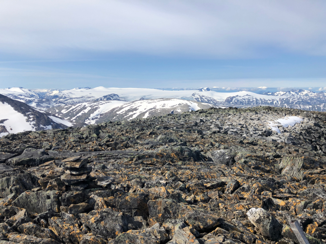
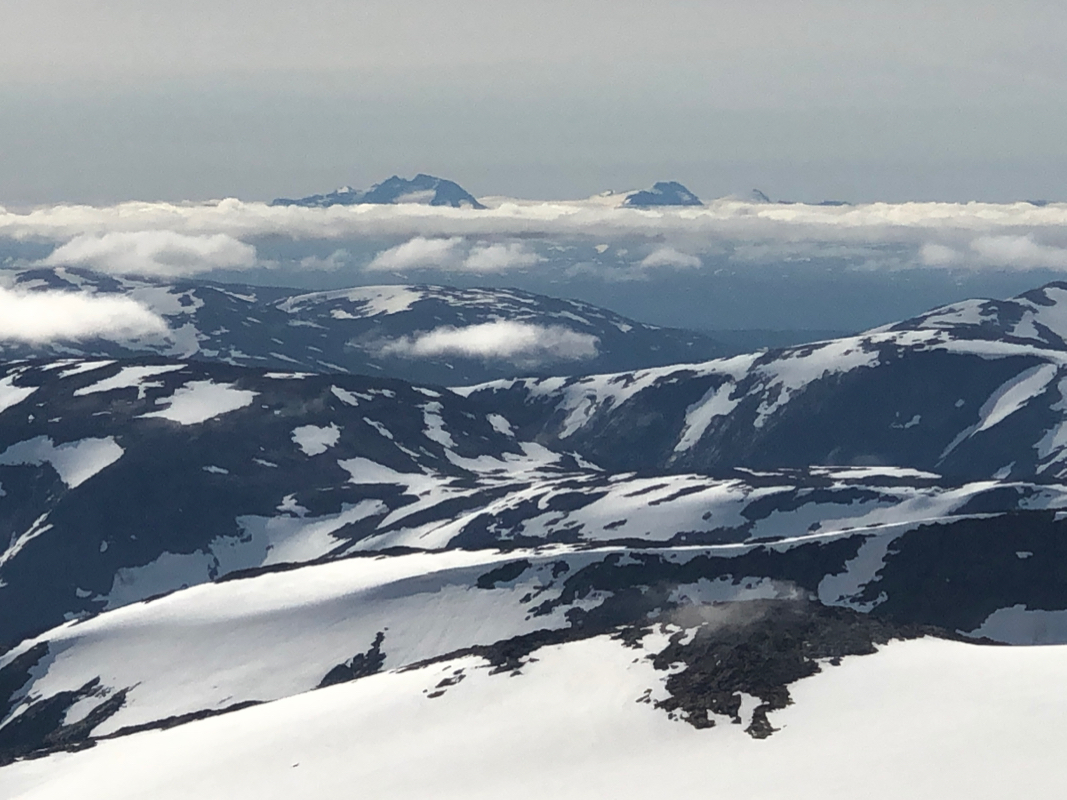
The summit was a good place to be on such a nice day.
A good view south to the Svartisen glacier.
The distinct valley between
the west and east glacier could also be seen, it brought back
memories more than 45 years ago, when I had a very bad experience hiking there.
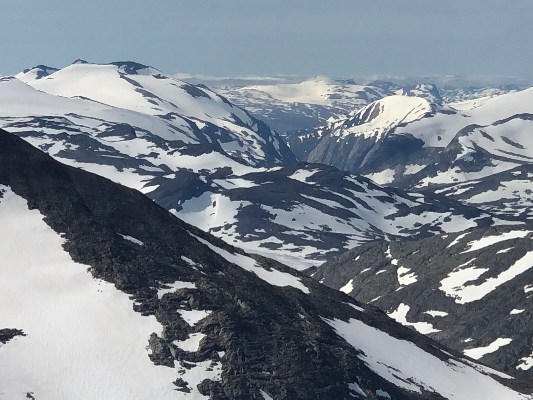
Looking more east, Ølfjellet,
the closest higher peak, it took me two tries to climb it.
I signed the summit register and
noticed that only 2 parties had been here before me in 2020.
After 30 minutes, I started back down.
Since I carried my axe and crampons, I decided to descend on the glacier, avoiding all the
rocks on the final, steeper section. This was a good plan, nice and easy.
Easy going until I started descending the snow above the small concrete dam. I
crossed the river at the higher (and larger) snow bridge.
A final look back up the valley to the peak,
then focus on how to descend the lower part.
The plan was to descend more
north and hopefully find a more friendly way down. A last view up the valley to
the peak, before following a steepish snow patch that got me down near the creek Fonneelva.
The plan worked well until I got entangeled in dense birch bushwacking. Well, it came
to and end and the final stretch back down to the parking was easier.
