Skåla has been visited more than 10 additional times - skiing.
Information:
How to get there:
Skåla is a very distinct mountain that dominates the view from the
innermost part of Nordfjord. The road to the trailhead starts right next to
the (luxurious) Hotel Alexandra in Loen, a small village between Olden and
Stryn. Follow this road (the sign may read Kjenndal and/or Bødalsseter),
for about one kilometer and look carefully for a small (dirt) road that goes left
just afer a farmer's field. There should be a small sign at this road
saying "Skåla". Opposite, on your right hand side, there is a dedicated
parking (self serve toll, NOK 40 in 2017), information signs etc. Park here.
Route description:
The trail climbs through forest on the left (west) side of the creek
Fosdøla and passes a small seter (summer farm house) at about 300
meter elevation. The trail continues up the main valley on the left side of the main creek
until about 640 m elevation, here the trail crosses the creek and heads north-east, later
south up to a small lake, Skålavatnet (1142 m) with Vesleskåla (1238 m)
on your right (west) side. From here the trail is well marked with cairns leading
towards a very distinct saddle at about 1400m (note that one shall not
ski all the way to this saddle, only to the point where the steep climb gives way
to more moderate terrain.) The trail makes a 90 degree turn left just as the slope levels off and climbs
the broad Skåla ridge. This ridge narrows as one approaches the summit with the
hut Skålatårnet itself. Loen Rundt:
We have travelled from Bergen and put up camp at Tjugen seter. This is only a short hike
up from the parking, perhaps 45-60 minutes depending on the load.
I used to start with an overnight at Tjugen seter, However, with the Skålabu hut
available, the schedule has changed. We now start a bit earlier from Bergen and climb to
the top of Skåla on the first day.
This is the start of various Jostedals glacier ski trips. The next leg
is from Skålabu to a spot near Lodalskåpa.
Skålabu
In 2016, it was decided to build a new mountain hut on the Skåla mountain, next to the
125 year old Skåla tower. You may read more about this
fabolous hut, its constructuion and inaguration by clicking here. Hoven via ferrata
In 2016, a very impressive skylift was opened, serving
the top of Hoven, 2011 m.
This is described under the link to Hoven above.
Comments:
The highest (rock) point on the ridge is at the far
end (1848 m), the traverse along the ridge is quite easy.
One shuld note that this ridge first climbs gently from the Skålatårnet, then
drops perhaps 30 meter before a somewhat more distinct climb to the big cairn at the summit.
Careful GPS measurements indicate that the snow ridge was 6-7 meters higher (that is around 1855 m)
on May 2002. The general snow cover on the mountains was very small at this time.
This is one of the longest, continuous uphills that you can
find in Norway, ending at a most unique mountain cabin.
This hike is my favorite way of starting a longer trip (3 days) traversing
the Jostedalen Glacier. Be aware that the mountain drops very steeply
to the north. This side often has a big overhanging cornice and deadly accidents
have occured. Keep a very safe distance, especially during winter and spring.
The tower itself (the hut) was constructed in the 19th century as a place
to treat people with tuberculosis. Equally impressive, large rocks have been moved
around to make steps up the mountain, this is normally covered by snow in May.
I say that anybody that made the hike up
to the tower was likely to be healthy and be cured of his symptons.
Resources:
Images
The steps
made more than 100 years ago to facilitate the hike to the
Skåla summit.
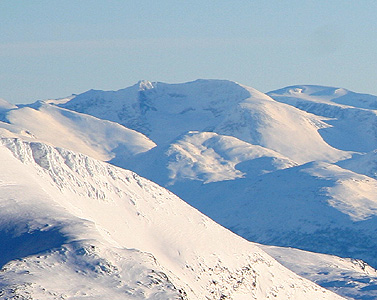
The Skåla ridge,
as seen from the summit.
The tower (not visible) is on the right side of the ridge.
GPS measurements revealed that this ridge is indeed 6-7
meter higher than the Skåla mountain.