Location: North 66.89758 East 015.56065 (GPS on the summit)
Junkerdal National Park, Nordland, Norway
Difficulty: (YDS) class 2.
Attempted November 12, 2012
Climbed September 20, 2015
`
Information:
How to get there:
Drive south on E-6, about 41 kilometer from Fauske (Fauske is east of Bodø),
to Røkland. Exit E-6 (right) here and follow sign for Evenesdalen, ie. use the overpass
in order to go east. After a couple of kilometers, go right where the road forks. Continue
up Evenesdalen (a valley) and drive all the way until the road ends at Skogly, there is
a turn around area and a signed parking. This is the trailhead. Route description:
Head into the forest where some information signs are posted. The trail runs south-east across this area
and down to the river that runs at the base of the mountain. There is a bridge, but in
winter one can cross almost everywhere.
Ascend the slope and pick your way uphill, going left whenever convenient. You will reach a broad
and more flat section at about 700 meter of elevation. Follow this going left (ie. east). Ascend gradually as
you get closer to the creek that drains lake 952 (in the small valley called Satertindhola). Ascend more right as
the terrain permits in order to gain the lower part of the broad ridge coming down from Satertind.
More info will be provided after climbing the mountain.
Update 2015:
In summer, follow the red-marked trail from the trailhead, this trail runs a bit right from the forest access track.
Immediately after this trail crosses a small creek on a wooden bridge, the trail forks. The right fork leads to
the bridge that you must use in summer.
Ascend on the far side of the bridge going more left as you easily walk
up a broad slope (with a creek draining down on your right hand side). There is actually some cairns that may guide you
along the plateau until you turn into the small valley that drains the lake. Turn more right as you reach about 1000 meter
of elevation and ascend a broad ridge until the terrain again is less steep at about 1200 meter. Frome here, there are
two possibilities, one can ascend while going a bit left to reach the lower part of the very distinct south-east ridge,
then ascend this directly to the summit. Alternatively, ascend more directly uphill until 1400 meter of elevation, then
follow gentle terrain to your right (north) and complete the ascent from the north side of the peak.
Trip Report / Comments:
I had been further south, making a failed (due to bad weather) attempt on
Geittinden, before returning north to the DNT self-serve hut located close to Lønsdal railroad station.
I spent the night there, expecting my friend Åke to arrive with the night train, early next morning.
He showed up around 0745 and after breakfast, we cleared out of the hut and drove to the Satertind trailhead.
The forecast was not great, and clouds covered the mountain.
We skied through the sparse forest and descended to the river a bit upstream of the bridge marked on my map.
No problem to cross on snowbridges today. The uphill section before treeline was easy in terms of progress and
skiing conditions. Higher up, we ran into a few steeper steps, we were sort of left of my planned route, but nothing
difficult. We reached the broad and flatter section and followed this towards the lake 952 area. Unfortunately, the
weather got significantly worse. The wind increased in force and visibility was close to zero. After
getting to about 1000 meter of elevation, we left the skis and made an attempt to continue uphill on foot.
Not much luck, Åke struggled with a local snowdrift, wind blasting, when I suggested that we should turn back.
He agreed without hesitation.
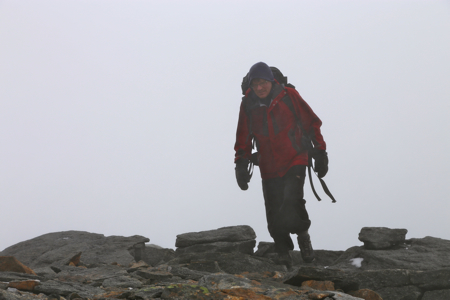
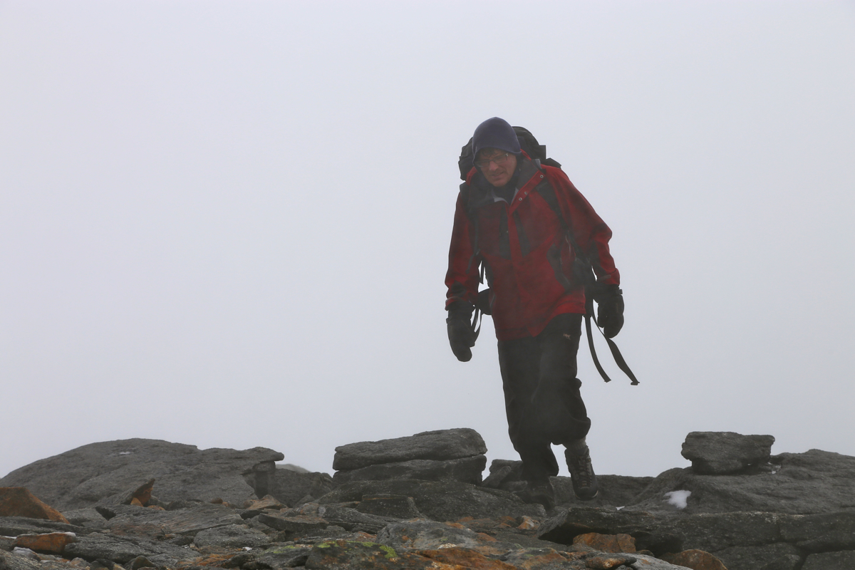
Perhaps next time, I shall be able to see this mountain? Ascent in September 2015:
No such luck, the day promised to be foggy with a drizzle of rain. We started out at 0850 after driving from
Storjordstua where we had established our base camp. The terrain was easy and our ascent quite a nice hike despite
limited visibility. We ascended the south-east ridge and arrived
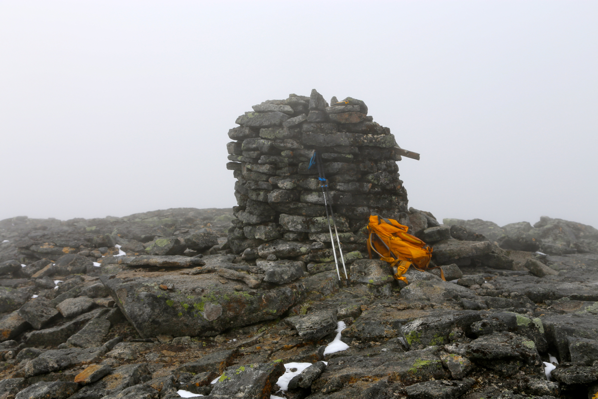
at the summit at 1205.
Leaving at 1220, we descended to the north and found good snow along the traverse bringing us back to the
route of ascent. We were back down by the car at 1500.