Location: North 47.60206, East 013.69852 (GPS at the summit)
Difficulty: YDS class 2+
Climbed September 29. 2014.
Information:
How to get there:
Locate Bad Ischl, east and a bit south of Salzburg. From Bad Ischl, Hwy. 145
connects with roads further south. Drive this road about 18 kilometer, you should park
at a good sized parking area on your right hand side, exactly at the highest
point of the road. There is a small restaurant nearby on the left side (just before).
This location is N47.62188, E013.69460, elavation about 1000 meter.
Route description:
From the parking, head back to the highway and locate a smaller road/path that
runs sort of parallel (below the fenced off area above you). There should be a
trail sign here. Shortly, you will locate a sign that takes you directly right and
a bit uphill, before the trail continues its more or less horizontal contouring
going more south. There is (2014) logging activity and tracks from tractors etc.
However, the trail is marked in the normal way, white and red paint.
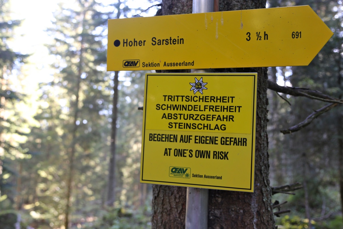
Eventually, you arrive at a new signed fork. There is a pretty strong warning
sign here, seems very foreign. The Austrians should refrain from putting up such
signs.
From here, the trails heads uphill and climbs to the lower end of
much steeper terrain.
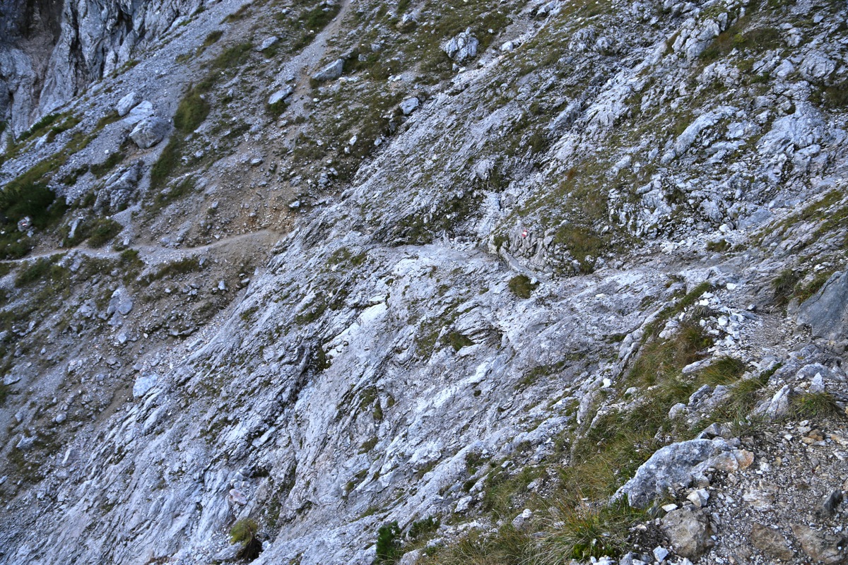
Then up the steepest section of this route, well marked, partly protected
by cables and with some steps cut in the rock. Not difficult, but earns a (YDS)
class 2+.
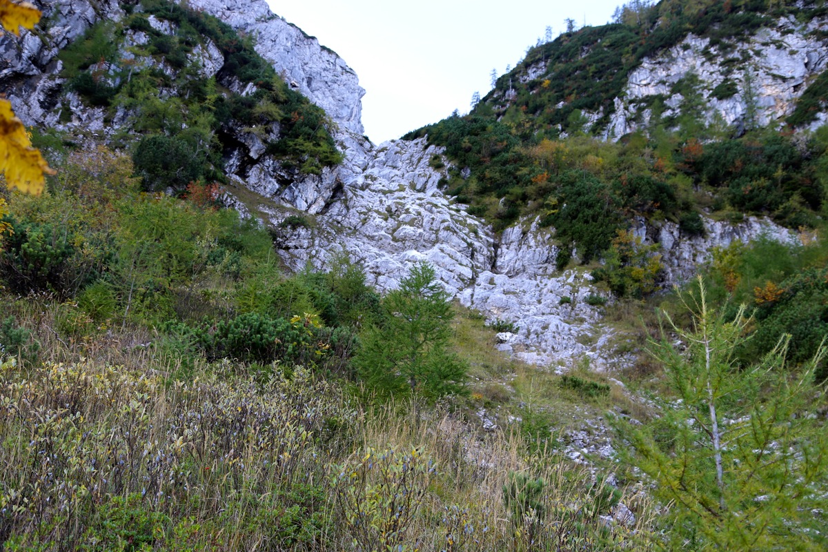
Next you emerge in a large gully, the trail crosses to the left side and zig-zags
steeply uphill. Higher up, the trail traverses back
to the right side, this may be
an area where special care is needed if the rock is wet (and slippery), a somewhat
exposed crossing, but not long. A few more short, steepish sections, then the trail
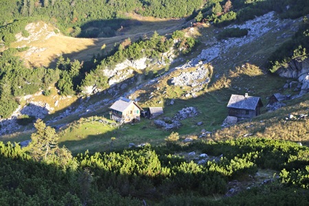
continues gently between some large boulders, then climbs the main col.
There are a few buildings,
Sarssteinalm, just on the other side of this col.
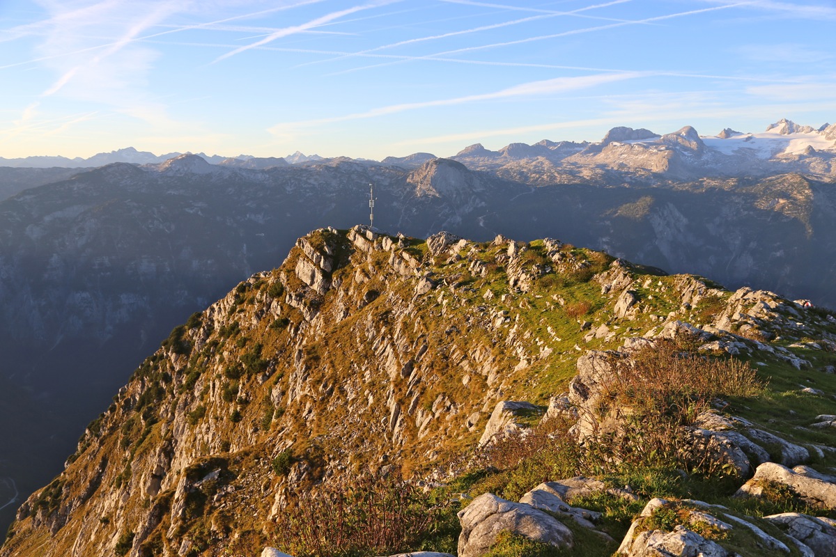
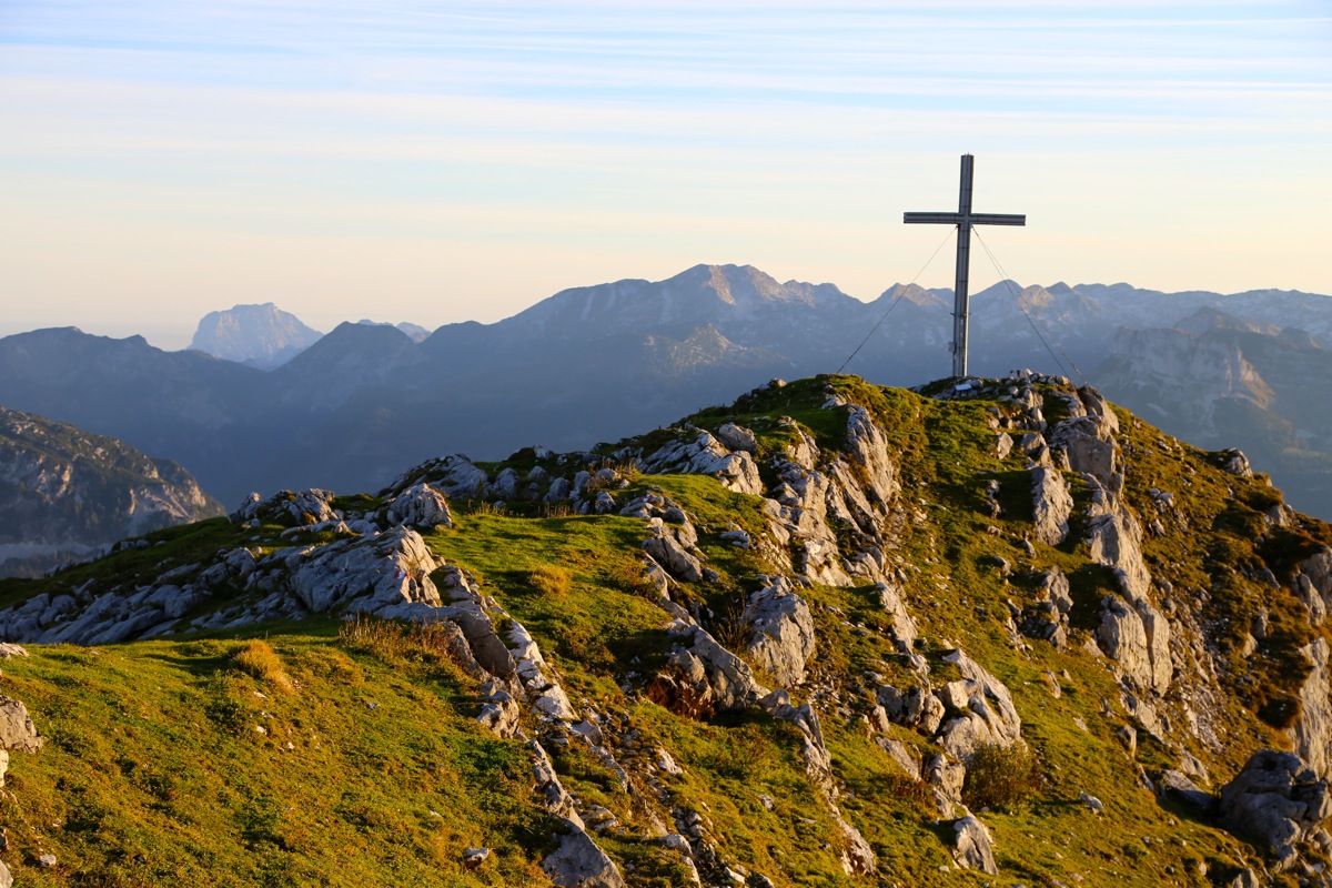
The route forks left and climbs the slope above in several zig-zags. Finally, a bit
north of the highest ridge as an easy trail connests to the highest summit ridge.
The highest point may actually be located approximately in the middle of
this ridge,
while the summit cross will be at the left (north) end when you arrive.
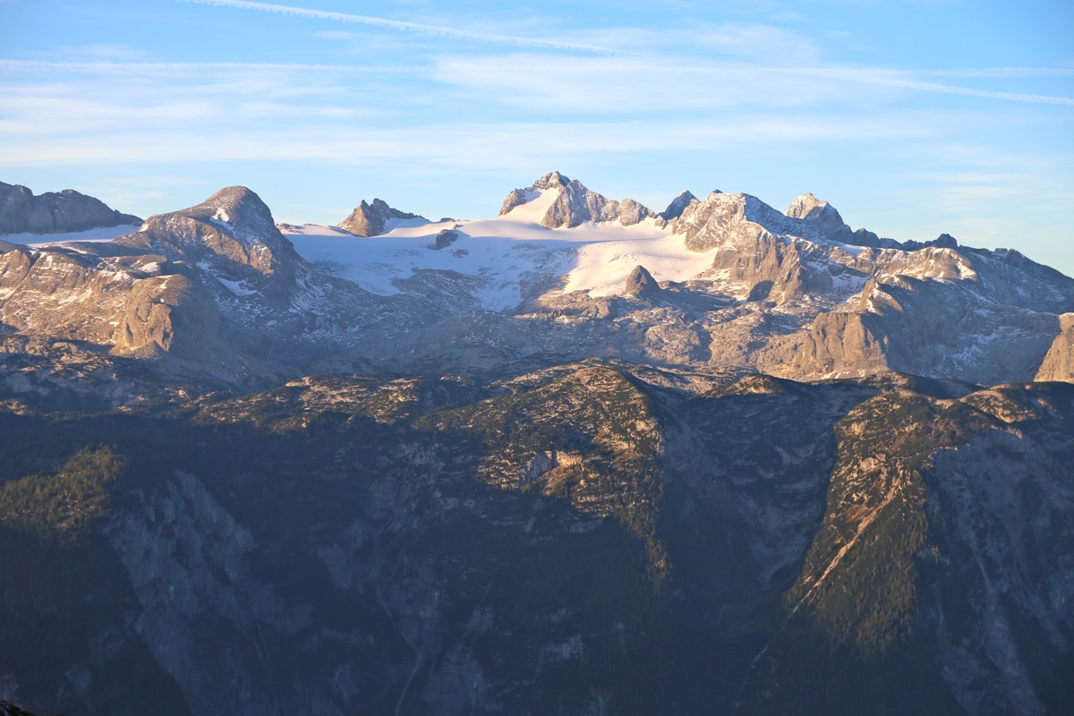
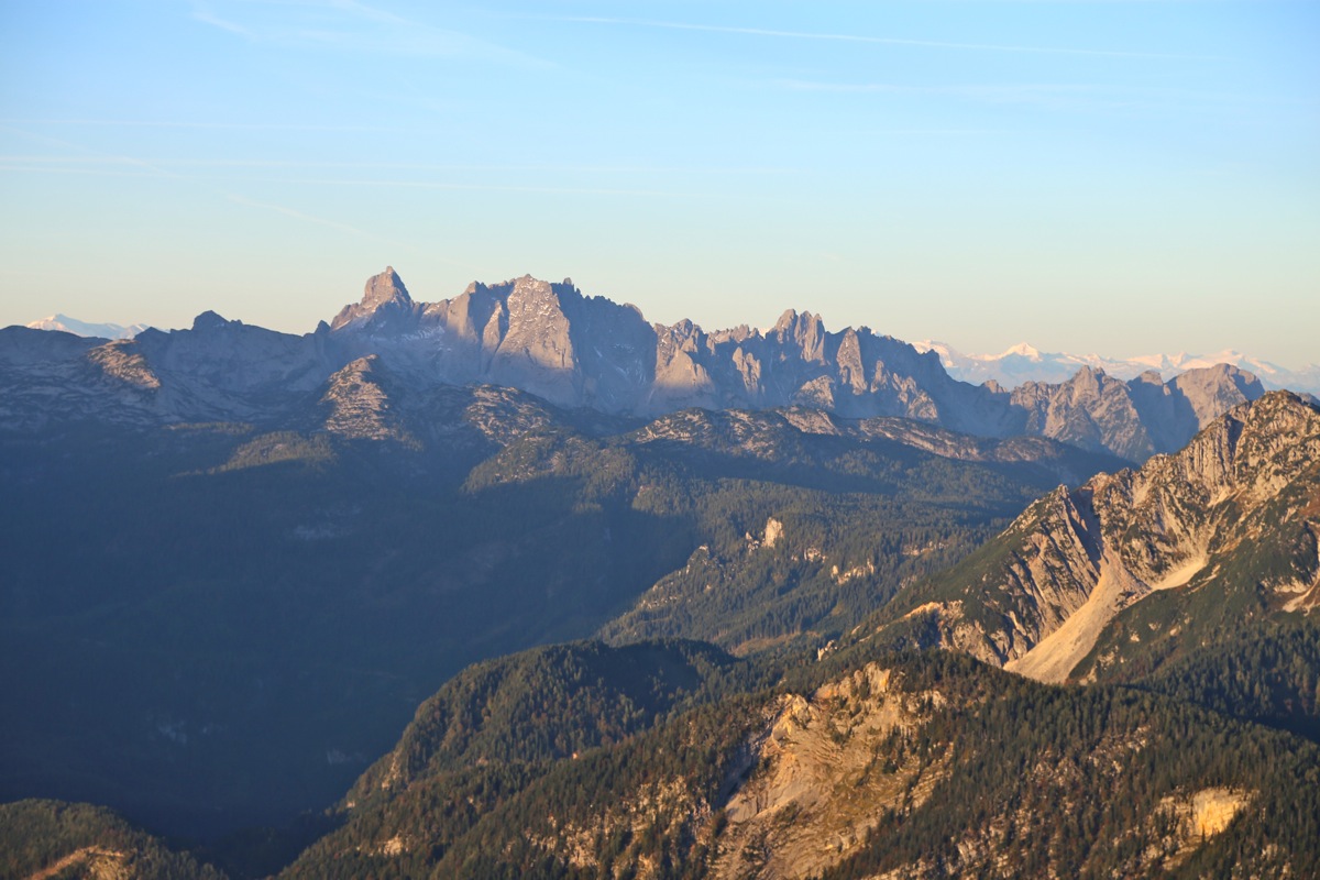
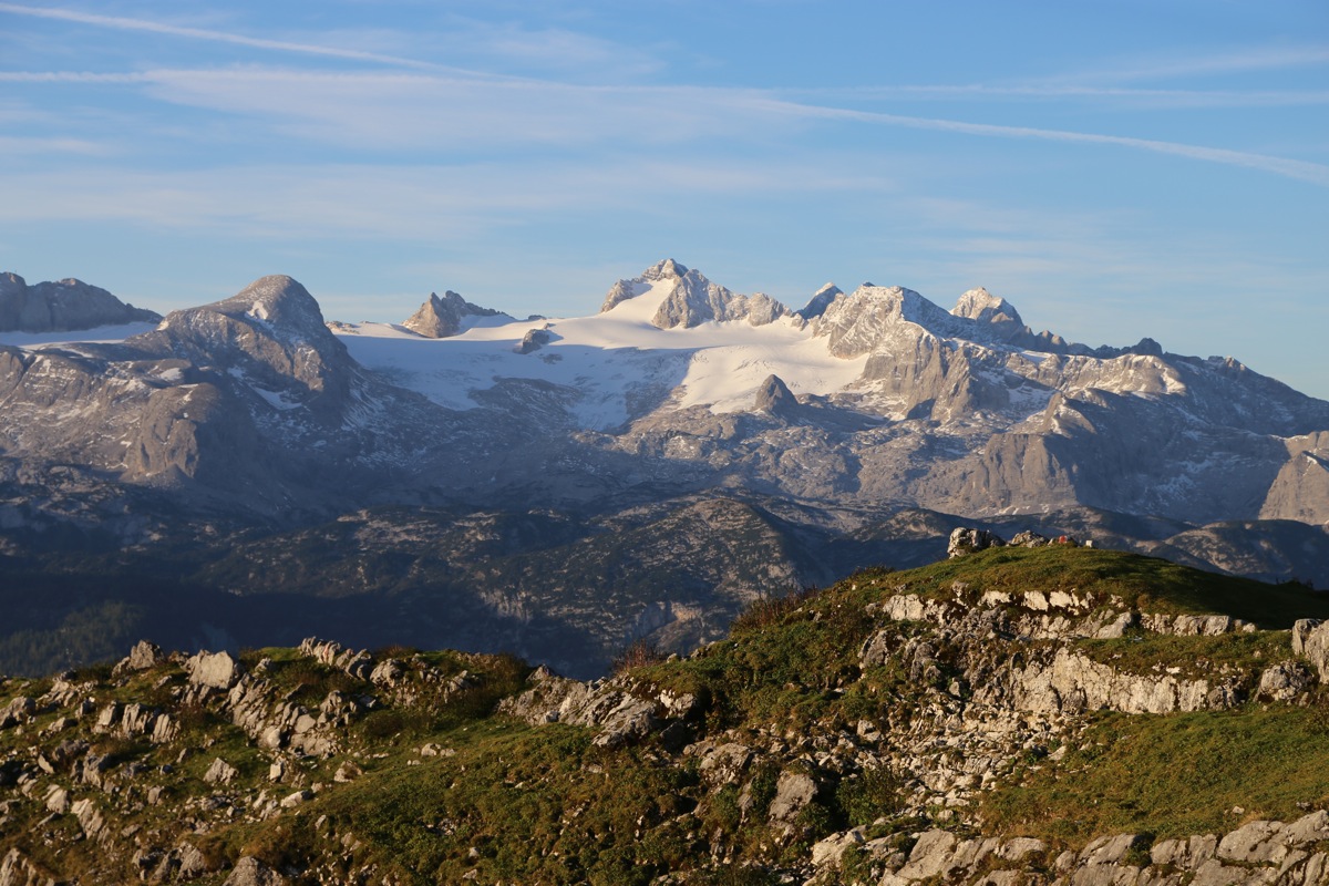
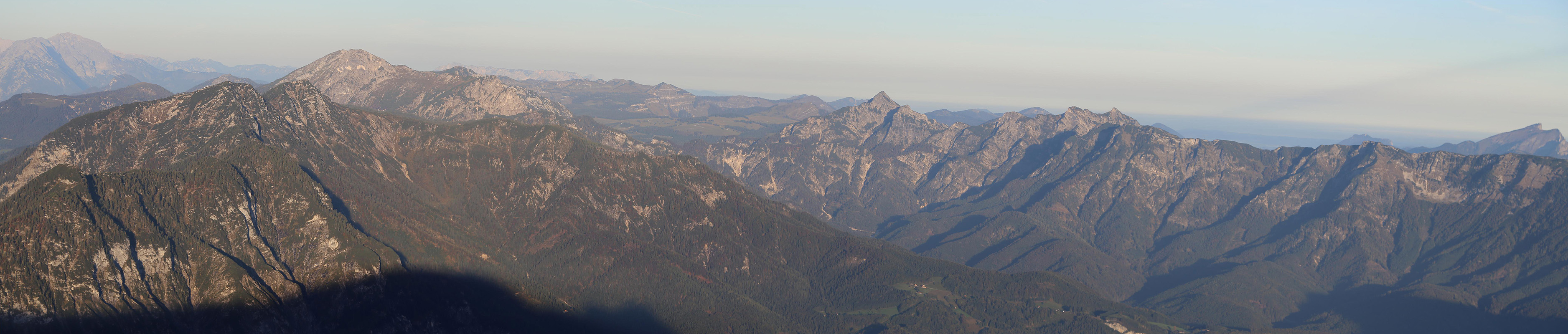
The summit must be one of the best locations from
where to see Dachstein. Comments:
The conference that I attended in St. Wolfgang See (near Strobl), did not
begin before noon. I was going to chair the opening session, so no option
to be late. However, having arrived at the hotel the previous night, it seemed
like a good plan to make an early morning hike.
I drove early and was ready to hike at 0535. It seemed pitch dark, but I carried
a pretty strong head torch so no problem. When I hit the warning sign in the middle
of the forest, it really surprised me.
You expect this kind of silly sign in the
USA, not in Austria.
As I climbed up the steeper gully, daylight was arriving and I could put away my light.
It looked like a gorgeous morning and the sun rose just minutes
before I made the summit
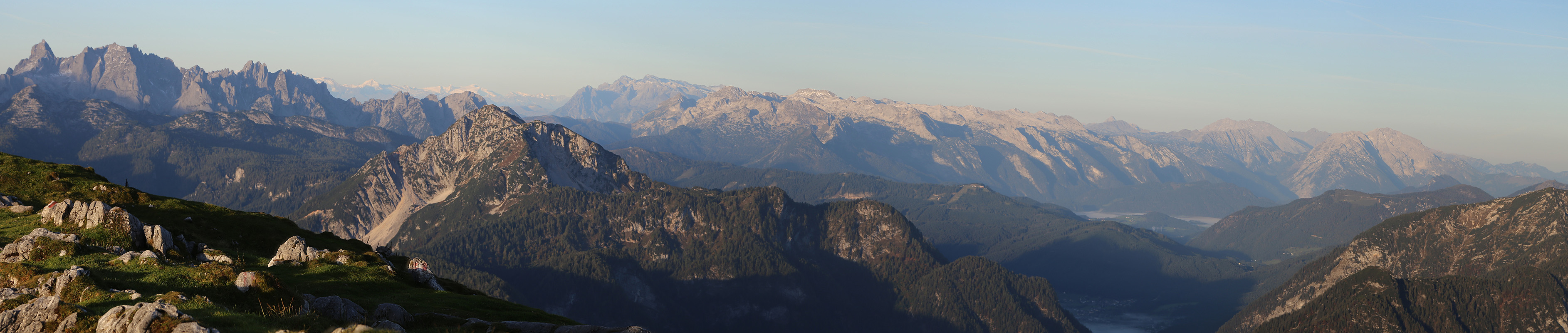
at 0730. This was a very nice viewpoint.
The sun had not reached the valley and morning fog
made the scenery very special.
In particular, Dachstein with the first rays
of sun, caught my attention. I enjoyed the silence and solitude until 0745, then started
descending. Below the steeper section, I met a few people coming up. The walk back was
easy and I arrived at my car by 0940.