Location: Near Fjærland, Sogn og Fjordane, Norway.
Location: North 61:27.501, East 006:52.528: (GPS on the summit)
Difficulty: YDS class 2+
Climbed June 30 2009.
Information:
How to get there:
This mountain is located near the small village Fjærland in Sogn.
One can drive to Fjærland by first going along E-16 to Lærdal, then taking
Hwy. 5 via Sogndal to Fjærland. An alternative is to drive E-39 to Skei in Jølster, then
take Hwy 5 about 28 kilometer south.
From Fjærland, go north along Hwy. 5 and locate the signed road going right to Suphellebreen. If coming
from Skei, this would be a left turn a few kilometer after exiting the long tunnel. Drive 0.5 kilometer on
this road, then make a right turn (across the river). Continue 1.5 kilometer and look for a side road that
turns (sharply) left and climbs the hill. This road is paved in the very beginning. Drive uphill about 1.5
kilometer and you will arrive at the Horpedal farm. This is the trailhead, location N61:25.363, E006:46.937,
elevation about 165 meter. Ask at the farm for a place to park that does not interfere with the life and work
at the farm. Route description:
From the farm, take the farmers road that continues uphill bearing left. Follow this road
passing a couple of gates, until it makes a right turn on a small hilltop. From here, follow
a small trail that heads up the valley. First, down to an open field then generally quite close
to the river. The river that comes down from your right is crossed on a good bridge. If you loose
the trail, seek towards the river. This trail may can be followed up the valley until just below
the first waterfall. You are now at approximately 300 meter elevation.
The terrain ahead is much steeper and the most complex part of the route. Hike towards the right
hand side of the lower waterfall. Ascend on the right side after crossing a smaller creek that
comes down from your right. Continue more right, ascending a green slope, before turning more
parallel to the main river, now somewhat higher up. The route now runs on an ascending traverse
upwards, but still in the direction of the main waterfall further into the gorge. Climb as high
as feasible, staying below the upper cliffs. You may see a faint climbers trail leading up through
the dense vegetation. As the passage becomes more narrow, continue uphill until you turn the corner
ahead. There are some trees that one can grab and hold onto, an ice axe may also be useful for
general support in the gras, moss and general soil.
Around this corner, you see a very distinct gully that runs uphill to your right. Climb this gully,
there is still no rock, only small bushes and general wet and slippery vegetation. As you top out,
the terrain above is more gentle (but still messy!). Ascend while traversing left towards the upper
part of the river. You will then arrive at the end of
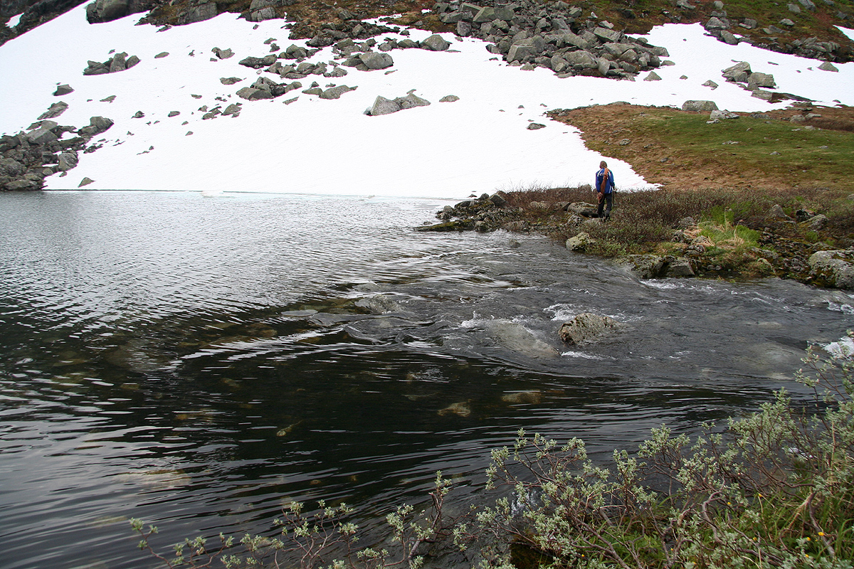
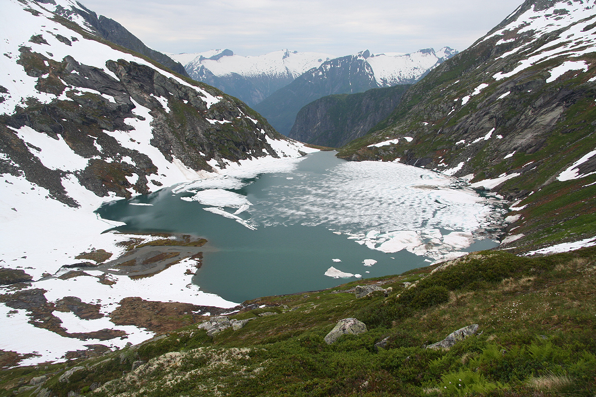
the small lake Nedra Fessadalsvatnet marked at 904 meter on the map.
This location is N61:26.275, E006:51.151.
From here, there are two options. One possibility is to cross the river just where the lake ends.
This may be cold and the river may be pretty deep, we did this one June 30th. Stay away from the
river current by being on the lake side.
An alternative is to hike along the lake to the opposite end. This hike crosses snow and avalanche
slopes that run directly into the lake. A fall here may be critically dangerous with near zero
temperature water below. The upstream river then needs to be crossed. It is slightly smaller
than the river downstream, but it may be more swift. Early in the season (all of June?) there
may be a snow bridge that can be used, see my comments below.
If you cross the river, head uphill and gain the ridge that separate you from the lake Ryssenipvatnet at 1247m.
Next, follow this ridge to the plateau. From here, the last kilometer is almost flat with a small
hill as you approach the cairn.
From the inner end of lake 904, there is a natural ridge that heads uphill. One may follow this
without difficulties and continue uphill along reasonable slopes until gaining the plateau at
almost 1600 meter elevation, location N61:26.987, E006:52.279. This route is also fine on snow
early (May / June) in the season. Comments:
I first tried to climb this mountain back in April 2006,
as part of the Sogndalseggi route with Bergen Fjellsport.
However, that trip was aborted and subsequent trips to this area had all been cancelled. By now, I had decided to
try a summer approach directly from the small community Fjærland.
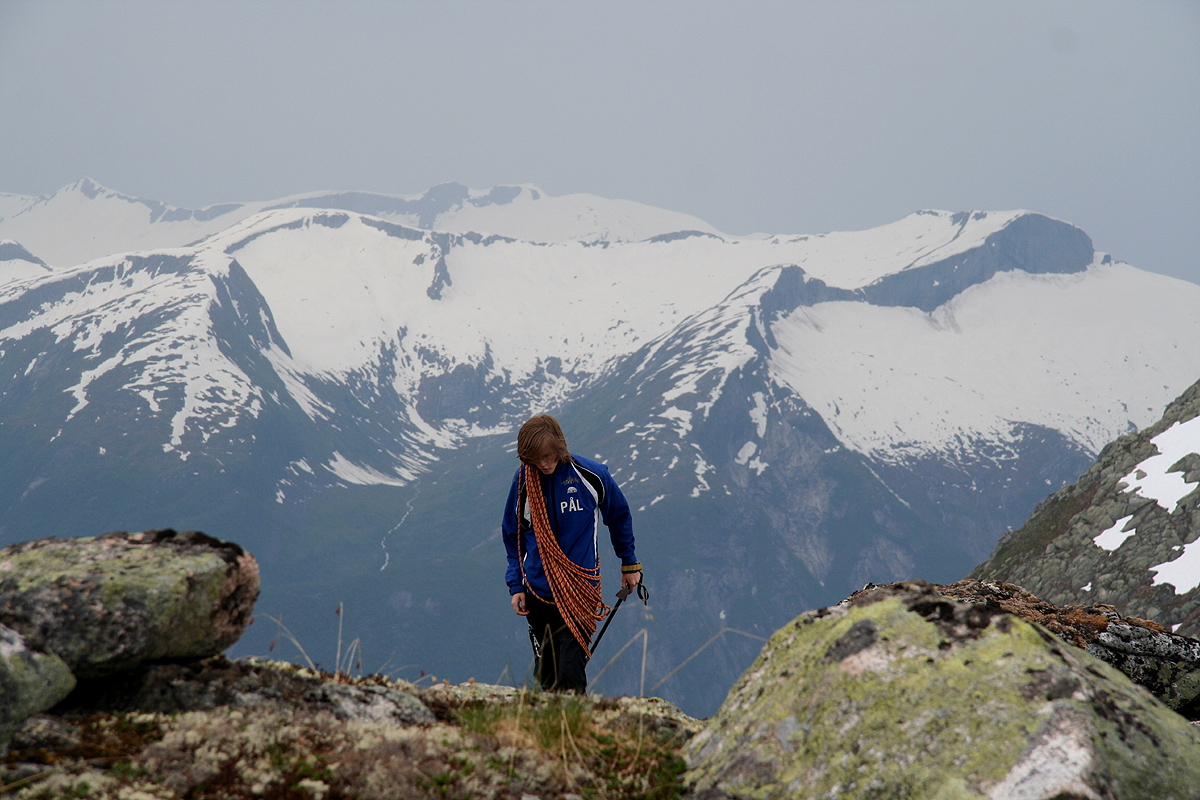
I did this trip with my son Pål Jørgen, age 20.
We drove from Bergen around 10 and had a good dinner (trout) at the
historic Mundal Hotel (from 1891). We parked up at Horpedalen farm and
asked the farmer about the possible routes up to Ryssenipa. He adviced
us to climb the steep section on the right hand side of the big waterfall.
He further informed us that we would have to cross the river just as it
exits lake 904 (above the waterfall). The river was running pretty big
right now and he warned that water might be waist deep.
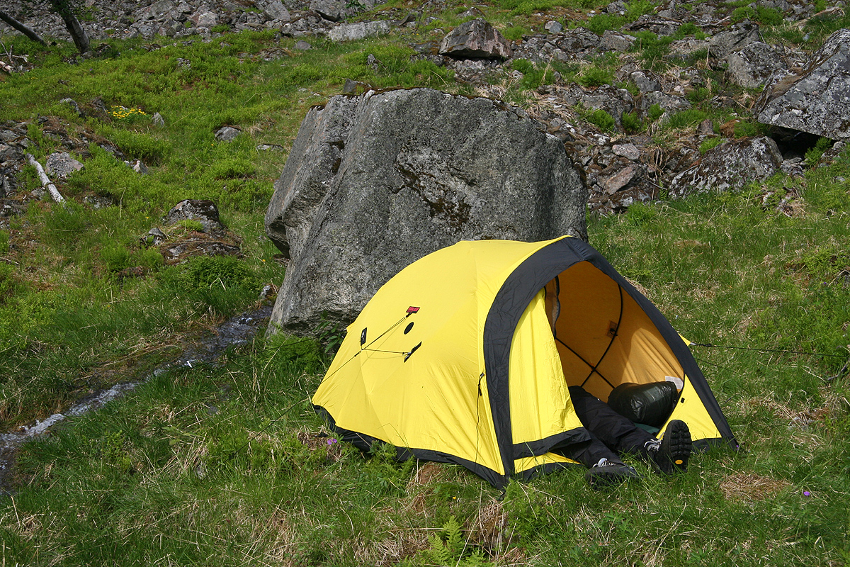
We started hiking around 1630 and established camp at about 300 meter
elevation just below the lower of the two waterfalls at 1800.
We had rain during the night, so a pretty good decision to bring a tent.
Got up slightly before 0600 and prepared two REAL dinners (dehydrated food)
for a filling breakfast.
We were off by 0630 and explored a route up the slope near the upper
waterfall. Pretty messy, slippery and exposed. The key to this route is to
get around a fairly exposed corner and into a gully above that turns right and
carries you up to more gentle terrain. An ice axe may be useful even when there is no
snow or ice!
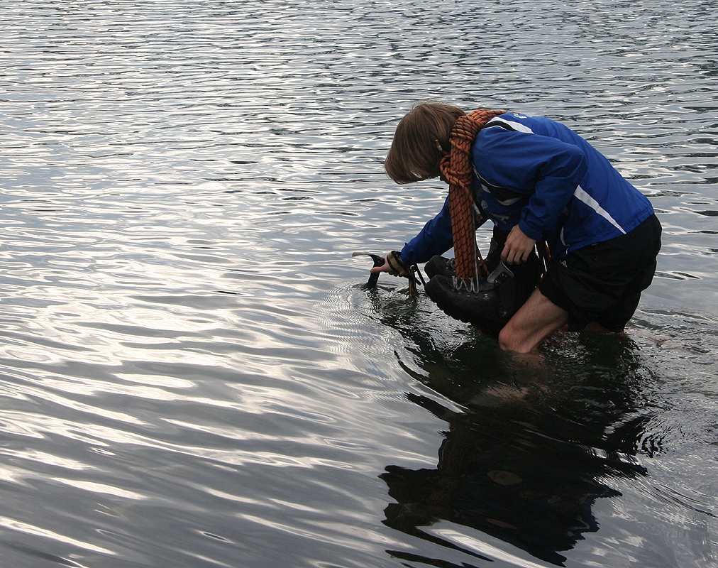
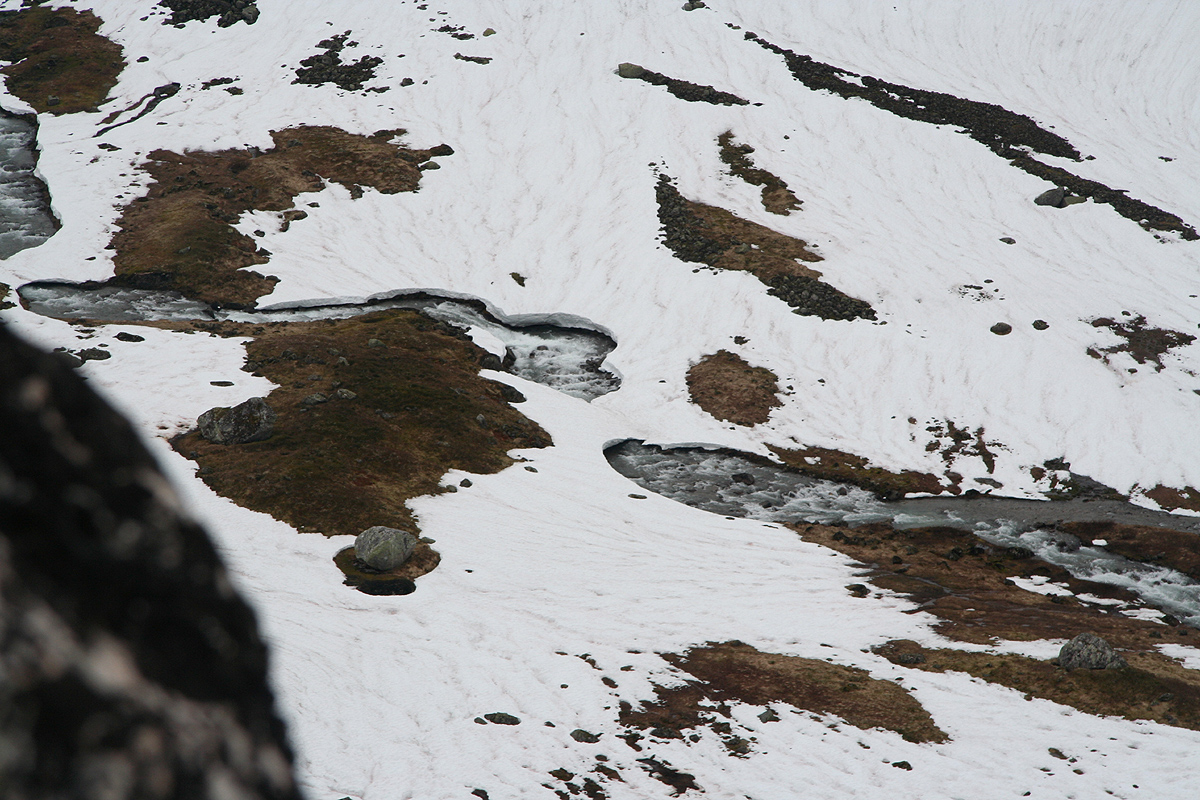
We were at the lake around 0830 and crossed the freezing cold river.
This river is rather swift
and tumbles down towards the steeper falls, thus the only safe place to cross is slightly
on the lake side, before the current builds. The lake was
75 percent covered by ice and we agreed that the temperature was as close to zero
Celcius as it could possibly be.
The water was one meter deep and once started it was
clear that finishing before getting cramps from the ice cold water kept you with a single
focus.
A short scramble up the first hillside and we were on snow the rest of the route.
We made the main ridgeline around 0925 and had a brief rest with some food before
heading up the final slope.
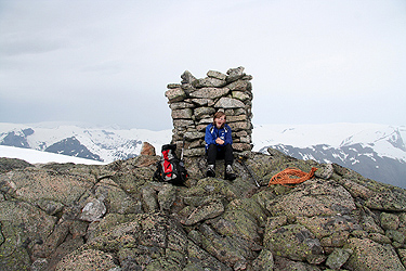
Arriving at the summit by 1030, the weather was overcast, but
the visibility still reasonable.
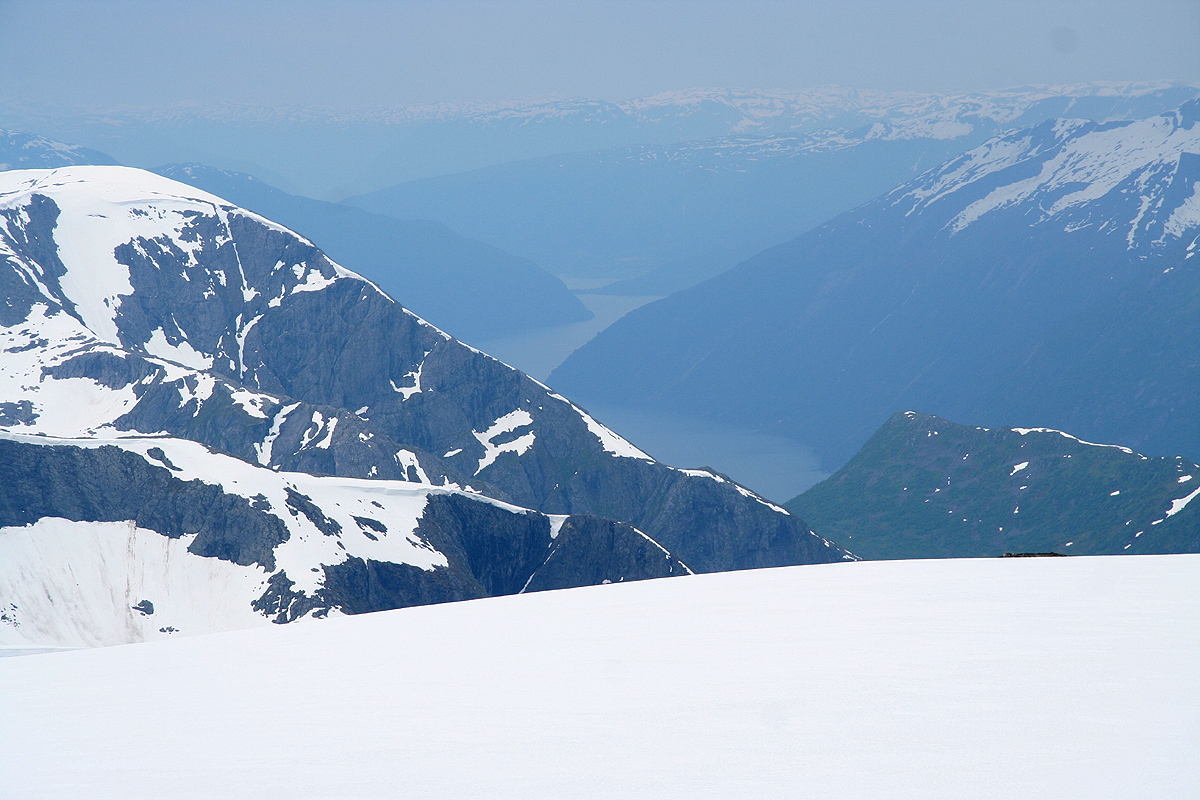
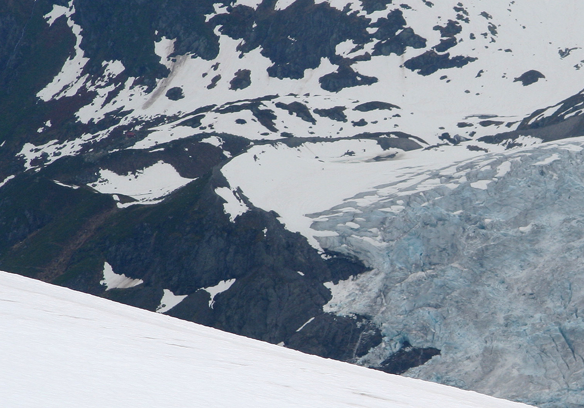
We had good views back down to the fjord as well as across to a couple of arms from
the Jostedalen glacier. A good view across to Supphellebreen
where the most popular route
across the glacier ends, the mountain hut Flatbrehytta being visible as well.
We spent 30 minutes resting and finishing the rest of
our trail food.
We decided against the cold river crossing and headed more directly down towards
the innermost end of the lake.
Halfway down, I suggested that the river entering the lake from above might
be equally cold and difficlut to cross. A bit further down, we could see what looked like a pretty
steep slope going directly into the lake. Could it be that we were getting into more difficulties
rather than less by this choice of route?
Things actually worked out pretty well. First, the slope going down this way is quite
reasonable and caused us no difficulties. Second, I spotted
a single remaining snow bridge crossing
the upper river. If it would hold (which it did), the river crossing would be solved. Third, the
slope along the lake was steep, but not too difficult. Still, this traverse required the utmost care
and attention, since a slide directly into the icy lake would be a pretty serious incident indeed.
Back by the lake on the correct side of the river, we carefully descended back down the same route
as on our ascent. A brief stop by the tent in order to pack up, then further back down to the car by 1600.
This trip is a rather long one, we took 9.5 hours plus the 1.5 from the previous day. My guess is that
this peak has few ascents, its remote location and rather complex terrain makes this likely.
We drove to the small restaurant at the base of the Bøyabreen glacier for a well
deserved dinner. Next, we continued driving in order to establish a new base camp in Valldalen. We had planned
to climb Finnan on skis the following day.