How to get there:
First locate the small place called Woss along Hwy. 19.
Continue about 20 kilometer more (north-west) on Hwy. 19.
Turn left near location N50.27683, W126.85712, the road continues north-west parallel
to Hwy. 19 in the beginning. Next, turn right near location N50.27401, W126.88198.
Keep left, then turn south near location N50.27544, W126.88859.
Continue south (keep left) near location N50.10945, W126.81213.
Then turn left near N50.04679, W126.79339.
Finally, continue to near location N50.00942, W126.72064. Near this location, a rough forest road
forks uphill left. You need a high clearance, rough 4WD in order to proceed with your vehicle.
We consider that the hiking route starts from here.
In 2022, there were significant obstacles near the upper end of this road, but a sturdy 4WD
could still drive pretty high.
See this summary of climbs in BC, August 2022.
Route::
From the road fork, continue up the road.
After a bit more than 200 meter of vertical gain, the old route forks right, leaving
the road near a place where the roaad bends left. This location is well marked
by a cairn. However (see below), this route is no longer recommended. Continue to
ascend along the road, keep left where steep (short) side-roads go right. Big logs and rocks
may partially block the road higher up, navigate past this and follow the road until
near location N50.02050, W126.70156, elevation just below 900 meter.
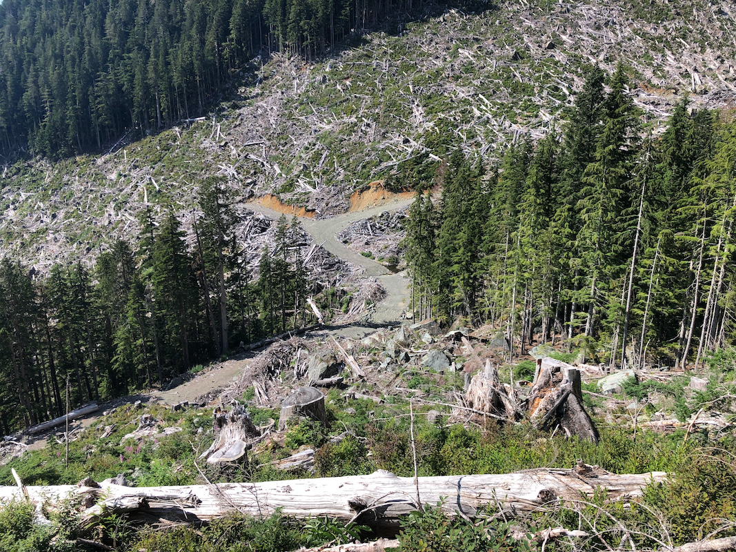
There is aa cut-block (area where trees have been logged) up on your right hand side.
Ascend this along a best possible line, in order to ascend above while avoiding local
cliffs. This section is unpleasant, but fairly short. Continue more or less directly
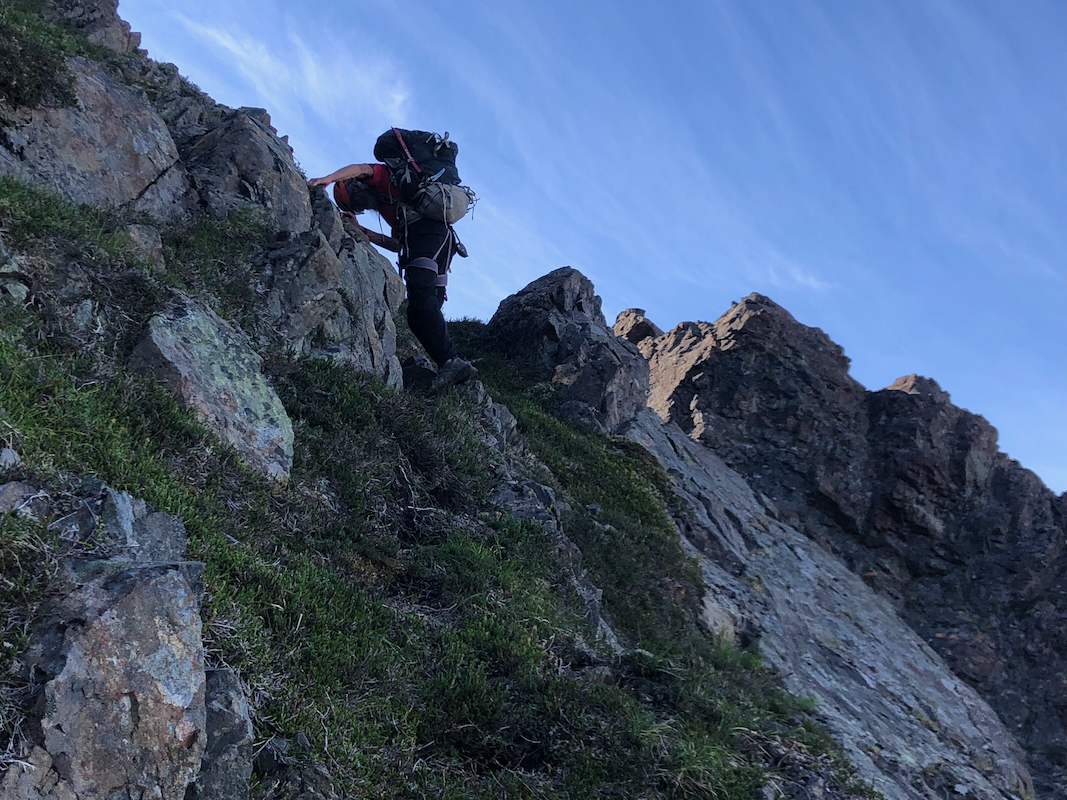
uphill, the terrain is steepish, but not impossible.
When you reach the main crest (ridge), then turn left. You should look for and find
the flagging from the (old) route that came up to this ridge from the opposite side of
the ridge. Once you find the flagging, the route should be fairly easy to follow as it
continues uphill.
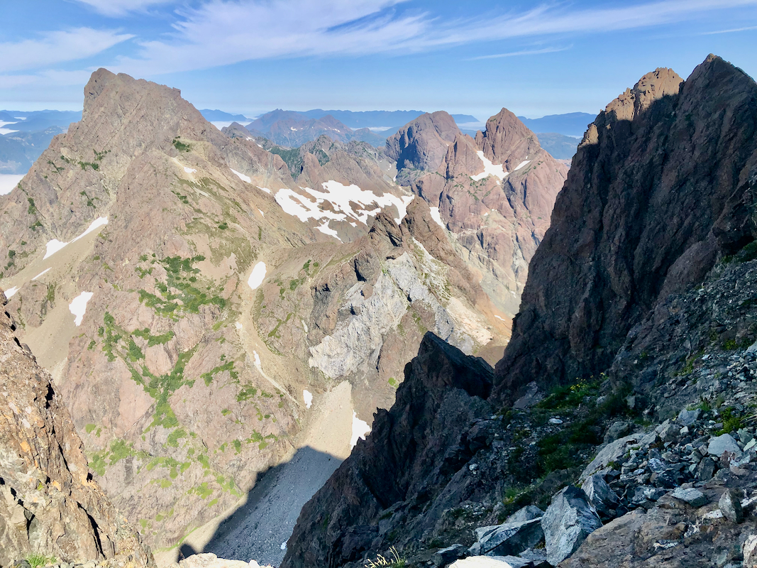
Near location N50.02132, W126.69460, elevation about 1200 meter, you arrive at a
distinct local high-point named the Balcony. A nice view point and good location
for a short rest.
The route continues with a quite small descent, then ascending fairly steeply in the
hillside across, in order to make a traverse above even steeper ground, to reach
the basin below Nathan.s Col. The last part of this traverse crosses a small stream,
a good place to collect water. Descend on slabs to complete the traverse into the
basin below the col.
What remains is a steepish ascent to reach the col. The best route is at least
partially marked with cairns. This col has a few nice camp-sites, look far right
(when looking up from below), that is near the Rugged Mountain itself.
This is the best place for an overnight if the plan is to climb this peak in 2 days.
From Nathan's col there are 2 routes to the summi that are possible for most
parties. The easiest and shortest route will cross the very upper end of
the glacier then access rocks in a fairly broad area that looks good for
scrambling. There is a big bergschrund that cannot be crossed in summer and fall. However,
there are snow-bridges that may be used in the spring. Once you are among the broken
rocks, scramble higher until you can look down opposite. Turn right here and
find your way (YDS-3) a short distance up to the summit.
The other route, called the WFH-route, can be used in summer and fall (most likely not
in the spring). Exit the ridge forming Nathan's col (and the camp-sites), onto the rightmost
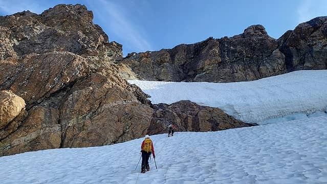
part of the glacier and immediately climb (right) the easy snow slope extending to a higher notch.
This first snow ramp is visible on the right side
in this picture taken from Nathan's col.
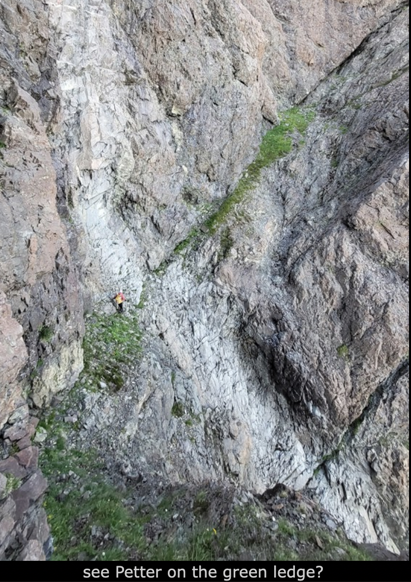
From this notch a sequence of ledges (partly fairly narrow) may be followed. There is
significant exposure here, but no technical difficulties. Continue quite far, until you
turn a corner from where you see new terrain. At this point, when the continuation of the
traverse sort of ends, scramble uphill while traversing to the lower end of a long and
pretty distinct gully.
This gully has
slabs of rock with good friction going uphill
on its right hand side.
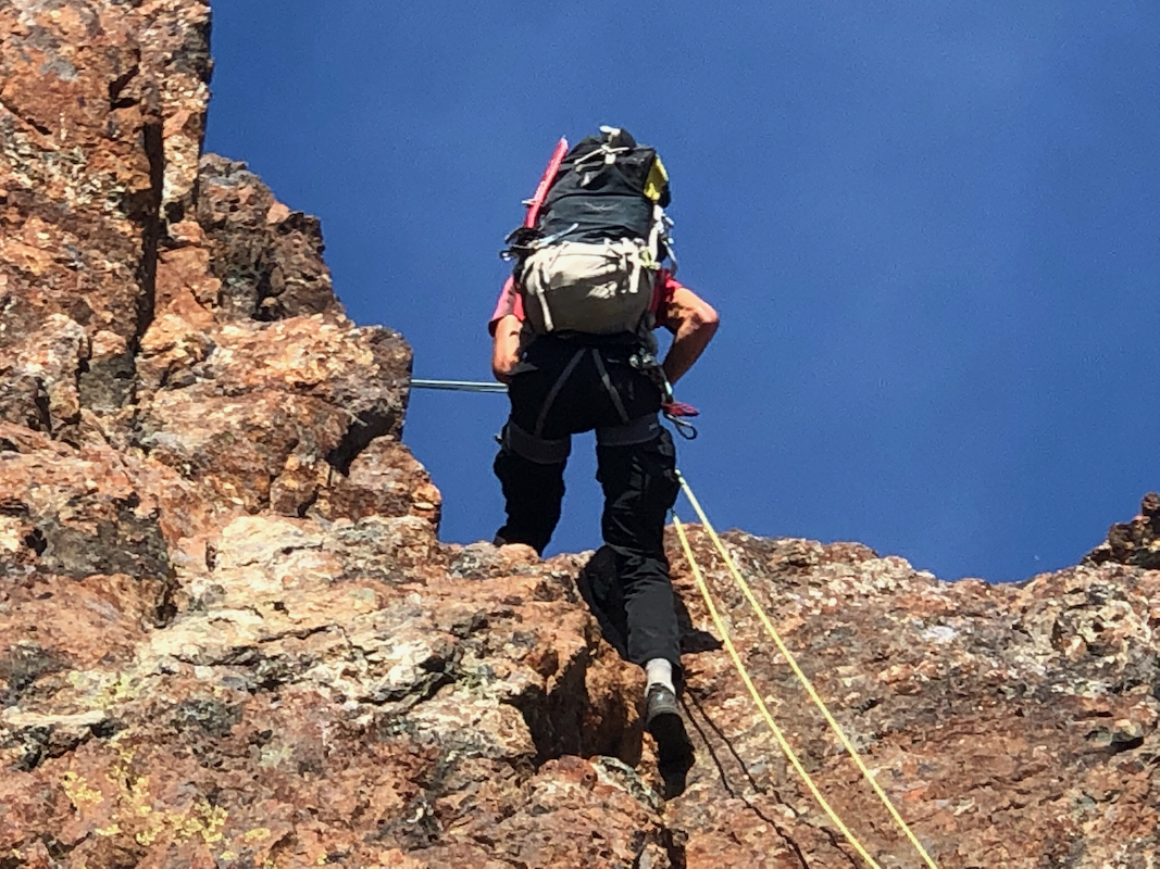
Climb the slabs (or the gully) all the way until a pretty large choke stone sort of
blocks the exit from the gully. This may now be bypassed on climbers right hand side (short
YDS class 4) You will arrive in a small col where the spring route (above) would arrive
from the other side. Follow the natural line higher, going left, then a short passage
directly up. From here, a short, easy scraamble to the summit.
Comments/Trip Report:
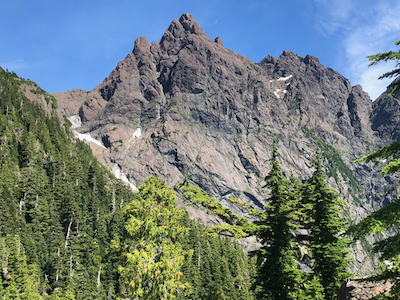
After our nice climb of Victoria Peak, my next objective was Rugged Mountain.
I knew this would be a pretty tough peak and thought a rest day would be nice.
Dave and Adam wanted no rest and went ahead to climb Mount Sutton, while I took
a day off. We met the next day and drove onwards to Woss and the pretty long
approach road going back south. We decided to camp a short drive from the
trailhead at location N50.01233, W126.72514.
The next morning, August 19th. was planned to be our approach hike. We could
possibly climb the peak late this day or, more likely, the following morning.
The plan was to investigate the "Bergschrund route" first, then consider the
WFH route if an approaach from the glacier proved too difficult.
We started hiking up the road at 0715. This road was much too rough for our
Subaru car. No difficulty in locating the cairn that showed where to leave the
road (right) in order to follow what may have been a very old road into
the basin. This was the traditional route and it remains pretty well marked
with tape (flags). However, the route showed no signs of recent use, very
bushy and overgrown. We located the dry creek that signaled the beginning of the
steep ascent to gain the ridge. The climb with overnight gear in our packs,
proved quite hard. We finally made the ridge with somewhat easier terrain, gaining
the Balcony view point by 1150 - about 4.5 hours.
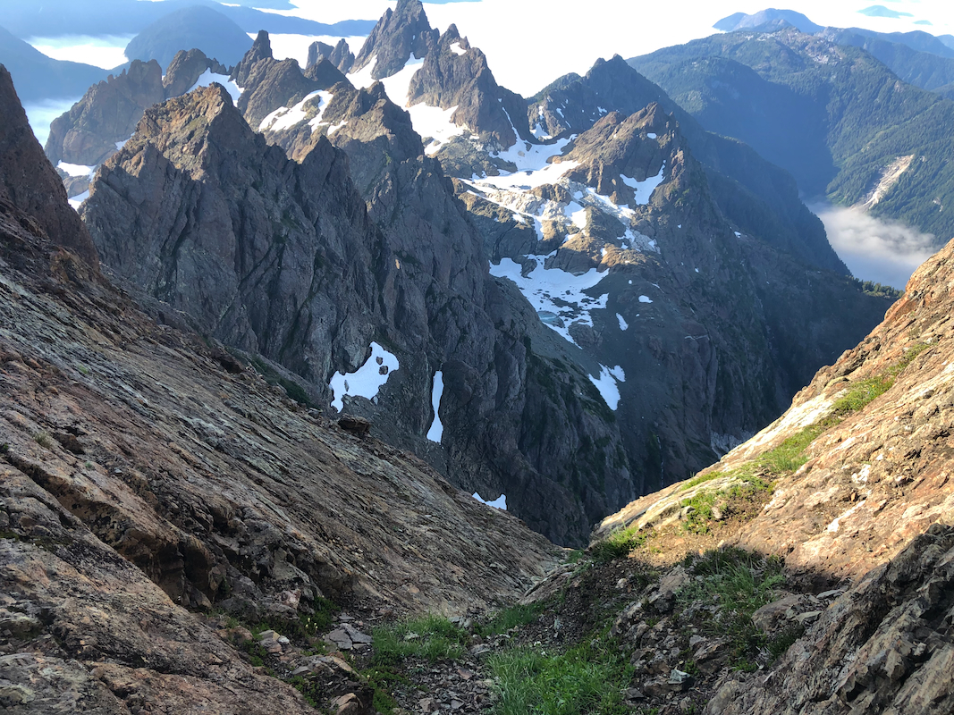
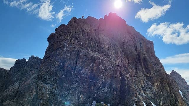
From here, one has a nice view Rugged Mountain,
the WFH route traverses the upper west face (senn in this picture), from the high notch to
the opposite side.
The peak looked pretty close, and given the hard work to get here, Adam suggested
to establish camp at the Balcony. However, Dave and I immediately realized that
this would greatly reduce the flexibility needed to successfully climb the peak.
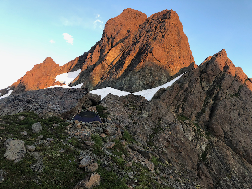
Thus, it was decided to carry on and establish camp at Nathan's col. This is certainly
still quite an effort, we arrived at 1415, established camp and got a well
deserved rest.
The day was not over and we set out to explore if we could cross the bergschrund or possibly
get around it? We roped up in order to safeguard Dave, he was then charged with exploring
the bergschrund. Walking all the way to the lip,
with a safe belay from behind, he concluded
that, unfortunately, no way wecould cross to the rocks.
We next decided to proceed along the crevasse until we found the first possible place
where we could safely cross from glacier to rock. This opportunity caame quickly. We climbed
a moderately steep snow slope to a notch on the rock. Could we climb this (east) ridge and connect
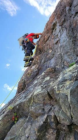
with the route ascending from the bergschrund? We quickly came to a near vertical rock.
Dave led, admitting that this
was indeed pretty hard climbing.
Adam stayed behind while I
managed to follow Dave, hárdest pitch I had completed in quite some time. Above, the ridge
was more of a scramble.
We got to a small local top, then a very narrow knife-edge crossing.
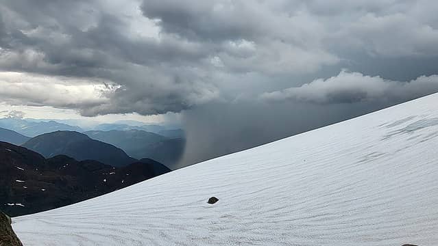
Dave looked for a way to proceed at the same time as Adam made us aware of some dark clouds.
Advancing was difficult and in any event, we would not have time to climb much more today.
We retreated and the dark cloud kept coming closer. Adam decided to hurry back to camp and
save equipment from getting wet. Dave and I needed to get off this ridge as the clouds now
also presented themselves with lightning and thunder. We needed a safe anchor for an
absail, no obvious candidate. A bit uncomfortable, looking for
a safe absail while thunder
kept getting closer. Finally, we found a solution and got off the ridge. Returning to camp,
Adam had taken don the tent, why? - Well, he told me he had left the outer tent (the water proof
part) in the car to save weight. It was not supposed to rain.
Well, here it comes, so much for the forecast. we discovered a large rock that provided
shelter. An hour later, the storm had passed. The evening sun hitting our tent and making the
rock of Rugged glow in red.
Dinner, then bed time. A nice clear sky. Without the rain fly, I could lay down in my sleeping
bag and just gaze at the stars. Wait! what the he.. is that? A large, rectangular space object
appeared in the sky. I had never seen anything like it. It looked like some science fiction
star ship. It turned out that we had spotted 53 Star Link satellites that launched from the
space center in Florida this day.
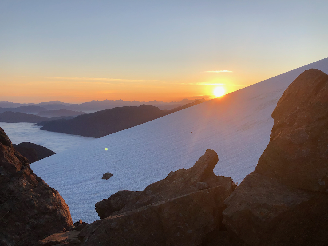
Next morning, a nice sunrise,
a new day with new possibilities.
Our camp-site enabled us to explore a possible route yesterday, then still
have time for a second choice today. The "famous" WFH-route should now be tested. We quickly
cramponed up the snow slope to the notch and proceeded to look around the first corner to see
what the future might hold, Yes indeed, a somewhat narrow ledge continued around the first
part of the big rock face. I eagerly went ahead to get a better idea. Adam looked at this,
it clearly looked worse than reality.
He decided to turn back. Dave came along and quite
incredibly, this ledge route got us all the way around the big rock face of Rugged Mountain.
Just as Dave was looking to see how to continue the traverse, I pointed uphill and said that
the route now would climb up into a big gully. We advanced fairly fast up on the friction
slabs on the right hand side of the gully, then a final, slightly harder move to get around
the choke stone on the very top. From here, we could look down towards the bergschrund area.
What remained was not very hard and we were soon on the summit of Rugged Mountain.
The time was 0930, it had taken us 1:30 from camp. Beautiful views all around. Quite
a good summit to enjoy for a while. We finally left at 1000, used the rope for
a couple of abseils in the upper part.
Next, carefully back along the WFH route,
along the narrow ledges, then
returning to camp at 1100, one hour.
After about a one hour break back in camp, we started back down at 1200. This climb
is not done before you are back by the car. Descending from Nathan's col with overnight
backpacks requires continuous care, the first part of this descent is still steep.
We made it back down to the Balcony by 1415. The ridge part is one of the easier sections,
then we decided to descend off the ridge to our right, opposite of our ascent. It is a steep
and somewhat complex hillside, but much shorter than our route of ascent. Back down on the
forest road
by 1530, then more leisurely along the road, returning to the car by 1700.
Many thanks are due to both Dave and Adam for excellent company on a peak that certainly
lives up to its name!
Resources:
Images
Many pictures in this report are taken by Adam Walker.
Panorama view from the summit of Rugged Mountain (video).