How to get there:
This trailhead is next to a rifugio (often closed?) located in a small
mountain valley at location N44.13434, E10.19759, elevation about 1070 meter.
SP-51 and SP-58 both connects to a final, narrow road that leads to this trailhead.
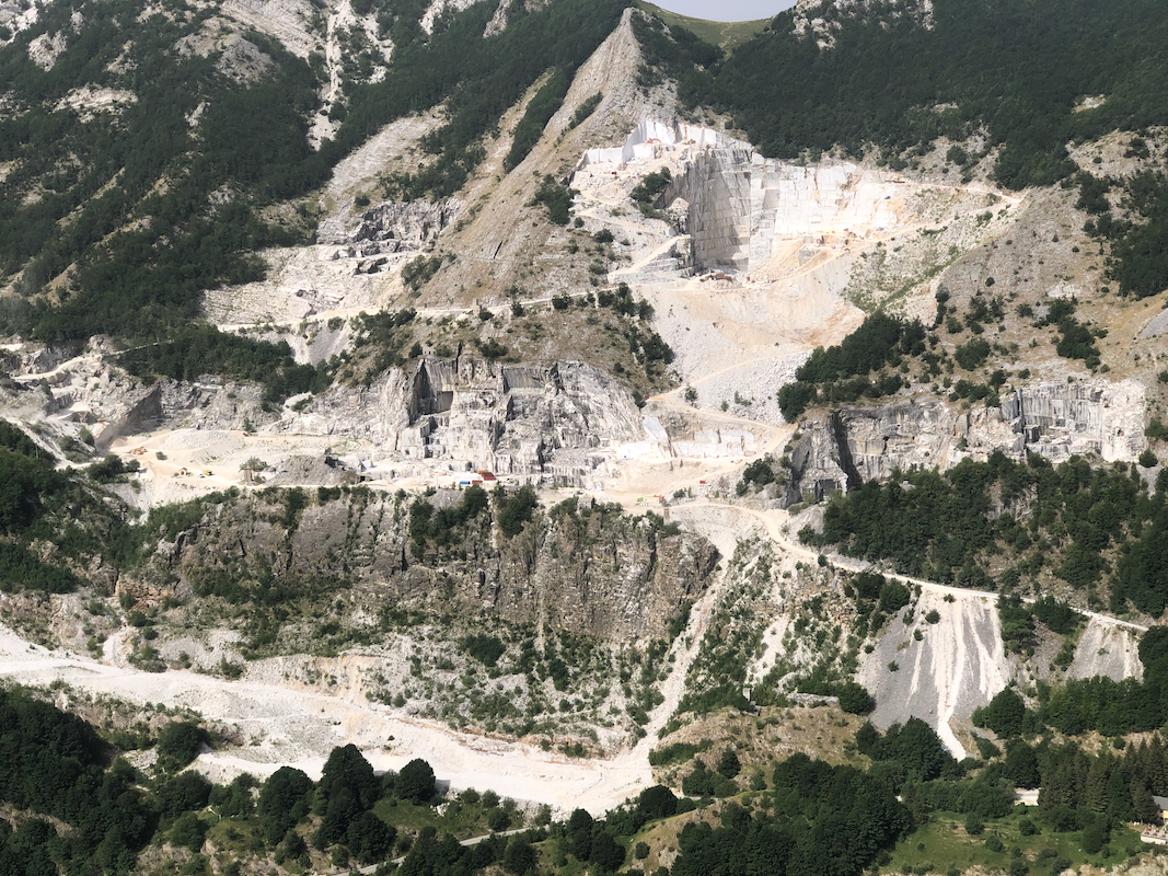
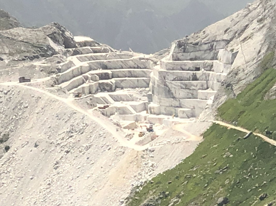
One should be aware that big trucks that carry rocks are very frequent
on this road since (unfortunately!) there is a quarry
in the mountain slope opposite of Pisanino at the end of this
valley.
Route::
A quick summary of the peaks climbed in Italy 2022.
Start from the parking area immediately before the rifugio building. A little looking around should
reveal a small, unmarked climbers trail in the grass that heads across to the mountain slope.
Follow this path, it is helpful and will get you up the pretty steep grass slope, a vertical
gain of about 400 meter. There are some small areas of rock that this trail avoids by going
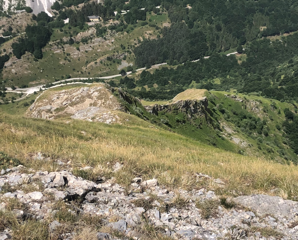
right. You should get to location N44.13877, E10.20385, elevation neaar 1400 meter. This is a pretty
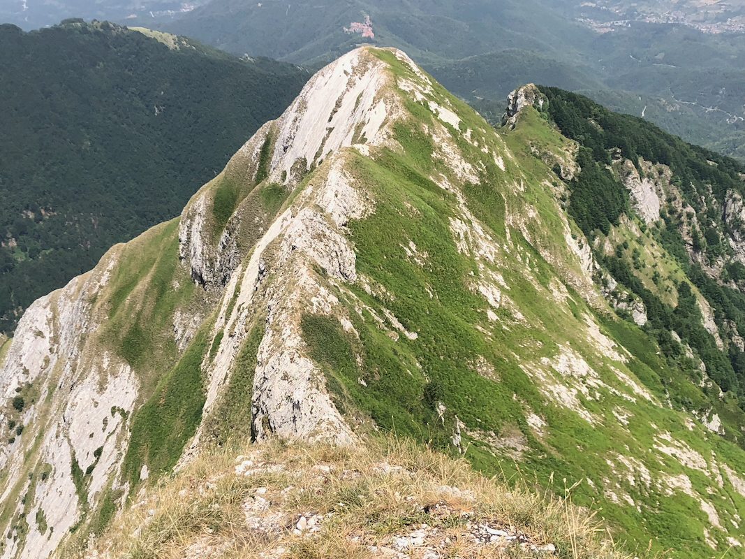
distinct, small plateau and one will see a well defined ridge line
extending uphill from this point.
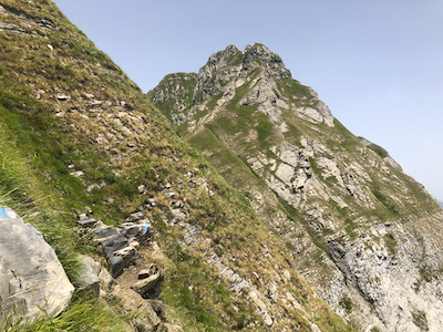
From here, follow the ridge uphill, staying on or slightly on the right hand side.
There is (YDS) class 3 scrambling along this ridge.
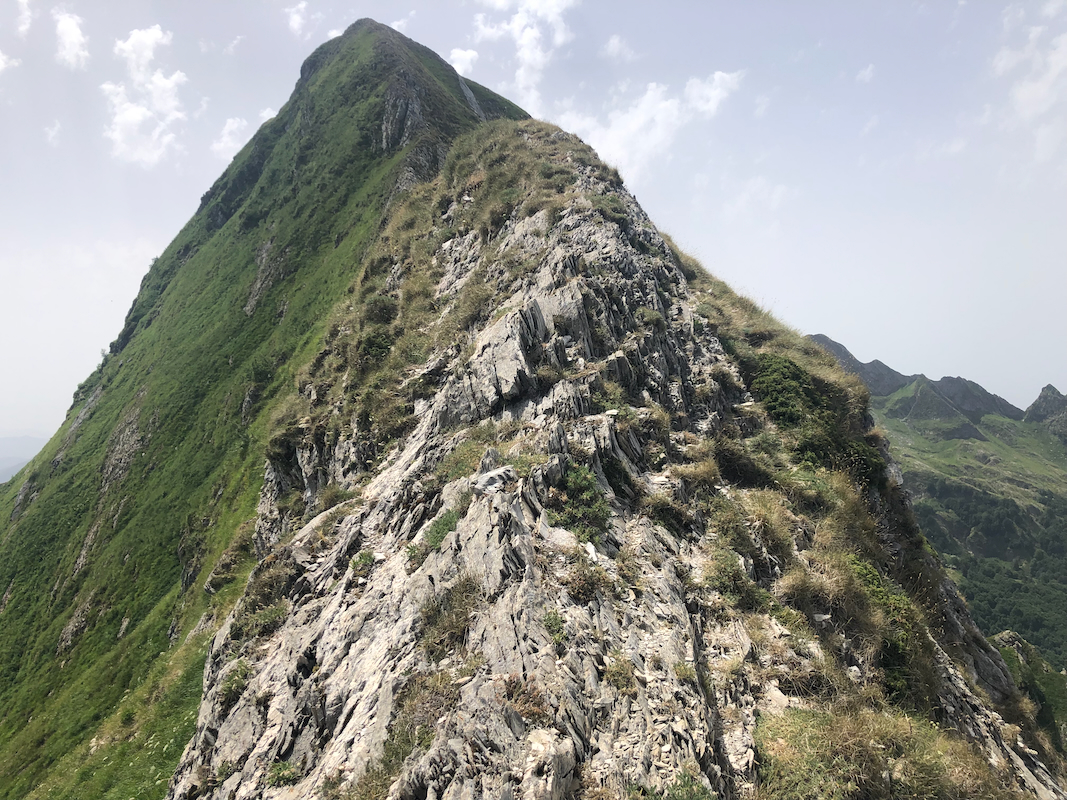
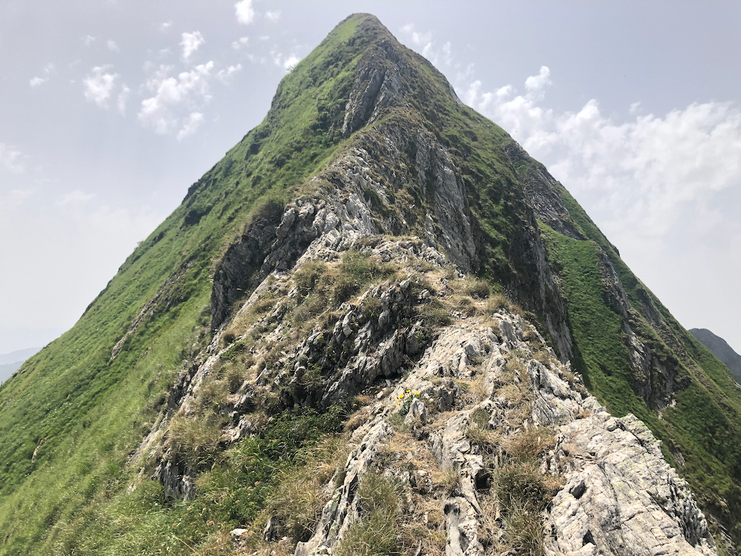
Higher up, the ridge steepens, one may
continue on the very top of the ridge crossing a large, slab like rock (with cracks), then
ascend more steeply, or make a by-pass out to the right (a fair way), then ascend as one
traverses back towards the main ridge. This may be the crux area of the ascent.
The route then reaches a small summit point at location
N44.13817, E10.21030, elevation near 1800 meter. You have reached the main north-south
ridge, the hardest part of the climb is done.
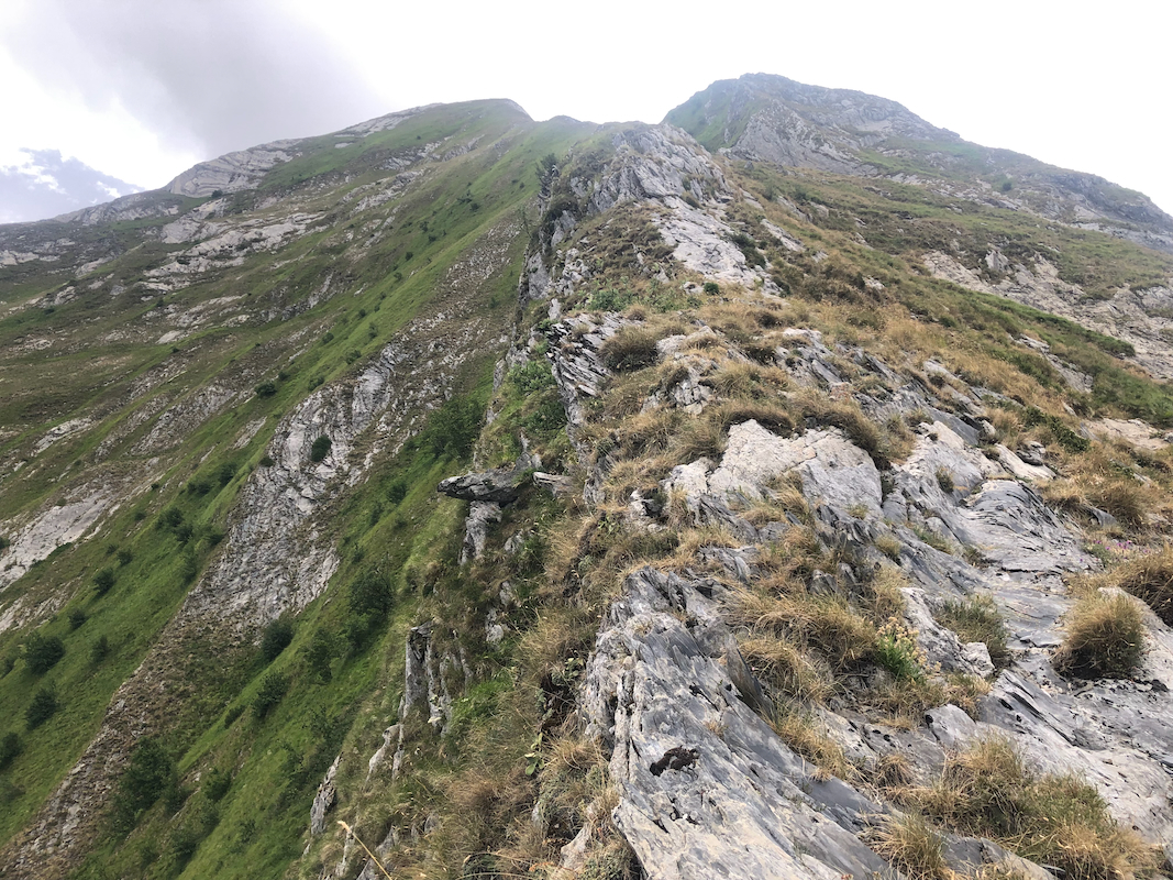
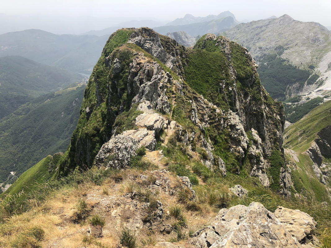
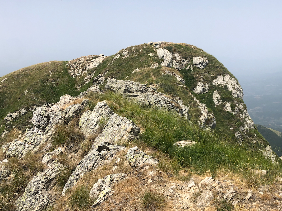
From here,
the route continues south along the top of the ridge,
nothing difficult, however the ridge is quite narrow
in various spots.
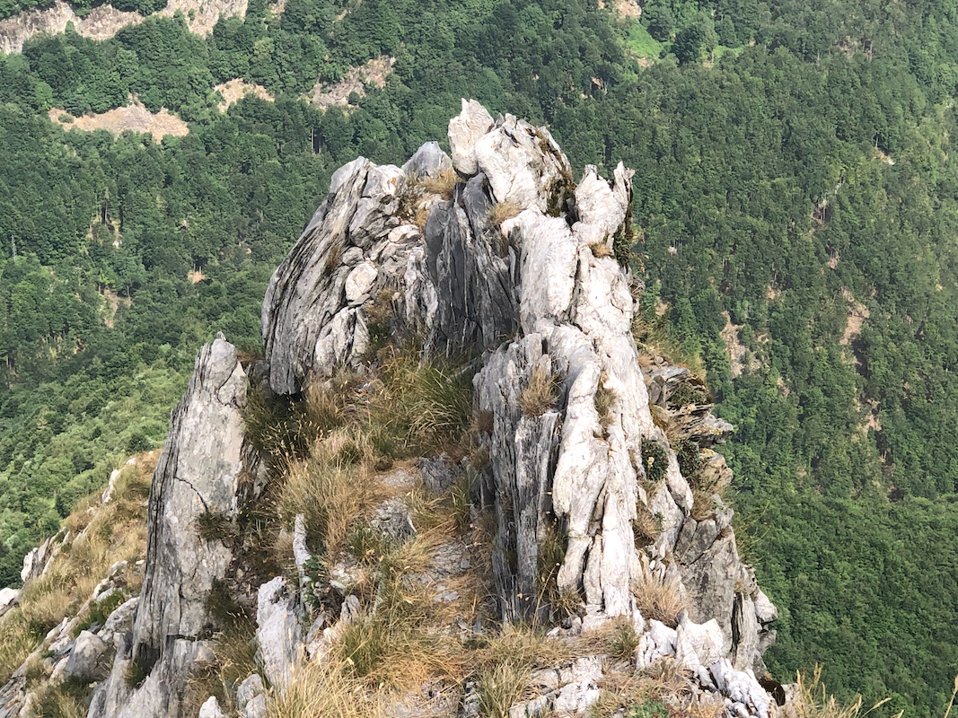
You will reach a single, steeper step. One may climb
up along the rocky ridge, climb a small
gully immediately left or bypass this point (steepish terrain) on the right hand side, possibly
also on the left. Once above this point, the remaining part of the ridge is quite easy.
You arrive directly to the highest summit.
There is a blue marked route from the summit back down into the valley. This route is marked with
the normal red/white stripes after merging with other routes part-way back. This route provides
a way to climb Pisanino that never exceeds (YDS) class 2 in difficulty (ie. no scambling/climbing).
If using this route to climb the peak, then continue into the valley (from the parking) and follow
the signed and marked route numbered 178. This will connect with the blue marked summit route.
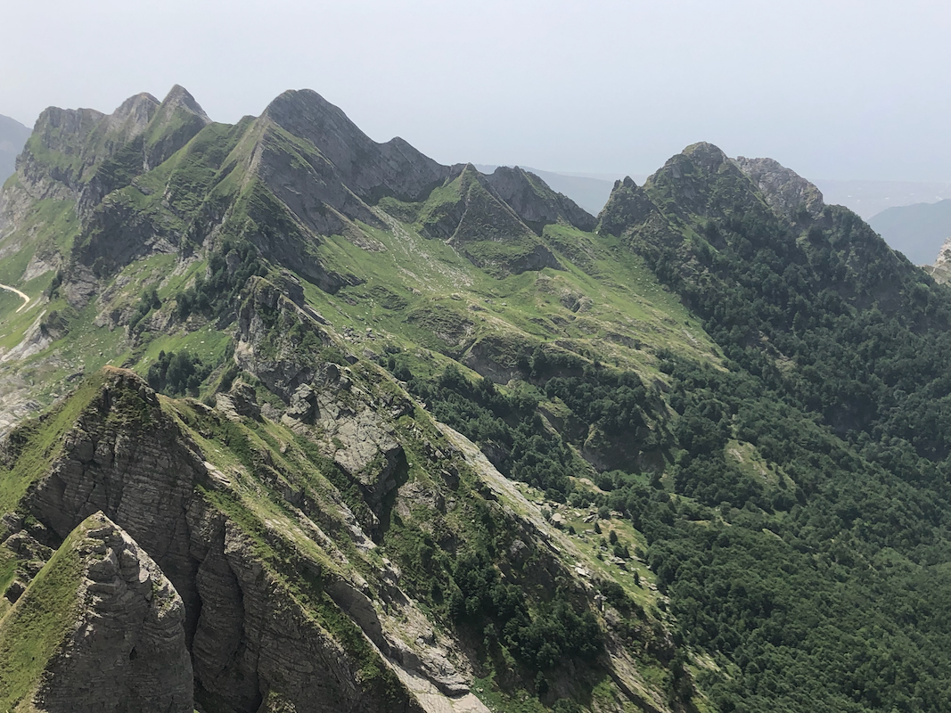
There are a couple of summits points
as one proceeds along the ridge, but these are
all lower than the main summit.
Comments:
I started at 0900 and reached the main ridge near 1800 meter shortly after
1100. On my way to the summit, a single gust of strong wind blue my hat off
and down below the steepish cliffs that formed the narrow ridge that I was about
to pass. I decided that I wanted my hat back. It took significant time to first
backtrack to a point from where I could safely descend, then traverse the terrain
below the ridge (still steepish), and search for my hat. I eventually did find
it, then climbed back up on the ridge
before completing the step, then arriving at
the summit near 1200 noon.
I left the summit around 1215,
descending along the blue marked route.
This first descends a pretty long gully, then
shifts across to the east (eft when descending) side of the main crest.
After quite a bit of traversing as well as descending, this route finally
climbs back up and crosses the main ridge in a col named
Foce di Cardeto at location 44.12212, 10.21428, elevation near 1640 meter.
From here, the trail, marked as trail no 178, descends back into the valley.
I was back down by my car around 1500 after a nice hike descending along this normal
route for ascending Pisanino.