How to get there:
This mountain is located close (west) of the capital San Salvador.
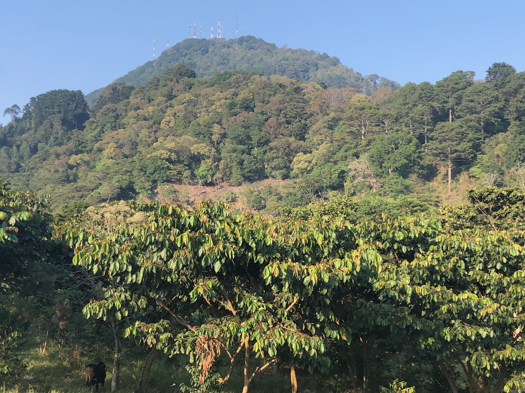
The summit is a fenced in area of antennas. These are guarded by armed personel
and they do not allow access to the highest point. I would therefore recommend that
one finds an alternative summit to climb.
The best trailhead is from a north-south road, directly south-west of the summit
at location 13.73663, W89.26486, elevation close to 1600 meter.
A quick summary of the peaks climbed in Central America.
Route::
Cross the road and follow the trail that heads towards the hill. This trail soon climbs
uphill and gains the south ridge. Continue up the ridge, then foow a steeper section where
the trail has zig-zags. You will arrive at the south end of the fence. If the objective is
to come as close to the summit as possible, proceed going left, ie. walk along the fence
on the west side. You will locate the highest point near location
N13.74446, W89.25662, elevation about 1940 meter.
The highest point is only a few meter on
the inside of the fence.
Comments:
We arrived at the trailhead on our return drive after first visiting the
highest mountain in El Salvador, Cerro El Pital, around 1415.
The trail was easy to folow and pretty short,
about 40 minutes to the fence.
This trip had been "sold to us" with a promise of reaching the highest point.
I was therefore quite surprised when it turned out that the guides wanted to turn
back as soon as we reached the fence. I told them that as a minimum, we would have to
encircle the fence, investigate where the highest point was located etc. They immediately
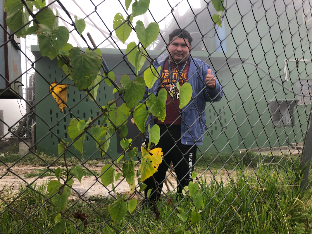
tried to argue that this was impossible and very dangerous. However, we went along the fence
and soon met a man on
the inside. Asking him to enter turned out to be negative.
We next continued to the road access and talked to a guard stationed there. Same result.
The continued route on the west side is somewhat cumbersome.
They have used this slope
to throw away all sorts of garbage. Quite unpleasant. We finally located the
highest point, it would have been much easier if we had circled clock-wise. The return
descent was pretty fast as well. Basically, this was a peak one should avoid.
