Cozzo del Pellegrino
- Cozzo del Pellegrino
- 1987 m
- Primary factor 942 m
- Italy
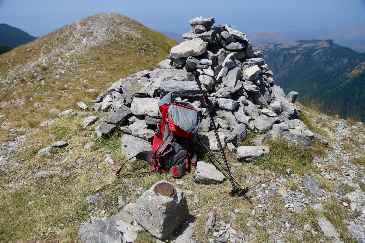
- Location: North 39.74227, East 016.01118 (GPS at the summit)
- Difficulty: YDS class 2
- Climbed August 4. 2017.
Cozzo del Pellegrino
|
|
How to get there:
The key road to locate is Hwy. SP263. This road can be accessed quite easily from the autostrada A3, via
SP131 and SP132 (just north of the lake Lago dell Esaro). SP263 runs across to the coast. If driving from
the coast, then the turnoff to San Donato Ninea is just after milepost (actually kilometer!) 42, this is
measured from the turnoff from SS18 (that runs along the coast). Shortly after you enter San Donato Ninea, driving
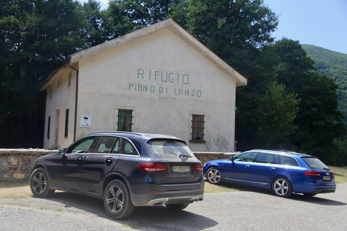
uphill, you will see signs for Pellegrino and the Rifugio. The road to the rifugio is paved all the way, but
has a few section with dammage where one should drive slowly. Park at the rifugio, location N39.72799, E016.01986,
elevation about 1350 meter.
Route description:
Walk about 50 meter back along the road, locate the normal red/white markers leading steeply uphill
along a pretty wide track. Soon, you are up at a farmers road that heads left. Follow this road, there
is one fork where you should take the right (uphill) fork. This road runs all the way to a small clearing
near a saddle/col along the main crest. Just as you are about to enter the clearing, the well marked path
turns right and climbs to the col. There, the route first follows the ridgeline, then ascends in a small gully
before a bit more of ascent on the right hand side of the gully. Next, the route crosses some rocks, then
ascends steeply up a slope that will gain a small, subsidiary peak.
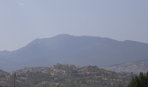
From here, you have a clear view
of the peak for the first time. The trail descends into the forest and picks its way (be careful to
find the marks) through, emerging along the ridge. What remains is now a very short ascent to the nice
summit.
Comments:
I drove from our hotel at 0900 and had decided to go south along the coast, then take SP263 inland.
My car GPS objected more than normally to this choice, but when it/she finally accepted my choice
the distance dropped from 120 km to 80 and the expected arrival time remained about unchanged. I parked
at the rifugio shortly
before 1100 and left at 1110. The trail was easy to follow and the route was quite nice.
I arrived at the summit at 1240, so 1:30 up with no rush.
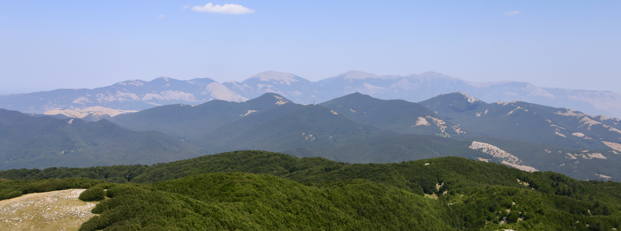
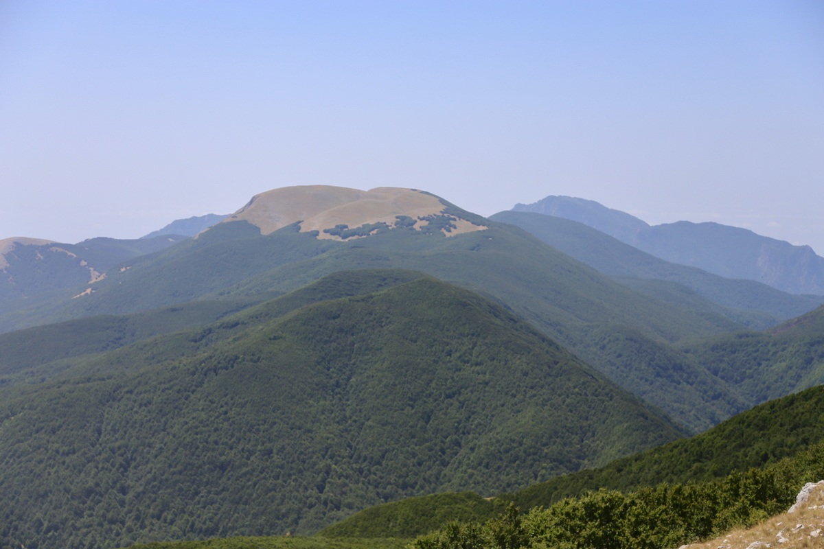
Pictures were taken. The nearby ultra that we climbed
already 12 years ago could be seen to the north.
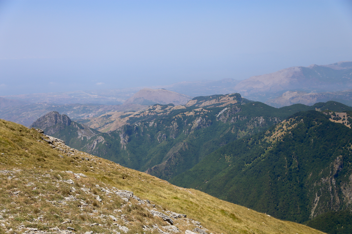
One should be able to see both coasts, but too much haze prevented this.
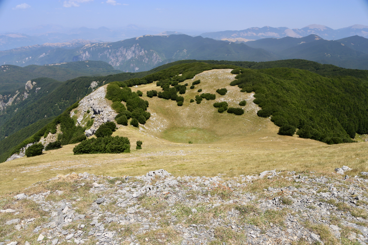
The nearby landscape was nice, a small bowl just
below the summit - in Norway this would have been a lake.
The limestone rock drains such formations here.
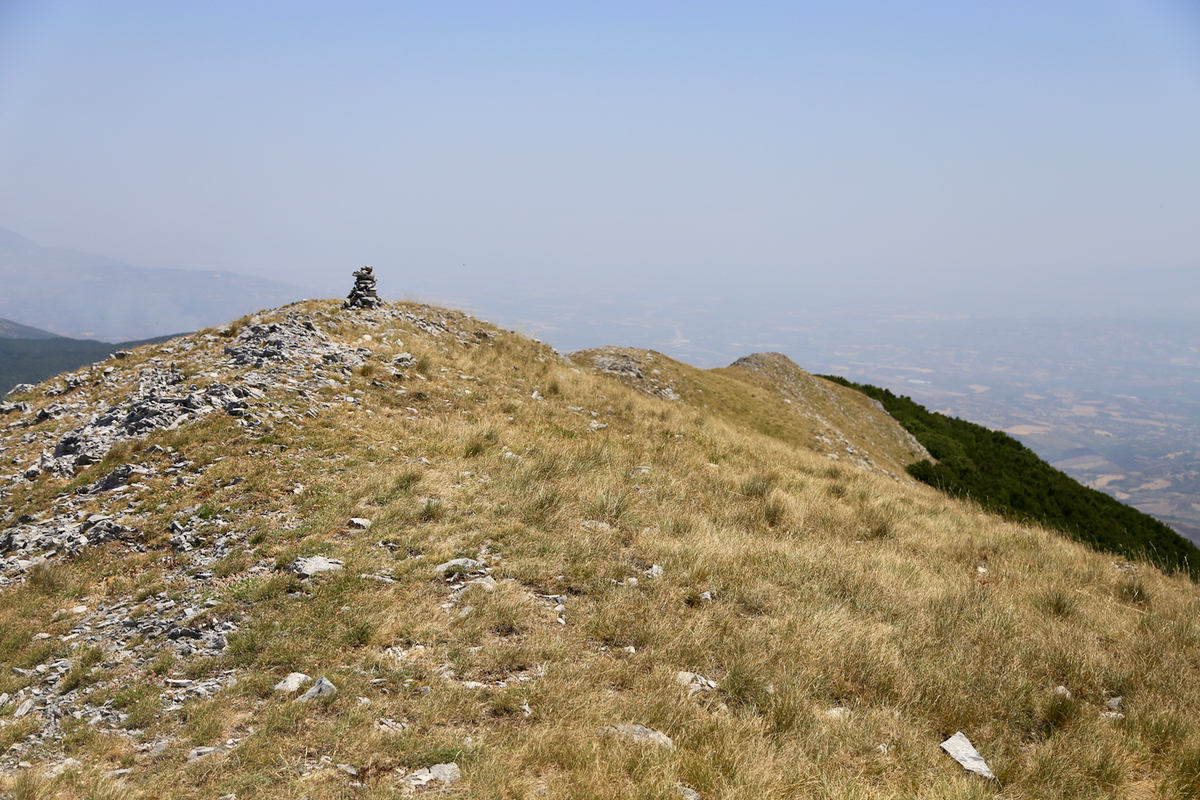
Similarly, the ridge falling off to the east might be a good
route, perhaps in winter.
The lake Lago dell Esaro was visible
in the main valley. The continuation of the crest beyond the col where my route came up, holds another
peak above 1900 meter.
After 15 minutes, I started walking back down. In one hour I was back at the rifugio.
I decided to accept the GPS route preference going back. Not surprisingly, the A3 was quite nearby.
It still took 2 hours also this time, so the choice should depend on other
factors.