Montalto
- Montalto
- 1956 m
- Primary factor 1710 m.
- Location: Calabria, Italy
- Location: North 38:09.515, East 015:55.197 (GPS at the summit)
- Difficulty: YDS class 1
- Climbed: July 18. 2005
|
|
Information:
How to get there:
This summit (it is really not a mountain) can be accessed via a short
path from a nice little road that will take you close to the summit.
Drive to the small resort town of Gambarie, this is about 30 km inland from
the strait of Messina (separating Sicily from the Italian mainland). From
Gambarie, head south, then keep left at the roadforks staying at the small road
(signs for Montalto) that climbs the ridge running (more or less) west to east,
locate the base of Montalto (signs and a small trail).
Alternatively, if this should be a real hike with some vertical gain on foot, your
trailhead is in the middle of the small village Gambarie. This place (the fountain)
has elevation 1322 meter, location N38:10.021, E015:50.190.
Route description:
Montalto is really just the highest point on a long ridge. The entire
hill is covered by trees. I did not see any natural steep ascent route, thus
the best way to make this climb satisfy the minimum 600 meter vertical ascent
(established for climbing the Europe 100 most prominent peaks) seems to be
with a start in the center of Gambarie.
The roundtrip hike is about 18 kilometer, the local tourist map indicates a 9 hour
hike, however, a strong walker can do it in 5-6 hours, depending a bit on the route
taken.
Alternative I Head uphill from the fountain along the road that
runs parallel with the chairlift. Locate the downhill slope and continue uphill
until the top. Follow a dirt road a short stretch until it connects with the
small paved road that serves Montalto.
This location has elevation 1793 meter and coordinates N38:09.181, E015:51.874.
Follow the paved road (left) until you reach the base of Montalto, a pretty obvious
trail forks off to the right and climbs the final stretch to the summit.
Alternative II There is an "official" trail from Gambarie to the
summit of Montalto. This trail is number 3 and is supposed to be marked with red and
white paint. From the fountain, go down to the main crossroad (route 183), go right
until you leave town, then locate the trail as it enters the forest (just left of a fence).
The trail is broad as a small dirtroad, but there is little sign of use. Follow this trail
as it climbs the hillside, generally traversing, the uphill will be on your right side.
The trail winds its way in and out of gullies, crossing small creeks etc. After a while, it
becomes a much smaller trail, but still marked. Eventually it crosses a ski slope, first under
a chairlift then across a downhill slope. At this point I lost the trail and cannot offer
much more description. It is always possible to climb the hill and find the small road
that runs along the top ridge (see Alternative I). I did notice where this trail is supposed
to join the road, a possibility would be to trace the route starting from Montalto, however due
to limited time I did not investigate this option.
Comments:
We arrived in Gambarie from Sicily and I decided that a hike
to Montalto before dinner might be good. Asking in the hotel
reception about the hike, they produced a tourist map with trails
and told me that a hike to Montalto might be about 2 hours.
I located the trailhead indicated and started along a trail that looked good
except that nobody seemed to have used it for years. It seemed to correspond to
the map as I crossed several small creeks, however, it got progressively worse
and after crossing a downhill ski slope I totally lost the trail. A struggle in a
steep and slippery (due to leaves) hillside brought me up to another trail. This
trail topped out on the crest of the hill where I located a small road winding its
way. I now followed this road to the base of Montalto, then took a short uphill
trail to the top. I had been walking fast, partly jogging, but still this ascent
took 2.5 hours. I considered the tourist map and found a short description of the
trail from Gambarie to Montalto in Italian. I did not understand much of it except
the estimated time: "9 Ora". I had left at 1530, reached the summit at 1755, I stayed
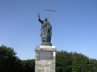
for 15 minutes and drank my one litre of water, took some pictures, but the haze and
trees prevented a really good view. I decided to find a better route home as dinner
was planned for 8. Running back along the small road on the top of the hill until
I located a dirt road that branched out on a ridge pointing towards Gabarie, then
straight down the ski slope there brought me back to the hotel in 1:25, not bad
considering the official time estimate.
The M5 trip continued two days later with ascent of Serra Dolcedorme.
Resources: