Location: North 62.47272, East 007.63837 (GPS on the summit)
Norland, Norway
Difficulty: (YDS) class 3
Climbed October 17. 2015
Information:
How to get there:
The trailhead is located slightly above the tourist facilities at the top of
the famous Trollstigen highway. This road (Hwy. 63) connects Åndalsnes with
the valley Valldalen. There is a turnout parking for 4-5 cars at a place named Strupen,
location N62.44700, E007.66164, elevation about 750 meter.
Route description:
Follow a cairned path from the trailhead up to a bridge at the outlet
of lake Bispevatnet, elevation 1000 meter. From here, the trail runs
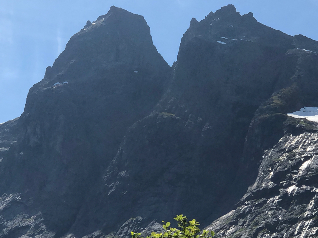
along the lake (east side), then gains the (1120-1140) saddle between
the two peaks, Bispen and Kongen. The trail actually serves Bispen, in order
to not get too high, leave the trail left and cross through talus (boulders)
to the saddle.
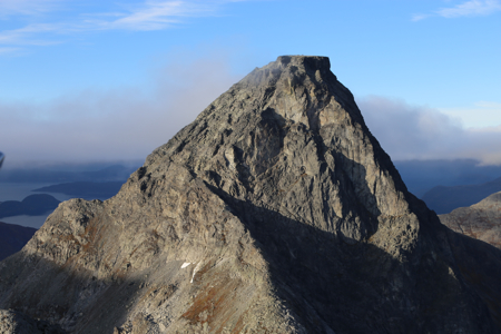
From the saddle, climb the obvious ridge that ascends towards the higher
cliffs of Kongen, then turns a corner on the left. From here, the route
is marked with some red paint on the rocks as well as with small cairns.
Ascend a wide gully, then traverse right, slightly exposed and ascend a
step (crux of the route), in order to get into another gully running
further right. This gully serves the summit.
The summit is rather large and pretty flat. There is a big and many
smaller cairns as well as a small shelter.
Comments:
We all mt already on Friday evening at the "hut" in Valldalen owned by
Børre. Our DNT Fjellsport foundation had scheduled its annual board meeting
on Monday. With a good forecast, we all looked forward to 2 good days in the mountains.
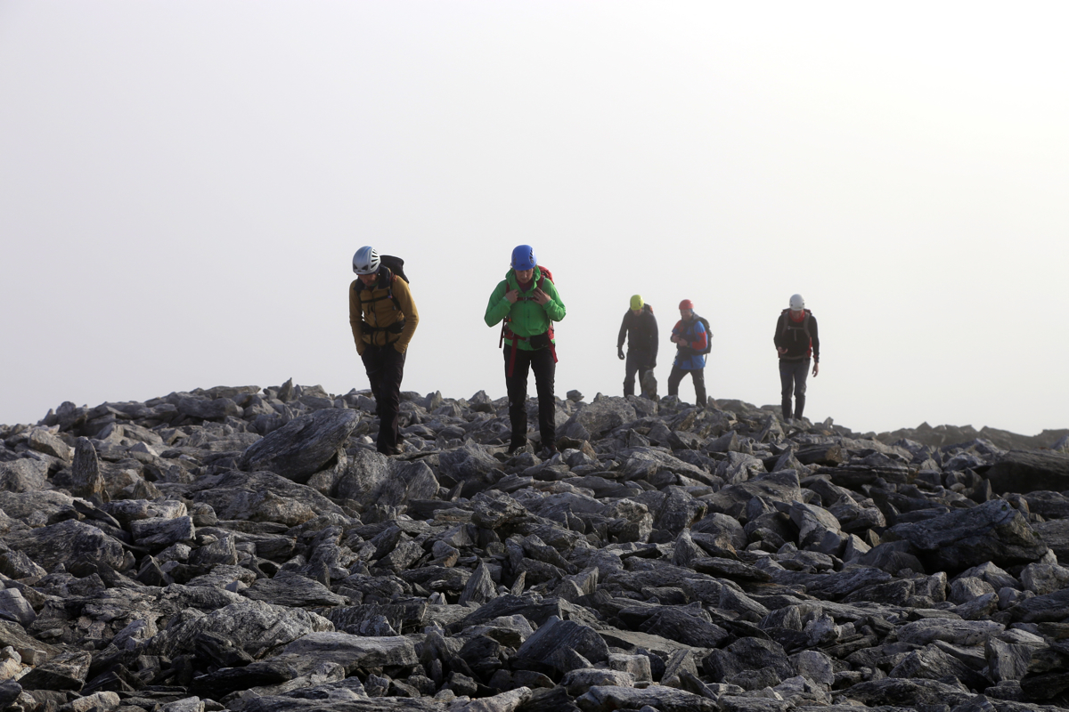
We were ready to hike around 1000. The hike to the saddle was straightforward. The ridge
that continued, looked interesting. We quickly ascended. Turning the corner where the
ridge ended, got us into a route that was well marked. I was up a bit before
1300, the group followed shortly after.
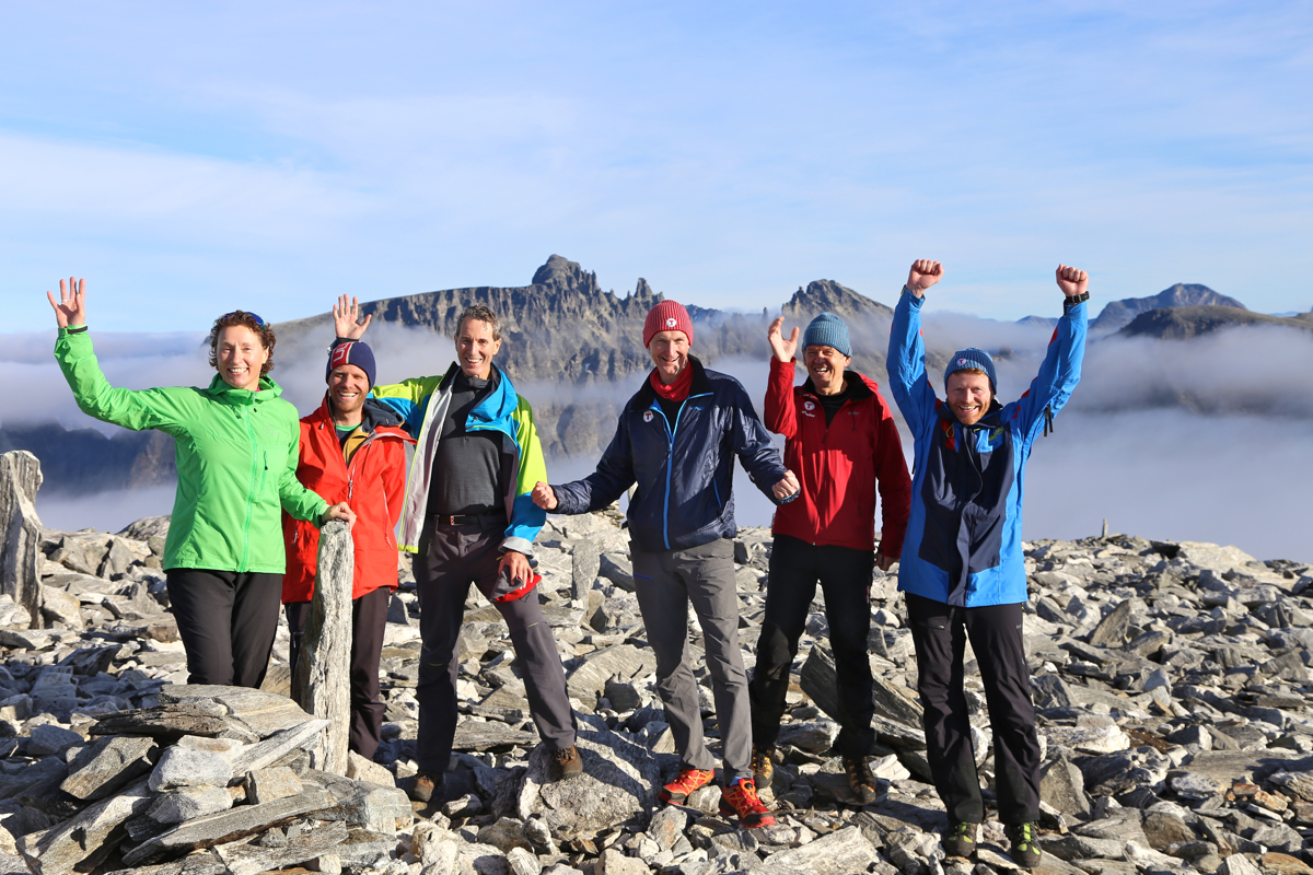
The summit was still fogged in, however one could sense that the fog was slowly
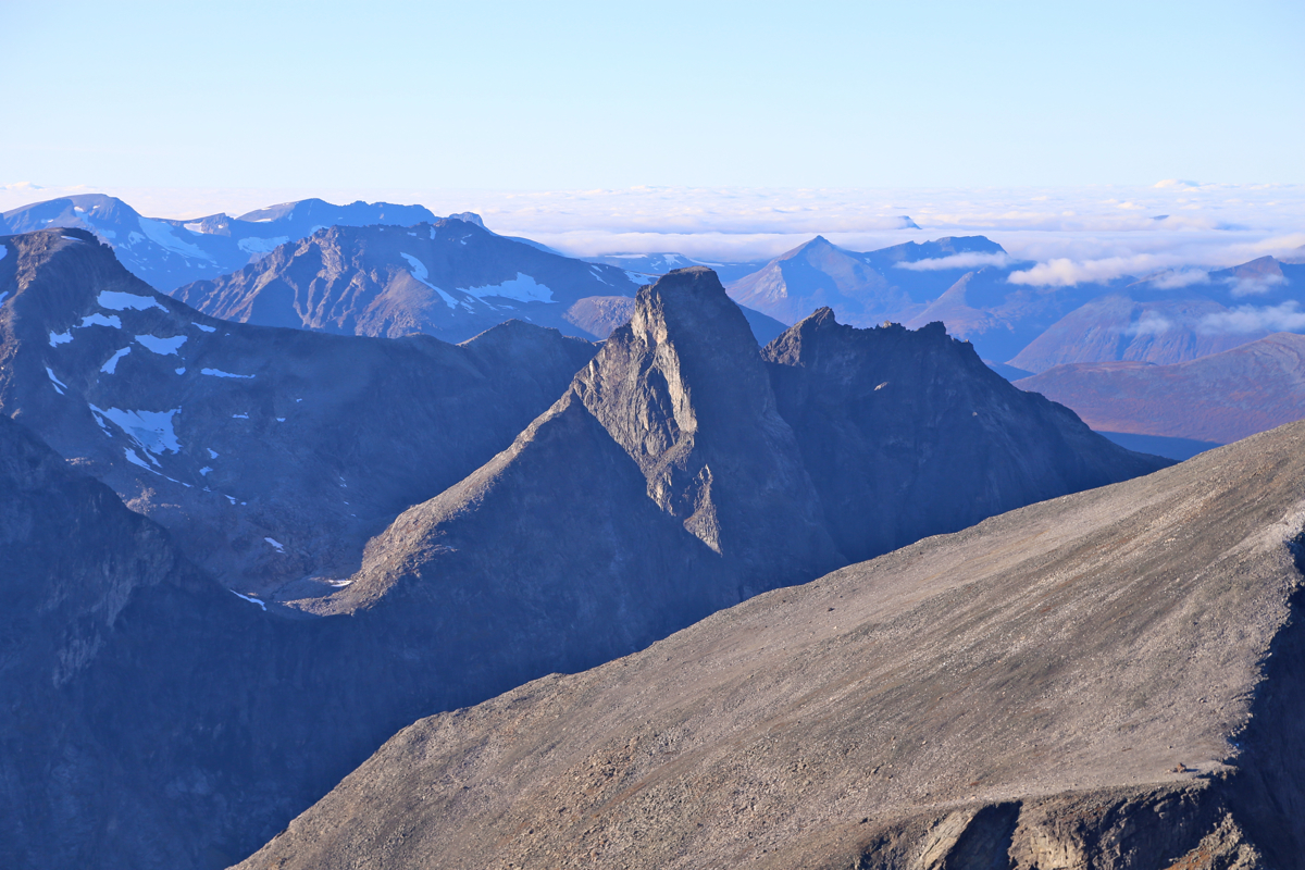
going away. Gradually, other peaks started to appear. First, Store Trolltind, then
Finnan. The next neighbor, Dronninga, also started to emerge from the mist, the sun made
an interesting "Broken Spectre" visible on her right hand side.
We stayed on top for 1:15, by the time we descended, the fog had cleared and the
landscape below was in clear view. We were back down at the saddle by 1500, then ascended
Bispen (1545), descended back down and returned to our cars by 1800. A very nice day among
famous peaks near Trollstigen.
Thanks are due to all participants,
Nils, Lars, Børre, Kari, and Halvor.