Location: North 47.72941, East 014.77745 (GPS at the summit.)
Difficulty: YDS class 2
Climbed October 5. 2014.
Information:
How to get there:
Locate Hwy. 25, this road connects Wieselburg near the authobahn from Vienna
to Linz, with the village of Hieflau further southwest. That is, Wieselburg is
located about 110 kilometer west of Vienna. Going south on Hwy. 25, to a small
place called Palfau, this is on your right (wesa) side shortly after passing the
fork where Hwy. 24 runs east. Take this sideroad to Palfau, continue until you are
close to the church, fork right just before the church and drive uphill to the
last (large) farm. You may park somewhere without blocking any access near the first
house. Ask the local people about parking if this is not obvious.
This location is N47.71114, E014.79754, elevation about 640 meter.
Route description:
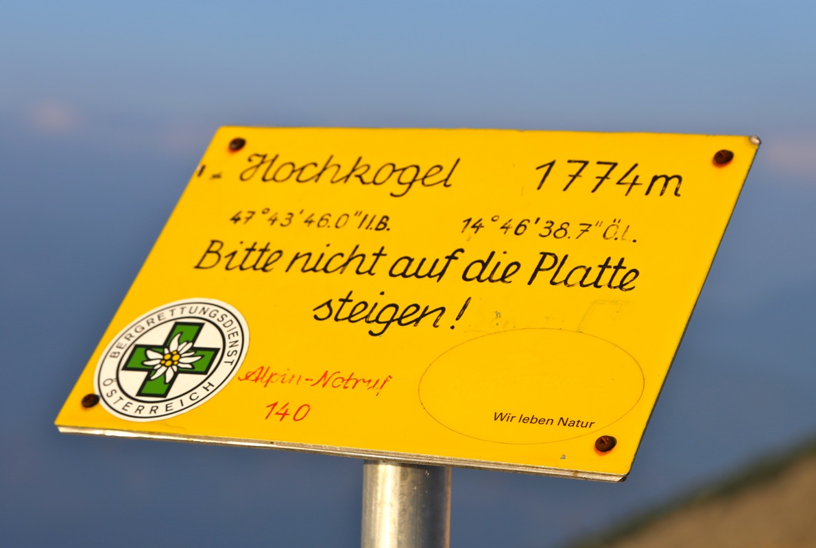
Note that all trail signs related to this peak says Gamsstein.
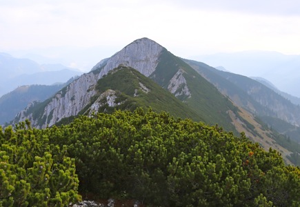
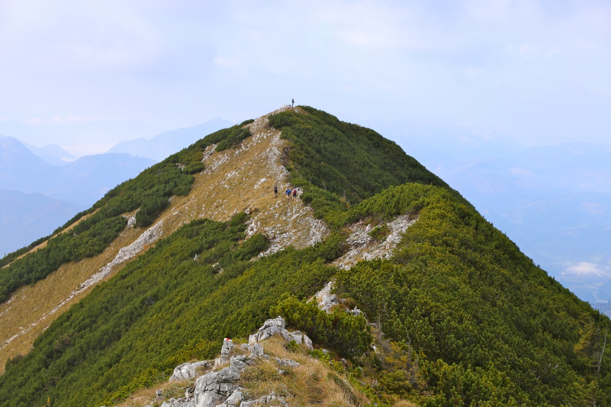
Gamsstein is the north peak on a short and fairly horizontal summit ridge.
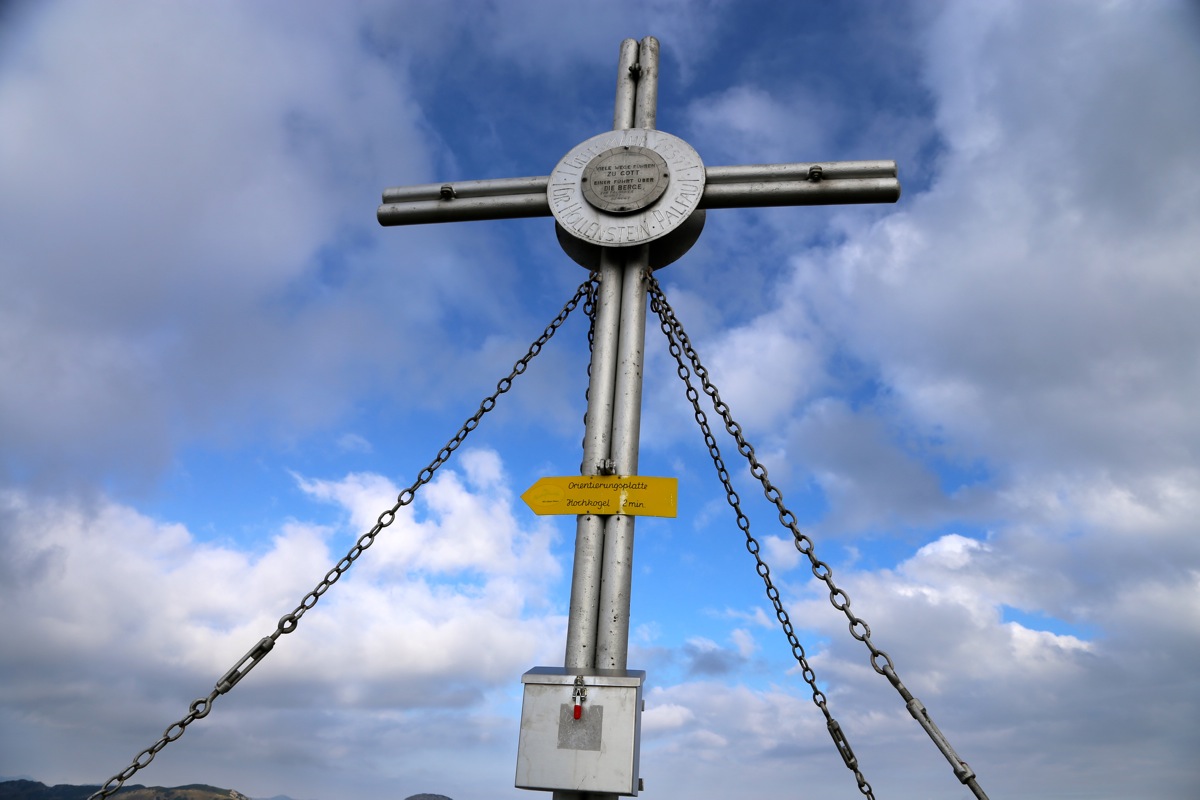
Gamsstein has the summit cross and the visitor book. However, the south end
of the ridge is supposed to be 4 meter higher. This point has been given the name Hochkogel.
Why this mountain has two different names is a mystery to me. I asked a couple of
local hikers, but none of them could offer any explanation.
From the trailhead, continue the narrow, paved road as it curves right and climbs
up to the last and highest building. There, a forest road runs right, this is not
correct. Instead, head directly uphill on grass as you locate a small trail sign
posted higher up. (this sign would have been better placed down by the road.)
Follow the trail, marked with red and white uphill. There is more or less an old
forest road the first part. Higher up, the trail climbs a slightly steeper grass slope
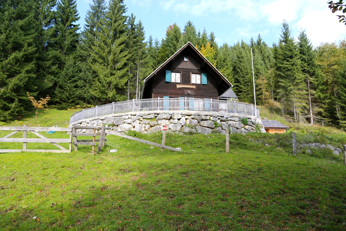
in a few zig-zag turns. You arrive at more grassy landscape and will locate the hut
called Naturfreundehütte, at
the upper side of the open area.
Follow the road left on the left hand side of the hut, you will then reach a second
building. Here there is a trail fork, do not go right, but follow the path that continues
more directly uphill. From now, there are no more difficulties and the trail will take you
steady uphill until you climb the final slope
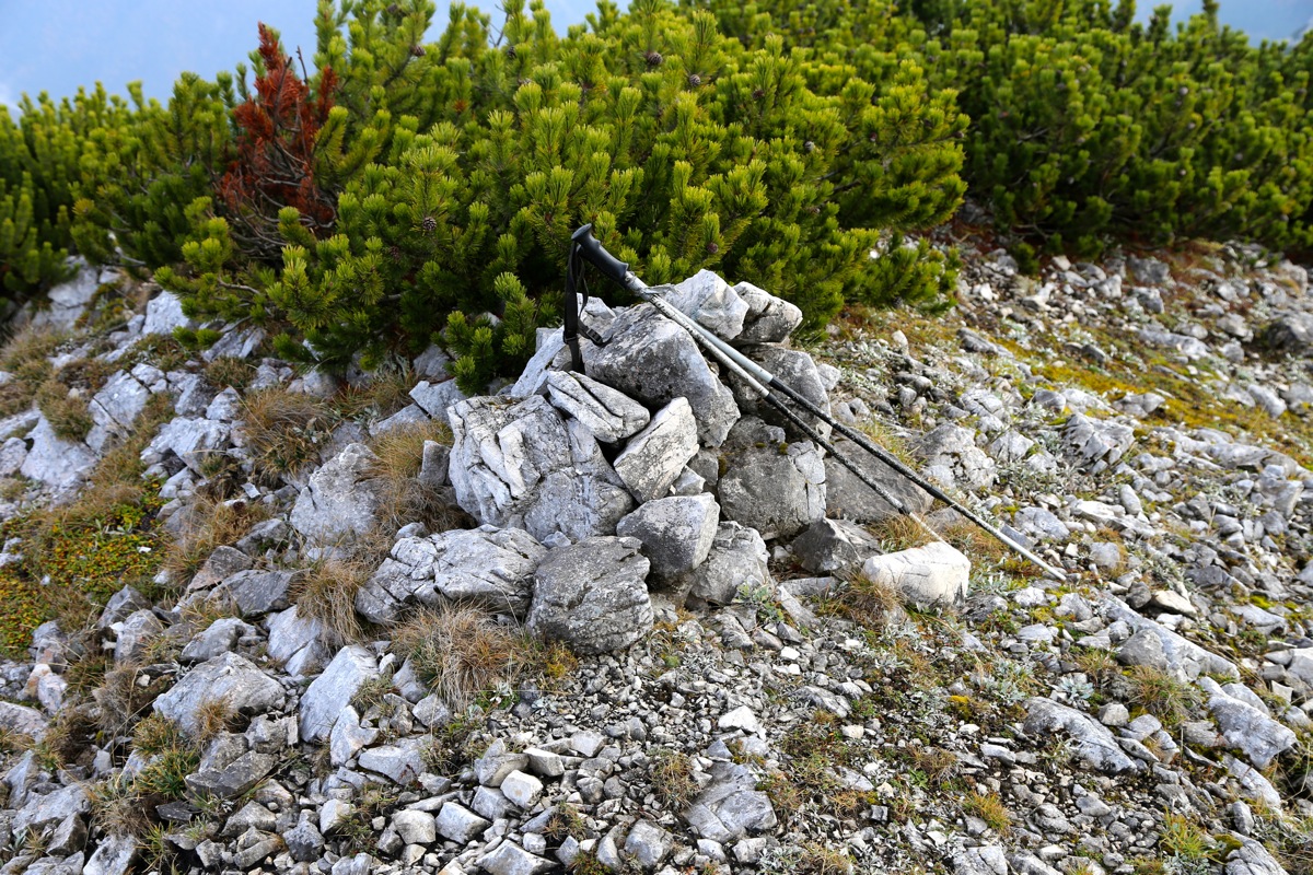
and arrive at the summit cross of Gamsstein.
The ridge may then be followed a couple of minutes
to the other end, where there is a
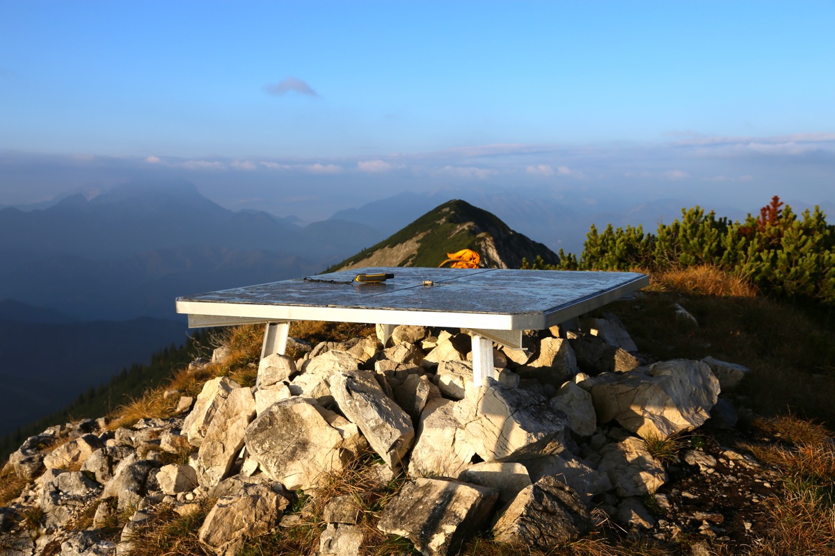
viewfinder plate and a small sign saying Hochkogel. Comments:
After climbing Haldensteiner Calanda on Saturday,
I drove the long way to this trailhead. I had an afternoon flight back home to
Norway, a strong motivation for finding a peak in the east part of Austria.
I did not find the local Gästhof (there is one), and ended up exploring the
option offered by a sign in the road saying "Zimmer frei" (room available). This
worked well and I soon slept preparing for an early departure. The host had checked
with his wife that breakfast at 0530 was acceptable. I had a nice breakfast, the
woman, in particular, pointed out that the egg was very fresh from her own hen.
Food and lodging came to Euro 20.- one cannot complain about prices in Austria!
I left around 0540 and was ready to hike by 0550. It turned out that this
route had a few challenges in the dark. As I reached the end of the small
paved road, I continued on a dirt farmers road. This was wrong and I soon
returned back. Then I found a familiar yellow sign up in the forest (misplaced if
you ask me). I continued uphill, lost the trail again, but this time in a trivial
way, a small shift to the right and I was again in business.
The next problem came near a small building that the trail led to, shortly after
passing the local (closed) tourist hut. Here, I followed a trail that curved right,
when descending it was easy to see that there is indeed a trail fork here and I picked
the wrong trail. This led me across a large field of grass, then into a forest with
pretty large trees. I realized that I was again wrong and decided to bush-walk along
and ascending traverse back left. This plan worked well and I recovered the trail near
the top of the slope that started down near the tourist hut.
The rest of the climb was straightforward
and I arrived at the first summit,
called Gamsstein at 0750, exactly two hours. The hike across to Hochkogel was
completely trivial, at most 2 minutes.
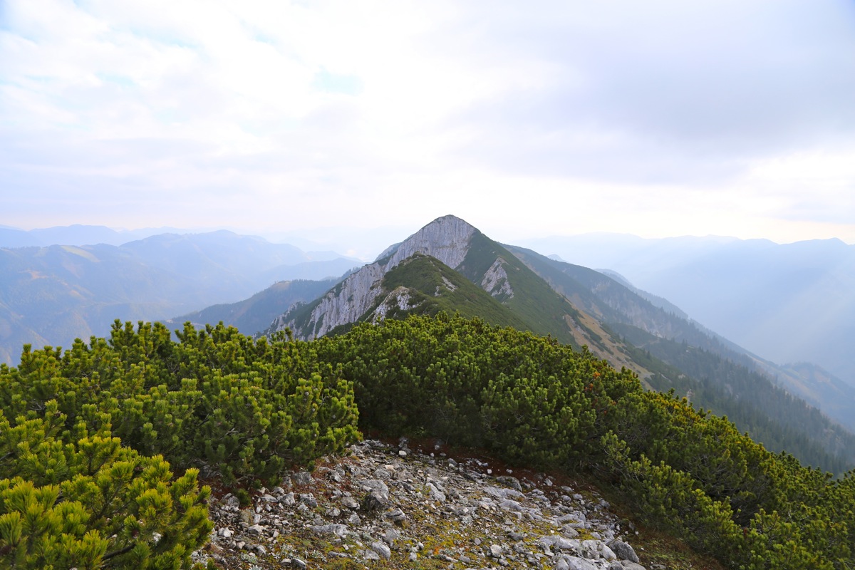
Hochkogel had a square meter large, flat viewfinder plate.
I used it as a
planar line of sight verifying that Gammsstein seemed to be lower.
However, when looking
at the third summit point, a bit further
south, this peak seemed to be of similar
height.
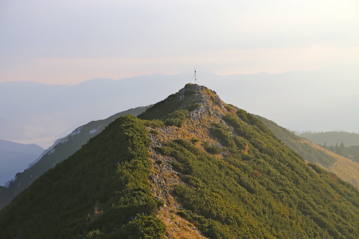
I decided to head over there to check thos out. However, it turned out to
be a very difficult side trip. The dwarf pines that covered much of the slopes, turned out
to be quite some trouble. I quickly got myself lost in this jungle and progress slowed
considerably. In fact, it took me a full hour to get across to
this small summit.
Looking back, the Hochkogel summit
still looked higher. This was also confirmed by my GPS.
I had arrived at a summit called Gamsteinneck, remembering that I had a flight to catch, I certainly
believed that my return hike would be quicker. No such thing, it took yet another hour to get back
to Hochkogel.
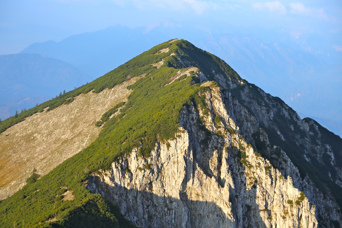
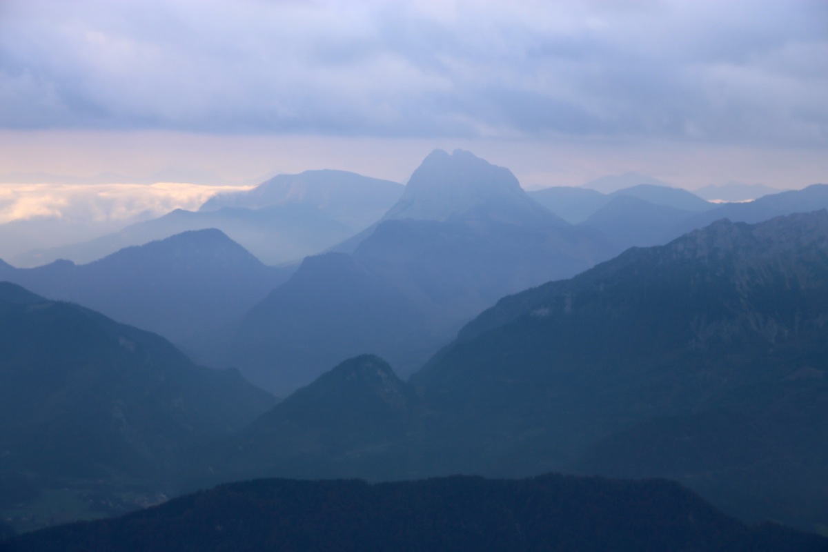
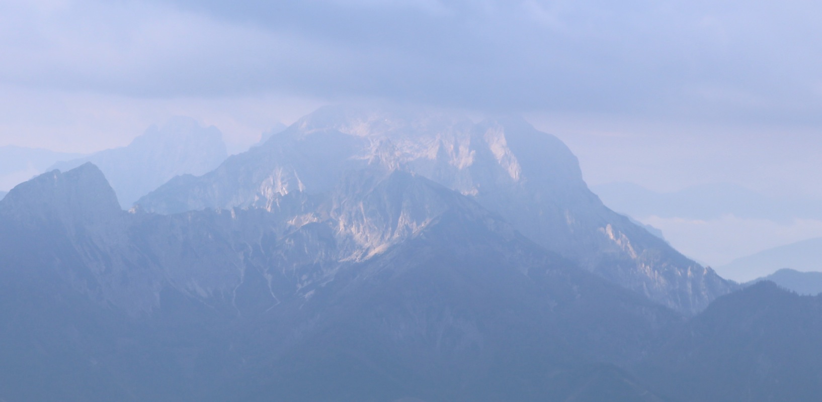
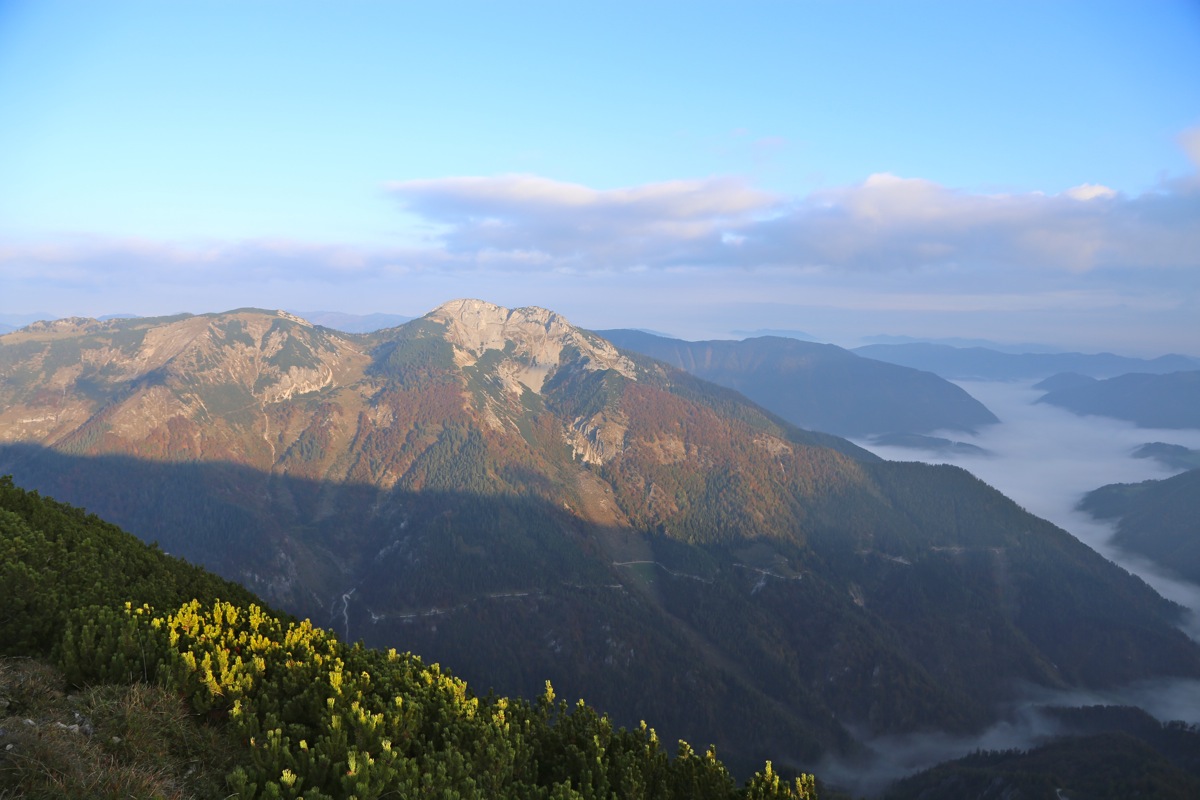
Unfortunately, the air was rather cloudy with haze.
I could barely see some impressive contours among
the clouds.
I hurried back down, making my car in 1:10, arriving there at 1120. With this time, I had
quite a safe and reasonable time to drive back to the Vienna airport and my flight home.