Location: North 61.36894, East 008.09820 (GPS at the summit)
Difficulty: YDS class 3
Climbed October 1. 2016.
Information:
How to get there:
This mountain is normally approached from the Tyin lake, see the
description of Stølsnostind.
However, this report describes a route from the west that also was used when
I climbed Falketind.
From the west (Bergen), the best approach is to drive Hwy. E-16 to Lærdal,
drive through the village and continue to Årdal, then up the valley to
Øvre Årdal and finally up the lower part of Utladalen valley until the gate
that closes the upper part of the road to normal traffic. (Signs for Hjelle or Utladalen).
Travel time from Bergen is about 4 hours.
This is the trailhead.
There is parking on the left, this location is
N61.34716, E007.87948, elevation about 110 meter.
Route description: Hut climb:
The first part follows the nice little road serving the farm Vetti.
This road crosses the river several times as it winds its way up the very
impressive Utladalen canyon. After 4 km you arrive at Vetti. Just above the
uppermost buildings there is a fork in the trail. The trail that continues up the
valley, first goes to the base of the famous Vettisfossen waterfall. Another
trail forks right through a small gate in the fence and climbs directly up and
out of the canyon. This is your trail.
This location is north 61:22.507, east 007:55.694 with an elevation of 350 meter.
Continue up the steep trail to the rim of the canyon. This may be tricky early in winter,
but should pose no problem from mid March, however crampons may be needed if the path
is icy. As soon as you reach the rim, continue along the trail that runs north to the
Vettismorki farm cabins.
The trail forks, the left branch is perhaps the best one in order
to get to Ingjerdbu. This trail also pass a viewing platform for the impressive
waterfall Vettisfossen. Ingjerdbu is a self serve (no food) DNT mountain hut. It is locked with the
standard lock and the 2005 charge was 180 NOK per night for members of DNT. Mountain climb:
There are basically two choices when starting from Ingjerdbu at Vettismorki. One can head east
up the valley along the left side of the river, towards Koldedalen. There is a small trail that
can be followed. Cross the river near elevation 1000 meter, then head south ascending the ridge that
tops out at point 1404 on the main west ridge. The disadvantage with this route is the river crossing.
In periods when the river has plenty of water it may be difficult/tricky to cross it without
getting wet feet. It may indeed be better to walk down to the first bridge below Ingjerdbu, cross the
river there, then head uphill along the right hand side of the river.
A slightly longer, but also a very convenient route, is to take the marked trail from Ingjerdbu
across the river, then follow signs for Hjelledalen and Tyin. This trail will ascend to Morkaskardet at
about 1000 meter of elevation. Leave the trail here, ascend east passing south of point 1184 meter.
Continue up the very broad and gentle ridge to merge with the alternative route near point 1404 meter.
Continue along the ridge passing point 1555 meter, then slightly right to point 1694 meter. From here,
one may cross the small tops 1884 and 1873 or contour on the south side in order to reach the distinct
col slightly lower than 1800 meter west of Hjelledalstinden.
Ascend the ridge (easy terrain)
to reach a flat ridge at
elevation about 1950 meter. Descend about 20 meter
to the small col just before the summit. From here, traverse horizontally
to the right (south side), when the
terrain steepens here, descend another 20 vertical meter (south), then
resume your traverse. Keep left, that is
follow a few ledges and a tiny gully that
ascends higher.
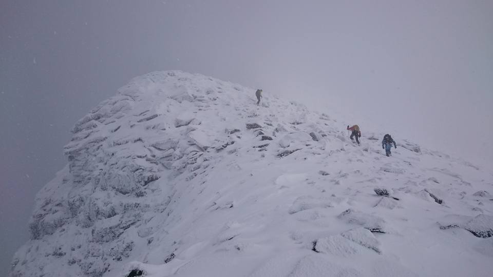
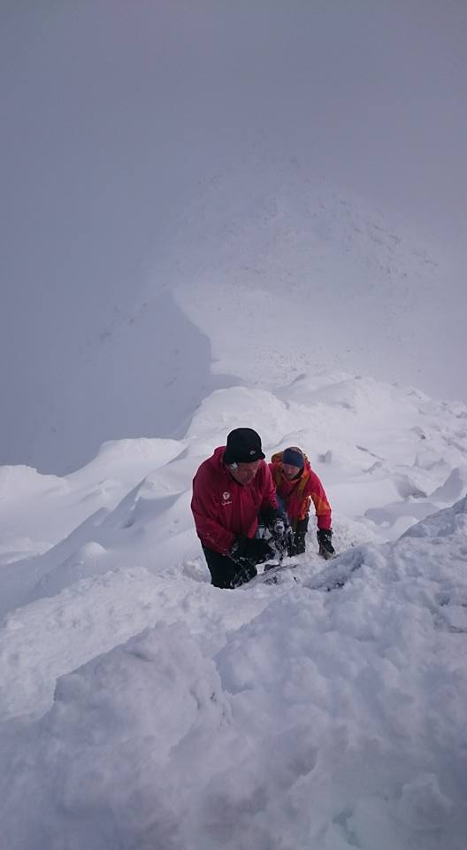
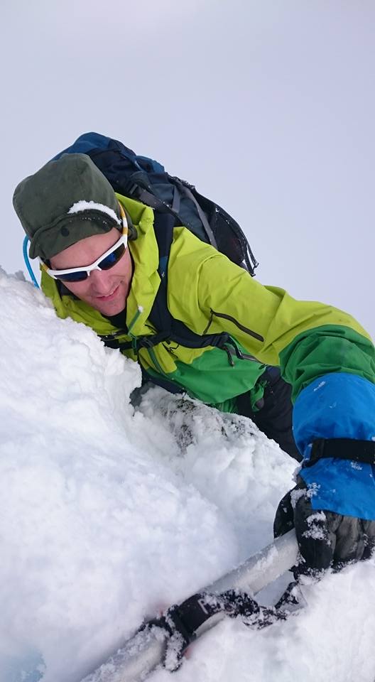
This will get you to the small crux of the route,
a short, but steep section straight uphill. Ascend a slanting ledge, from here you will reach the top of
the next ledge. Pull up with your arms, there are few footholds at
least when there is ice/snow. From here,
the short remaining ascent is easy.
Comments:
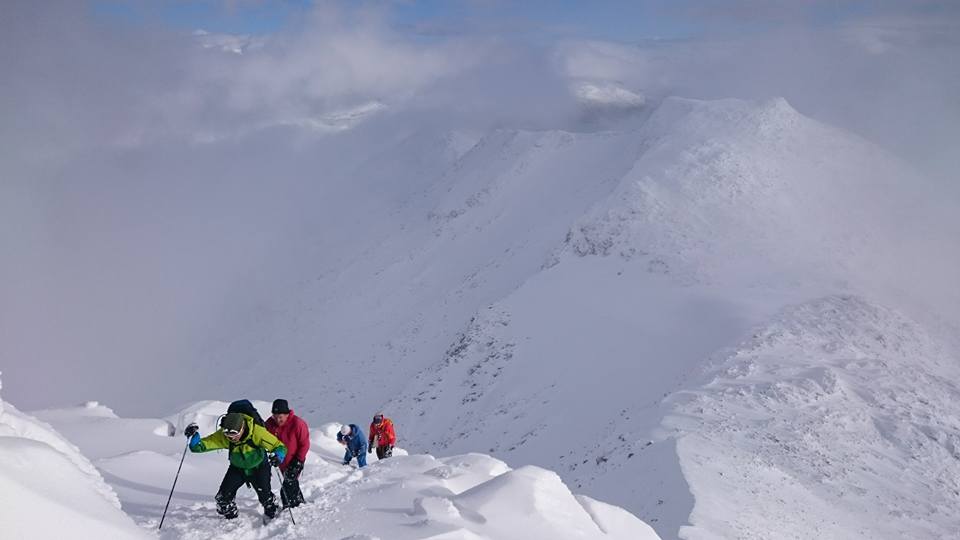
This was a trip for Bergen Mountaineering guides. We were 12 persons
that travelled to the nice DNT hut Ingjerdbu on Friday, September 30.
Along with a nice Friday evening dinner, we planned to attempt 3 different
peaks as we split into 3 different groups. My group turned out to be
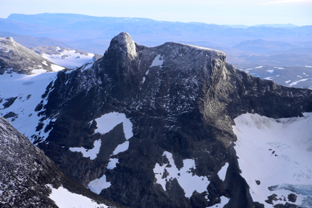
the larger, as 6 people wanted to attempt the 1989 meter Hjelledalstinden.
Stig Anton started around 0700 and went up the valley intending to cross the river
around 1000 meter of elevation. The other 5 (including me) left Ingjerdbu at
0800 and took the trail to Morkaskardet. We ran into snow shortly after
Morkaskardet, with fog it was sometimes difficult to plan the optimal line
in order to avoid areas with boulders. Such places are tricky with new snow since
it is impossible to see where one can safely place a boot. Lots of (deep) holes,
all hidden requires a lot of attention and progress becomes slow.
We hit the track made by Stig Anton, very convenient as we could relax route-finding
and also proceed in his footsteps,
breaking trail is always the hardest work
under these conditions.
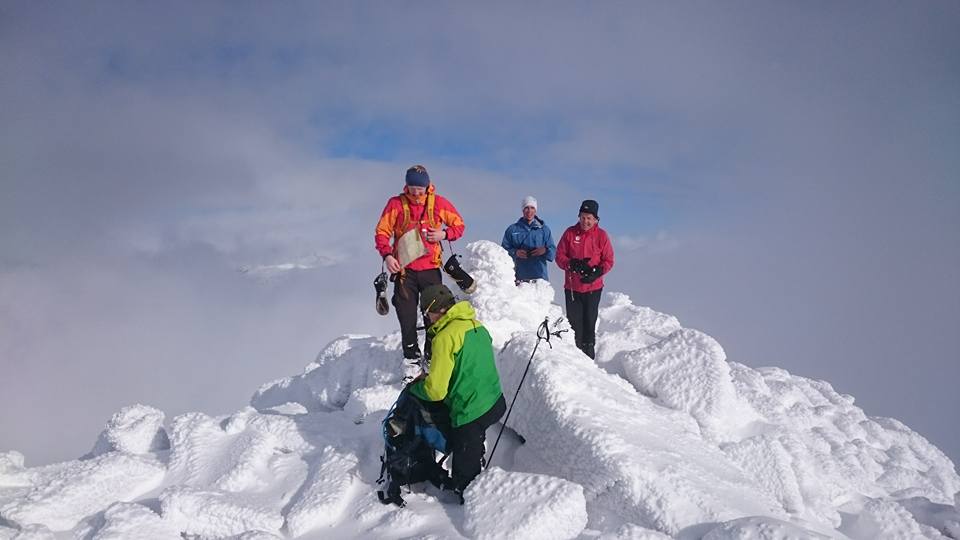
We finally met Stig Anton near the crux point,
he descended and was on his
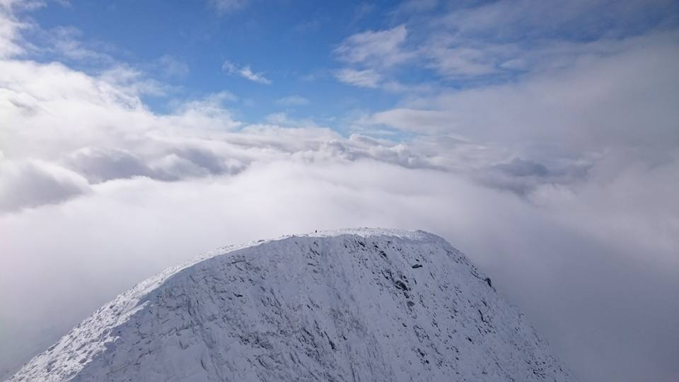
way back. Arriving on top at 1415, we were quite happy,
since this summit seemed
pretty difficult to reach when we struggled in deep snow back down on the west
ridge. More than 6 hours one way! To make the day even better, we had blue sky
above and a sun that broke through the clouds.
After 15 minutes on top, we started the long hike back down. To make a variation
as well as a slightly shorter route, we descended in the tracks of Stig Anton,
crossing the river resulted in wet feet, however, now all that remained was
2.5 kilometer easy hiking through the woods. I was back
at Ingjerdbu at 1850, so slightly less than 4 hours for the descent.
(Pictures above, copyright Kristine Solberg)