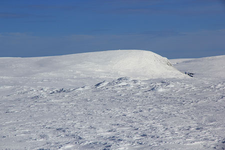
Folarskardnuten

  • Folarskardnuten
  • 1933 m.
  • Primary factor 955 m.
  • Hallingskarvet, Norway
  • Location: N60:36.446, E007:46.959 (south summit 1933m) (GPS at the summit)
  • Location: N60:36.805, E007:47.477 (north summit 1930m)
  • Climbed October 31 1998 and March 3. 2012.

Information:

How to get there:
The easiest access is from the railroad station Haugastøl on the Bergensbanen railroad connecting Oslo and Bergen.
Route description:
The mountain is climbed from the Folarskard, a pass in the long and impressive Hallingskarvet mountain ridge. From Haugastø this is about 15 kilometer. From the Folarskard there is a summer route going up west, starting just south of the small lake. I climbed the mountain in early winter conditions, it was too steep to ski and quite a hard struggle in all the steep, deep snow.
The summit plateau is rather flat with two marked points, south and north. The southern point is marked as slightly higher on the map.
Hallingskarvet traverse:
From the summit of Hellevassfonni, 1885m, continue east to another south-north saddle, then gently uphill to the south (and highest) summit on Folarskardnuten, 1933m, and the highest mountain south of Jotunheimen.
From here, there is a rather steep descent into the Folarskardet pass, the deepest south to north cut across Hallingskarvet. This descent requires care in the winter. Hard and icy snow and/or avalanche conditions may prevent a safe descent. The best route runs south-east from the summit, following a pretty broad ridge that ends south of the small lake at 1603 meter. The descent is easy until you have about 60 vertical meter left. At this point, cut left (north) and find a line of descent that gets you down to more gentle slopes.
This route continues to the east part of Hallingskarvet.
Comments:
1998 climb:
There was snow drift in the air and quite limited visibility. It took me 3.5 hours to ski from Haugastø breaking trail to the Folarskard pass. Then another 3 hours to climb the mountain. There is an old mountain hut called Lordehytten named after a british lord Garvagh who had it built in 1880 right in the Folarsskard pass.
2012 traverse:
We arrived the Folarskardnuten summit around 1630. From here, we quickly descended to the steepest part. This section was traversed (to the left) on foot. The crust was hard and we had to dig quite a few footsteps in the snow with a shovel. In this way, everyone made it down safely. Three guys went back up and carried most of the weight from the (single) sled back down in two backpacks. It was then quite easy for the third man to descend with the (almost empty) sled in front (downslope).
We made camp in Folarskardet around 1800.

Resources: