Location: North 40.17622, East 021.67240 (GPS at the summit).
Difficulty: YDS class 1.
Climbed October 12. 2021.
Information:
How to get there:
Get off motorway A-2 and locate the place N40.23244, E021.59784, elevation about 740 meter.
At this location, a dirt road forks left from the (paved) main road. Continue along this
dirt road about 7 kilometer. The road can be driven by quite ordinary cars.
Eventually, the road starts ascending and it will reach a somewhat unusual place with
space for parking etc. Locate a gate in a low rock fence, this is where the road
continues. Drive uphill to location N40.20000, E021.65825, elevation about 1310 meter.
This may be the trailhead for low clearance (ordinary) cars. There is a fork here, the route
continues right, this road is rougher than the road that continues straight ahead.
Drive up a pretty long hill to reach a new fork. This location is N40.19928, E021.65478,
elevation about 1370 meter. One may park to the left.
I decided to park here. Sturdy 4WD
vehicles may continue all the way to N40.19209, E021.65219, elevation about 1580 meter.
This last section is rougher and there may be larger rocks that have fallen onto the road
and cause possibly narrow passages.
Route description:
Follow the dirt road, take the right (main) fork immediately
after my trailhead. The route is marked well with red and white
ribons as well as red paint. Note that it leaves the road climbing
right well before the road makes a sharp left.
This is a short-cut, the trail curves left near the first col and then
merges back with the road. (You basically save a switch-back road section.)
Next, the road gently climbs while traversing the hillside. It finally
makes a sharp right next to a wooden structure having its roof on the ground
on the side. This is location N40.19209, E021.65219, elevation near 1580 meter.
A good 4WD vehicle could drive to this location if desired.
Leave the road here. Walk on the left side of the wooden structure, and continue
on a well marked trail. The trail first descends to a local col, then carries
along with some slightly steeper sections of ascent. Initially, the route stays on the
main ridge, next the trail runs on the left side, before getting back
to the main crest. The final part is along
a nice and gentle grass ridge that leads to the summit.
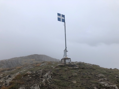
The summit has
a pole with a metal flag, as well as a summit register. There is also
a religious symbol near by.
The next little rock area about 30 meter onwards may be of equal elevation,
its a short and easy walk.
Comments:
A grey day. I drove from our hotel in Metsovo in about one hour. I turned uphill
on the final mountain road, but decided to park at a small junction on top
of the first hill. A good 4WD could drive to the sharp bend (described above),
however, the road side had vegetation branching into the road, it also turned
out to be a couple of places where bigger rocks had rolled onto the road,
creating narrow passages. Overall,
I was happy with my choice of trailhead.
I left my car at 1030 and had a good walk in dense fog all the way to
the summit, arriving there at 1155. I visited both summit points, they are very
close together and also vey similar in elevation. I also made an entry in
the summit register, a very nice book. The summit seems quite popular, many entries
in 2021, about 10 days since somebody was here.
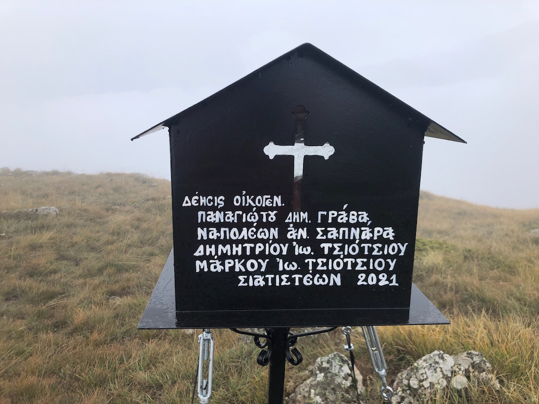
There was also a new little
religious "mini-house" on
a black pole. It looked like
this was new in 2021. A small light blinking (battery power) and some traditional
painting.
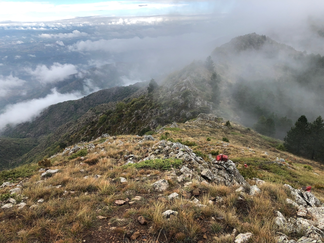
Leaving at 1205, the fog lifted when I
was half-way back. Nice landscape, lucky
to see a little on this day.
Back at the car by 1325, an easy drive back to meet Heidi. She had explored part
of the Ursus trail, made more distance as well as more elevation gain!