Location: North 47:49.031, East 013:42.319 (GPS at the summit)
Difficulty: YDS class 2 (winter)
Climbed January 20, 2008.
Information:
How to get there:
This peak is located near Ebensee, at the south end of the lake Traunsee.
From Linz, this is 90 kilometer. First drive A1 about half way towards Salzburg.
Exit south on Hwy. 145 towards Gmunden. Drive through Gmunden and continue south
on Hwy. 145 along the west side of Traunsee. Just after a tunnel, you enter
the town of Ebensee. Make an immediate right turn off Hwy 145, then another right
after about 150 meter. There are signs for the gondola lift (Seilbahn) to Feuerkogel.
Drive uphill through parts of Ebensee for about 1.2 kilometer and park on one
of the designated parking areas for the lift. This location is
N47:48.770, E013:45.445, elevation about 485 meter.
Route description: A. From the base.
Hike or ski up the downhill slope that comes down to the lower lift station.
This is a continuous, somewhat steep uphill. When it seems to top out, then continue
the trail into the forest going right (when looking uphill). The trail/downhill continues
steeply uphill before reaching the bottom of a (groomed) downhillslope served by a local
lift. This location is N47:48.540, E013:44.123, elevation 1226m.
Continue up the broad slope to the top of Feuerkogel, where the gondola top station is located,
there are many buildings in this area. One need not go to the top station, but can keep a bit
further left (south), this location is at N47:48.886, E013:43.145, about 1600 meter.
From the top of the lift (Seilbahn)
Taking the gondola avoids a steep climb of the downhill slope and gets you directly to
better terrain for cross country skiing. The shortest route to this summit is to traverse
the small summit Heumahdgupf, elevation 1680 meter. This top is served by a T-bar skilift.
This local hill is located in the continuation of the ridge of the gondola top station.
There is only a very minor saddle along this way. From the top of this skilift, continue a short
stretch along the top ridge, then descend right to the saddle that separates this top from
Alberfeldkogel. One can ski up along the ridge on your right side (when facing Alberfeldkogel),
or take the slope that is further left and first climbs a small subsidiary hump (1693 meter).
Either way, the route is straightforward if you have visibility. Beware of the steep cliffs further
right if you pick the rightmost route.
Comments:
I visited this nice peak on my return trip from climbing
Grosser Höllkogel. This is a return route that
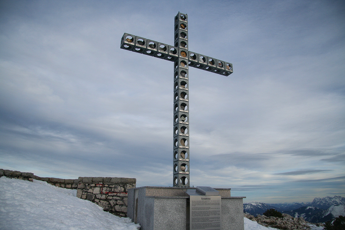
can be recommended. The large cross on the summit is called
Europe "kreutz", it has
the names of each EU country and a rock from each country is placed in the cross just
behind the country name.
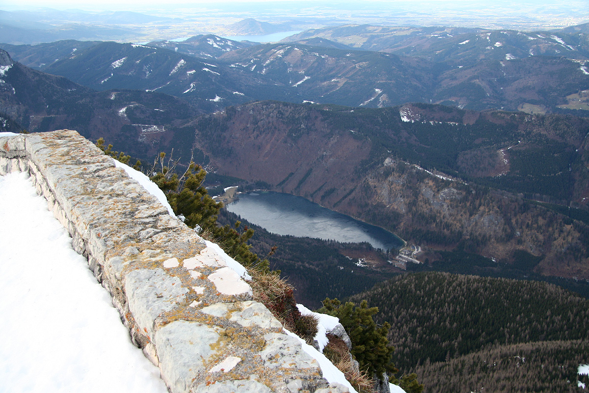
The view to the flat land further
north is very impressive, this peak has a steep rockface,
the mountain really ends rather abruptly here.
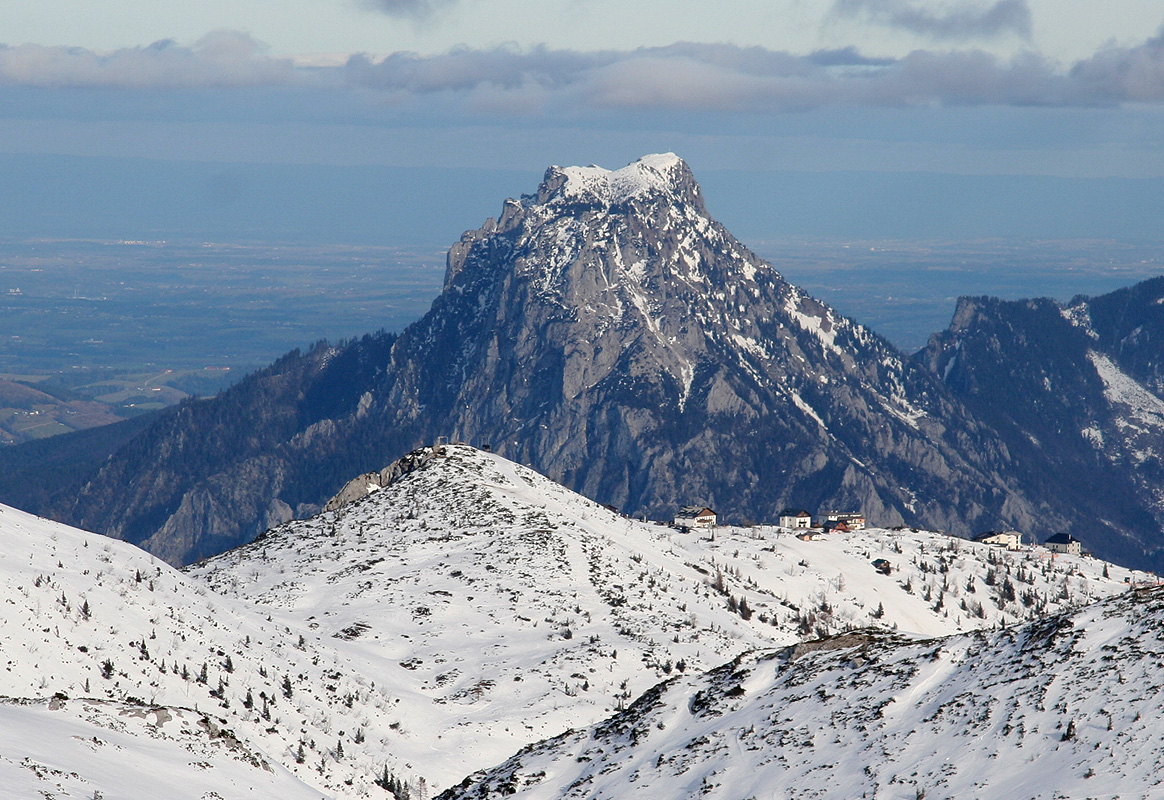
Another peak that stands out is Traunstein (1691m),
quite independent while guarding the flat land beyond.
It took me about one hour from the summit of Grosser Höllkogel, arriving at 1510. I left 10 minutes
later and traversed Heumahdgupf (1860m), in order to reach the gondola at 1550, well ahead of
its 1600 departure.
